BOURNEMOUTH COAST PATH
Stage 2: Mudeford Quay to North Haven Point
Wednesday, May 16, 2012

(1) Mudeford Quay

(2) Mudeford Sandbank

(3) Mudeford Ferry

(4) Mudeford Sandbank
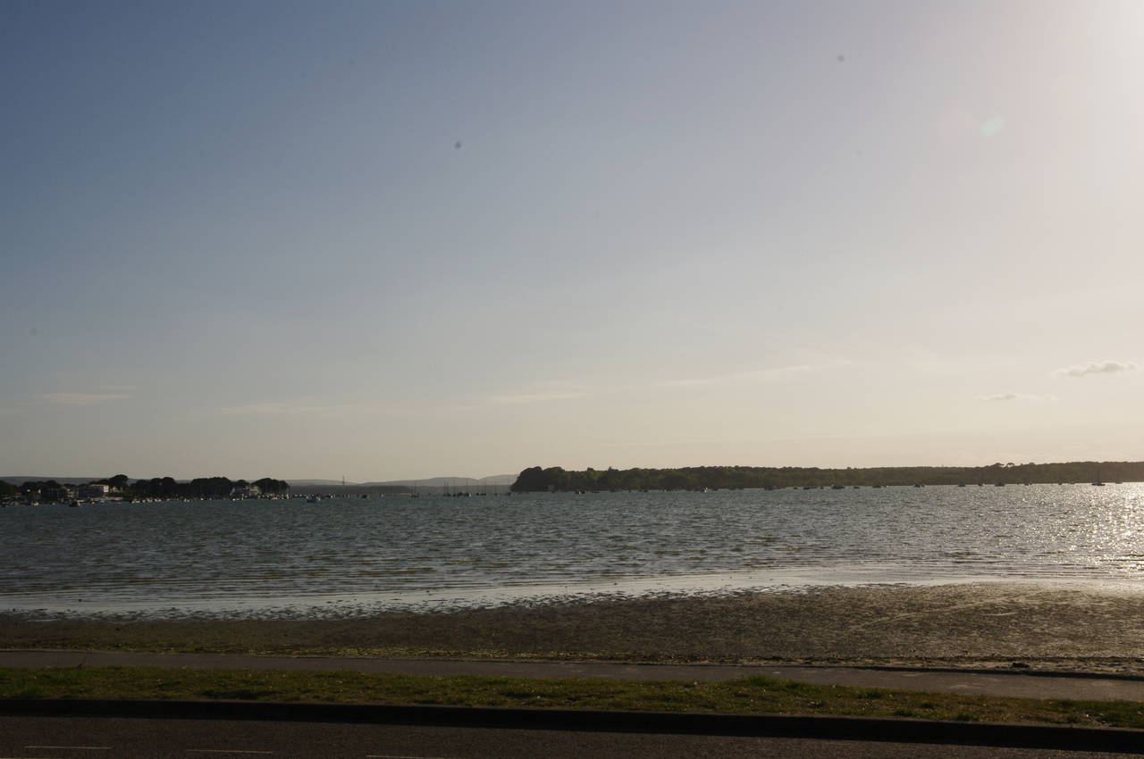
I was already warmed up when I returned to Mudeford Quay to resume my walk along the Bournemouth Coast Path, having already walked five kilometres from Christchurch Station. With almost a quarter of an hour to wait for the ferry across the narrow passage connecting Christchurch Harbour to the sea, I had time to wander around the quay (picture 1), which was rather busier than when I arrived just before sunset on the previous Sunday night.
The ferry runs diagonally across the passage, giving some good views of the Black House and some of the 350 beach huts on the Mudeford Sandbank (picture 2). The Black House was built as shipbuilders accommodation in the 1750's, while the beach huts didn't begin to appear until 1929. The English take their beach huts rather seriously; some of those on Mudeford Quay have changed hands for extraordinary sums of money and are among the most expensive in the UK. This is even more surprising when you discover that the sandbank can grow or shrink quite significantly each year depending on the weather and some of the huts could one day be washed away.
Just after 11 o'clock, the ferry deposited me at the end of a jetty on the bank of Christchurch Harbour (picture 3). From the jetty the Coast Path follows a track in front of the huts (picture 4), which are lined up two and three deep.

(5) Mudeford Sandbank Land Train

(6) Mudeford Sandbank from Hengistbury Head

(7) Hengistbury Head

(8) Quarry Pond
The track soon becomes a tarmac path used by a land train (piocture 5), the only form of motorized transport here. Nearing the end of the long line of huts, the path passes a lagoon and a sign marking the start of another long-distance walking path, the Stour Valley Way, which runs through Dorset for 103 kilometres up to Stourhead.
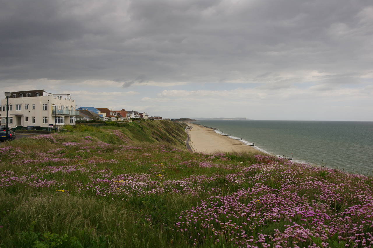
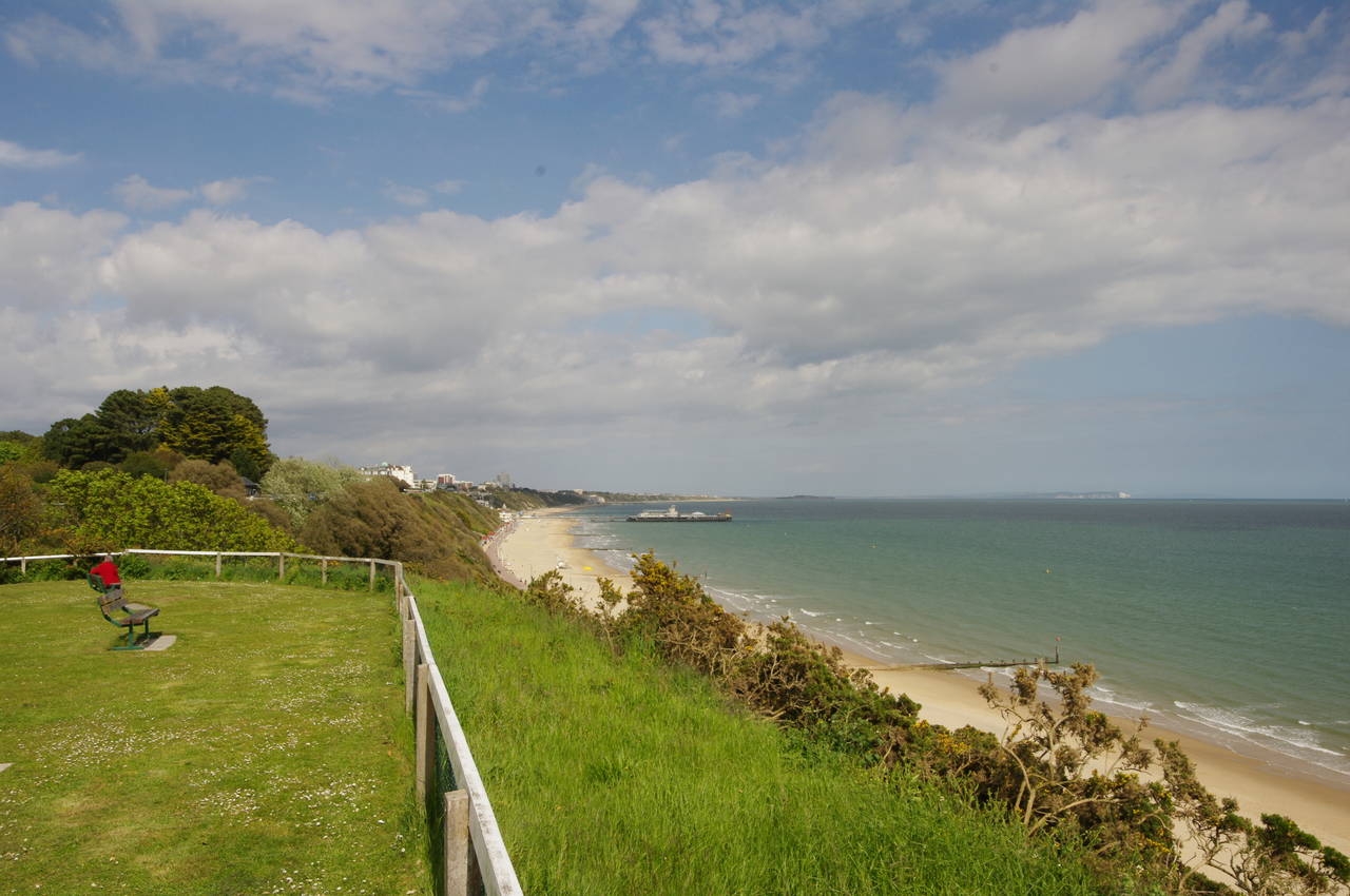
When the tarmac road bends right, the Coast Path instead bears left, passing the last few huts and beginning the short climb up to the top of Hengistbury Head. From the top of the 36 metre high headland, there are good views back over the sandbank to Mudeford Quay and Avon Beach (picture 6).
The route soon turns west on a neat path where I got my first views ahead across Poole Bay to the rolling green hills of the Isle of Purbeck (picture 7), where I could see the white chalk coastal cliffs at Old Harry Rocks just north of Swanage. I would have to wait until the following summer to walk that stretch of the coast, at the beginning of the South West Coast Path.
The path heads along the middle of the plateau, passing by Quarry Pond (picture 8), a freshwater pond created in 1976 to fill a hollow where iron ore had been mined more than a century earlier. Since mining began in 1848, around a third of the headland has been lost to the combined forces of mining and erosion, leading to the building of coastal defences on the southern side of the headland.

(9) Christchurch Harbour

(10) Christchurch Priory

(11) Poole Bay

(12) Barn Field and Double Dykes
Beyond Quarry Pond, the path climbs gently to the summit of the headland, passing a small coastguard station. From the summit, which is marked by a trig pillar, there are superb views in all directions, including the wide expanse of Christchurch Harbour (picture 9) and beyond to Christchurch Priory (picture 10, zoomed in), the longest parish church in England.
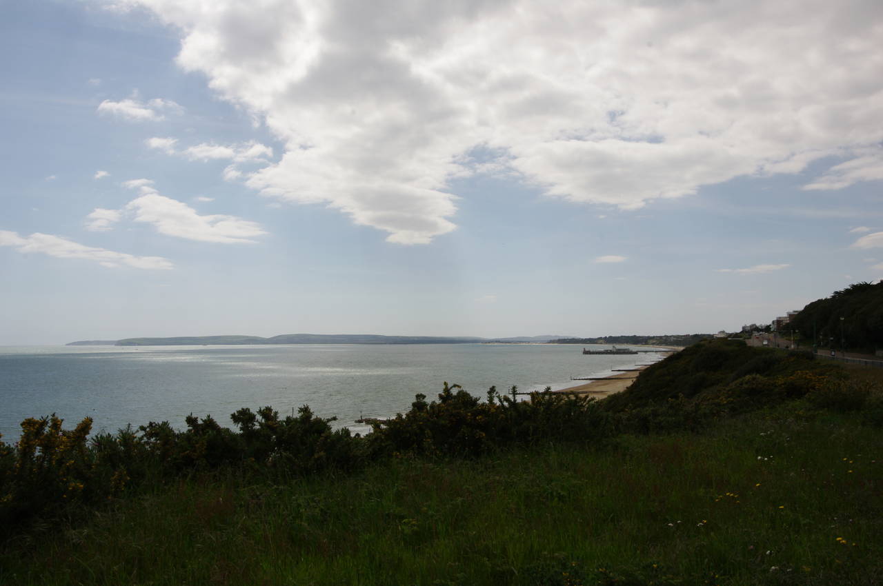
Ahead the land drops away, revealing the path ahead around Poole Bay, along the dunes and cliffs of the sprawling town of Bournemouth (picture 11). The path descends into an area of grassy dunes known as Barn Field and where the path forks (picture 12), the Coast Path bears left, parting ways with the Stour Valley Way. The raised earthwork across the middle of the picture is Double Dykes, built in the Iron Age to defend the approach to Hengistbury Head.

(13) Dunes behind Solent Beach

(14) Path joins Southbourne Coast Road
(15) View back to Hengistbury Head

(16) Gordon Steps Zigzag
The path heads around the end of the dykes next to Solent Beach, before bearing right again to follow a path parallel to the beach in the dunes. Part of this path is a wooden boardwalk (picture 13) and sections of the dunes are fenced off, evidence that the local authorities are trying to minimise erosion on this part of the coast, where as much as a metre a year was lost before the building of coastal defences on the beach.
A few hundred metres beyond a wooden gate, the path across the dunes reaches the Southbourne Coast Road on the edge of Southbourne (picture 14), originally a separate resort town from Bournemouth, but long since absorbed into the town. To the left of the road, I had expected to see the Point House Cafe, which opened on the site in 1963, but sadly I would have to look elsewhere for lunch. The site was surrounded by construction hoardings, the café having been bulldozed in May 2011 to make way for apartments after a five year battle between a developer and the locals.
At a junction just past the construction site, the path turns left to continue along Southbourne Coast Road, which gradually climbs past several clifftop houses and a long carpark to a roundabout. Hidden from view below the cliff is a popular beach, but from the clifftop there are views across the bay.
From the roundabout, the route follows Southbourne Overcliff Drive, where for the next 400 metres the sea views are blocked by a line of clifftop houses. Shortly after the road bears left around the last house, the Coast Path leaves the road on a tarmac footpath to return to the clifftop, with views back along the beach to Hengistbury Head (picture 15). The path soon starts to descend gently, passing the top of the Gordon Steps Zigzag (picture 16), also known as Mount Misery, presumably due to the steep climb up from the beach.

(17) Boscombe Overcliff

(18) Boscombe Cliff Gardens

(19) Honeycombe Chine

(20) Boscombe Pier
The Coast Path ignores the zigzag, instead continuing along the clifftop, here known as the Southbourne Overcliff. After about a kilometre, the path passes the top of the Portman Zigzag and on along the grassy Boscombe Overcliff (picture 17) for about as far again to reach a metal gate at Boscombe Cliff Gardens (picture 18).
The Coast Path goes through the gate and along the footpath through the middle of the pleasant gardens. On the other side, the path circles around the clifftop above Honeycombe Chine, where a large complex of 169 apartments has recently been constructed in the bottom of the Chine (picture 19). The land was sold to developers by the local council to fund construction of Europe's first artificial surf reef a short distance offshore. The project has so far been a failure, with several of the reef's giant sandbags having broken open.
Part of the way around the chine, the Coast Path meets a footpath beside a road called The Marina, and descends steeply into Boscombe Chine, where Boscombe Pier stretches out into the sea (picture 20).
Boscombe Pier originally opened in 1889 and has had a somewhat chequered history since then. Originally 180 metres long, the pier was partly demolished during World War II to avoid giving potential German invaders an easy place to make landfall. It was reopened in 1962, but gradually became derelict until being closed over safety concerns in 2005. The pier was then restored and reopened in 2008.

(21) Boscombe Pier
(22) View ahead from Boscombe
(23) East Cliff Lift

(24) Bournemouth Pier and Russell-Cotes Museum
At the end of The Marina, the route turns left for a short distance along Sea Road to reach a roundabout where two strange tall stone columns stand in front of the pier (picture 21). Ahead, steps lead to a path that climbs back up to the clifftop, with more great views over Poole Bay (picture 22).
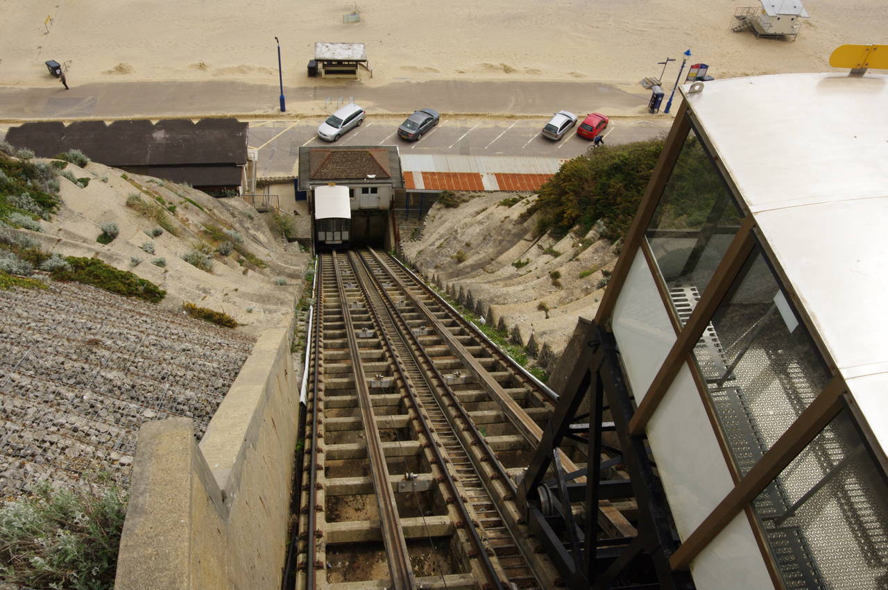
The footpath soon joins East Overcliff Drive, passing the top of the Toft Zigzag after about 500 metres and then the East Cliff Lift after a further 800 metres (picture 23). The lift was originally built in 1908, and is the tallest of the three cliff railways along the Bournemouth coast, climbing 52 metres at a gradient of 69 degrees. The two cars are counter-weighted, using gravity to do most of the work.
A hundred metres further, the East Cliff Zigzag snakes its way down the cliff, looking a lot less enjoyable than the lift, at least for those on their way up. After another 250 metres, the road curves off to the right, while the path continues along the cliff, which begins to descend towards Bournemouth Pier as it passes the Russell-Cotes Art Gallery and Museum (picture 24).

(25) Russell-Cotes Museum

(26) Bournemouth Pier
(27) Highcliff Hotel

(28) West Cliff Zigzag
A little further down the slope, one can get a better look at the Russell-Cotes Museum (picture 25). The building dates from 1894 and has been a museum since 1922, housing a number of famous and priceless paintings. The museum is apparently also famous for it's vintage lavatories.
The path descends to the mouth of Bournemouth Chine, where the Bourne Stream reaches the sea near the pier. Bournemouth Chine is the largest of the chines on this part of the coast, stretching several kilometres inland. Most of the chine is parkland and the narrow stream can be followed up the chine through the heart of Bournemouth. This area was unpopulated until the first house was built here in 1810 as a quiet coastal retreat. These days the area around the pier could not be described as quiet, with an IMAX Cinema, Oceanarium and various tourist facilities on and near the pier.
The pier (picture 26) was built in 1880 to replace an earlier pier that was damaged several times by storms. Like Boscombe Pier, it was partly demolished in 1940 due to the threat of German invasion, rebuilt just after the war and then repaired several times since.
The Coast Path runs to the right of the Bournemouth Oceanarium and climbs the slope of the West Cliff, passing the Bournemouth International Centre, which has played host to numerous political party conferences. Opposite is the West Cliff Railway, slightly shorter but slightly steeper than the East Cliff Lift.
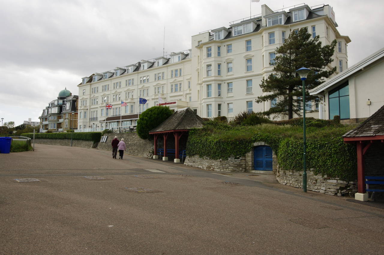
Near the top of the slope stands the Highcliff Hotel (picture 27), a Victorian building where a meeting in May 1940 resulted in Winston Churchill becoming leader of the Labour Party, and soon afterwards he became Britain's Prime Minister during the darkest days of World War II. Just beyond the hotel, the path passes the West Cliff Zigzag (picture 28), built in 1928.

(29) View across Durley Chine
(30) View east from Argyll Gardens
(31) Old Harry Rocks
(32) Alum Chine Suspension Bridge
The Coast Path now follows a fence along the clifftop to the edge of Durley Chine (picture 29). Here the route leaves the coast temporarily and follows a footpath inland above the chine before turning left down steps to cross the road that runs down into the chine. Steps on the other side of the road lead up to West Overcliff Drive, which the coast path follows to the left.
The road heads back towards the cliff before curving around to the right to head inland again along the east side of the thickly-wooded Middle Chine. At a junction the road bears left to cross a bridge over the chine and then left again to head down the west side of the chine, still on West Overcliff Drive, and back to the clifftop opposite the bowling greens of Argyll Gardens.
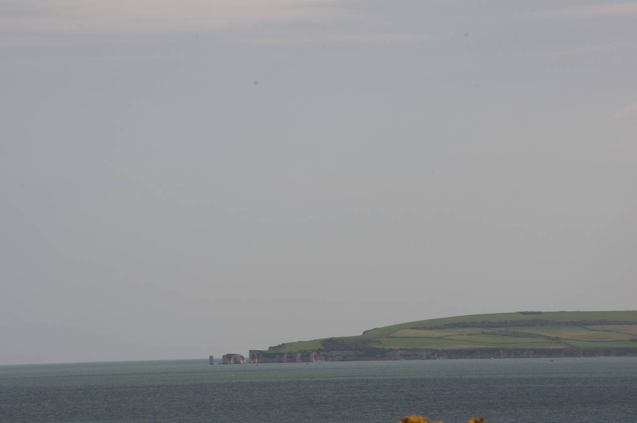
From here there are good views east along the coast back to Hengistbury Head at the start of the day's walk (picture 30), while in the other direction the chalk stacks of Old Harry Rocks were clearly visible on the tip of Purbeck (picture 31, zoomed in). Before the end of the last ice age, the chalk ridge running west from Old Harry Rocks also ran east across what is now Poole Bay to the western tip of the Isle of Wight and still forms the west to east spine of hills running across the island.
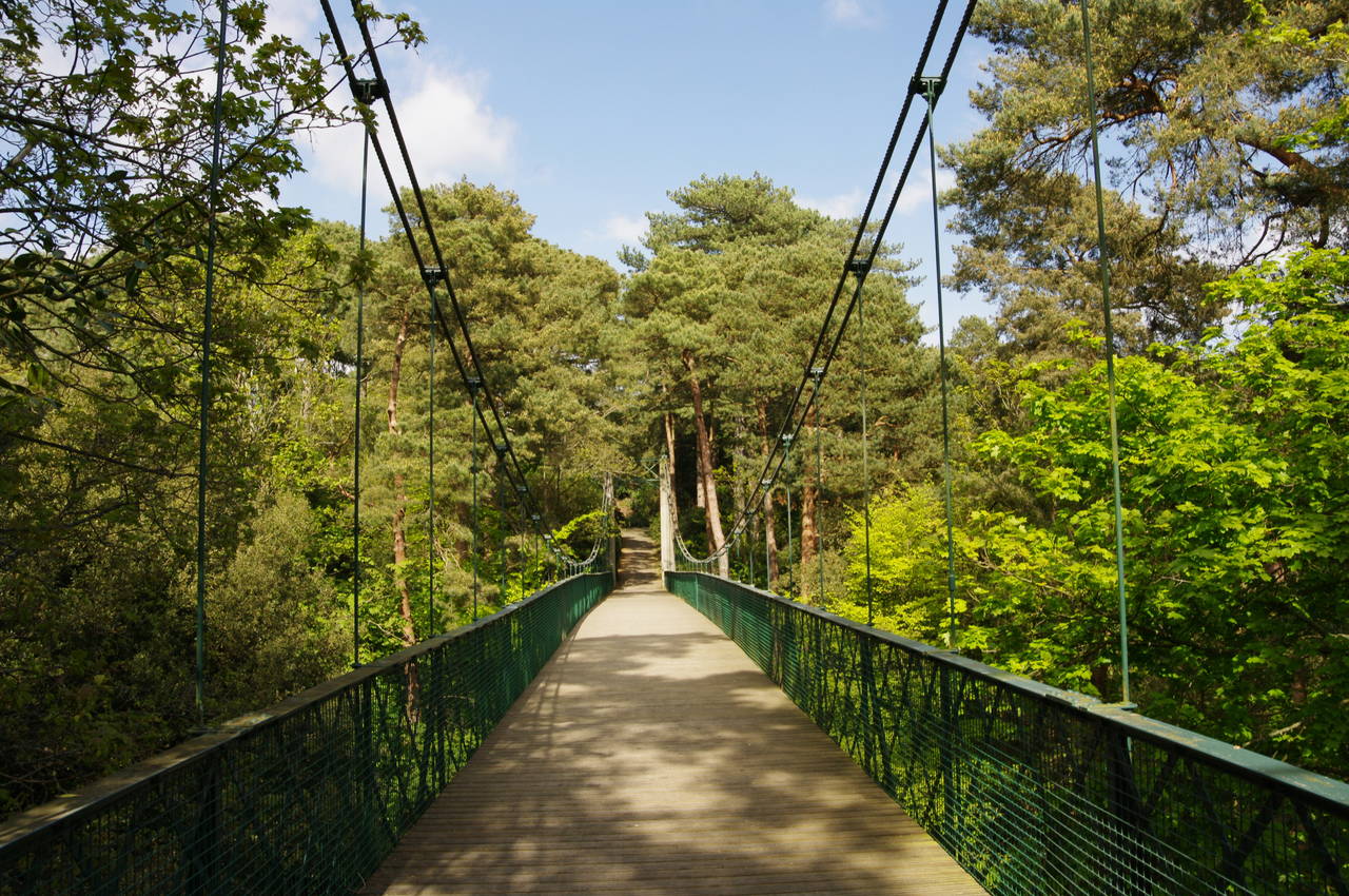
This turns out to be another brief flirtation with the clifftop, as the road immediately swings back along the edge of the long Alum Chine, named after a short-lived alum works established here in 1564. After around 600 metres, a footpath leaves the road to the left to cross a suspension bridge over Alum Chine (picture 32).

(33) West Undercliff Promenade

(34) View east from Canford Cliffs

(35) Shelter on Canford Cliffs

(36) Garden on Canford Cliffs
From the end of the bridge the route continues ahead along the quiet residential Beaulieu Road, taking the third turn on the left into Alumhurst Road. After 150 metres the route bears left along Sandbourne Road, reaching a junction in another 150 metres and turning right, still on Sandbourne Road, and crossing the boundary between Bournemouth and the borough of Poole. Just before reaching the cul-de-sac at the end of the street, the Coast Path turns right on an enclosed path between houses, signed as Footpath number 63.
The path runs beside a brick fence and then turns left down steps to a carpark at the bottom of Branksome Dene Chine. The Coast Path now heads down towards the sea, joining the West Undercliff Promenade next to a kiosk, where I stopped for an ice-cream.
For the next 500 metres, the Coast Path follows the promenade past various upmarket beach hut complexes (picture 33) to reach the mouth of Branksome Chine, which is occupied by a beach shop and the Branksome Chine Restaurant. The route crosses the carpark behind the restaurant to join a footpath that climbs steeply up to the top of Canford Cliffs, from which there are more great views back around the curving coast of Poole Bay (picture 34).
Where the path forks, with steps going both up and down, the Coast Path goes up, soon passing by a strange little shelter (picture 35) and then behind a large ornamental garden perched on the clifftop (picture 36).

(37) View from Cliff Drive
(38) Flag Head Chine

(39) Sandbanks
(40) Poole Harbour
About a hundred metres past the garden, the route turns right through a small carpark and up to the B3065 Western Road next to the Canford Cliffs Library. Here the path turns left and follows Western Road for two blocks towards the shops at Canford Village, turning left into Ravine Road just before the first shop. About 150 metres along Ravine Road, just before The Cliff pub, the route turns right and joins a footpath beside the Esplanade. At a junction of paths. the route turns left, then at a fork it bears right to follow a fence along the edge of Canford Cliffs Chine, used by smugglers to land contraband in the days before this area became heavily populated.
The path soon reaches Cliff Drive, which heads back to the clifftop and follows it for a time (picture 37), before turning sharp right to head inland above Flag Head Chine, the last chine on the Bournemouth Coast Path. Reaching an intersection, the route turns left along Flaghead Road for 50 metres, then left again on a narrow road down into the chine (picture 38), signposted as Footpath No. 80.
The road runs all the way down to the beach, where the Coast Path turns right and heads along the promenade for about 400 metres to its end at Poole Head, where the cliffs of Poole Bay also end.
Ahead lies the long sandy spit of Sandbanks, separating Poole Bay from Poole Harbour (picture 39). Real-estate on Sandbanks is among the world's most expensive, and in the UK is second only to a few select parts of central London.
There is no public right of way along the beach beyond Poole Head, so the Coast path turns right along Shore Road for 150 metres before cutting through a small park on the left to join Banks Road on the shore of Poole Harbour (picture 40). Poole Harbour is the second largest natural harbour in the world, after Sydney Harbour.

(41) Banks Road, Sandbanks

(42) View towards Brownsea Island

(43) Sandbanks Ferry

(44) View towards Shell Bay
Banks Road follows the shore of the harbour along the edge of the spit (picture 41), which narrows to be only wide enough for the road and a single row of houses, before widening again.
Off to the right, the large Brownsea Island sits inside the mouth of the harbour (picture 42). The island was the scene of the first boyscout meeting in 1907 and is now a nature reserve owned by the National Trust.
About a kilometre from Poole Head, the road reaches the point where the narrow neck of the spit joins the circular head. Here the road bears right, leaving the shore of the harbour and passing some shops. Soon the road divides into a single lane one-way road around the head of the spit and the Coast Path takes the left branch, continuing for about 500 metres behind beachfront houses and apartments, though there are few views of the beach.
Just beyond the Haven Hotel, which is the oldest building on Sandbanks, completed in 1887, the route turns left into Ferry Road and runs down the last few metres to the slipway of the Sandbanks Ferry at North Haven Point, where the Bournemouth Coast Path officially ends. According to my GPS, I had walked 20.6 kilometres since setting off from the Mudeford Sandbank.
As I arrived, the Sandbanks Ferry was preparing to depart on its journey across the 400 metre wide mouth of the harbour to South Haven Point at the northern end of Shell Bay. The Sandbanks Ferry (picture 43) is one of only eight chain-ferries still operating in the United Kingdom. The ferry operates by pulling itself along a pair of heavy chains laid across the harbour mouth. When not in use the chains sink to the bottom to allow other boats to pass through the harbour mouth. The current diesel-powered ferry has been here since 1958, but its predecessors have been operating here since at least as far back as 1581.
Before catching a bus back to Bournemouth, I paused for a few minutes to survey the views across to Shell Bay (picture 44) and South Haven Point, where the South West Coast Path, Britain's longest National Trail, begins its 1014 kilometre journey to Minehead in Somerset, via Land's End. I would have to wait for the following summer to tackle that path however.