ISLE OF WIGHT COAST PATH
Stage 3: Brighstone to Yarmouth
Wednesday, May 23, 2012

(1) Marsh Chine

(2) Brighstone Holiday Centre

(3) Mottistone Estate
(4) View ahead from Sudmoor
I began the third day of my walk around the Isle of Wight a couple of kilometres off the path in the village of Brighstone. Retracing my steps of the previous evening down New Road and into Marsh Chine, I rejoined the Coast Path at the signpost where footpaths BS57 and BS59 meet (picture 1), a little uphill from the group of a dozen or so chalets that sit near the bottom of the chine.
The path climbs across the camping ground on the western side of the chine to join a clifftop path across two fields to the Brighstone Holiday Camp, which was used to hold prisoners of war in World War II. The path continues ahead past a row of cabins which are now only about five metres from the eroding cliff edge. Some broken concrete slabs hanging over the cliff edge a few metres further along suggest that at least one building has already been lost (picture 2). Beyond this, a second row of cabins is now so close the edge that the Coast Path has to go around behind them before joining the next section of clifftop path.
That path follows the cliff edge past two more fields to the corner of the grounds of the Isle of Wight Pearl, a sort of tourist attraction that sells pearls and jewellery. I don't expect that too many walkers have stopped off there to make a purchase, though after following the signed path along the right hand boundary and out to the A3055 Military Road, it did seem that they were doing brisk business with a rather full carpark.
The Coast Path turns left along the road to pass the Isle of Wight Pearl and the top of Chilton Chine, before turning left again and following the edge of the chine back to the clifftops. Continuing along the edges of more fields with the waves slapping ceaselessly at the cliffs below, it isn't long before the path enters the National Trust's large Mottistone Estate (picture 3), which stretches inland as far as the top of Mottistone Down, which an information board suggests is an hour's walk away. The part of the estate by the cliffs is called Sudmoor.
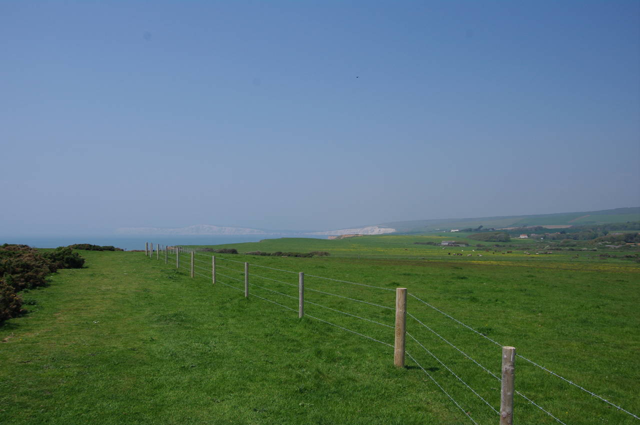
Reaching the next crest of the cliffs, I got my first, rather hazy, view ahead to the bright white chalk cliffs that plunge into the sea below Compton Down and Tennyson Down (picture 4), both of which I would be walking over a bit later in the day.

(5) Landslip at Sudmoor

(6) Approaching Brookgreen

(7) Old Lifeboat House, Brookgreen

(8) Path above Brook Bay
Along this section of the path, there are a number of sizeable landslips. In several cases, large slabs of ground have slid a few feet but have remained upright and kept their top layer of grass (picture 5). I saw another walker's dog running across a couple of these strange terraces, but I suspect that humans would be well-advised to stick to the clifftop path.
About three kilometres after leaving Chilton Chine, the Coast Path reaches the hamlet of Brookgreen, a line of houses occupying the top half of Brook Chine (picture 6). Getting nearer the chine, one can see what looks like a low stone wall, but when you finally reach it, you discover that it's actually a stone building that is partly hidden in a hollow. The building is the Old Lifeboat House (picture 7), which was built in 1860 to house a large rowing boat used to rescue people in trouble in the surrounding seas. The lifeboat was retired in 1937 after motorised lifeboats were introduced at Yarmouth and Bembridge, some 363 lives having been saved while the Brook lifeboat was in operation.
From the Old Lifeboat House, the Coast Path heads up the chine in front of the houses to reach the A3055 Military Road once more. Turning left along the road, the path soon reaches a carpark, crossing it to return to the clifftop above Brook Bay (picture 8).

(9) Shippards Chine carpark

(10) Path above Compton Bay

(11) Landslip above Compton Bay

(12) Approaching Compton Chine
A short distance along the clifftop, where the road runs within about 20 metres of the edge, I found that a recent landslip had cut a gouge almost up to the edge of the road, which had been reduced to one lane by temporary barriers. Here I was forced to walk along the narrow verge on the other side of the road for a few hundred metres before being able to use Footpath BS98 to return safely to the clifftop path shortly before it rounds Hanover Point which nominally separates Brook Bay from Compton Bay.
The cliffs around Hanover Point have been a rich source of fossils over the years. In 1972 the fossilised skeleton of an iguanodon was found here and at low tide the petrified remains of ancient pine trees can be seen in the sea just off the point.
A couple of minutes walk beyond the Point, I reached another carpark at Shippards Chine where a large number of people had come to enjoy the sun on the beach below the cliffs. I stopped here to join the queue for an ice-cream van while I observed that part of the carpark had obviously fallen victim to erosion in the recent past if the line markings were anything to go by (picture 9).
The path continues for another two kilometres to Compton Chine, with colourful little flowers all around the grassy path and the Freshwater Cliff below Compton Down growing ever larger ahead (picture 10). Along the way, the path has to circle around behind two more large landslips (picture 11). Compton Chine itself (picture 12) turns out to be a much smaller fissure than the other chines and the path bears right over a stile and diagonally across a small field to cross the chine via a small footbridge before bearing left across the next field and over a stile to return to the cliff edge. Looking into the chine, I could see the remains of an earlier footbridge, closer to the cliff, which has fallen into the widening chasm sometime in the last few years -- at the time of writing that bridge is still shown in its original position on the Google aerial photographs of the area.

(13) Freshwater Cliff and Compton Down

(14) View back from Compton Down

(15) Path by the A3055, Compton Down

(16) Monument on Freshwater Cliff
From Compton Chine, the path climbs steeply uphill to meet the A3055 Military Road, which now runs very close to the cliff edge, on the steep slope of Compton Down above Freshwater Cliff (picture 13). On meeting the road the Coast Path follows a well-worn trail just beside the tarmac, where countless walkers have worn away the grass to expose a narrow white line of chalk With the path still climbing fairly steeply, there are good views back towards the village of Brook, a kilometre or so inland from Brookgreen, and back along the coast (picture 14).
Ahead, there was still a fair amount of climbing to be done before reaching the crest of the road, with Compton Down rising even more steeply on the other side of the road (picture 15). Disappointingly, the view across the bay to the Highdown Cliffs was mostly obscured by the haze, which seemed to be getting worse as the day wore on.
Once over the crest of the downs, the path bears away from the road, descending past a small obelisk that I initially thought was a trig pillar (picture 16), but turned out to be a memorial to a child who fell from the cliff here on 28 August 1846.

(17) Freshwater Bay

(18) Stag Rock, Freshwater Bay

(19) View back from Tennyson Down
(20) Tennyson Down
Continuing to descend from Freshwater Cliff, the Coast Path eventually reaches the cliffs above Freshwater Bay (picture 17). The cliffs continue part of the way around the small inlet, with the weather-beaten Stag Rock standing just offshore (picture 18). Stag Rock used to be accompanied by Arch Rock, a little further to the left. The stone archway finally collapsed in 1992 and now only the bases remain.
A little further around the bay, the Coast Path descends some wooden steps to join the promenade, which is followed up to the front of the Albion Hotel. Here the route turns right to the main road, Gate Lane, then left along the road past the hotel's carpark to turn into an unsealed lane on the left just before a bus stop.
The lane heads back to the cliff edge above Watcombe Bay, reached after about 400 metres, though there is a gate on the left much earlier with a signposted alternative route. The Coast Path now begins the steep climb up Tennyson Down, owned by the National Trust, heading for the tall granite Celtic cross of the Tennyson Monument on the summit about two kilometres away. Despite the haze, there were still some good views back across Freshwater Bay and much of West Wight as the path rose higher (picture 19).
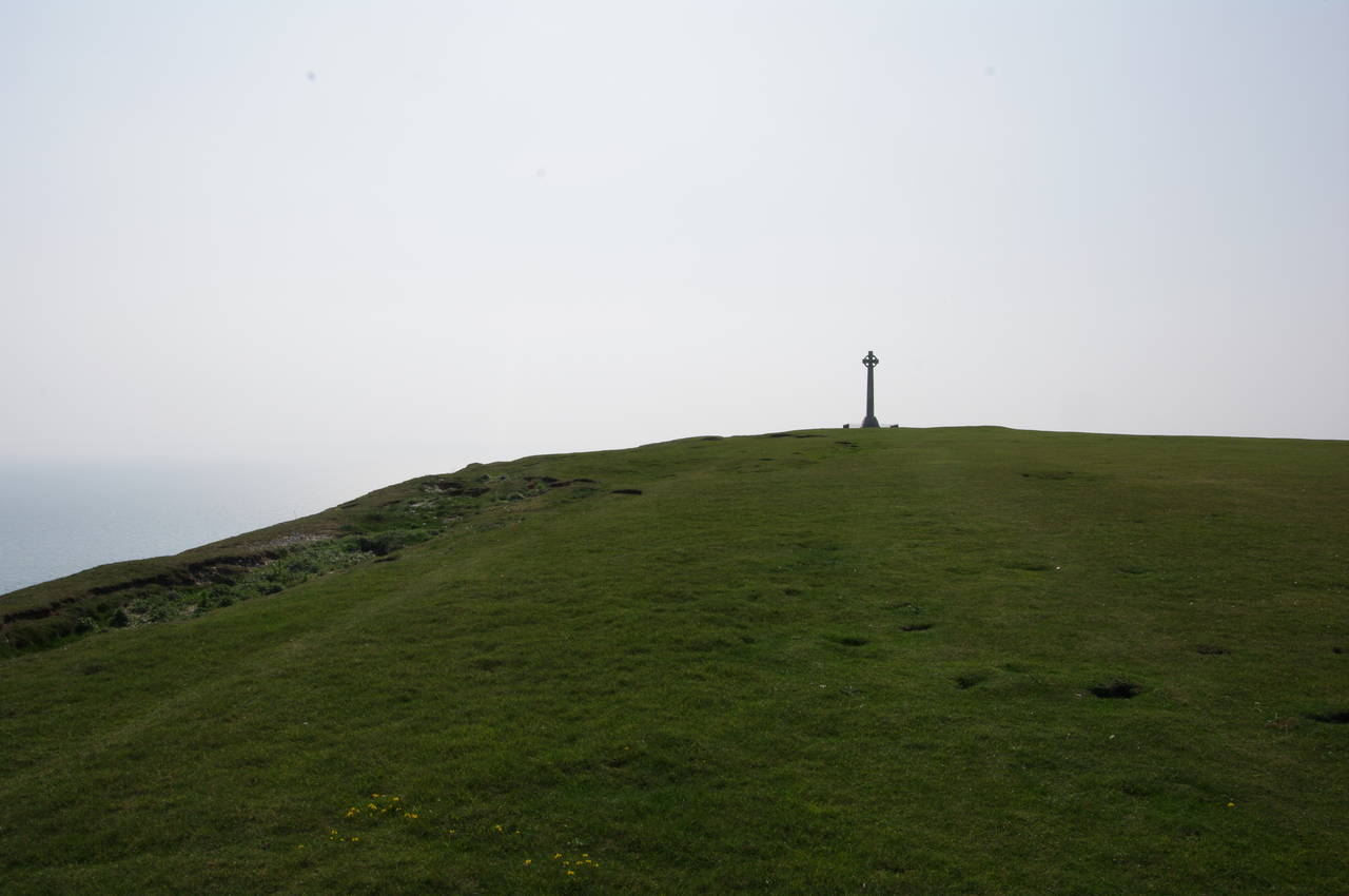
The rounded shape of the downland means that the cross isn't visible for the majority of the climb, though it would have been visible from Compton Down if there hadn't been quite so much haze in the air. As the slope becomes a little gentler the monument eventually comes into view (picture 20), the cliff edge nearby showing signs of cracking that will eventually lead to more huge slabs of chalk falling into the sea.

(21) Tennyson Monument

(22) Toposcope next to Tennyson Monument

(23) View north from Tennyson Monument

(24) View towards West High Down
The Tennyson Monument (picture 21), erected in 1897, stands on the highest point of Tennyson Down, 147 metres above sea level. Both monument and down are named after the Poet Laureate, Alfred Lord Tennyson (1809-1892), who lived nearby from 1853 until his death and walked here almost daily on what was then called East High Down.
In August 2009, to mark the bicentenary of the poet's birth, a toposcope was erected beside the monument. The toposcope is a flat polished slate panel showing distances to various nearby and far-flung places (picture 22), with one of Tennyson's verses displayed around the edge.
From the monument there are sweeping views in all directions, including northeast (picture 23), over the towns of Freshwater and Yarmouth and across the Solent to the mainland. though little detail of the latter could be recognised in the haze.
Continuing west from the monument, the Coast Path descends a little and gradually moves away from the cliff edge, running up the middle of the chalk ridge for the next two kilometres from Tennyson Down, through a slightly lower-lying area of scrub and back uphill to the open grassland of West High Down (picture 24).

(25) Coastguard cottages on West High Down

(26) The Needles
(27) Alum Bay from West High Down
(28) View back from Headon Warren
The shape of the land makes this part of the walk look much shorter than it really is, but in due time I eventually reached a group of Coastguard cottages built in a sheltered hollow on the top of West High Down (picture 25). The cottages stand near the Needles New Battery, where British rocket scientists worked in secret during the Cold War.
The Coast Path bears right, heading diagonally down the slope to the right of the cottages to a wooden gate by a road. This road runs for the last few hundred metres past the New Battery and up to the Needles Old Battery on the very tip of the headland overlooking the famous chalk stacks of The Needles. Unfortunately, the Coast Path doesn't continue up that way, but instead turns almost 180 degrees to the right in front of the gate.
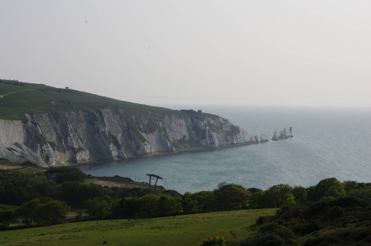
Although I knew that I would be back here a few days later to visit both batteries before walking the Tennyson Trail, I thought it would be a shame not to see The Needles while walking the Coast Path, so before continuing on the Coast Path I headed up the road and was able to find a viewpoint near the southern edge of the cliffs above the Old Battery, from which I was able to see the farther two of the three chalk stacks and the 1859 lighthouse (picture 26).
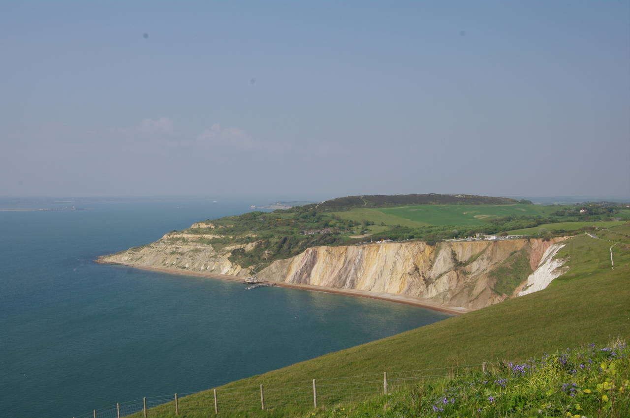
From the wooden gate where I had left the Coast Path, the route follows a well-worn chalky path eastwards down to a lower part of the access road. The route then takes another well-worn chalk path along the other side of the road as it gently descends to the tourist park above the corner of the L-shaped Alum Bay, with superb views of the bay's multicoloured cliffs all the way down the hill (picture 27).
In 1897 and 1898 Alum Bay was the scene of some of Marconi's early experiments with radio transmission, while in more recent times the bay has become a popular tourist destination due to the spectacular scenery and unusual geology -- the strata of soft sand and clay are almost vertical here due to folding of the earth's crust and the twenty or so different colours come from various oxidized substances in the sands.
At the bottom of the hill, the path follows the road around to the left and through the tourist park, passing a small glass works and the Needles Hotel before the road swings back to the right and into trees. About 100 metres further, the Coast Path turns left up a narrow lane to find a wooden gate on the right after another 80 metres, signed as the National Trust's Headon Warren.
From here a narrow sunken trail snakes its way uphill to Headon Warren. There are several places along this track where it is worth stopping to take a look back across Alum Bay, with the chairlift that runs down from the tourist park to the beach on this side of the bay and The Needles on the far side (picture 28).

(29) Bronze-age barrow, Headon Warren

(30) Hurst Castle from Headon Warren

(31) Totland Bay Old Lifeboat House

(32) Totland Pier
Headon Warren is so named because it was once literally a rabbit warren where, according to 15th century records, rabbits were farmed for both food and fur. The higher part of the heather and gorse-covered warren is scarred by several depressions that were once gravel quarries, while the summit is crowned by a bronze-age burial mound that is thought to be around 3,500 years old (picture 29), one of three barrows on Headon Warren.
From the barrow, the Coast Path begins to descend the east side of the Warren, from which there are views across the Solent to the fortress and lighthouse at the end of Hurst Spit (picture 30), which I had visited ten days earlier while walking the final stage of the Solent Way. The end of the spit is the closest point of the mainland to the Isle of Wight, separated by only 800 metres.
Nearing the bottom of the hill, the path skirts around Warren Cottage to arrive at the corner of Cliff Road and York Lane on the edge of the town of Totland. The Coast Path turns left here and follows the winding Cliff Road for about 400 metres until a signpost on the left points along Public Footpath T33, which takes the path the short distance down to the Totland Bay Old Lifeboat House (picture 31), which was in service from 1885 until 1924. Turning right, the path follows the sea wall past Totland Pier (picture 32). which dates from 1880, and ahead towards Warden Point.
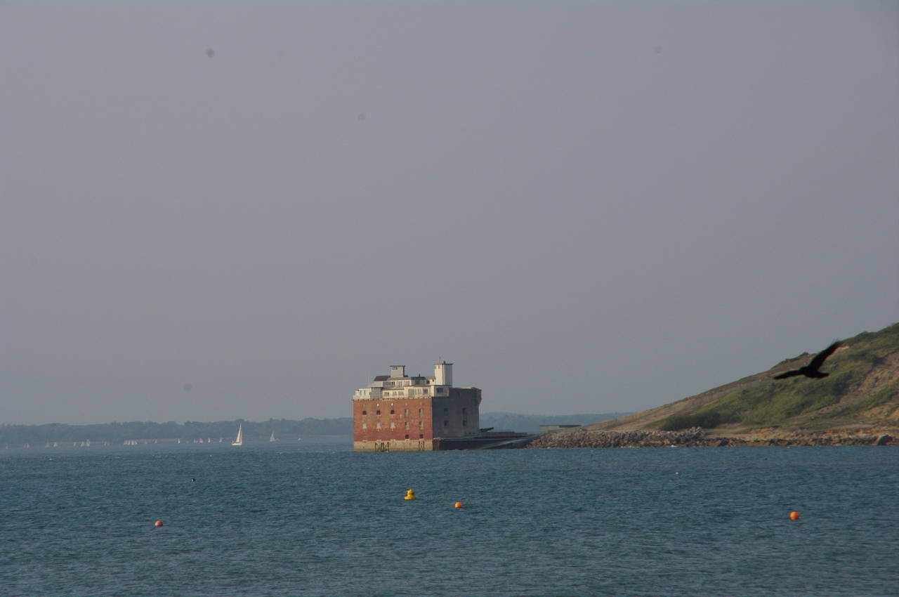
(33) Fort Albert from Warden Point

(34) View from Fort Victoria Country Park

(35) View ahead from Norton

(36) Yarmouth Harbour at sunset
Rounding Warden Point, there are views across Colwell Bay to Fort Albert (picture 33), which was built between 1852 and 1856 as part of the defences of the western Solent against a feared French invasion that never materialised. Within a couple of years of opening, the fort was made obsolete by the invention of armoured warships, though the fort was in military use on and off up until 1957. Fort Albert is now privately owned and has been converted into flats.
The Coast Path follows the sea wall around Colwell Bay, passing some beach huts and crossing a slipway where a Coastal Path signpost had been rotated 90 degrees to point out to sea. About 100 metres past the slipway, the Coast Path follows a path away from the bay, soon joining Madeira Lane for a 500 metre walk into the centre of Colwell, where the route turns left along the A3054 Colwell Road. At a bend about 300 metres along the main road, the Coast Path turns left, following a track that passes Brambles Farm and then kinks right and left before entering the Brambles Holiday Centre, where the next right turn takes the Coast Path out of the holiday village to the hedge-lined Monks Lane.
Turning left along Monks Lane, the Coast Path goes as far as the gates of the Cliff End Private Estate, where a signpost points the route to the right along a narrow enclosed path just outside the fenceline of the estate. Before I could follow that path, I had to wait a few minutes for a group of forty or so runners who were going the other way, though I'm not sure if they were training or actually competing in some kind of event.
When I did get going again, I soon left Cliff End behind and continued ahead into the Fort Victoria Country Park, reaching a viewpoint where I paused again to take in the magnificent late-afternoon views across the Solent to Hurst Castle and beyond to the coastline adjoining the New Forest (picture 34).
The next part of the Coast Path runs through quiet woodland for about a kilometre to reach Westhill Lane, still in the woods. To the left, off the Coast Path, the lane leads up to Fort Victoria, a gun battery and barracks built around the same time as Fort Albert, now housing a planetarium, aquarium and model railway. As it was now well past closing time for the fort, a visit would have to wait for another day and I followed the lane to the right instead. At the next bend, a signpost on the left for Public Footpath F6 points the way down to the sea wall at Norton, with the town of Yarmouth ahead on the far side of the River Yar (picture 35).
When the sea wall ends, the Coast Path heads right to join the A3054 road, which crosses the busy Yarmouth Harbour (picture 36) via the Yar Bridge to reach Yarmouth Quay, where I finished my walk at the Bus Station, which is conveniently located right on the Coast Path. My GPS showed that I had completed a further 25.4 kilometres of the Coast Path, not including my diversion for a closer look at The Needles.