THE NORTH DOWNS WAY
Stage 2: St Martha's Hill to Dorking
Saturday, July 24th 2010
The day was sunny and quite warm, with very little cloud, making for good views from the higher parts of the downs. On this stage of the trail, the sound of aircraft is audible at regular intervals, with Gatwick Airport off to the southeast.
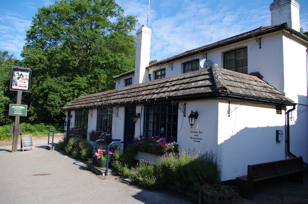
(1) The Villagers Inn, Blackheath

(2) Amusing street sign in Blackheath

(3) The Downs Link climbs St Martha's Hill

(4) Albury Downs
Before heading back towards St Martha's Hill where I would rejoin the North Downs Way, I spent some time exploring the little village of Blackheath, with its Villagers Inn (picture 1), where I'd spent the night, some picture postcard houses and a street sign that I'd love to have outside my house (picture 2).
I rejoined the Downs Link just north of the village and retraced my steps of the afternoon before climbing part of the way back up St Martha's Hill (picture 3) to the point where I had left the North Downs Way.
The North Downs Way soon passes Keepers Cottage and joins a road for a few hundred metres, passing some livery stables where it sounded like there was a lot of activity going on. The trail then climbs on a footpath on the left of the road for a few hundred metres more, before the path steps back down to the road and crosses over it into some woods. The climb through the woods is brief however, and it wasn't long before I was following a footpath across Albury Downs with good views off to the right (picture 4).

(5) View from Newlands Corner

(6) Snack Bar with a View

(7) Horses in West Hanger Wood
(8) Dew pond
After about a kilometre, I reached the busy A25 road at Newlands Corner, which is famous both for its magnificent views of the Surrey Hills (picture 5) anf as the place where novelist Agatha Christie staged her disappearance in 1926 (she was found safe and well in Yorkshire ten days later). Newlands has some facilities for the walker, including "The Snack Bar with a View" (picture 6), a restaurant and toilets.
After crossing the A25, the trail enters a long stretch of bridleway through dense woodland known as West Hanger. A little over half way, a sign for "Silent Pool" points down a path to the right -- worth the 15 minute round trip. Legend has it that King John once carried off a maiden he found bathing in the Silent Pool, and while Agatha Christie was missing it was feared that she may have drowned herself in the pool, having abandoned her car nearby.
Continuing aloing the bridleway, I saw several groups of horse riders on the path (picture 7) and also some evidence of recent logging activity.
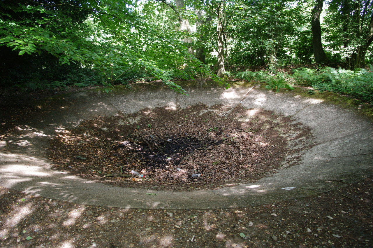
The bridleway emerges into a carpark, then crosses the road and re-enters the woods before emerging onto a second road next to the large concrete bowl of a dew pond (picture 8). Here the signposting was deficient -- the route turns right, following the road for about 50 metres, then turns left onto a wide track. The directions were confirmed by a couple of passing cyclists, who said they planned to ride the length of the North Downs Way in a weekend.

(9) Hollister Farm
(10) View from Blatchford Downs

(11) Pillbox
(12) Half-pipe
A few minutes walk later, this track turns left past Hollister farmhouse and stables (picture 9) and enters another long stretch of woods above the villages of Shere and Gomshall.
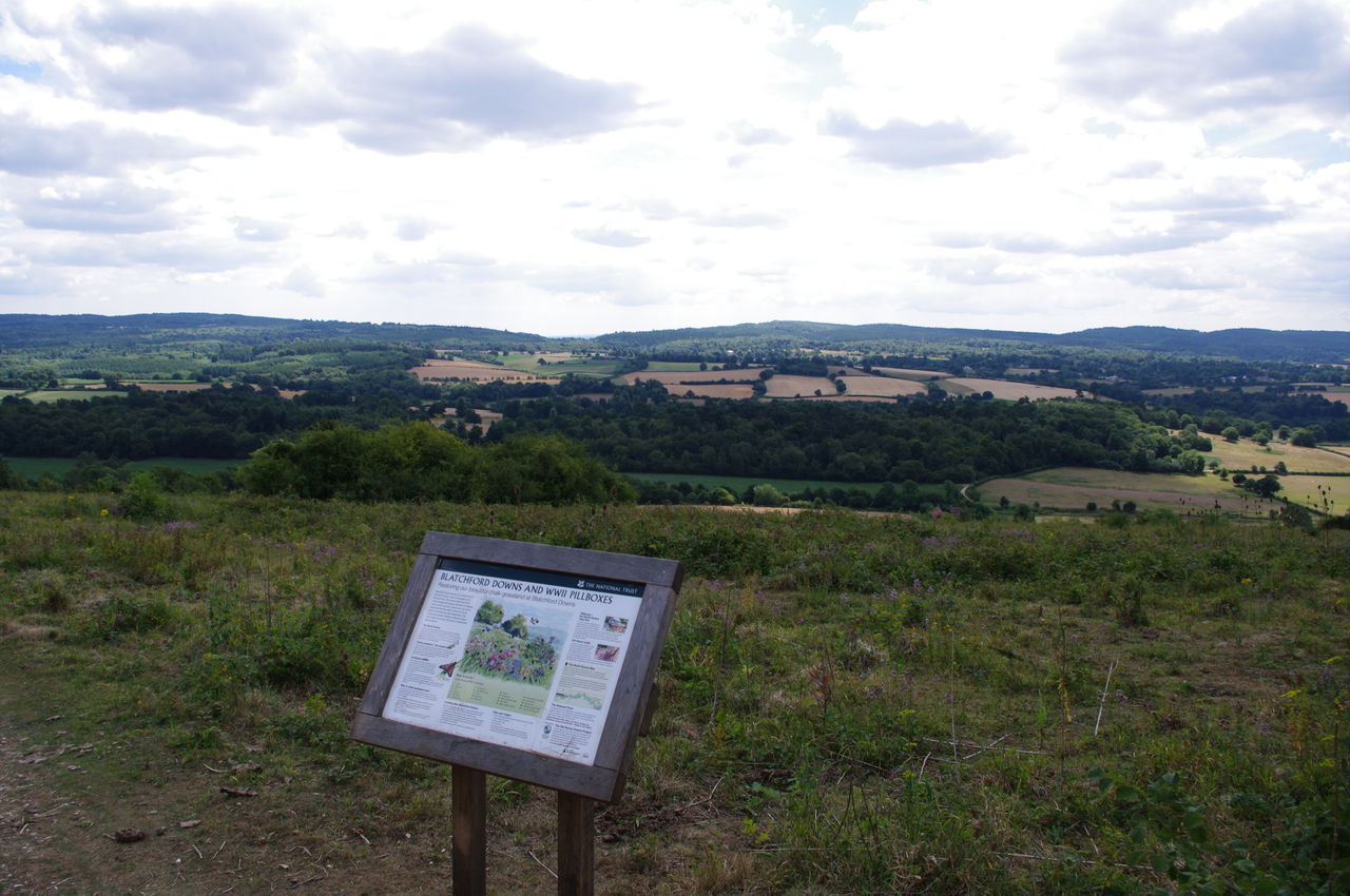
Eventually the trail leaves the woods and passes through several wooden gates into an area of open downland known as Blatchford Downs. Before long, I came across an information board (picture 10) and then the first of several World War II pillboxes along this stretch of the trail (picture 11).
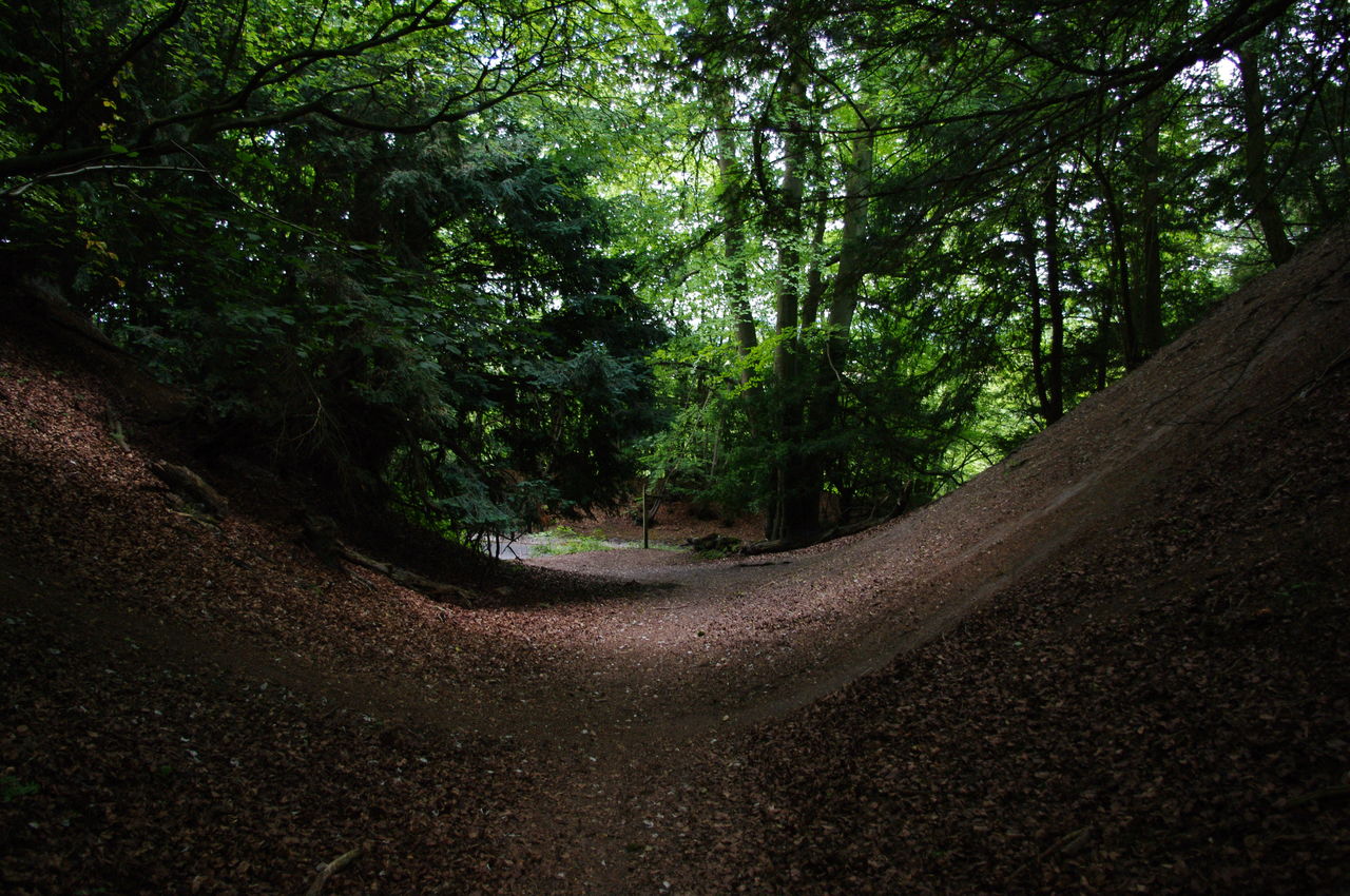
After crossing Blatchford Downs, the trail enters another section of shady woodland. In one part of the woods was a sunken part of the track where tyre tracks suggest that mountain bikers have been using it as a half-pipe (picture 12).

(13) Pickett's Hole

(14) View to Dorking
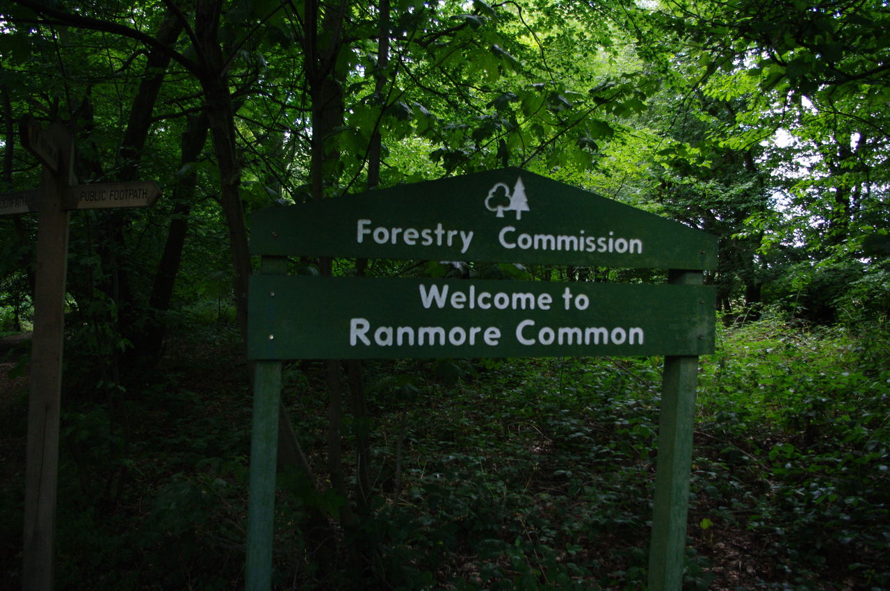
(15) Welcome to Ranmore Common

(16) Steers Field
The path passes a few more pillboxes in the woods, and after the last one it traverses a raised section of track known as Pickett's Hole (picture 13), before turning right at an informaiton board. A little further on, the woods open out on the right hand side to give some good views to the town of Dorking (picture 14), which is still a bit more than an hour's walk away. Further again in the woods was a sign indicating that the path is entering Ranmore Common (picture 15) and at the end of the woods, a gate takes the path into Steer's Field (picture 16).

(17) The Old Post Office, Ranmore Common

(18) St Barnabas Church

(19) Denbies Winery Tour

(20) View to Dorking from Denbies Estate
Taking the rightmost of the two paths through the long grass, the route reaches a fingerpost that points through a gate and across the road. The route then goes along a street to the right of a white cottage which was once a post office (picture 17). A short distance along this road, one can't miss the enormous spire of St Barnabas Church (picture 18).
When the road ends, the North Downs Way continues for a few hundred metres along a concrete path before turning right into a driveway, heading downhill and then turning left when the driveway reaches another unsealed road. This area is part of the Denbies Wine Estate, which is apparently England's largest vineyard. While walking along the track here, one must be wary of the winery tour vehicles, which come up behind you rather quickly (picture 19).
The track now gently descends through the vineyard and gradually curves to the left giving some great views of Dorking (picture 20).

(21) View to Box Hill
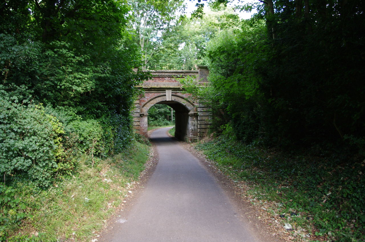
(22) Railway bridge near Dorking
As the track swung further to the left, there were also good views ahead to Box Hill (picture 21), which the North Downs Way climbs over. Near the bottom of the descent the path curves back to the right, then goes straight ahead for about 800 metres, passing under a railway bridge (picture 22) shortly before reaching the A24 road. The route then goes left along the A24 for about 400 metres, goes under a subway, then comes back along the other side of the road.
Almost directly opposite where it first emerges onto the A24, the route turns left and heads towards Box Hill. Here I left the North Downs Way for the day and continued along the A24 for another kilometre into Dorking, where I caught the train back to London.
Total distance walked today was around 23km, with 18.5km of that on the North Downs Way.