SOUTH WEST COAST PATH NATIONAL TRAIL
Stage 8: Seatown to Lyme Regis
Tuesday, May 7, 2013

(1) The Anchor Inn, Seatown

(2) Golden Cap

(3) View east from Golden Cap
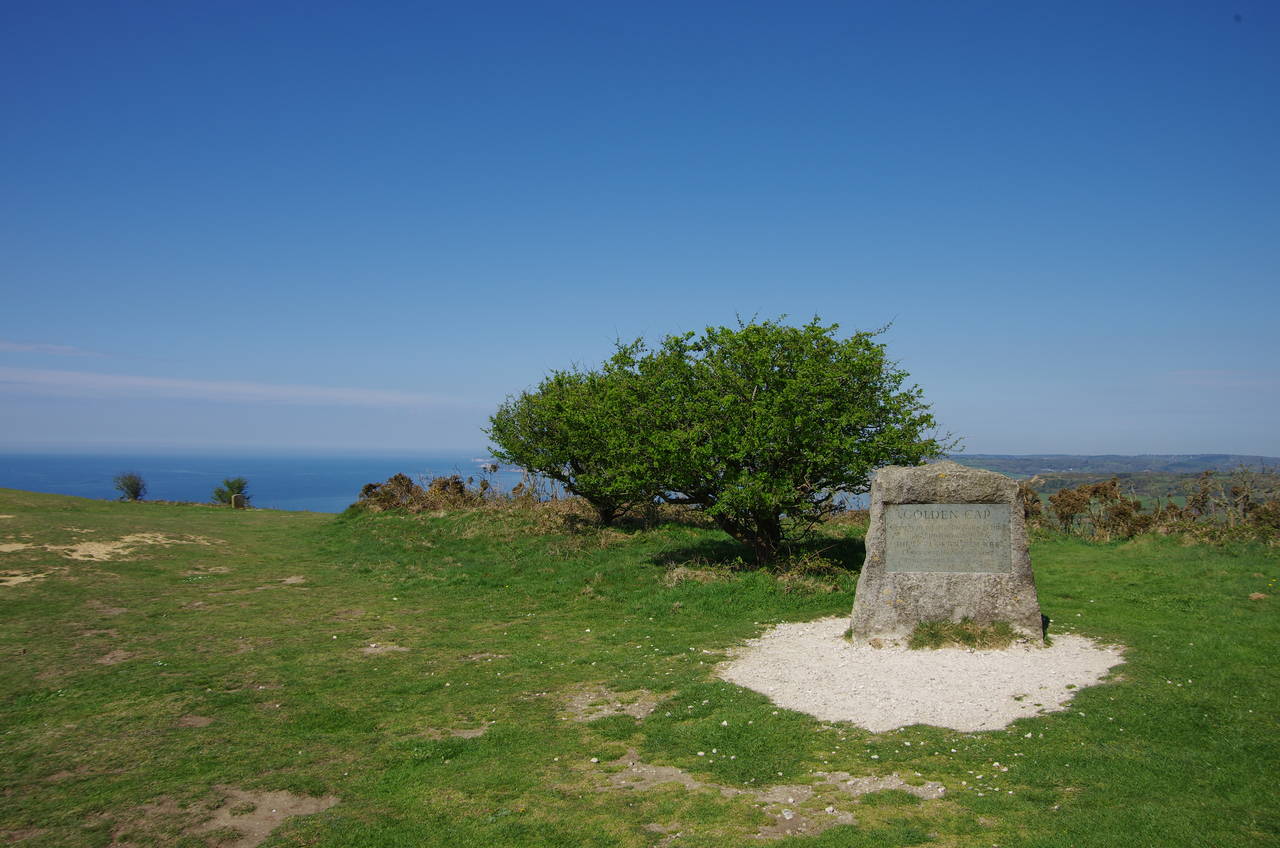
(4) Golden Cap Stone
After catching the first bus of the day from Weymouth to Chideock, I retraced my steps of a few days earlier back along the narrow lane leading down to the coast at Seatown. Thankfully, there was no traffic this time and I was able to rejoin the Coast Path in front of the Anchor Inn (picture 1) not long after eight o'clock on a glorious sunny morning.
Due to cliff erosion to the west of Seatown, the Coast Path no longer follows the cliff-top, but instead heads back up the lane for about 150 metres to find a gate on the left and follow a path through trees and across a field before beginning to climb the slopes of Golden Cap (picture 2). For the next 1500 metres the well-trodden path climbs steadily across several more fields, separated by patches of scrub. A final left turn through a gate for a short but steep climb up a stepped path brings one to a trig pillar at the summit of Golden Cap, the highest point on England's south coast at 191 metres above sea level. From the viewpoint here there are far-reaching views back eastward along the coast as far as the Isle of Portland (picture 3).
The path heads across the flat, scrub-covered top of Golden Cap to pass by the Golden Cap Stone (picture 4) -- a memorial to the Earl of Antrim, who was chairman of the National Trust from 1966 until 1977.

(5) View west from Golden Cap

(6) St Gabriel's Mouth

(7) St Gabriel's Church

(8) Landslip
A few strides further, the ground begins to fall away steeply, revealing another magnificent view, this time westwards across Lyme Bay to Lyme Regis and beyond across the county border into Devon (picture 5).
The path zigzags steeply down the initial part of the descent from Golden Cap before rejoining the crumbling clifftop and descending a little less steeply into St Gabriel's Mouth (picture 6). After a further 500 metres the path bears inland to find a wooden footbridge over the small stream that has cut the deep coombe into the soft cliffs.
Beyond the footbridge, the path climbs a few steps and crosses a stile into a pasture. Here I took a diversion from the Coast Path, following a signposted path to the right for about 400 metres to visit the ruins of St Gabriel's Church (picture 7), once part of a substantial community.
Returning to the Coast Path, I continued westwards along field edges above a large area of old landslips (picture 8).

(9) View back to Golden Cap

(10) Landslip east of Charmouth

(11) Descending from Stonebarrow Hill

(12) Charmouth Beach
The path returns to the clifftop at Ridge Cliff, where there are good views back to Golden Cap (picture 9), soon crossing a new footbridge over a little stream called Ridge Water. In fact, the bridge was so new that there were still notices about the collapse of the previous bridge attached to nearby signposts. A short climb and descent lead to a second footbridge over Westhay Water, beyond which the path climbs again to emerge from the scrub at the edge of another large landslip with the town of Charmouth beyond (picture 10).
The cliffs around Charmouth are particularly susceptible to landslips, which reveal a steady supply of fossils that has attracted many visitors to the area since the early 1800's, when local woman Mary Anning made a series of important discoveries, including three complete dinosaur skeletons.
The landslip on the eastern side of Charmouth caused the Coast Path to be temporarily diverted inland in 2007. The diversion seems likely to become permanent.
The signposted diversion heads northeast for 250 metres to reach a National Trust carpark on Stonebarrow Hill. Turning left, the route follows the quiet Stonebarrow Lane (picture 11) downhill for about a kilometre to cross the River Char at the edge of Charmouth. A short distance ahead along The Street, the route turns left into Bridge Road, passing the local fire station. At the end of Bridge Road, a narrow footpath leads ahead through the Seaview Park caravan park then River Way and Lower Sea Lane lead down to the beach by the Charmouth Heritage Coast Centre and a row of beach huts (picture 12).
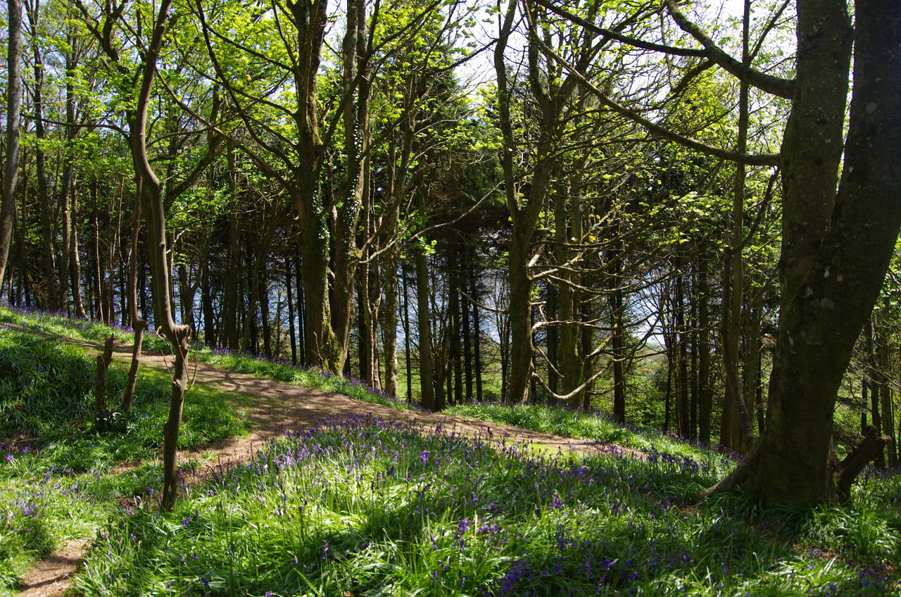
(13) Timber Hill
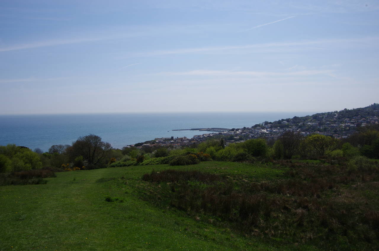
(14) Approaching Lyme Regis

(15) Lyme Regis Beach

(16) The Cobb
To the west of Charmouth is the most active area of landslips in Britain, and another lengthy and long-term diversion is in place, bypassing the entire stretch of cliffs between Charmouth and Lyme Regis.
The diversion route leaves the beach just to the west of the Heritage Centre, following a path between two rows of beach huts to join Higher Sea Lane, which is followed all the way back inland to The Street about 500 metres west of where the path previously left it. Turning left along The Street, which soon becomes Axminster Road, the route gently climbs as it heads out of the town, bearing slightly left on reaching a roundabout and continuing on the A3052 rather than the busier A35 which enters and leaves on the other side of the roundabout.
After another 300 metres, the route turns left off the road to cut through Fern Hill Coppice and then crosses the Lyme Regis Golf Course to rejoin the A3052. This second encounter is a brief one; when the main road bends right, the diversion route continues ahead on a lane called Timber Hill, passing the clubhouse then leaving the lane about 200 metres later to rejoin the original route of the Coast Path in a beech wood (also called Timber Hill) that was carpeted with bluebells (picture 13). A rather circuitous path leads downhill to the lower edge of the wood where a cross-path heads eastwards for 100 metres before the route turns back to the south-west to descend diagonally across three fields (picture 14) to join the A3052 for a third time, now on the fringes of Lyme Regis.
The route now follows the A3052 (here called Church Road) down into the town. In a couple of places the road is too narrow to accommodate two lanes of traffic, but is still a two-way road, and as I walked down past the Church of St Michael the Archangel, I witnessed the slightly comical sight of two double-decker buses meeting at one of the narrow bottlenecks. This stand-off was eventually resolved when one of the drivers got out and asked the half-dozen cars lined up behind him to back up so he could do likewise to let the other bus and a much longer line of cars through. I wonder how often this kind of thing happens here.
A little further downhill, the road swings right in front of the town's museum and reaches The Square, which overlooks the seafront. Crossing The Square the Coast Path joins Marine Parade, the promenade that runs alongside the beach for about 500 metres to Lyme Regis Harbour. At first the beach is made of pebbles, but nearing the harbour it becomes sandy (picture 15).
The harbour is sheltered by a very solidly built breakwater, known as The Cobb, which dates from 1824. I ended this stage of the walk at the RNLI Lifeboat Station at the landward end of The Cobb, having covered another 13.5 kilometres of the Coast Path. As it was not yet quite two o'clock, I had plenty of time to explore the town during the afternoon, including walking out to the end of The Cobb (picture 16).