SOUTH WEST COAST PATH NATIONAL TRAIL
Stage 10: Seaton to Sidmouth
Friday, May 10, 2013

(1) Seaton Hole Beach

(2) Chine Cafe

(3) Old Beer Road
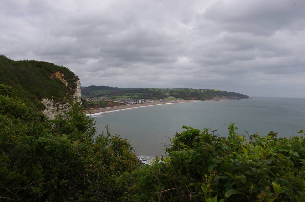
(4) Seaton Bay
When I returned to the seafront at Seaton the next morning, the seas were nowhere near as turbulent as they had been the previous afternoon, but the skies were still dark and the temperature rather cold.
From the roundabout at the end of The Esplanade, the Coast Path follows the promenade past a long line of colourful beach huts at Seaton Hole Beach, with the chalk headland of Beer Head looming over the bay (picture 1). Just beyond the last hut, the Chine Cafe suddenly appears, occupying a sheltered position at the foot of a combe (known in this part of England as a chine, where a small stream has cut a gap in the cliffs (picture 2). The Coast Path leaves the beach here, going around behind the café and following a footpath up through the grassy chine to meet the B3172 Beer Road.
A short distance along the road to the left, the Coast Path used to bear left into Old Beer Road, which runs along the clifftops. A recent cliff fall has caused the closure of the road and the Coast Path now continues along Beer Road for another 700 metres before taking a sharp left hand turn into the other end of Old Beer Road. The road heads downhill beside the tiny Beer Brook (picture 3), lacking a footpath or verge for most of the way, to reach an intersection where the Coast Path turns right onto Beer Hill.
As an avid homebrewer, the succession of beery place names I encountered on my approach to the town of Beer were helping to brighten my mood despite the gloomy weather. In truth, however, the place name has no relation to the amber fluid that has been my reward for many a day's walking, but instead derives from an ancient word for "grove", in reference to the woodlands that once covered this area.
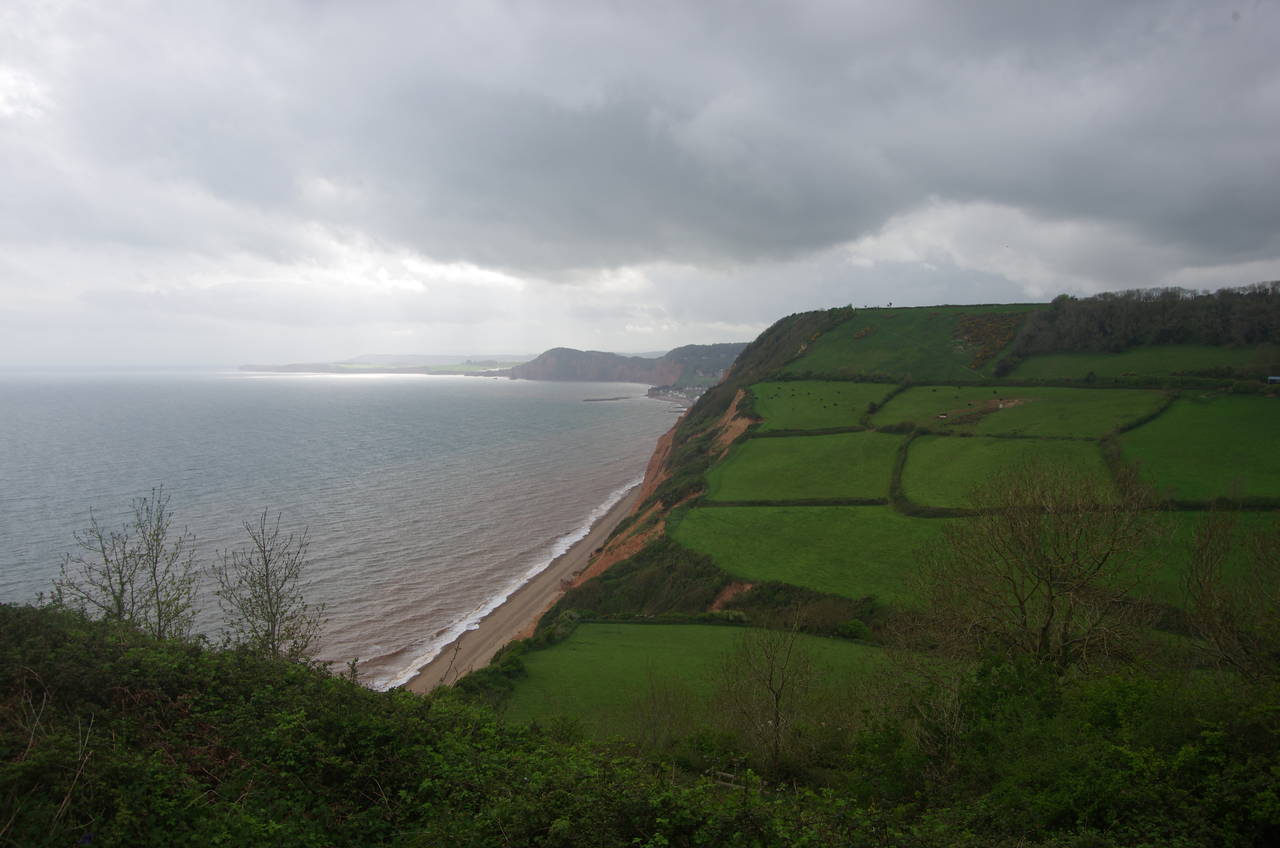
Part of the way along the narrow lane, the Coast Path climbs a ramp to the left of the road and returns to the clifftops, giving some nice views back across Seaton Bay (picture 4).

(5) Beer Beach
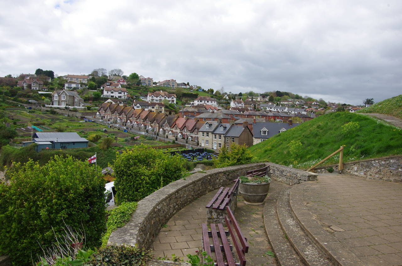
(6) Beer

(7) Beer Head

(8) View west from Beer Head
A narrow and mostly enclosed footpath runs along the clifftop around the promontory of East Ebb, eventually emerging high above the sheltered Beer Beach (picture 5), home to a small fleet of beach-launched fishing boats. The path descends through some pleasant parkland above the beach, with good views of the village clinging to the hillside (picture 6). Before long the path curves inland to meet Common Lane in front of the Anchor Inn, a little way uphill from the beach.
Turning left along the lane, the path climbs with houses to the right and clifftop allotments to the left. After about 300 metres, the path bears left on Little Lane, soon taking a narrow hedge-lined footpath to the right of a house and ahead to the edge of a large caravan park that blights the grassy hillside behind Beer Head. Mercifully, one doesn't have to look at the sprawling complex for long, as the path turns left and skirts around the edge of the caravan park and back to the clifftop.
In open countryside at last (picture 7), it's an easy walk up to the southern tip of Beer Head, where there are good views of the South Devon coastline stretching out westwards (picture 8). The chalk cliffs just to the west of Beer Head are the most westerly chalk cliffs in Britain.

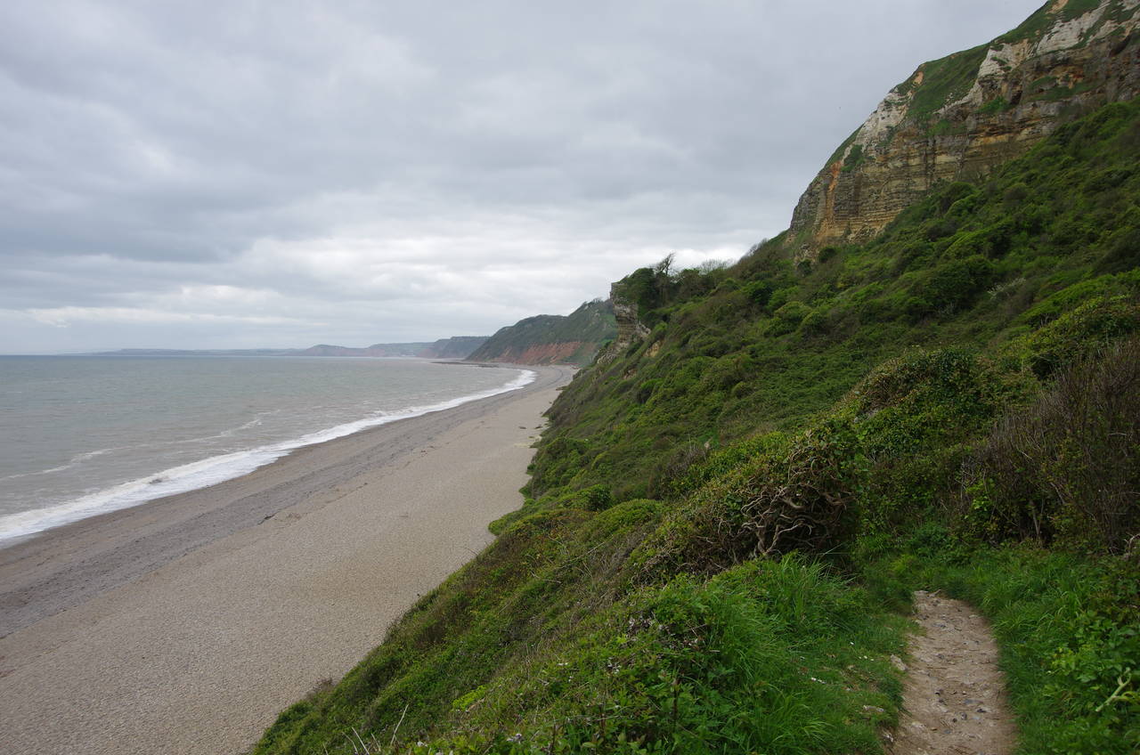
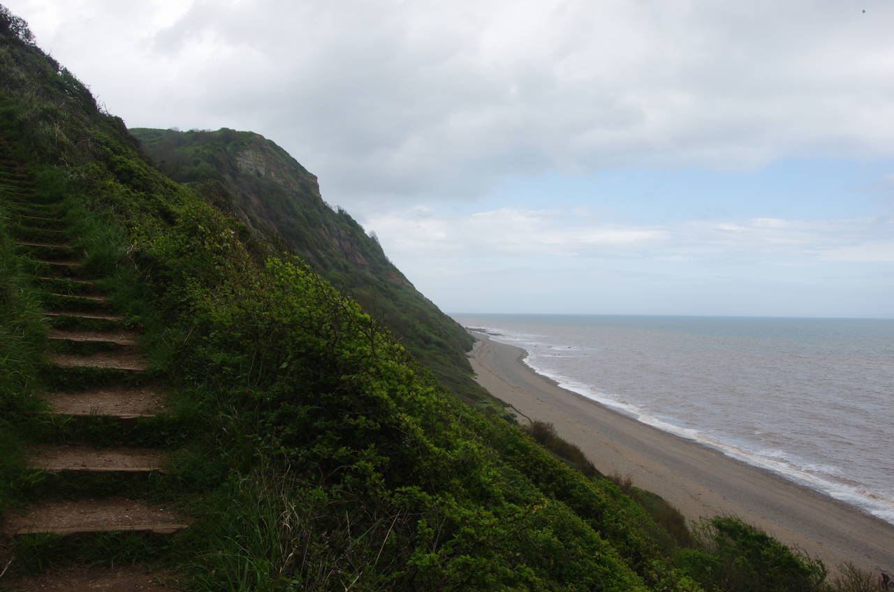
(9) Hooken Cliffs
(10) Hooken Beach

(11) Branscombe Mouth

(12) Berry Camp
The Coast Path follows the clifftop westwards for about 300 metres to a wooden kissing gate where the path descends steeply into the undercliff below Hooken Cliffs, giving a good view of the horizontal bands of rock in the cliff face (picture 9). The narrow path winds its way down through the scrub, going almost all the way down to Hooken Beach (picture 10) before climbing again to join a vehicle track along the back of a small caravan park perched on the steep hillside of East Cliff.
Descending across a field where an old World War II pillbox has been almost completely overgrown by gorse, the path fords a shallow stream to arrive at the hamlet of Branscombe Mouth (picture 11), where I stopped for some refreshment at the Sea Shanty Cafe.
The extra energy was soon being burnt up as I climbed the path to the National Trust-owned West Cliff, where the route passes another pillbox before heading around the landward side of a row of old coastguard cottages and up to a gate on the edge of a large wood. The path continues to climb inside the wood for a while before leveling out. Several separate properties make up the long stretch of ash woodland, first Little Seaside Coppices, then Mill Coppices and finally Church Coppice.
After almost two kilometres in the woods, the path emerges into a grassy field where a low bank marks the edge of Berry Cliff Camp, a hillfort of either Iron-Age or Roman origin (picture 12). The Coast Path crosses the ancient earthwork and runs along the inside of the hillfort before crossing the bank again where it meets the clifftop.

(13) Weston Mouth
(14) Lower Dunscombe Cliff

(15) Lincombe

(16) View from Higher Dunscombe Cliff
The Coast Path follows the clifftop a bit further before bearing inland on the edge of a field to pass behind a patch of tall scrub surrounding what appeared to be a railway goods van converted into a small dwelling. Continuing into the next field, the route crosses a deep dip to return to the clifftop, though tall scrub on the left hides the view until the path has passed by the next field and into a second, which an information board describes as the Weston Wildflower Meadow.
At the far end of the meadow, the path begins to descend steeply into Weston Combe, dropping down around 160 metres to the shingle beach at Weston Mouth (picture 13). The visit to the beach is rather brief, however, with the route crossing the tiny stream that emerges from the combe and immediately climbing a zig-zag path up the other side of the combe to Lower Dunscombe Cliff (picture 14).
Having regained the clifftop, the path heads through patches of woods and scrub before veering inland to pass around the top of Lincombe (picture 15) and then back to Higher Dunscombe Cliff. From here I could see that there was brighter weather further along the coast (picture 16), but it would remain tantalisingly out of reach for the rest of the afternoon.
(17) Salcombe Mouth

(18) Toposcope on Salcombe Hill

(19) Approaching Sidmouth

(20) Sidmouth seafront
The clifftop path runs along the edges of two large fields, then the land drops away once again, this time to Salcombe Mouth (picture 17). After zig-zagging steeply down through a patch of woodland, the path heads diagonally across a field to a footbridge part of the way up the combe. Just to the right of the bridge, about five metres of wire fence was hanging in mid-air, the ground beneath it having given way and fallen into the combe. The bridge seemed solid enough though, but how long it remains that way is anybody's guess.
For the next kilometre, the path climbs steadily, following field-edge paths just back from the cliffs to reach a viewpoint on top of Salcombe Hill. The summit is marked by a toposcope showing distances to various points on the Devon coast and the north of France (picture 18).
It's just about all downhill from here, as the path descends through a small wood and across fields towards the town of Sidmouth (picture 19). After joining the hedge-lined Alma Lane on the edge of town, two left turns and a right lead to a path down to a footbridge across the mouth of the small River Sid and onto the seafront Esplanade (picture 20).
A short distance along the seafront stands a small sundial, which seemed like as good a place as any to finish my walk, with a further 16.8 kilometres of the Coast Path completed.