SOUTH WEST COAST PATH NATIONAL TRAIL
Stage 38: St Ives to Portreath
Friday, June 5, 2015

(1) Porthminster Beach, St Ives

(2) Path beside St Ives Bay Line

(3) Carbis Bay
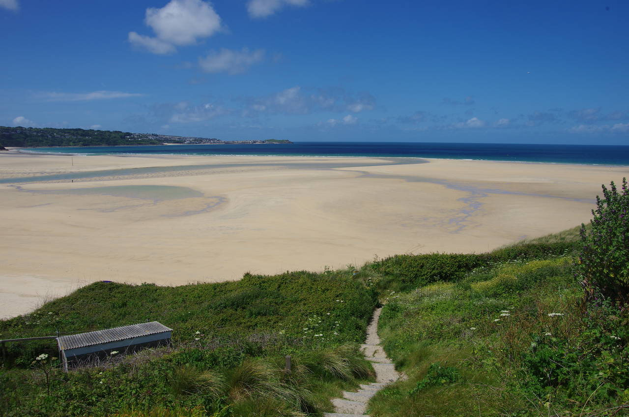
(4) Porthkidney Sands
It was a rather overcast and blustery morning when I returned to St Ives, catching the little train along the St Ives Bay Line to its terminus overlooking Porthminster Beach, where I rejoined the South West Coast Path (picture 1).
A tarmac path runs down to the Porthminster Beach Cafe and then climbs a pleasant tree-lined path (picture 2), which zig-zags a couple of times to reach a bridge over to the landward side of the railway line. The path continues to climb parallel to the railway line, soon joining a quiet residential lane bordered by high hedges and stone walls. About 500 metres further on, the route bears left on another shady tarmac footpath and almost immediately reaches a fork where St Michael's Way comes in from the right. The next four kilometres of the route is shared with St Michael's Way, which I had walked in the opposite direction the previous Sunday afternoon.
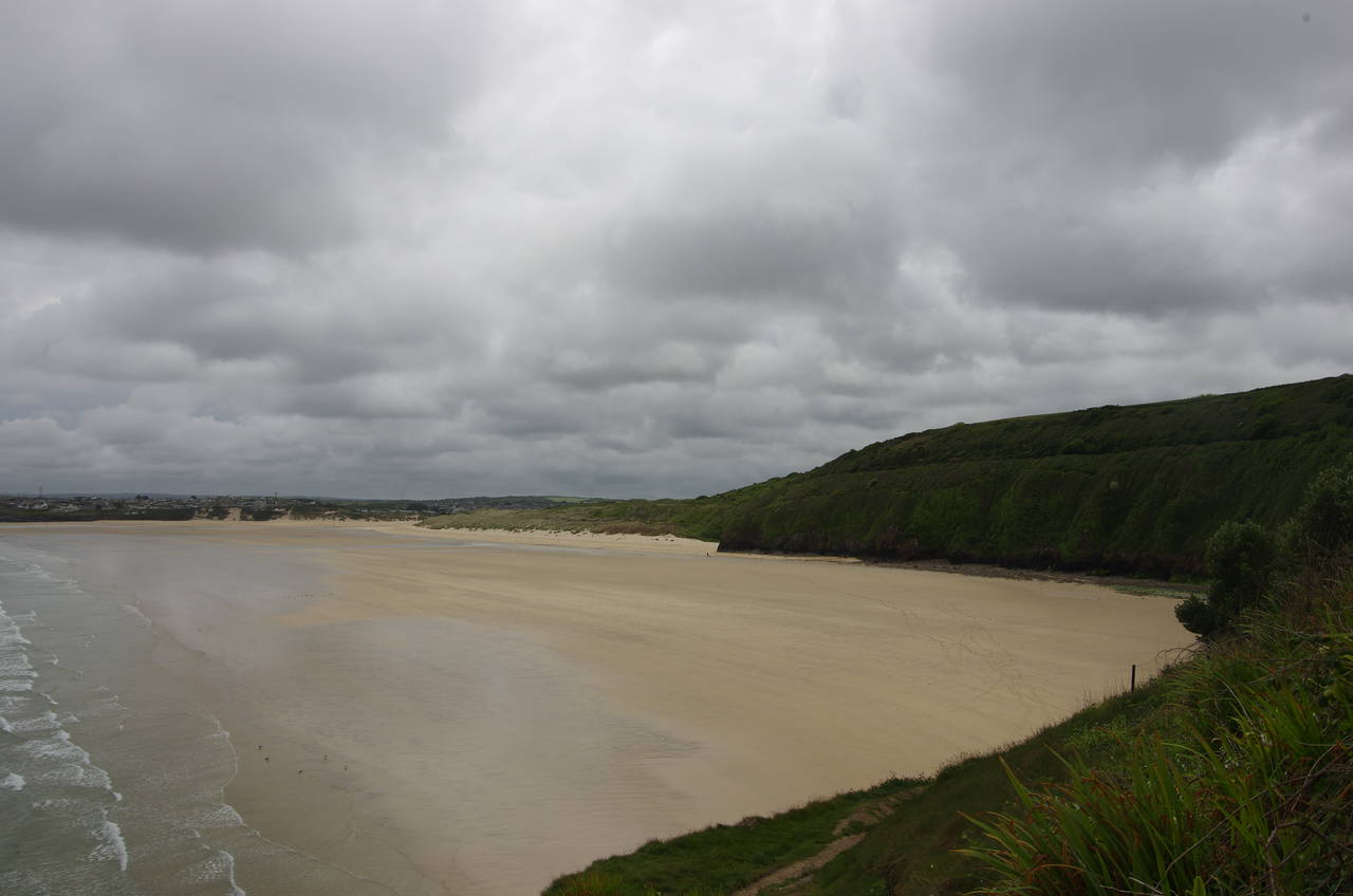
A little further along the enclosed path, the route crosses a footbridge back over the railway line, briefly getting a good view across the sheltered Carbis Bay (picture 3) before the foliage closes in around the path again as it descends beside the Carbis Bay Hotel. The path crosses the front lawn of the hotel to join the end of Beach Road, which climbs uphill for about 200 metres to find a signpost pointing left down some steps. This leads down to a narrow path that meanders along low clifftops and around the small headland of Carrick Gladden, which separates Carbis Bay from the much larger expanse of sand at Porthkidney Sands (picture 4).
(5) Lelant Towans
(6) Hayle Estuary

(7) Church of St Uny, Lelant

(8) Old Quay House, Lelant
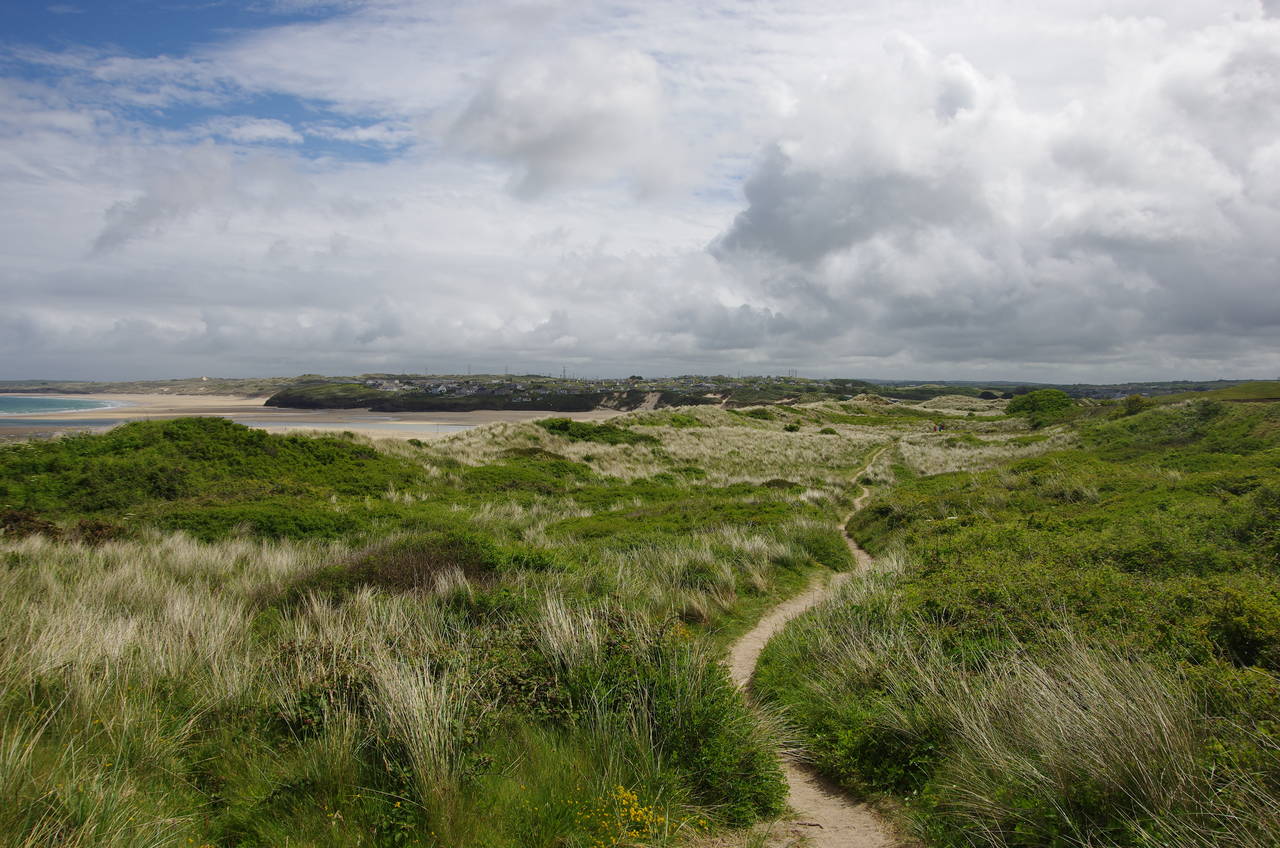
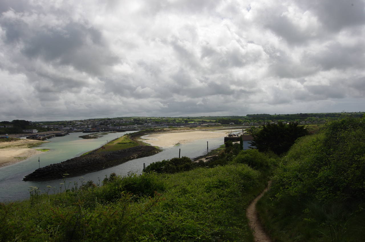
On the eastern side of the headland the path finds its way between a few houses and climbs back up to the railway line before almost immediately leaving it again to run through a fairly dense patch of woodland, in the midst of which the sun emerged from behind the clouds for the first time in the day. Beyond the woods, the path winds its way among the dunes of Lelant Towans (picture 5), never very far from the railway line until it reaches the edge of the Hayle Estuary after almost one and a half kilometres. A long narrow spit of land splits the estuary in two, separating the River Hayle on the right from Copperhouse Pool on the left (picture 6).
Here begins a long and relatively boring detour away from the coast to get around the estuary, walking about six kilometres to reach a point just 400 metres away across the water. The path dips down before turning right under the railway line, then climbs a sandy track across the West Cornwall Golf Course to the Church of St Uny on the edge of the town of Lelant (picture 7). Beyond the church the path reaches a quiet road, and the end of St Michael's Way.
A short distance ahead, the road forks and the Coast Path bears left on Green Lane and it doesn't take long to reach the railway line, which hugs the edge of the estuary. The road, now called The Saltings, bends right to follow the railway line past the tiny Lelant Station and about 300 metres beyond it the road bears right, leaving the railway line to skirt along the edge of Lelant for around a kilometre. When the road finally turns right, the Coast Path instead turns left into the carpark of Lelant Saltings Station, then right to follow Saltings Reach out to the fairly busy B3301 road.
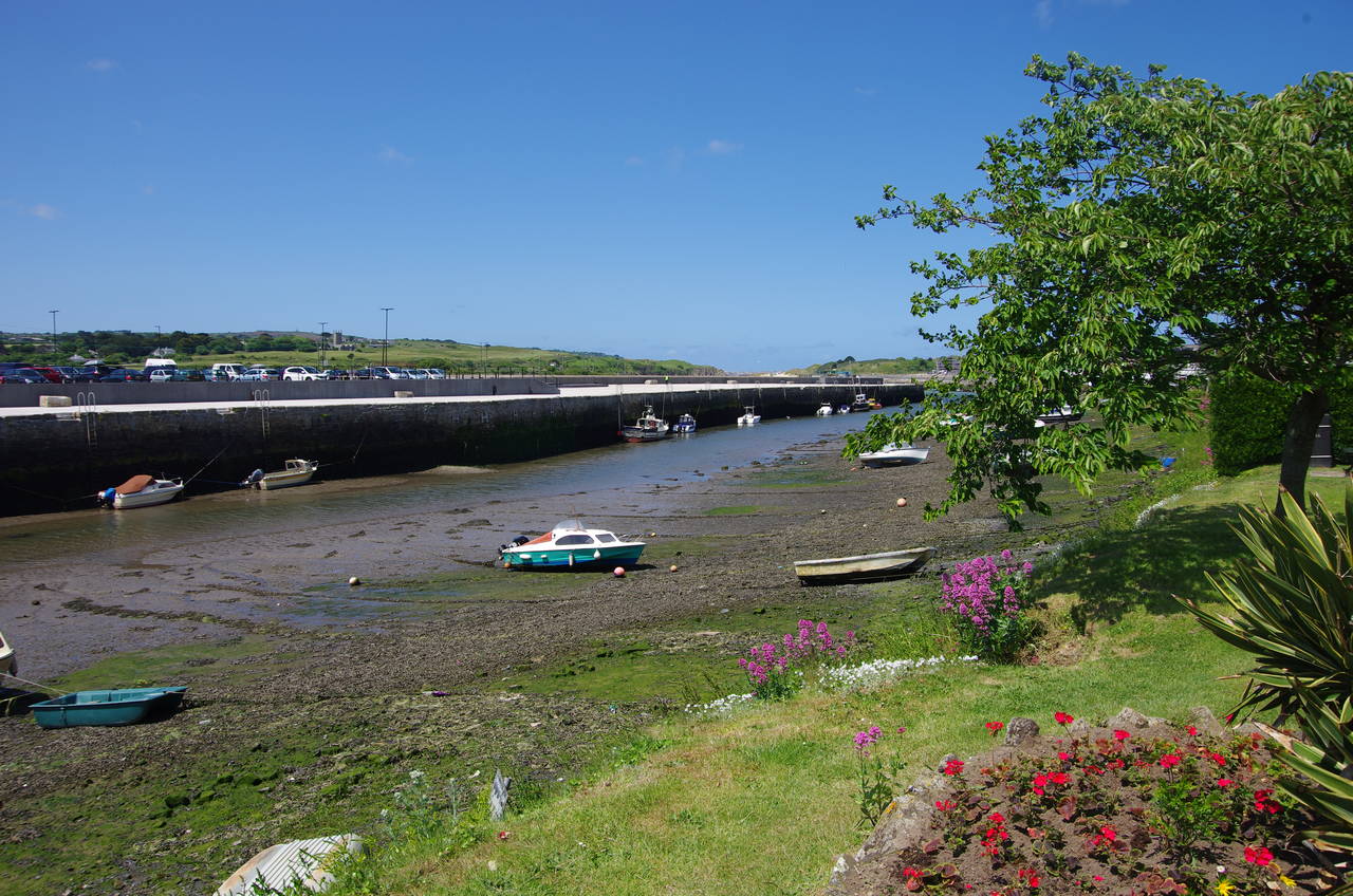
The route turns left along the road, which has no footpath or verge for about 200 metres until it reaches The Old Quay House pub, which stands on the edge of the estuary (picture 8).

(9) Hayle Estuary

(10) Carnsew Pool
(11) Copperhouse Pool
(12) Hayle Towans
Just after the pub it is best to carefully cross the busy road to follow the pavement on the far (right-hand) side for about a kilometre across The Causeway, which crosses the River Hayle and carries the road along the edge of the estuary. This is a rather noisy and unpleasant stretch of the path, the only compensation being the view across the estuary (picture 9).
Beyond a large industrial building, the path crosses back over and a signpost points off the road on a mercifully quiet path along the edge of the Carnsew Pool, a large tidal pool cut off from the rest of the estuary by a man-made embankment, with the town of Hayle up ahead (picture 10). Beyond another group of industrial buildings, the path turns right along the edge of an ASDA superstore carpark to rejoin the B3301. This area seemed to be undergoing regeneration and the route was a little confusing, with a dodgy looking diversion sign suggesting that the route here might be subject to change.
The Coast Path follows the road under a viaduct that carries the main London to Penzance railway line, curving around to pass back under it again less than a hundred metres later. The path now follows a grassy strip between the road (now Penpol Terrace, the main shopping street of Hayle) and the edge of Copperhouse Pool (picture 11). Eventually reaching a pub carpark, the road curves right and when the road straightens a Coast Path signpost points left across a bridge on North Quay.
The road runs alongside an old wharf that has recently been levelled then up into Hayle Towans, part of a large area of sand dunes that stretches for more than six kiloemtres along the eastern side of St Ives Bay from the mouth of the Hayle Estuary (picture 12) to Godrevy Point.

(13) Hayle Towans
(14) Mexico Towans

(15) Phillack Towans

(16) Upton Towans
An obvious path now runs along the edge of a large community of holiday chalets, eventually turning left beside a cottage to join a well-worn path along the edge of the dunes above the wide sandy beach. The turn is indicated by the first of a series of large slate slabs that mark the route through the dunes (picture 13).
After passing by a pillbox, a lifeguard post and another pillbox, the path leaves the chalets of Hayle Towans behind, making a short detour inland among higher dunes before returning to the edge of the dunes to get around another large holiday park at Mexico Towans. Mercifully the chalets are fairly well hidden from the Coast Path, making this stretch feel more isolated than it really is (picture 14). Beyond the holiday park the path once again heads up among the higher dunes of Phillack Towans (picture 15) and then into Upton Towans (picture 16), with the slate waymarkers showing the way at regular intervals.
Towards the end of Upton Towans, the path passes through an area where explosives were once manufactured, with the ruins of several buildings separated by substantial dunes, presumably to minimize the effect of any accidental explosions.

(17) Saint Gothan Sands

(18) Godrevy Point

(19) Godrevy Island

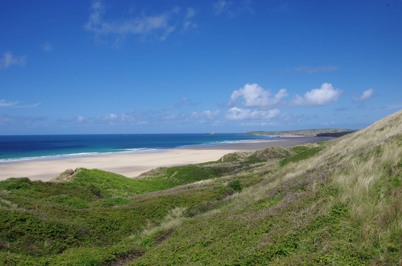
(20) View back across St Ives Bay
Beyond a carpark at Gwithian Towans the path reaches Strap Rocks, where a lifeguard post on the low clifftop overlooks Saint Gothan Sands (picture 17). From here the path circles around the back of the beach, passing a large pond shortly before finding a footbridge across the little Red River, which flows down from Carn Brea, near Camborne, 13 kilometres away.
The area around Carn Brea was once a very productive mining area and the river got its name from the red tin-mining waste that used to colour the river and the beach. A couple of days after this walk I visited the area around Carn Brea on the Great Flat Lode Trail, an interesting half-day walk through part of the Cornish Mining World Heritage Site.
About fifty metres to the left of the footbridge, the path climbs some steps on the right up to a carpark. Halfway along the left-hand edge a path leads off into the dunes of Godrevy Towans, the path surfaced with wood to prevent erosion.
Reaching the low clifftop once again, the path turns right past another lifeguard post and is then sandwiched between the clifftop and a road for most of the gentle climb up to Godrevy Point (picture 18). About 400 metres off the point is Godrevy Island, which is dominated by a 35-metre tall lighthouse (picture 19), built in 1859 to mark the dangerous Stones reef.
The path rounds Godrevy Point, now heading eastwards, and for a little while there are good views back across St Ives Bay (picture 20).

(21) Mutton Cove

(22) View ahead from Navax Point

(23) Hell's Mouth

(24) Hudder Down
From Godrevy Point, the character of the path changes quite dramatically, now running along crumbling, gorse-covered cliffs with many deep clefts cut into them by ferocious Atlantic storms. The first of these is the rocky little Mutton Cove (picture 21), followed by Kynance Cove, not to be confused with its more famous namesake on the Lizard.
About 20 minutes walk from Godrevy Point, the path reaches Navax Point, where the rest of the day's walk stretches out ahead (picture 22). After skirting along the edge of a large grassy meadow, an easy and well-maintained path runs along the crinkled clifftops for around a kilometre before dropping down to cross the evocatively named combe of Hell's Mouth (picture 23). On the other side, the path continues across Hudder Down (picture 24) and after about 1,500 metres the path again becomes squeezed between the clifftop and the B3301.

(25) Basset's Cove

(26) Porthcadjack Cove

(27) Porthcadjack Cove

(28) Portreath
For the next couple of kilometres, the road sticks fairly close to the clifftop, with a series of carparks providing access to the magnificent coastal views for those not so keen on a long walk. A broad cinder path makes for very easy walking along this stretch of the path, a world away from the rocky paths on the recent stages between Penzance and St Ives.
After the fourth carpark, the road bears away and the Coast Path follows a grassy clifftop path along the edges of a couple of large fields, freshly planted with a new crop, to reach another carpark above Basset's Cove (picture 25). Another kilometre along the cliffs, the path reaches Porthcadjack Cove (picture 26), where two steep-sided combes have to be crossed. The second of these is particularly deep, with the path zig-zagging steeply down into the valley and back up the other side, but the view from the far side offers ample compensation on the climb back up to Carvannel Downs (picture 27).
The path follows the edge of Carvannel Downs, passing above a little inlet called The Horse then shortcuts across the headland of Western Hill, from which the town of Portreath comes into view (picture 28). A rather steep descent down into the combe behind the headland takes the path down to the edge of town, joining a lane called Battery Hill, which climbs over the cliff behind the beach before descending to a bus-stop by a large beachside carpark.
This was a good place to end the walk for the day, with 28.7 kilometres completed -- a much longer stage than the last few, but relatively easy in comparison, even with the long stretch through the dunes between Hayle and Godrevy Point. There was a lot to like about this stage of the path, particularly as it had offered a lot more variety than the last few days on the other side of St Ives.