SOUTH WEST COAST PATH NATIONAL TRAIL
Stage 52: Woolacombe to Combe Martin
Friday, July 10, 2015

(1) Woolacombe Sands

(2) Woolacombe
(3) Barricane Beach

(4) Mortehoe
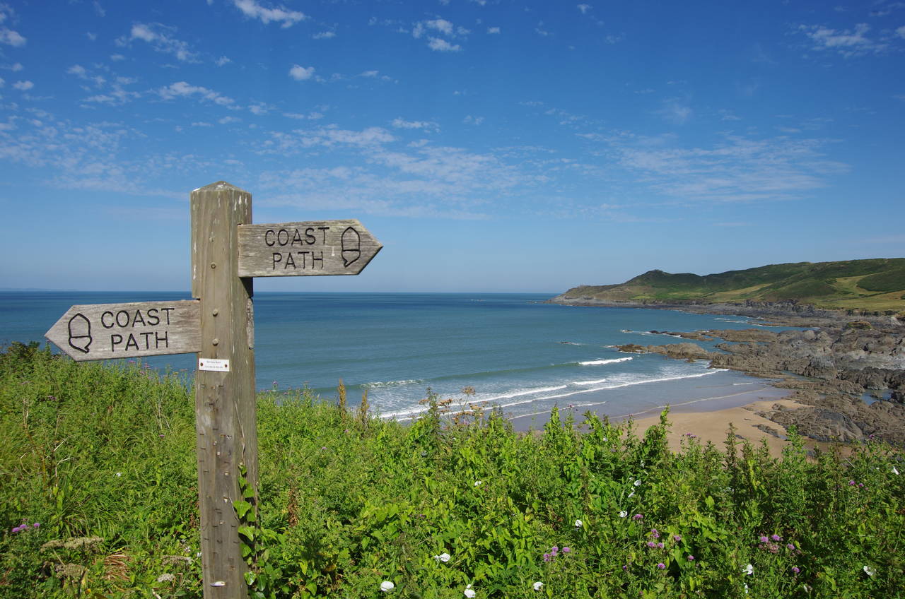
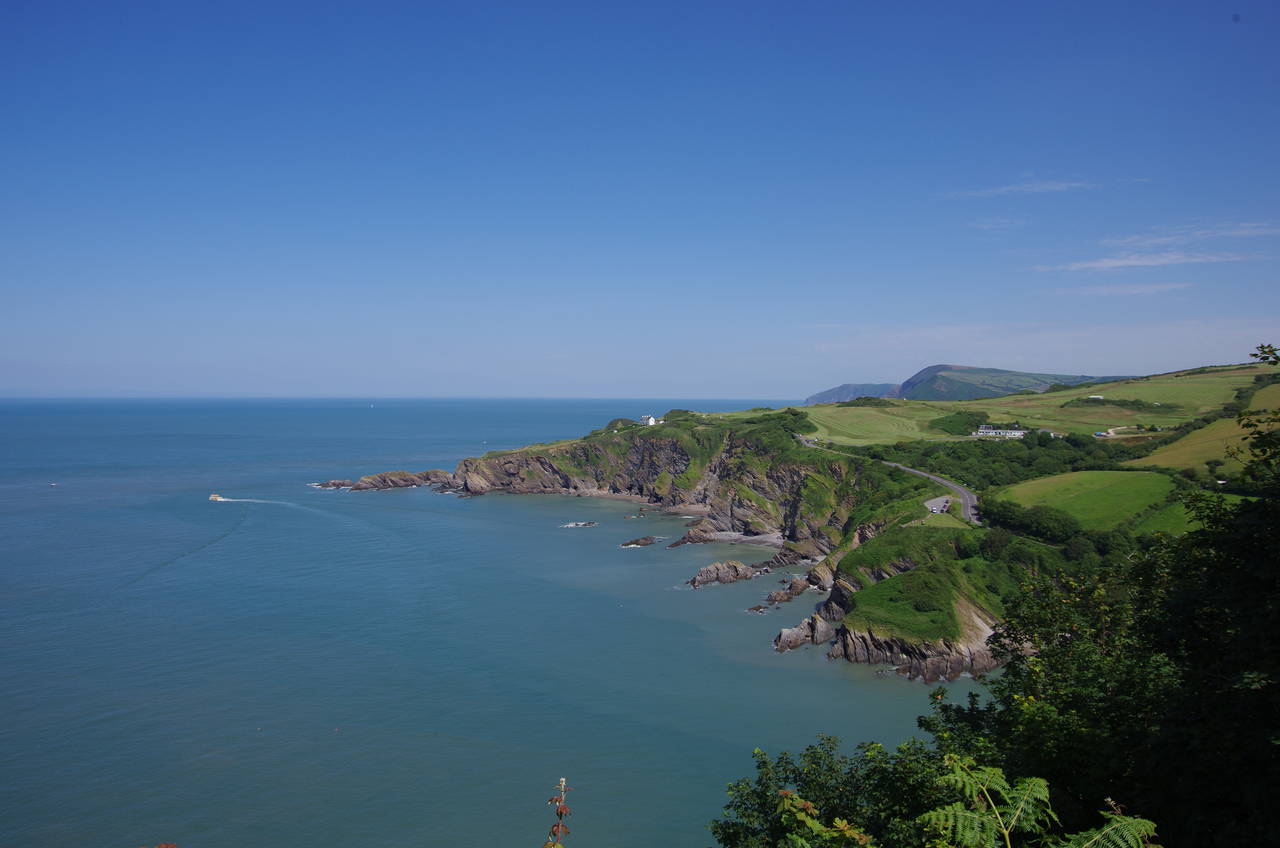
The journey back from Barnstaple to Woolacombe was much easier, with a direct bus taking only 40 minutes to return me to the Coast Path above Woolacombe's long beach (picture 1).
From the carpark above the beach, the Coast Path heads across a low grassy clifftop below The Esplanade, where an interesting castellated B&B is among the attractive houses overlooking the sands (picture 2). The path briefly joins the road to pass above the small Barricane Beach (picture 3) before striking out across the ragged cliff once more towards the village of Mortehoe (picture 4), which is virtually conjoined to Woolacombe.
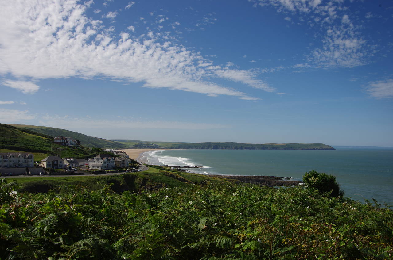
(5) View back to Woolacombe

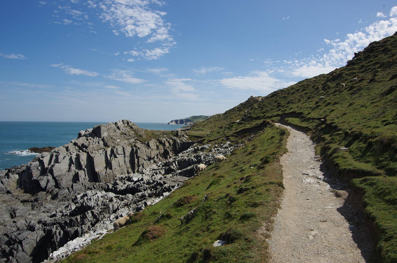
(6) Morte Point
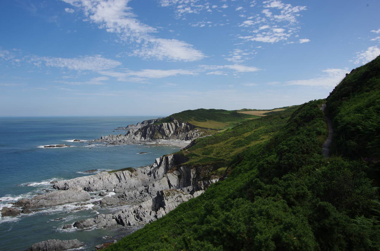
(7) Morte Point

(8) Rockham Bay
The path runs up beside the carpark of the clifftop Watersmeet Hotel to rejoin The Esplanade, turning left to follow the narrow road as it climbs steadily all the way to the other end of the village. A former clifftop route along the edge of the village had recently been permanently closed due to landslips, but at least there are still good views back to Woolacombe from the road (picture 5).
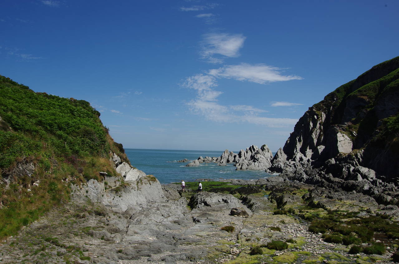
Immediately beyond the last building on the left, the route turns down off the road to head out onto the lower slopes of Morte Point (picture 6), a triangular promontory that separates Morte Bay from Rockham Bay. An obvious path runs along the sheep-grazed south side of the gorse-covered point for 1,500 metres to turn sharply around the rocky tip (picture 7) and head out along the edge of the rugged-looking Rockham Bay (picture 8).
(9) Rockham Bay

(10) Bull Point Lighthouse
(11) Bennett's Mouth

(12) Sandy Cove and Lee Bay
The next three kilometres around Rockham Bay is a wonderful walk, with many spectacular rock formations in the near vertical sheets of slate below the undulating path (picture 9) and few signs of human activity aside from the lighthouse perched on Bull Point at the far side of the bay.
Eventually reaching Bull Point, the Coast Path passes just outside the back of the lighthouse complex. The light was first established here in 1879 after a long series of local shipwrecks, operating until 1972, when a large piece of the cliff collapsed into the sea and the lighthouse became unsafe. The replacement (picture 10) was opened in 1976 and automated in 1988.
Bull Point marks the final major change of direction for the Coast Path, with the remainder of the walk across North Devon and into Somerset heading generally eastwards.
After climbing over the ridge behind the lighthouse, the path briefly levels out before zig-zagging down into the pretty, green combe of Bennett's Mouth, where the rocky opening (picture 11) is a good spot for rockpooling. When the path climbs up over the next ridge, there are good views ahead across Sandy Cove and Lee Bay (picture 12).

(13) Lee Bay

(14) Flat Point
(15) View over Ilfracombe
(16) Torrs Park
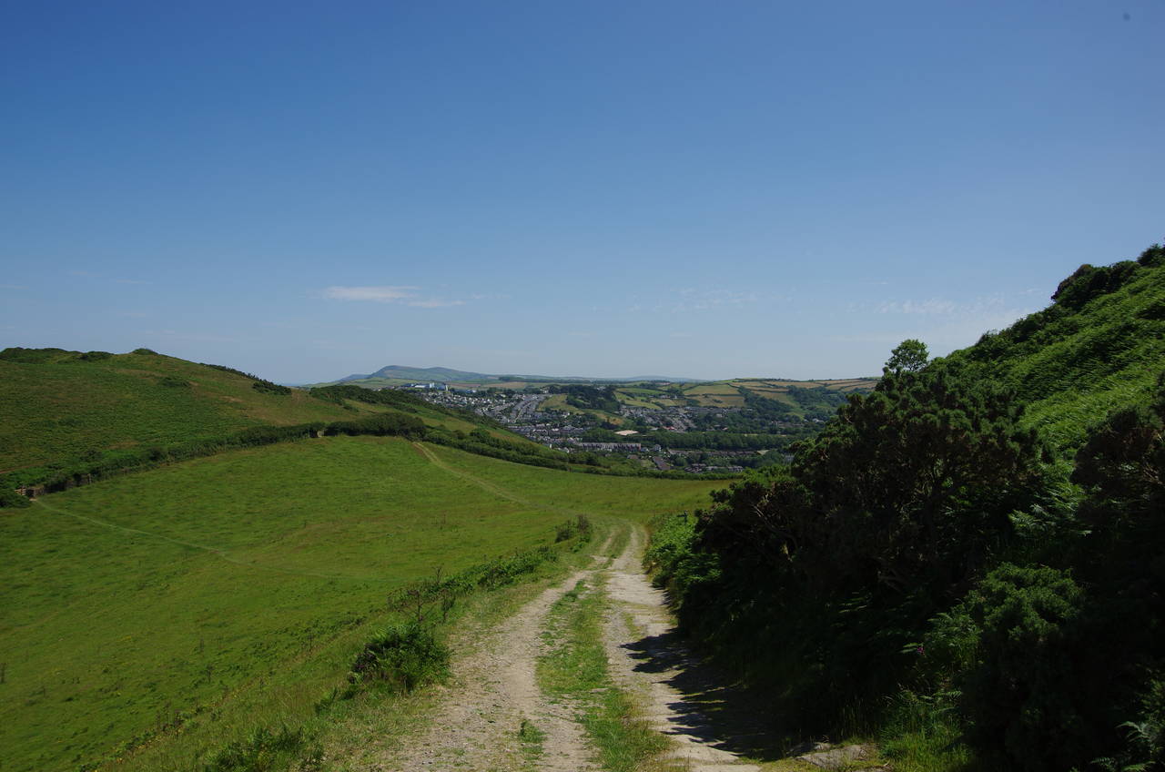
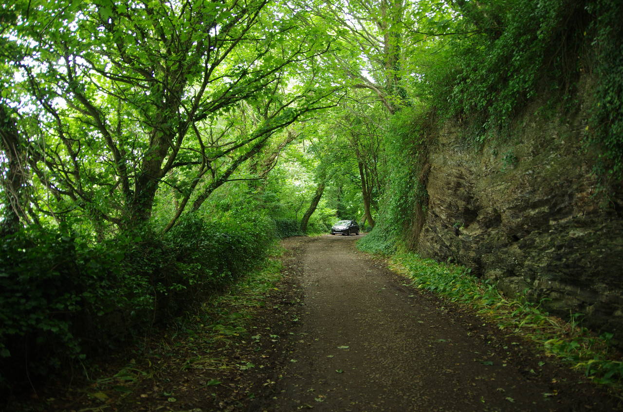
After crossing the combe just above Sandy Cove and climbing steeply over the next ridge, the Coast Path joins a narrow lane that sweeps down into the small village of Lee (picture 13). Having passed behind the small, rocky beach, the path swings right to reach a junction where the route turns left on the even narrower Home Lane. The lane turns right after a short but steep climb, passing the last few houses of Lee and then continues between unruly hedges that threaten to engulf the tarmac. Luckily no cars came along while I walked this two-kilometre stretch of the lane, as there were few passing places.
Eventually the route leaves the lane at a National Trust sign for Flat Point, heading across the grass for a brief flirtation with the clifftop before turning away from the edge to head across a pasture (picture 14). The path briefly gains a view over the town of Ilfracombe (picture 15) before swinging left through a gate in a stone wall and over a ridge into Torrs Park (picture 16).

(17) Torrs Walk

(18) Capstone Hill and Wildersmouth

(19) Landmark Theatre

(20) Windy Corner
Beyond another gate, the path becomes the Torrs Walk (picture 17), a twisting path cut into the seaward side of the ridge in the 19th century, providing a scenic but rather strenuous and lengthy path along the cliffs to the edge of Ilfracombe with several steep zig-zag sections.
On the edge of town the Torrs Walk reaches its end at the quiet residential Torrs Walk Avenue. This is followed along to Granville Road, which runs along the curved clifftop. Fixed to a stone wall on Granville Road is the first of eight information boards describing the parts of the town that the Coast Path passes through. This one mentions the Tunnels Beaches at the foot of the cliffs, and only accessible via tunnels bored through the cliff by Welsh miners in the 19th century.
When Granville Road reaches a hairpin turn, the Coast Path goes through a gate into the Southern Slopes, where a subtropical garden overlooks the town. A footpath through the garden soon returns to the clifftop, where there are views ahead across the cove of Wildersmouth to the headland of Capstone Hill (picture 18). The footpath descends over the grass-covered roof of the Landmark Theatre, whose most prominent features are two conical towers that look rather like upturned buckets of sand (picture 19).
A long flight of steps takes the Coast Path back down to street level, where the route skirts around the small Wildersmouth Beach, whose grey sand has been weathered from the surrounding Devonian slate. Overlooking the far side of the beach is the paved Clapping Circle, where a sign states that if you stand in the centre and clap, the echo will come back as an unusual squeaking sound. I tried it, feeling a little foolish, but didn't seem to get the advertised result. Perhaps there's something wrong with the way I clap.
Beyond the Clapping Circle the Coast Path joins the Capstone Parade (picture 20), a wide footpath that runs alongside Wildersmouth and around three sides of the base of Capstone Hill. The path was constructed in the 1840's as part of a scheme to provide work for unemployed labourers. The point where the parade turns away from Wildersmouth is known as Windy Corner, a name that seemed well-deserved as I walked by.

(21) Ilfracombe Harbour

(22) Larkstone
(23) View towards Hillsborough

(24) Ilfracombe
After turning around Windy Corner, Capstone Parade runs along the seaward side of the hill, below the steep grassy slopes, before eventually turning away from the water past the end of a terrace of early 19th century houses and then left onto Capstone Raod. This is followed up to the Sandpiper Inn, where the route turns right past shops then left to reach the edge of Ilfracombe's rather spectacularly sited harbour (picture 21), the largest harbour in north Devon.
(Continuing straight ahead from the Sandpiper Inn, and separating the harbour from the sea, is the quay shown in the picture, to which I made a brief detour from the Coast Path to acquire my lunch and to book my boat trip to Lundy Island for the following day. Overlooking the quay is Lantern Hill, where the small sailor's chapel of St Nicholas has sat atop the rocky spur since the early 1300's. A large lantern built into the roof of the chapel has served as a lighthouse since at least the early 1500's, making it the oldest operational lighthouse in England. The short climb up to the chapel is well worth the effort for the views over the harbour and town.)
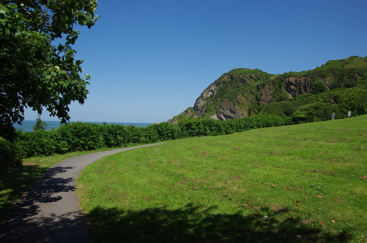
The Coast Path follows the harbourside road for about 300 metres to find a path on the left that heads through a shady area of parkland known as Larkstone (picture 22). The path emerges into a grassy area and circles around the edge, eschewing a path down to the small and rocky Rapparee Cove, site of a shipwreck that claimed 40 lives in 1796. Instead, the Coast Path climbs along the edge of the open area, beginning the long climb up to Hillsborough (picture 23). The hill, site of an Iron-Age fort, was purchased by the district council in 1895, an early example of setting aside land for conservation and public enjoyment.
In the top corner of the open area the route squeezes past the end of a fence and onto an enclosed path that climbs through thick scrub and across the ramparts of the old fort to emerge on a hillside with wonderful views over Ilfracombe and the harbour (picture 24).
(25) View ahead from Beacon Point
(26) Hele Bay

(27) Watermouth

(28) Watermouth Castle
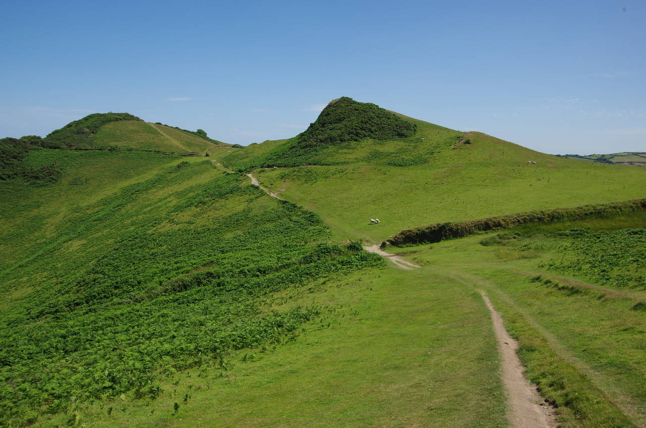
The path climbs a little higher before it peaks, heading through woods on the top of Beacon Point to reach a viewpoint at the top of the headland where there are more great views back over Ilfracombe and ahead past Rillage Point to the hills of Exmoor beyond (picture 25).
From the viewpoint the path winds its way downhill through the woods, at times quite steeply, to the sheltered beach at Hele Bay, which sits at the foot of a long combe occupied by Hele village. The view of the beach itself is rather dominated by a chalet park on the eastern side (picture 26).
Above the beach the Coast Path follows Beach Road a short distance up the combe to turn sharply left and follow the narrow pavement beside the A399 Watermouth Road as it climbs behind the aforementioned chalet park and up to the next point. Nearing the point the pavement ends and the path leaves the road, but stays close to it for the next kilometre as it runs along the ragged clifftop until, just before a row of white coastguard cottages, the path turns downhill onto Rillage Point. A well-worn trail with several steep ups and downs follows the clifftop around Rillage Point and then high above Samson's Bay and onto Widmouth Head, where I was able to get my first hazy view of the low hills of south Wales across the Bristol Channel.
The narrow trail circles around the edge of Widmouth Head with a couple more short sharp climbs before the path gains another wonderful view, this time of the sheltered harbour of Watermouth with the vast bulk of Great Hangman, the highest sea-cliff in England, beyond across Combe Martin Bay (picture 27).
The view is soon lost however as the path heads through woods to meet the A399 road again, following the road alongside the harbour and past the entrance of Watermouth Castle (picture 28), which isn't nearly as old as it looks, having been built in 1825.

(29) Outer Stone
(30) Track above Broadsands

(31) Combe Martin

(32) Combe Martin
Almost a kilometre after joining the road, a signpost on the left points into the grounds of the Watermouth Valley Camping Park. The Coast Path climbs around the left-hand edge of the large camping ground before passing above a sheltered cove at Outer Stone (picture 29)
The path soon joins a forest track above Broadsands Beach (picture 30), though the beach is entirely out of sight. After about 500 metres the track joins the end of a lane, following it past a few scattered houses to a junction where the route of the Coast Path turns sharp right to follow Barton Hill up for another encounter with the A399. This time the road is followed for about 500 metres to the next left turn where the route heads a short distance down Newberry Close to find a signpost on the right, where steps lead down to an enclosed path that runs below the road for another 300 metres before coming back up for one final short stretch beside the A399 on the edge of Combe Martin.
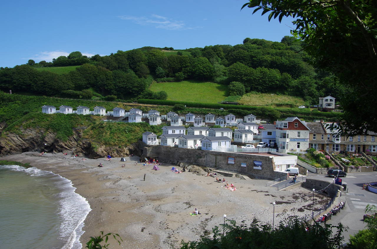
At the next junction the path bears left down to the end of the quiet Berry Lane, turning left down Newberry Road as far as a narrow path that passes beside a cottage and down onto a small patch of shingle beach (picture 31). Steps on the other side of the beach take the Coast Path up to a walkway around the small point that separates the shingle beach from Combe Martin's slightly larger and significantly sandier main beach (picture 32).
Here I left the Coast Path for the day, with another 22.3 kilometres covered from Woolacombe. I didn't have long to wait for the next bus back to Ilfracombe (the second-last of the day), so I decided to leave an exploration of the town to my next visit. The earlier bus gave me enough time to get some dinner on Ilfracombe's quay and to climb up to the top of Capstone Hill before getting a bus back to my accommodation in Barnstaple.