THE THAMES PATH
Stage 2: Cricklade to St John's Lock
Monday, June 6, 2011

(1) Path beside the Thames, near Cricklade

(2) Meadow near Cricklade

(3) Path under the A419

(4) Pipes cross the Thames
It was raining lightly as I walked over to Swindon Bus Station to get the 7:05 bus to Cricklade. Fortunately the rain had stopped by the time I got off the bus just around the corner from Cricklade's High Street, though the sky remained overcast and would do so for the entire walk. The temperature was considerably lower than it had been for the previous stage of the walk and it would be several kilometres into the walk before I would be warm enough to do without my jacket.
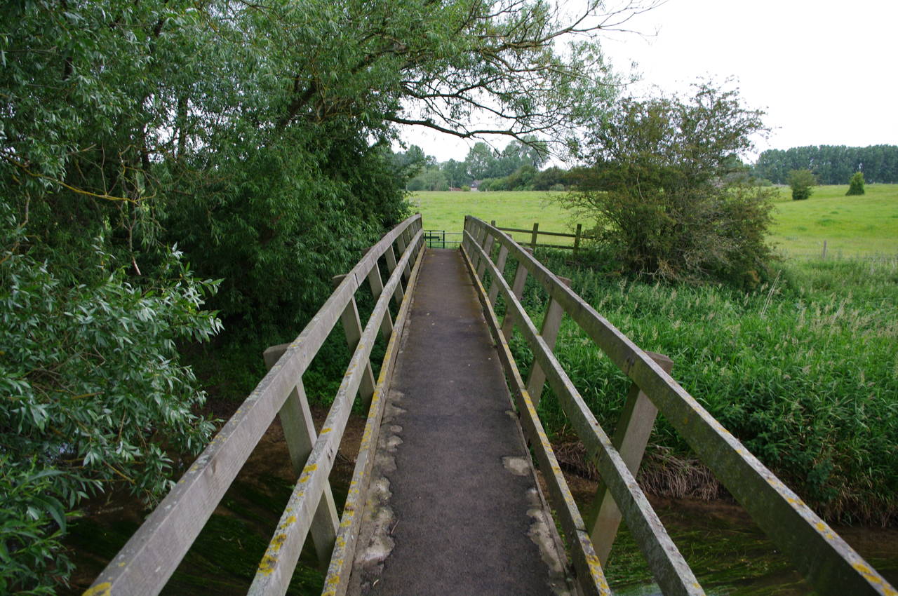
Shortly after 7:30, I rejoined the Thames Path at the corner of High Street and Abingdon Court Lane, following the lane until it swings right and a Thames Path signpost points left down a drive. At the bottom of the drive, the path crosses an unusual stile, where a couple of steps lead over a slab of stone.
The path now turns along the left edge of a meadow with some houses visible ahead and to the right across the long grass. Soon the Thames is flowing gently to the left of the path (picture 1) and the path continues along the left of the next meadow where it passes several picnic tables and a set of rugby goalposts can be seen in the distance (picture 2).
At the end of this meadow, the path crosses a concrete footbridge over the River Key as it adds its waters to the Thames. Over the bridge the path turns left and soon follows the river under the A419 (picture 3). The thunderous traffic noise from the road soon fades away as the path continues along the riverbank beside meadows and soon passes a rusty metal arch that carries a couple of large pipes over the river (picture 4).
(5) Eysey Footbridge

(6) Path past Eysey Hill

(7) Water Eaton Footbridge

(8) Path beside bean crop
A little further on, the long wooden Eysey Footbridge (picture 5) carries the path over to the north bank, where the well-worn path leads past the low slope of Eysey Hill (picture 6), shortcutting past a couple of small loops in the river.
Rejoining the riverbank, the path eventually reaches the Water Eaton Footbridge (picture 7) and crosses back over to the south bank of the Thames. The path continues to follow the river, with the large barns of Water Eaton Farm across the fields to the right. Soon, a footbridge over a side-channel takes the path into a field of wheat, before another footbridge leads the path into a shady grove of young trees. The following field was planted with a waist-high, but still immature, crop of beans. All along this section there were many small white and yellow flowers lining the path (picture 8).

(9) The Red Lion, Castle Eaton

(10) Blackford Lane
(11) View to Kempsford

(12) House at Hannington Bridge
The path follows the riverbank beside several more large, empty fields before the cottages of Castle Eaton come into view. A little short of the cottages, the path veers away from the Thames, passing through a gate and across a footbridge to join Mill Lane. The path continues along Mill Lane and then ahead into The Street, soon passing the Red Lion pub (picture 9). At the end of The Street, a short diversion from the path through a lych gate on the left leads along a footpath to the 12th-century St Mary's church, which was unfortunately almost entirely covered in scaffolding and plastic for restoration work.
Returning to the Thames Path, the route turns right past a line of terrace houses known as Long Row and then left into School Lane. School Lane soon bends around to the right and reaches a junction where the Thames Path turns left along the shady Blackford Lane (picture 10). The path follows the lane around several bends to reach Blackford Farm, where the route crosses the lawn in front of the farmhouse and then turns left along a field edge to reach the Thames once more.
This encounter with the river is brief however, as the path soon follows the bank of a tributary through more farmland, with the church tower of the village of Kempsford visible in the distance across the fields to the north (picture 11). Eventually, the path reaches a road in front of an old house next to Hannington Bridge (picture 12) and turns right along the road to a junction where it turns left along another shady lane.

(13) Path beside the A361
(14) St John the Baptist, Inglesham

(15) The Roundhouse, near Inglesham
(16) First boats on the river
Just before the lane swings left past a house, the path heads off to the right along a bridleway, which runs for around two kilometres with trees to the left and fields to the right, before bearing right across one of the fields for another kilometre to join a lane in the village of Upper Inglesham. Following the lane to the left the path reaches the A361 road, where the route crosses the road and tuns left. The Thames Path runs along the grass verge beside the road (picture 13) for almost two kilometres before crossing back over the road and heading down a lane towards the tiny village of Inglesham.
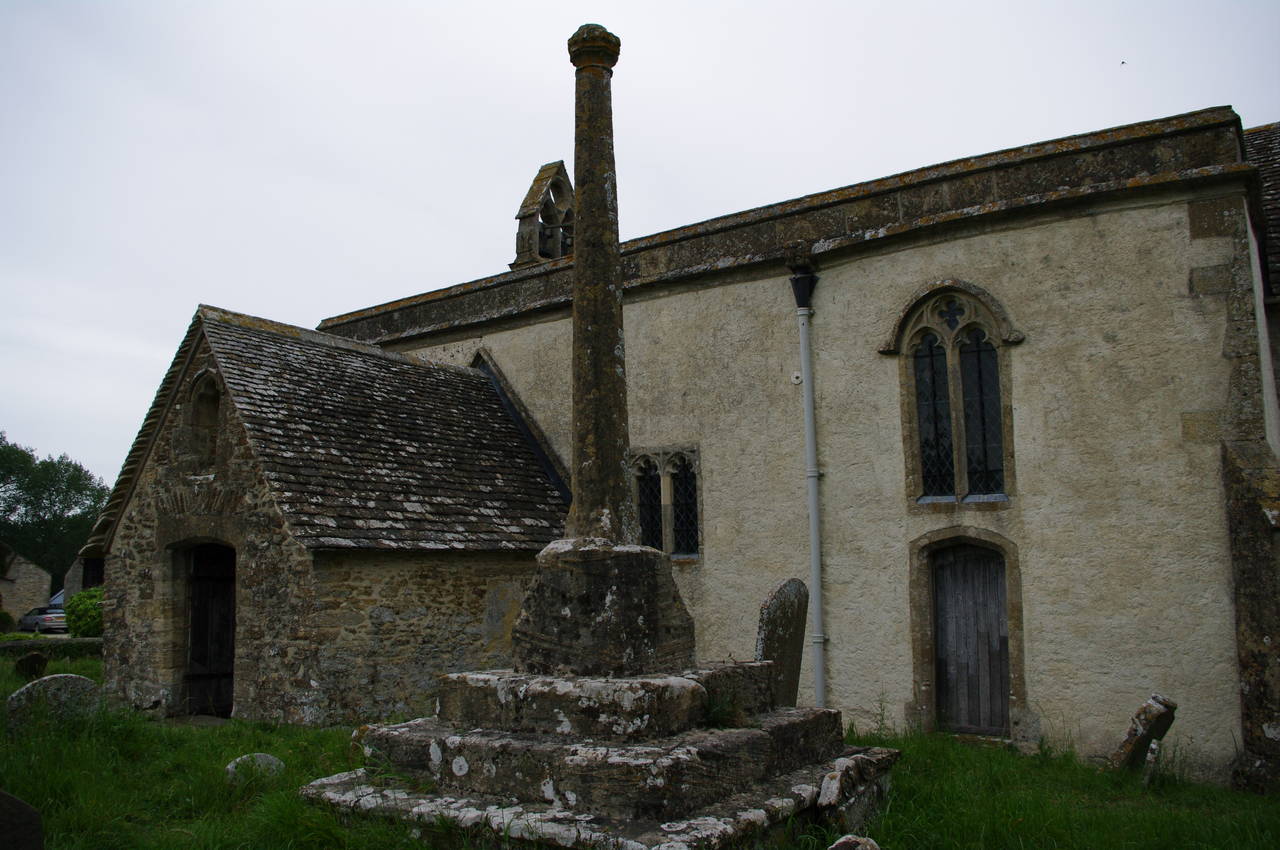
Just before the first building of the village, a Thames Path signpost points to the right, through a metal kissing gate, but here I left the route and continued ahead along the lane for about 100 metres to the small 11th-century church of St John the Baptist (picture 14). The church is somewhat unusual in having escaped the heavy modifications usually performed during Victorian restorations, instead being restored to something close to its original state by William Morris.
Returning to the path, I passed through the gate and followed the path slightly left across a field to a footbridge over a ditch that marks the boundary between Wiltshire and Gloucestershire. Just beyond the footbridge, the path finally rejoins the River Thames.
Following along the riverbank, the path soon passes opposite a farmhouse behind which the top half a roundhouse could be seen (picture 15). The roundhouse was a lock-keeper's house and stands by the point where the River Colne joins the Thames and where the now disused Thames and Severn Canal once left the Thames to carry river traffic to the River Severn near Stroud.
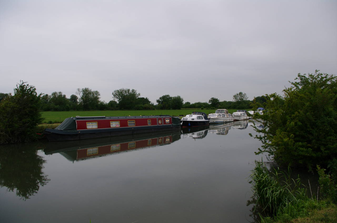
Continuing along the riverbank, I soon passed the first boats I had seen in the river (picture 16), including a number of long narrowboats, designed to fit through the narrow locks further down the Thames.

(17) Approaching Lechlade

(18) Swans on the Thames near Lechlade

(19) Ha'penny Bridge, Lechlade

(20) St Lawrence's, Lechlade
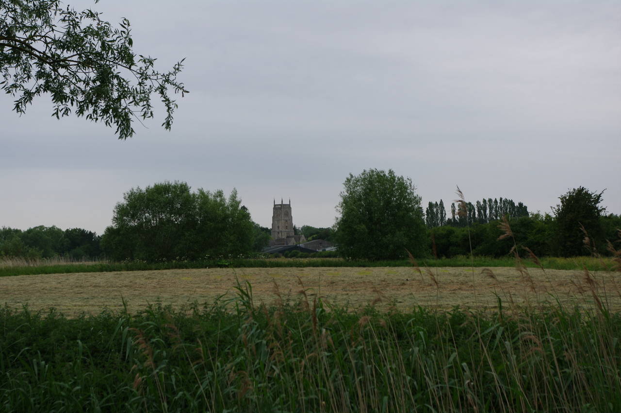
Up ahead, the tall spire of St Lawrence's church in Lechlade towers over the surrounding countryside (picture 17) as the path follows the riverbank towards the town of Lechlade. Along this stretch of the river there were many large white swans in the water and a few came up quite close to me when I stopped at the water's edge to take some pictures (picture 18).
I soon reached the 18th-century Ha'penny Bridge, which carries the A361 over the river into the town of Lechlade, which sits on the north bank of the river. The Thames Path goes through a small archway under the bridge and emerging on the other side one can see the old Toll House perched beside the north end of the bridge (picture 19). The bridge gets its name from the toll that was once charged here, and is only wide enough to carry one lane of traffic at a time, necessitating traffic lights at each end of the bridge.
From here the path continues along the south bank of the Thames with some magnificent views across the river to the tall spire of the church of St Lawrence (picture 20) from which I could hear bells tolling for midday.

(21) St John's Lock
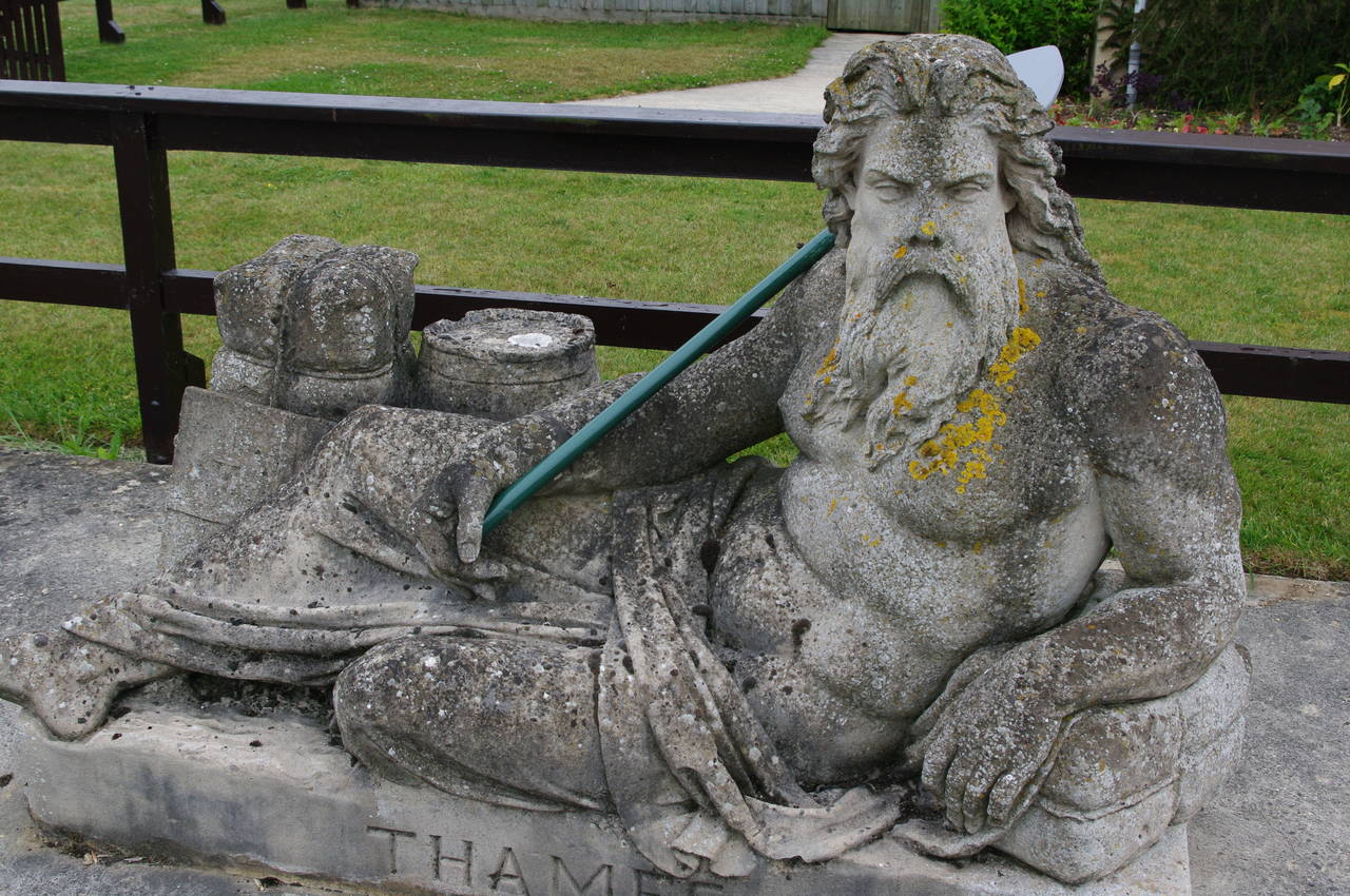
(22) Old Father Thames, St John's Lock

(23) The Trout Inn, St John's Lock

(24) The Crown, Lechlade
The river twists and turns for another kilometre to St John's Lock (picture 21), now the highest of the 45 locks remaining on the Thames. The current lock was built in 1905, replacing an earlier lock built in 1790, and the level of the Thames drops around 85 centimetres through the lock.
A statue of Old Father Thames sits by the lock (picture 22). The statue was originally made for the Great Exhibition at Crystal Palace in 1851, moved to the Source of the Thames in 1958 and then moved again to its present site in 1974 to protect it from vandalism.
Just beyond the lock, the Thames Path heads under St John's Bridge, which carries the A417 over both the lock channel and the main channel, which drops over a weir a short distance downstream of the bridge.
I left the path for the day and crossed the bridge to the Trout Inn -- a cozy old free-house that dates back to 1472. I had made good time today, having covered 18.4km of the path by half past twelve, and decided to reward myself with lunch at the inn.
After lunch, I walked along beside the A417 back into Lechlade and had a look around the town, including a visit to the Crown pub, which is home to the Halfpenny Microbrewery opened in 2009. Among the ales brewed on the premises is the nice Four Seasons Bitter, of which I sampled a pint, purely for research purposes of course.