THE THAMES PATH
Stage 11: Hammersmith to Tower Bridge
Saturday, June 18, 2011

(1) Hammersmith Bridge

(2) Hammersmith Bridge

(3) View upstream from Hammersmith Bridge

(4) Riverside houses, Barnes
It was a fairly dull Saturday morning as I made my way out of Hammersmith tube station and then back down to the Thames at Hammersmith Bridge (picture 1). The graceful suspension bridge was built in 1887 to replace an earlier bridge of similar design, which was conceived by William Tierney Clark, who also designed Marlow Bridge which I had passed earlier on the walk. The bridge has had a chequered history, being closed for several lengthy periods due to structural problems and three IRA bombing attempts in 1939, 1996 and 2000. Despite those incidents, the bridge is one of the more interesting ones on the London stretch of the Thames, with some intricate metalwork on the towers at either end of the bridge (picture 2).
As I crossed the bridge towards the south bank of the Thames, I could see that the tide was out, exposing large sections of the gravel riverbed and leaving several landing stages looking rather marooned (picture 3).
Descending from the bridge, I rejoined the Thames Path, which heads off downstream past a row of riverside houses (picture 4) and then by the fenced off Harrods Village, a former Harrods Depository, now converted to housing.

(5) River Thames near Barnes Common

(6) Steve Fairbairn Memorial

(7) Putney Bridge
(8) Putney Bridge
Beyond the buildings, the Thames Path follows the riverbank past the disused reservoirs of the London Wetlands Centre before continuing alongside a large complex of sporting fields on Barnes Common (picture 5). Next to the path stands a memorial to Steve Fairbairn, founder of the Head of the River boat race (picture 6).
Just beyond the memorial I passed a boathouse where a number of rowers were busy preparing their craft and a little further on the path joined the riverside promenade of Putney, where the sun came out for the first time in the day. This point marks the end of the Thames towpath, which the route had been following for most of the way since Lechlade, now around 230 kilometres behind me.
Passing more boathouses and a couple of wide barge-loading slipways, the path comes up to the sturdy stone Putney Bridge (picture 7). A little before the bridge the path leaves the riverside path and follows the nearby road up to the end of the bridge (picture 8) before crossing the approach road in front of a small church and heading around the right hand side of the church before returning to the riverside.
(9) Wandsworth Park

(10) View towards Wandsworth Bridge
(11) Confluence of the River Wandle

(12) Approaching Wandsworth Bridge
The route soon leaves the riverside promenade again, joining Deodar Road to head under a railway line and then soon heading through a brick arch at Blade Mews to enter Wandsworth Park (picture 9). The route skirts around the riverside edge of the park under a long avenue of shady trees with Wandsworth Bridge visible a little over a kilometre ahead around the next bend in the river (picture 10), while off to the right were several football pitches hosting Saturday morning games.
When the park ends, the path continues a for short distance past apartment buildings until a temporary looking wall blocks the riverside path. A doorway in the wall leads to a fenced path across some waste ground to a footbridge over the mouth of the River Wandle (picture 11).
The path soon joins a road called Smugglers Way, following it behind an industrial site and a carpark before heading back to the river beside a large apartment complex, now much closer to Wandsworth Bridge (picture 12).

(13) The Ship Inn, Wandsworth

(14) Unusual sign

(15) Heavy rain shower

(16) After the rain
Nearing the bridge, the path is forced to leave the river once again, turning right then left to emerge beside the Ship Inn (picture 13), where the lettering on the front of the building states "Purveyors of Fine Ales". Turning right and then left again, the route follows Jews Row past some tall silos and up to the approach road of Wandsworth Bridge.
To get across Wandsworth Bridge Road it was safest to follow the road to the right for about 100 metres to a pedestrian crossing at a roundabout where a rather unusual advertising sign stands (picture 14).
As I waited for the light to turn green, I noticed that the sky was getting quite dark and by the time I had walked back up the other side of the road and found the steps down to the riverside path at the foot of the bridge, it was beginning to rain. Within a minute it was absolutely pouring and the wind was blowing fiercely, forcing me to dash for shelter under the nearest riverside apartment building. The onset of the heavy shower had been so sudden that I was already fairly well saturated before I had a chance to try putting on my wet weather gear.
I waited for about 20 minutes for the rain to stop, eventually deciding to take a few photos to pass the time (picture 15). Almost as suddenly as it came, the rain stopped (picture 16) -- pictures 15 and 16 were taken only five minutes apart -- and I was able to venture back onto the path.
(17) Battersea Railway Bridge

(18) St Mary's Church, Battersea

(19) Chelsea Power Station

(20) Sculpture by Battersea Bridge
For a few hundred metres the path passes modern apartment buildings before the Thames Path is forced to take another detour away from the river to get around a riverside heliport. The path soon returns to the river just upstream of the Battersea Railway Bridge (picture 17), but this encounter with the Thames is brief as the path is soon blocked by a brick wall and once again the path is forced to leave the riverbank to follow Lombard Road under the railway line before a paved path goes back to the river.
The next stretch of riverside path is quite pleasant with lots of small trees and the sun began shining. By the time I neared the riverside St Mary's Church (picture 18), there was barely a cloud in the sky and there were just a few puddles on the path to remind me of the wild weather I'd witnessed just half an hour earlier.
Across the river from the church stands the imposing shell of the disused Chelsea Power Station (picture 19) and ahead, beyond several low apartment buildings, stands Battersea Bridge. Just before the bridge a small open square contains a sculpture of a child held aloft by its parents, while across the bridge approach road a pair of swan sculptures guard the walkway back onto the riverside path (picture 20).

(21) Albert Bridge

(22) Battersea Park

(23) London Peace Pagoda

(24) Chelsea Bridge
Passing several more apartment buildings, including a quite striking semicircular affair, the path soon reaches Albert Bridge (picture 21), which was closed to traffic and swathed in scaffolding as major strengthening work is undertaken. Built in 1873, the Albert Bridge has had structural problems from the beginning and has been subject to traffic restrictions despite several previous rounds of strengthening works.
Crossing the road at the end of the bridge, I joined the long riverside promenade of Battersea Park (picture 22). About halfway along the park stands the 30-metre high London Peace Pagoda (picture 23), where a large group of monks were holding some kind of ceremony as I passed.
Further along the promenade I stopped for a lunch break before continuing to the far end of the park, which is marked by the 1937-vintage Chelsea Bridge (picture 24).

(25) Queens Circus Roundabout
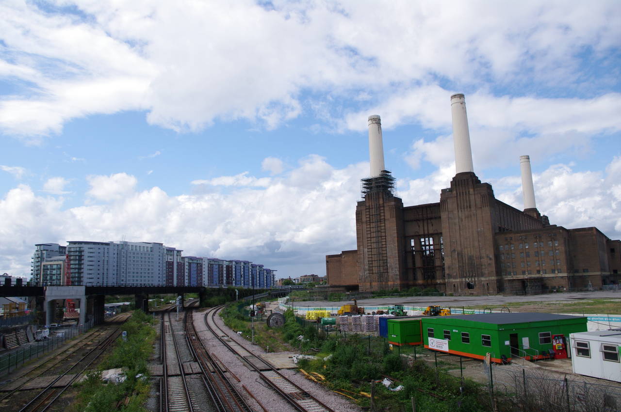
(26) Battersea Power Station
(27) Riverside boatyard, Nine Elms
(28) Wandsworth Road, Vauxhall
At the foot of Chelsea Bridge, the Thames Path begins a long detour away from the river in order to navigate around the site of the disused Battersea Power Station which occupies the riverbank ahead. The route turns right just before the bridge and heads through a pleasant strip of woods on the edge of Battersea Park, eventually reaching a roundabout called Queens Circus (picture 25) and heading under the railway bridge in the middle of the picture to follow Prince of Wales Drive until it joins Battersea Park Road and heads left under another railway bridge.
A little further along, the road crosses over more railway lines, and from the bridge there is a good view of the power station (picture 26). All of the railway lines hereabouts join up and run across the Grosvenor Bridge (just downstream of Chelsea Bridge) and into Victoria Station.
Battersea Power Station was built in two stages in the early 1930's and early 1950's, is the largest brick building in Europe and is a listed building. Since ceasing power generation in 1983 the site has been the subject of several failed redevelopment proposals. If one of these proposals eventually succeeds, the Thames Path may one day run along the riverfront of the site.
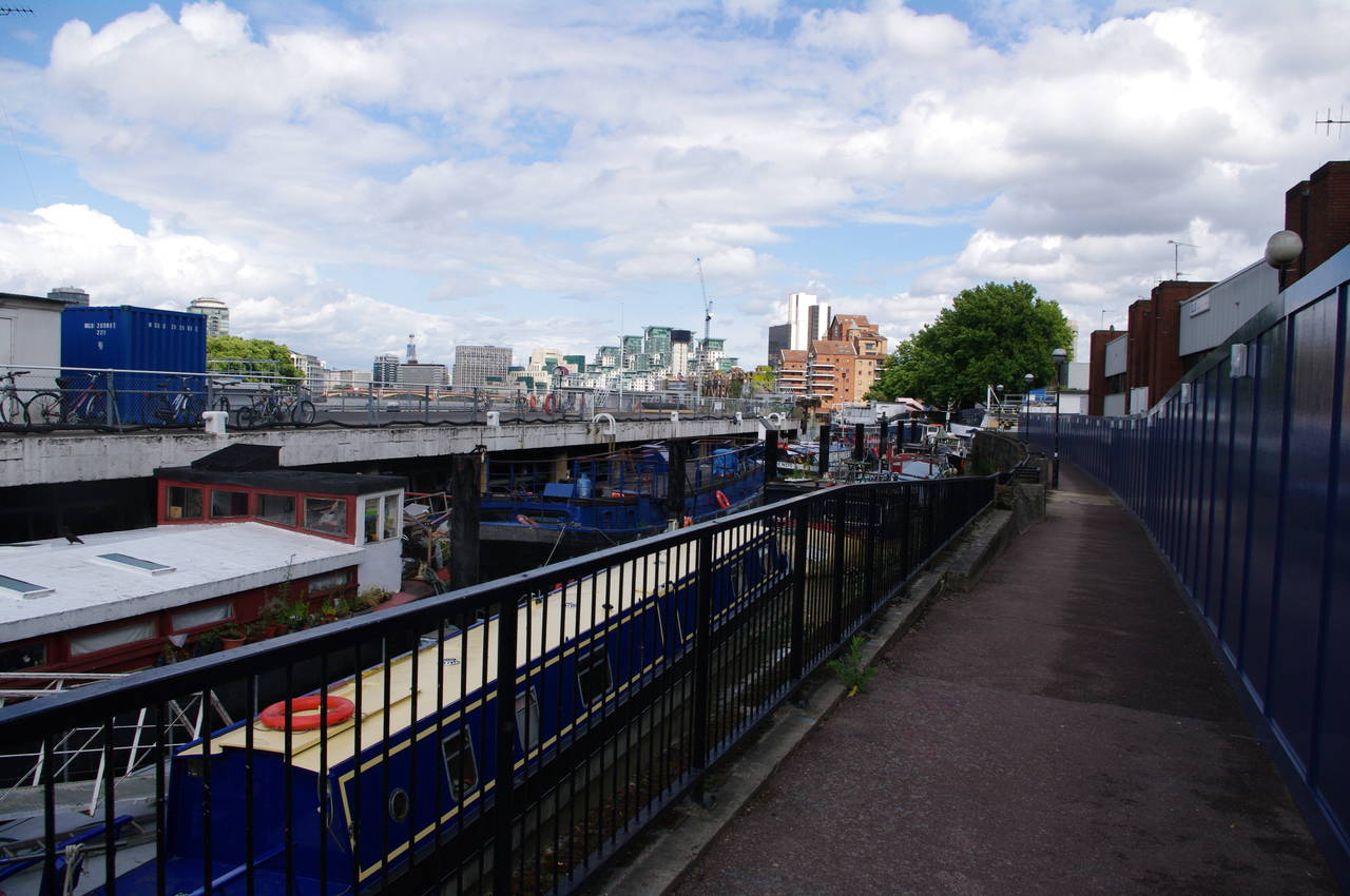
After passing a long line of construction hoardings, the path eventually turns left into Kirtling Street, Nine Elms, which takes a right-angle turn to the right after about 200 metres. A short distance further a signpost directs the path beside a high brick wall and back to the river, where the path heads to the right through a very crowded boatyard (picture 27).
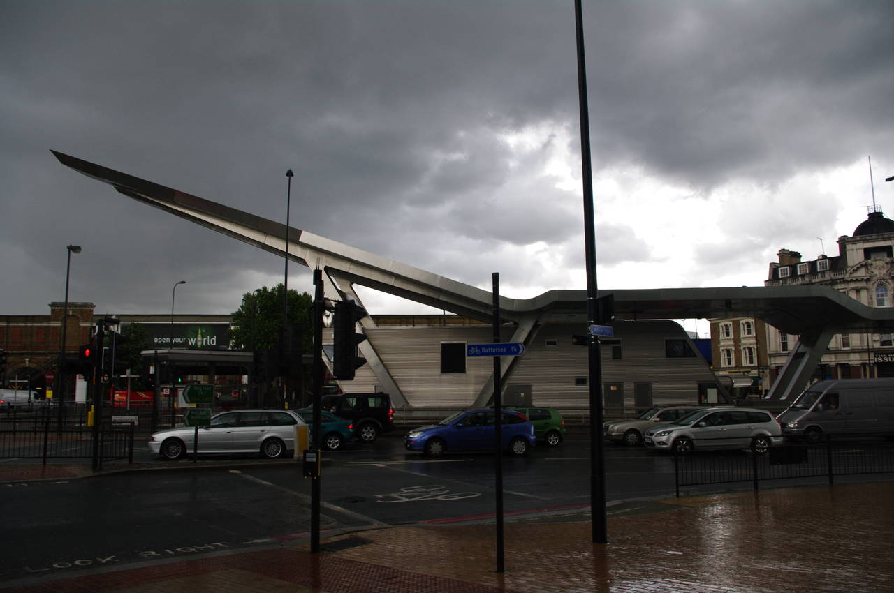
The path now follows the riverbank past apartments until another construction hoarding blocks the way and the path joins Nine Elms Lane and then Wandsworth Road to skirt around a massive modern apartment complex and reach the approach road of Vauxhall Bridge. Across the road from the corner was an unusual structure, which appeared to be part of a bus station (picture 28).
(29) Vauxhall Bridge

(30) Approaching Lambeth Bridge
(31) The Houses of Parliament
(32) Lambeth Palace
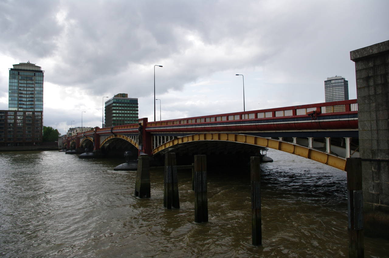
While I was considering investigating the strange building, another sudden heavy rain shower began, encouraging me to dash up the approach road and take shelter under the end of Vauxhall Bridge (picture 29). After about an hour the rain finally stopped and I resumed my walk along the riverside promenade, now known as the Albert Embankment. For the first time on my walk along the Thames Path, I was on familiar territory, having walked along both sides of the river through the rest of central London several times on previous visits.
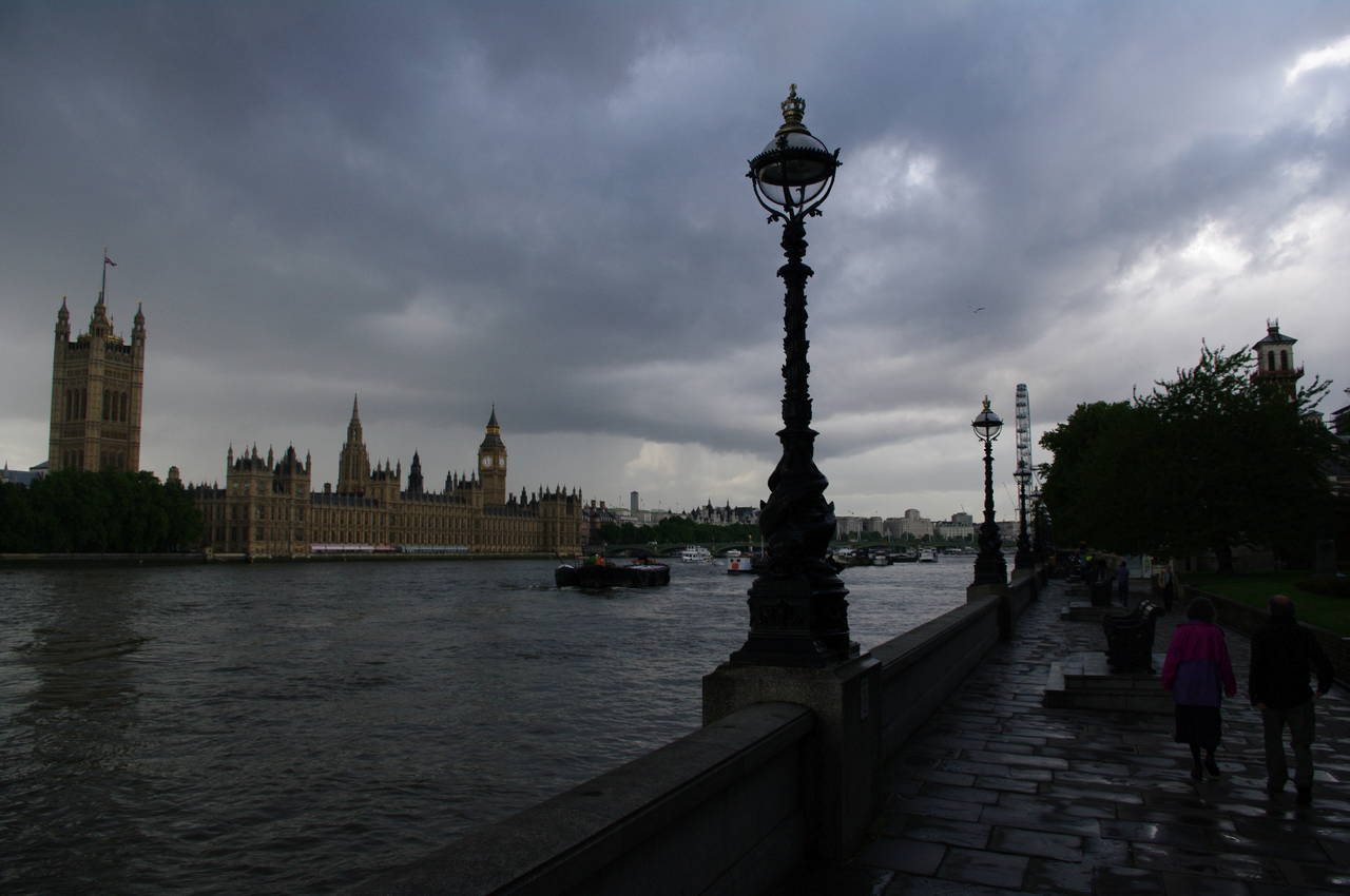
This section of the path offers the first views of some of London's best known landmarks as the path approaches Lambeth Bridge (picture 30). The bridge, opened in 1932, is similar in design to Vauxhall Bridge and is painted red to match the colour of the benches in the House of Lords, which occupies the closer end of the nearby Houses of Parliament (picture 31).
All along the Albert Embankment, the flood wall is topped by fancy lampposts like those in picture 31.
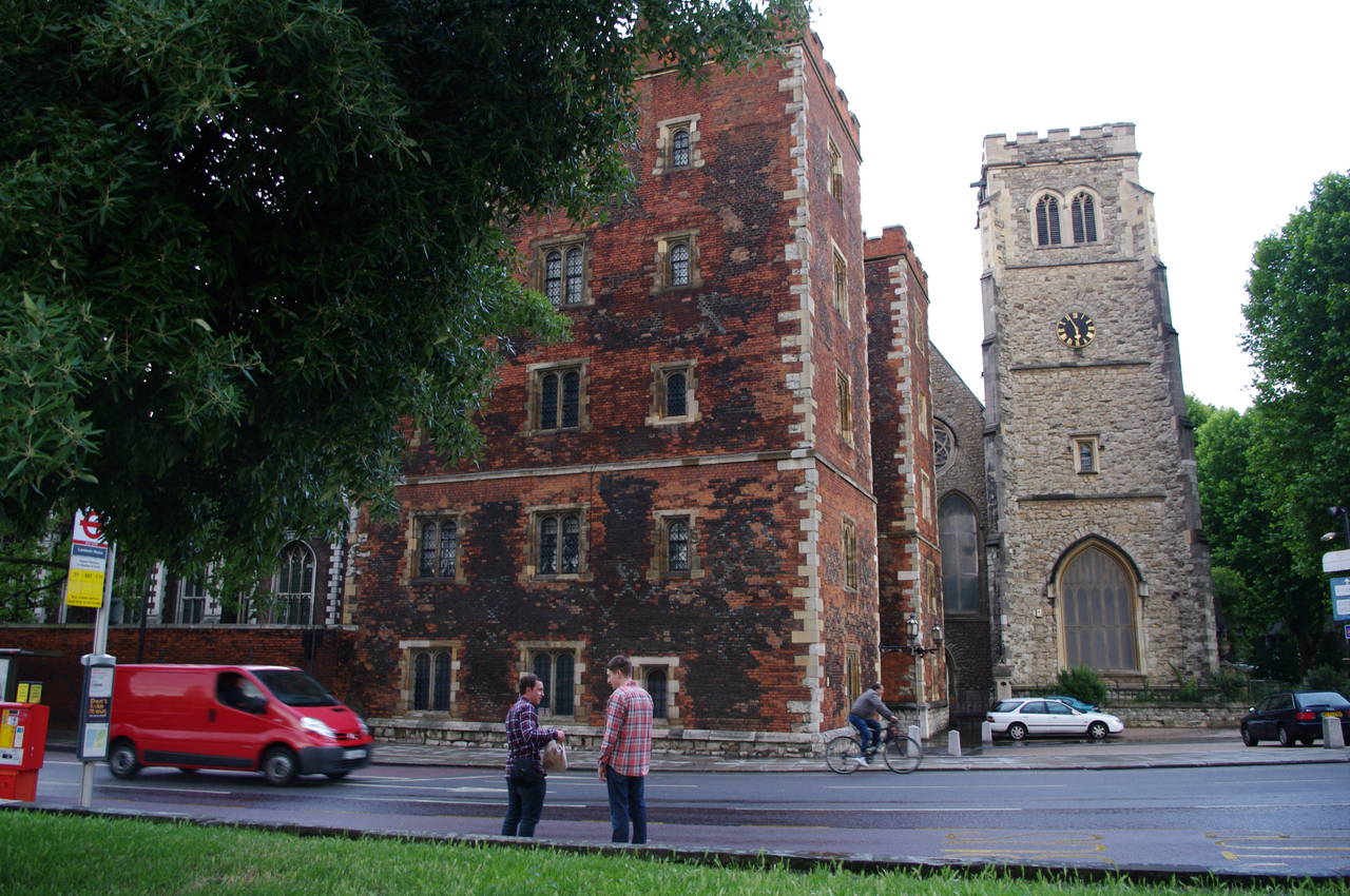
Just to the right of the end of the bridge stand the buildings of Lambeth Palace, which has been the London residence of the Archbishops of Canterbury for more than 800 years.

(33) Westminster Bridge and Big Ben

(34) London Eye
(35) London Eye
(36) Hungerford and Golden Jubilee Bridges
The Thames Path follows the wide public walkway opposite the Houses of Parliament up towards Westminster Bridge, where I sheltered from yet another shower. This time the sun returned before the rain had completely stopped, making for an interesting view across the river to Big Ben while the endless hordes of tourists scuttled across the bridge trying to hold onto their umbrellas (picture 33). Similar to Lambeth Bridge, the predonminant green colour of Westminster Bridge matches the green benches in the House of Commons, which occupies the nearer end of the Houses of Parliament.
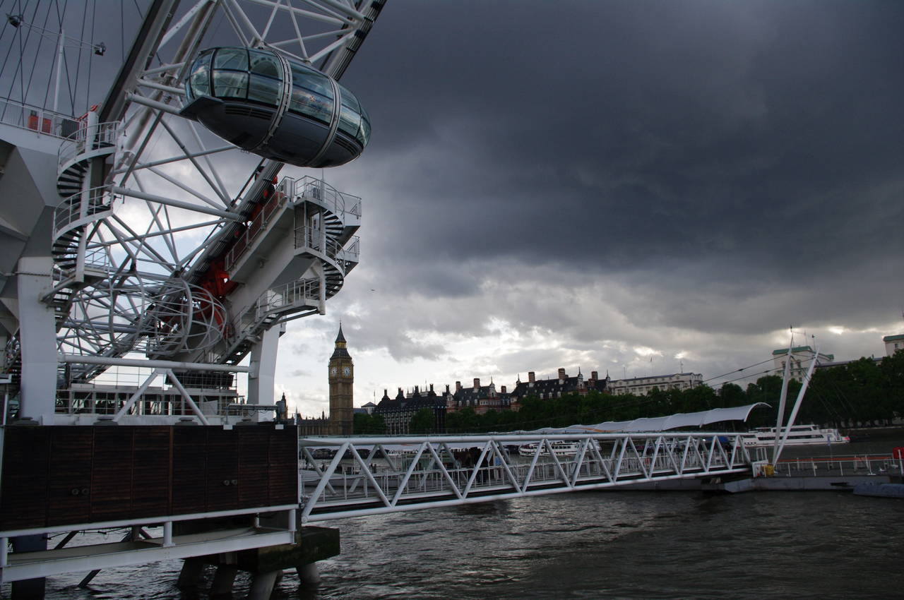
The next part of the path passes by the London County Hall and under the famous London Eye (picture 34), the world's largest ferris wheel when it was built in 1999 at 135 metres high. Although there are now taller wheels in Singapore and in the Chinese city of Nanchang, the London Eye remains the tallest in Europe and is the UK's number one tourist attraction with over 3 million visitors a year.
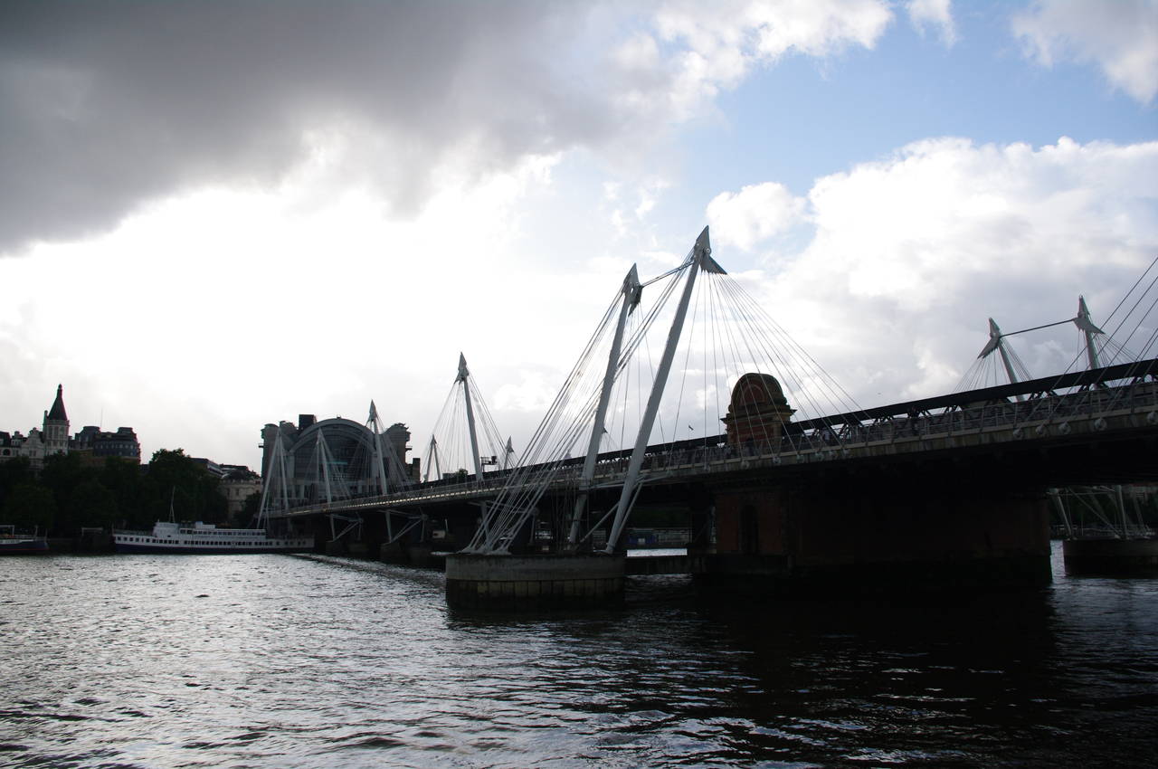
The path heads under the wheel and past the attached pier (picture 35), soon reaching the Hungerford Bridge, which carries railway lines into Charing Cross Station, and the Golden Jubilee pedestrian bridges attached to either side of the railway bridge (picture 36).
(37) Waterloo Bridge

(38) View to St Paul's Cathedral

(39) Gabriels Wharf and OXO Tower

(40) Blackfriars road and railway bridges
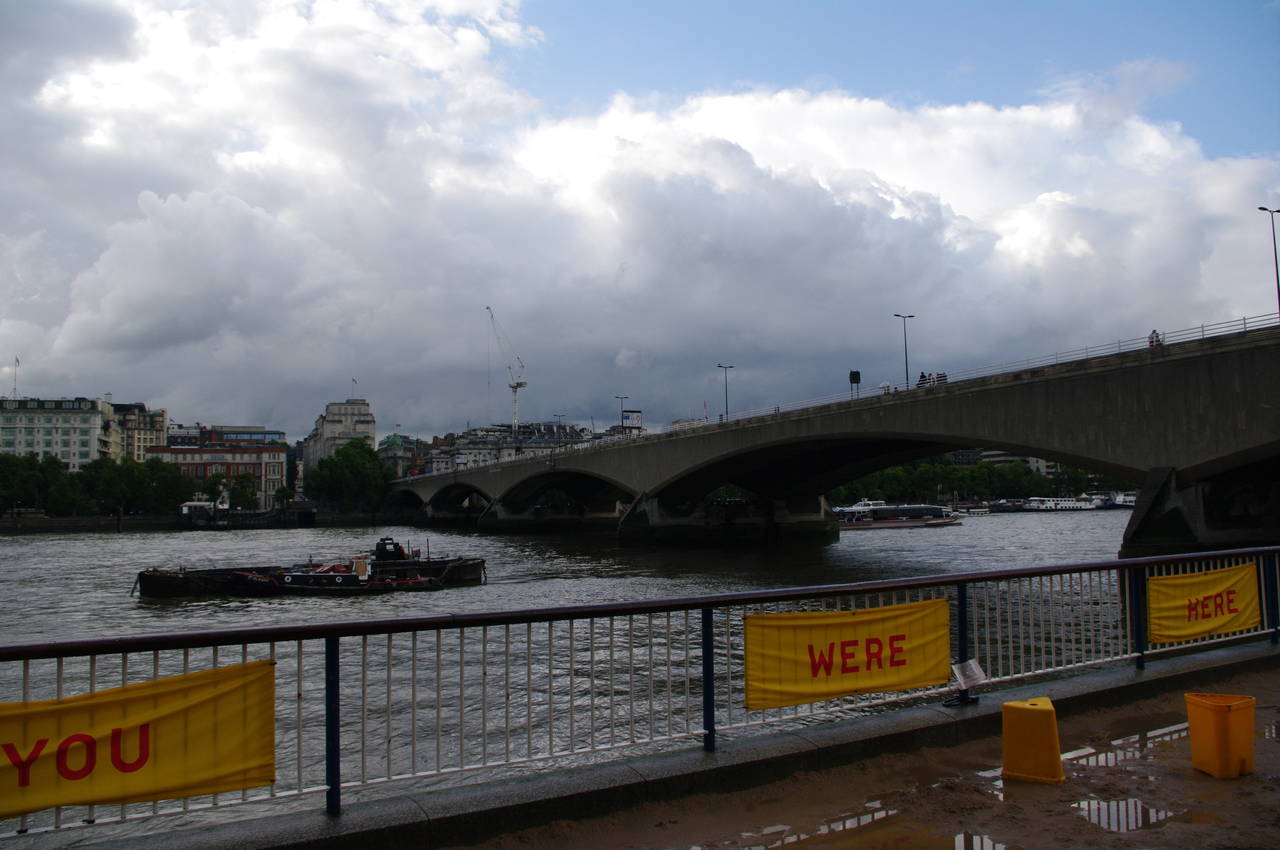
The wide, busy riverside path passes under the bridges and then passes the Royal Festival Hall and Queen Elizabeth Hall before reaching Waterloo Bridge (picture 37). Along this part of the river, a long series of bright yellow banners bearing random words and phrases were tied to the railings, though I'm not sure what, if anything, they were intended to promote.
There was also persistent light rain as I walked along this section and this was curtailing the activities of the many performers who can usually be found along this part of the embankment.
After passing under the bridge, the path passes the bland concrete structure of the National Theatre, before a more pleasant tree-lined stretch of path gives views ahead and across the river to the buildings of the City of London and the magnificent dome of St Paul's Cathedral (picture 38, zoomed in).
The path soon kinks briefly to the right around an area of sandy riverbank where I have sometimes seen sand sculptors creating couches and sea creatures below the riverside path at low tide, though in the wet weather they were absent. From this point there are more good views of the City and of Gabriels Wharf -- a shopping and housing developement in an old dock, which is topped by the OXO Tower (picture 39). The tower was built in a clever and successful attempt to circumvent advertising laws by incorporating the OXO logo in the design of the tower's windows.
The Thames Path passes along the edge of Gabriels Wharf and two more large office buildings to reach the adjacent Blackfriar's Bridge and Blackfriars Railway Bridge. The bridges were covered with cranes and scaffolding as part of lengthy redevelopment work for Blackfriars Station (picture 40).

(41) Tate Modern Gallery
(42) Millenium Bridge and St Paul's

(43) Shakespeare's Globe

(44) Southwark Bridge
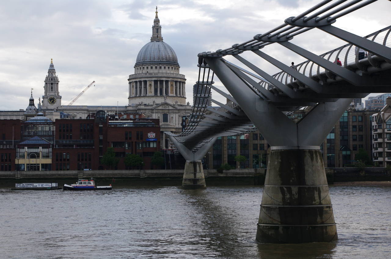
The Thames Path heads under Blackfriars Bridge and continues on past the massive former Bankside Power Station, which now houses the Tate Modern Art Gallery (picture 41).
In front of the Tate Modern, the Thames is crossed by the 370-metre Millenium Bridge (picture 42), which leads up to St Paul's Cathedral. The bridge is known to many Londoners as "the Wobbly Bridge", having been closed just two days after its official opening in 2000 due to alarming swaying of the structure caused by the footfalls of pedestrians. The bridge remained closed for the better part of two years while the problem was corrected and is now a perfectly safe and very scenic way to cross the river on foot.
About fifty metres further along the riverbank, the path passes by Shakespeare's Globe (picture 43), a 1990's recreation of the original 1599 building which stood about 200 metres away (the river was considerably wider in Shakespeare's time before the embankments were built in the 19th century). The original Globe Theatre was destroyed in 1613, when the thatched roof caught fire after a cannon was fired as part of a performance, and a replacement was pulled down by the puritans in the 1640's.
The modern recreation of the Globe Theatre is the first thatched building constructed in London since thatched roofs were banned in the aftermath of the Great Fire of 1666. During an earlier visit to London, I did a tour of the theatre and the adjacent exhibition, which were both quite interesting and informative.
Continuing downstream, the path soon passes a building whose front bulges out, making it look rather like a car headlight, before passing under Southwark Bridge (picture 44).

(45) Cannon Street Railway Bridge
(46) The Shard

(47) The Golden Hinde

(48) Southwark Cathedral
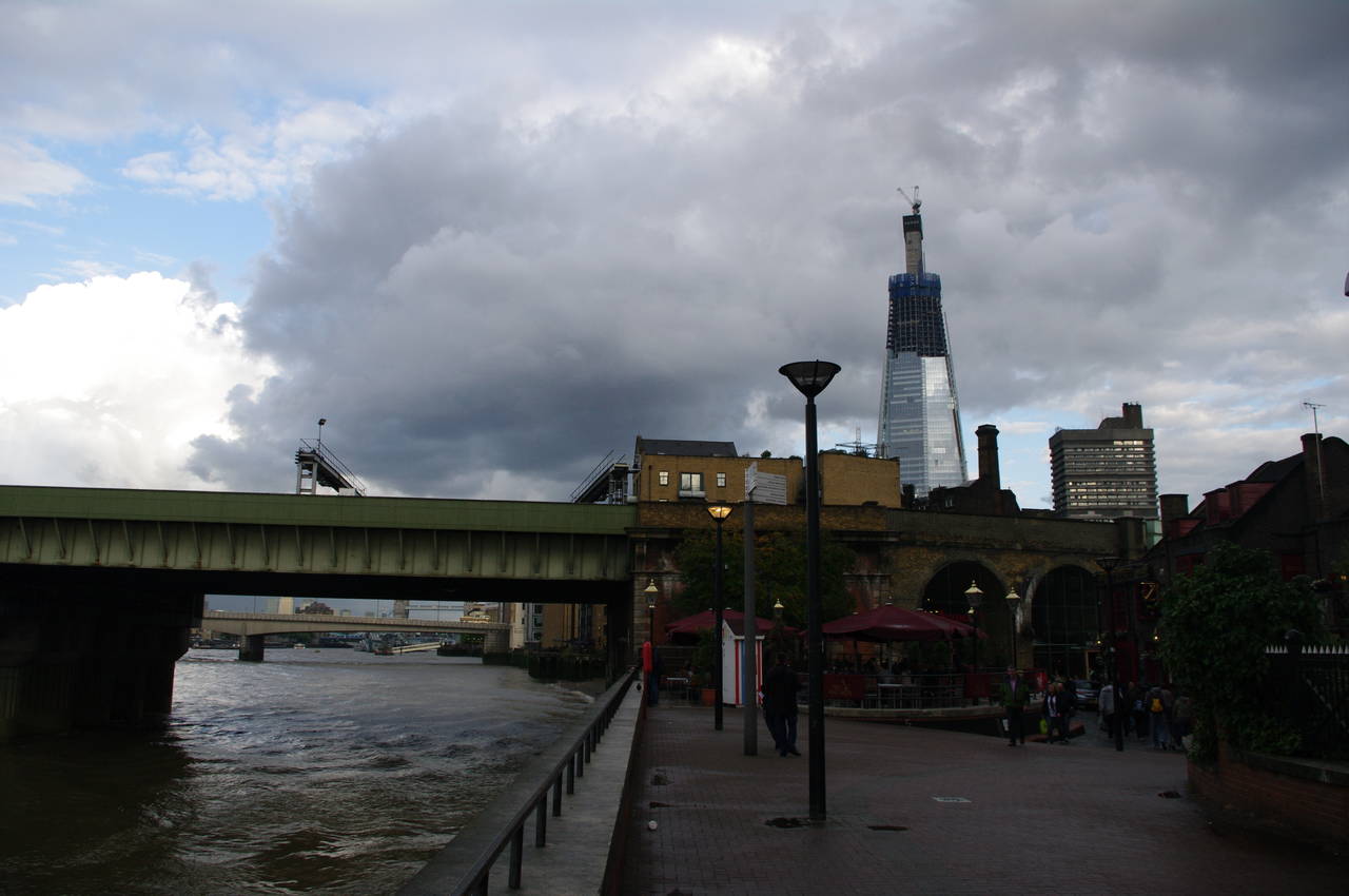
Beyond Southwark Bridge, the path approaches the Cannon Street Railway Bridge (picture 45), which carries railway lines into Cannon Street Station. Some of the station platforms actually stretch half way across the bridge. The partially-constructed "Shard of Glass", which surpassed the Canary Wharf tower as the UK's tallest building in November 2010, could be seen towering over the south bank up ahead (picture 46).
Just before the bridge the path heads away from the river, passing the 18th-century Anchor pub and heading under a railway arch and along Clink Street, site of the debtors prison that gave rise to the expression "in the clink". Clink Street leads between buildings to emerge at the St Mary Overie dock, which houses a full-size replica of The Golden Hinde (picture 47). The original ship was sailed around the globe by Sir Francis Drake in the 16th century.
Leaving the dock to the right of the river, the path goes between two office buildings and then follows a road around the left side of Southwark Cathedral (picture 48).

(49) London Bridge

(50) HMS Belfast, Tower Bridge and Hay's Wharf
(51) Hay's Galleria

(52) City Hall
The road goes past The Mudlark pub and under a long stone archway of the approach to London Bridge, though the bridge itself cannot be seen until, almost a hundred metres further along the road, the route heads under an office building and back to the riverside path just downstream from London Bridge (picture 49). Opened in 1973, this is the fourth, and least interesting, bridge on this site, succeeding Victorian, medieval and Roman bridges. The archway the path passed through is all that remains here of the Victorian bridge -- parts of which were carted off to America and used to clad a replica of the bridge in Lake Havasu City, Arizona.
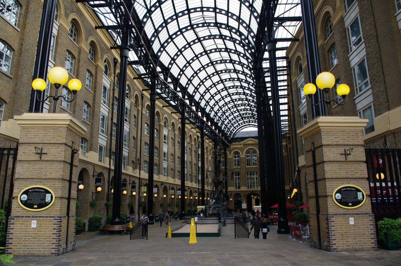
The path now approaches Hay's Galleria, an 1856 enclosed dock and warehouse complex now filled in and converted into shops and offices. Moored in the river in front of the building is HMS Belfast, a World War II battle ship which is owned by the Imperial War Museum and is open to fee-paying members of the public. Framed between the two was the magnificent Tower Bridge (picture 50), which I remember being fascinated by as a child.
After passing by the Galleria (picture 51), the path heads up towards Tower Bridge, passing the City Hall of the Greater London Authority, which looks even more like a car headlight than the building I had passed earlier in the afternoon (picture 52).

(53) Tower Bridge

(54) Tower Bridge
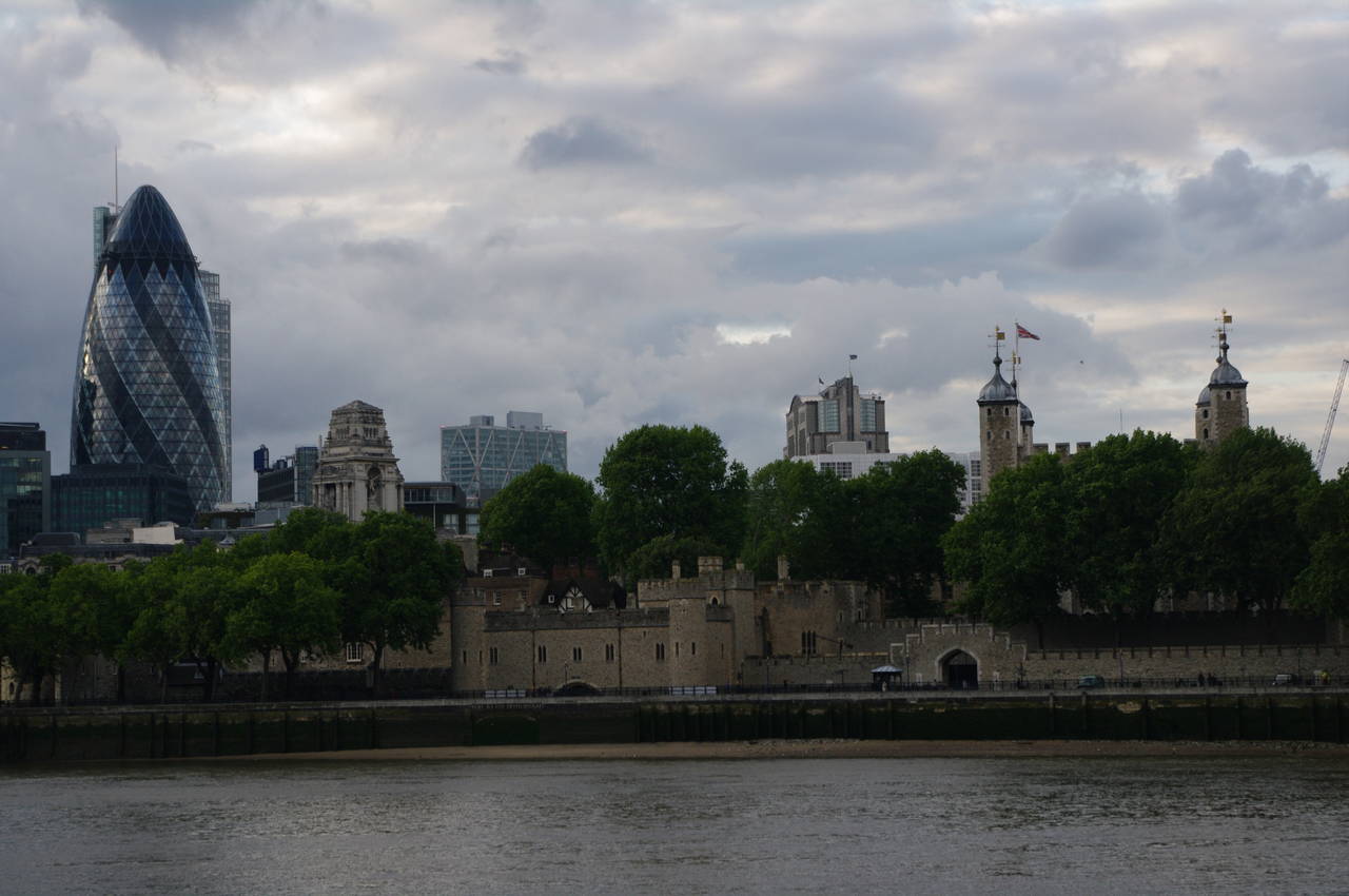
(55) The Gherkin and the Tower of London

(56) The Shard
Beyond an open grassy area where people were relaxing after work, the path reaches the southern end of Tower Bridge (pictures 53 and 54), where I decided to end my walk along the Thames Path as the rain returned. The deck of the bridge still opens occasionally to let tall ships pass through -- I saw this for the first time the following Saturday afternoon while giving my friend Daniel a whirlwind weekend tour of London's landmarks and pubs. It is also possible to take a tour inside the towers, upper galleries and engine room of the bridge, which I did on my first visit to London a few years ago. The views both upstream and downstream from the top of the bridge are superb.
My GPS estimated that I had covered another 19km of the path, but as I had observed it losing track of my position several times when I had passed under bridges, I suspect that it was short-changing me slightly. With several lengthy rain delays and so much to see on this part of the Thames Path, it had been a fairly long day and it felt like I had walked significantly further than I actually had walked.
Crossing over Tower Bridge, there were good views to the Tower of London, which sits upstream of the bridge on the north bank, and to the landmarks of the City of London's financial district beyond, where the iconic Gherkin is instantly recognizable (picture 55). There were also good views back along the south bank where the Shard is fast becoming just as well-known as the Gherkin.