ERME-PLYM TRAIL
Stage 1: Plymouth to Yealmpton
Monday, May 13, 2019

(1) River Plym from Laira Bridge

(2) Hooe Lake

(3) Radford Lake

(4) Radford Castle
With plenty of time on my hands and the prospect of a fine and sunny day ahead, I decided to walk from my accommodation on the northern edge of Plymouth's city centre to the start of the Erme-Plym Trail. The walk alongside the A374 and A379, the main traffic route to Plymouth's south-eastern suburbs and beyond, is fairly boring aside from the crossing of the River Plym at Laira Bridge (picture 1).
From the first roundabout beyond the bridge, I followed the West Devon Way through the suburb of Oreston for the last kilometre to a small carpark on the edge of Hooe Lake. This large backwater of the River Plym has an air of quiet decay, with the hull of a large wooden boat slowly rotting away in the shallow waters and several more lying discarded on the shore (picture 2).
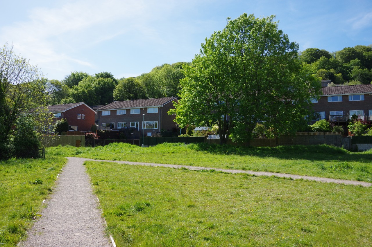
Nearby, a causeway separates Hooe Lake from the smaller Radford Lake (picture 3). The causeway is straddled by a derelict gatehouse, built in the 19th century as a folly and bearing the rather grandiose name of Radford Castle (picture 4).

(5) Path beside Radford Lake
(6) Radford Village Green

(7) Buddle Wood

(8) Radford Woods
In the carpark, a signpost shows distances to destinations on the South West Coast Path and the West Devon Way, which meet here, but most importantly for this day's endeavour it also marks the start of the Erme-Plym Trail.
The signpost points along a broad, shady path that runs beside a metal fence then a high stone wall to emerge in a grassy clearing beside Radford Lake. The Erme-Plym Trail crosses the grass to pick up another path skirting the trees that line most of the lake's edge (picture 5), eventually joining the short Mayers Way and following it out to Hooe Road.
Thirty metres to the right, the Trail crosses the road at a pedestrian refuge and takes a signposted footpath past a stone-fenced compound and onto the somewhat unkempt Radford Village Green (picture 6). A cinder path is followed across the green and past houses to head into Buddle Wood (picture 7).
A short distance into the wood, an uphill path bears right from the main path, but this seemed to be unsignposted and I managed to miss the turn, wandering on through the wood for a few minutes before I glanced at my map and realised my error. The correct path climbs and gradually curves to the right to run along the middle of a narrow strip of woodland separating two patches of suburbia. Crossing a broad track beyond the last of the houses, the path passes from Buddle Wood to Radford Wood, where bluebells lined the path (picture 8).

(9) Approaching Staddiscombe

(10) Staddiscombe

(11) Leyford Farm

(12) Leyford Farm
Reaching a gate on the far side of the wood, the Erme-Plym Trail turns left on a wire-fenced path that climbs alongside a thicket to the top of a ridge. A farm track descends the other side of the ridge between paddocks (picture 9) and at a cross-track, the Trail bears right to cross over a stone stile and follow the left edge of a small field to a kissing gate by a junction of lanes in the village of Staddiscombe.
The Trail turns left along Staddiscombe Road, following it down through the village to a complicated junction (picture 10), where a public footpath sign opposite points up a track that heads out across Leyford Farm (picture 11).
The Ordnance Survey map was incorrect here. Rather than trampling the farmer's crop, the correct route sticks to the track, which eventually comes up beside a wire fence and begins to descend into a deep gully (picture 12). When the track bends left, the Trail goes ahead through a gate beside a telegraph pole and descends to a little footbridge in the bottom of the gully before climbing a well-worn path towards another telegraph pole at the top of a field on Hollacombe Hill.

(13) Approaching Traine Road

(14) Path above Wembury

(15) Churchwood Valley

(16) Path descending to Wembury Beach
Through a gate in the field boundary, the Trail goes along the right edge of the next field and through another gate, then angles diagonally across a long field (picture 13) to a stile by Traine Road, a narrow sunken lane.
This is where the route from Plymouth meets the main coast-to-coast route. My plan was to walk down to the coast then backtrack to this spot and continue northward.
The Trail follows the road downhill towards the village of Wembury, but one field short of the village a signpost points the way through a gate on the right and the path climbs diagonally up a large field. At the top corner of the field, the path bears left and descends gently across the middle of an even larger field, bearing left again at a gap in the next field boundary to descend diagonally across the next field, where I gained my first view of the sea (picture 14). I paused briefly here, watching the wind moving the crop, almost appearing to come up the field like waves breaking on the shore.
Having effectively skirted around the north side of the village of Wembury, the path crosses a stile and heads through scrub to join the driveway of Higher Ford Farm. At the end of the driveway, the Trail turns left along Ford Road for around eighty metres then turns right on a signposted footpath heading down the Churchwood Valley (picture 15).
The shady path eventually passes a house and joins another driveway that merges into a tarmac lane and this soon reaches Church Road. Twenty metres down the road, a wooden gate gives access to a path down the lower part of the Churchwood Valley (picture 16), this part being owned by the National Trust.
Next to a small boatyard above Wembury Beach, a signpost marks the beginning (or end) of the Erme-Plym Trail and the Devon Coast to Coast where those paths meet the South West Coast Path.

(17) Wembury Beach

(18) Wembury Mill

(19) St Werburgh's Parish Church
(20) View from St Werburgh's Parish Church
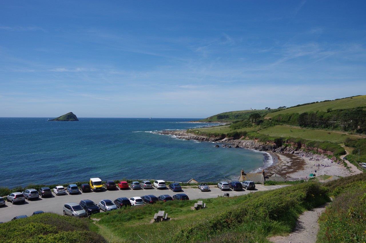
The stony Wembury Beach was quite popular in the sunny weather (picture 17), in stark contrast to my visit in rather bleak weather when I walked this part of the Coast Path in 2014.
Just above the beach is the old Wembury Mill (picture 18), which once used a waterwheel to turn millstones for grinding wheat but now houses a National Trust cafe and a holiday cottage. Occupying a prominent position on the hillside above the mill is St Werburgh's Parish Church (picture 19), evidently a favoured location for television productions, as I had seen it featured in two TV drama programmes in the weeks before this walk. Parts of the church are Saxon, but the building was substantially rebuilt in 1886.
The short but steep climb up to the church is worth the effort as it has a magnificent panoramic view over Wembury Bay, the coastline, and the offshore landmark of the Great Mewstone (picture 20). An information board in the carpark below the church describes how the Great Mewstone was once home to a convict who was 'transported' there with his family to serve a seven year term that would otherwise have been served in Australia.

(21) Wembury Beach

(22) Churchwood Valley
(23) Wembury village

(24) The Odd Wheel, Wembury
After exploring the church and churchyard, I returned to the signpost by the beach (picture 21) and set off back up the Churchwood Valley (picture 22), through Higher Ford Farm and over the fields above Wembury village (picture 23). On reaching Traine Road, I left the Erme-Plym Trail and wandered down the road to the edge of the village, stopping for lunch at the 18th-century Odd Wheel pub (picture 24), which stands by the junction of Traine Road and Knighton Road.

(25) First view of Dartmoor

(26) Andron Wood

(27) Path below Spriddlestone House

(28) Spriddlestone
After lunch I walked back up Traine Road, following it back up onto Hollacombe Hill. A little beyond the point where I had first joined Traine Road, the lane merges into the much busier Wembury Road and the junction offers the trail's first view of the high ground of Dartmoor (picture 25).
After crossing the road and following the pavement to the left for fifty metres, a Public Footpath signpost points down a driveway and through a gate into Andron Wood (picture 26). Soon emerging from the other side of the small wood, the Trail crosses a grassy, wildflower-carpeted depression below Spriddlestone House (picture 27), aiming for a stile to the left of a large barn. Over the stile, the route turns right to follow a track along the edge of Knapps Wood and onward to a crossroads in the hamlet of Spriddlestone, where the Trail turns right by a large white cottage (picture 28).

(29) Meadow near Spriddlestone
(30) Ford over Cofflete Creek

(31) Crossroads at the top of Lodge Lane

(32) Approaching Brixton
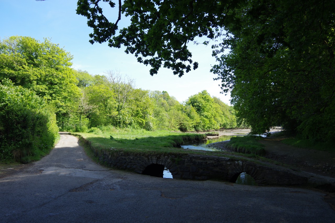
The lane climbs briefly to a stone cottage, opposite which an Erme-Plym Trail signpost points the way over a stone stile and along the edge of a meadow (picture 29). In a second meadow, the route bears slightly right to aim for a gate in the middle of the far field boundary. Following the left edge of the next field leads to another gate and an enclosed path through trees to a lane that fords Cofflete Creek (picture 30), a tributary of the River Yealm.
Across the creek, the Trail heads under the tall arch of a disused railway bridge and continues ahead on a long sunken track, turning left on a lane at the far end to reach the busy A379 at the edge of the village of Brixton. After waiting what felt like an age to cross safely, I turned right to walk alongside the main road.
A little strangely, the Erme-Plym Trail doesn't go directly into the village, but instead turns left after one hundred metres to follow Lodge Lane past a few houses and onward to a lonely crossroads among fields (picture 31). Seventy metres to the right along Hilltop Cottages, a walkers' gate on the right takes the path diagonally across a dusty field (picture 32) and onto a narrow alleyway between houses.

(33) Church of St Mary, Brixton

(34) Path leaving Brixton

(35) Quiet lane near Gorlofen

(36) Climbing toward Cole Hill Plantation
Across Cherry Tree Drive, another alleyway heads down steps to join a lane descending past the Church of St Mary (picture 33) to a small parking area by the A379. Once again, the Erme-Plym Trail eschews the main road and instead takes Old Road behind the Brixton Post Office. At the next junction, the route turns left up Red Lion Drive for a few paces then turns right to follow Woodland Drive past a long row of identical houses.
A gate at the far end of the street opens onto a large field (picture 34), where an obvious path continues in the same direction before crossing a stile and bearing a little left to descend to a gate hidden under trees in the corner of the next field. Through the gate and over another stile, the path runs along the left side of a smaller field then skirts around the left side of Scotch Fir Plantation. Beyond a gap in the next field boundary, the path bears away from the plantation and aims for a couple of telegraph poles near the corner of Gorlofen Plantation. The Trail skirts the plantation to find a stile from which a path cuts through the trees to a quiet lane leading past the Gorlofen estate (picture 35).
After five hundred metres, the Erme-Plym Trail is signposted over a stile on the right side of the road and angles up a field and through a gate to pass the end of Cole Hill Plantation (picture 36).

(37) Approaching Yealmpton

(38) Fore Street, Yealmpton

(39) The Volunteer, Yealmpton

(40) Church of St Bartholomew, Yealmpton
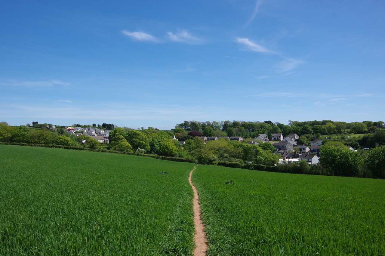
Just past the plantation, the path jinks through a gap in the field boundary and descends the right edge of three successive fields above the village of Yealmpton (picture 37). From the bottom of the third field an enclosed track leads down to Bowden Hill. Seventy metres to the right along the quiet residential street, another enclosed footpath heads down between stone walls to Fore Street, part of the A379 (picture 38).
Turning left along the main road, I soon crossed over and continued past the large churchyard of St Bartholomew's and opposite The Volunteer pub (picture 39) to reach a crossroads where the Erme-Plym Trail turns right down Torr Hill. I left the Trail here, having walked eighteen kilometres from Hooe Lake.
I still had almost an hour to wait for the next bus back to Plymouth, so I wandered down into the churchyard to find the best angle to view the building (picture 40). The church isn't as old as its Gothic architecture would suggest; it was built in 1850 and the tower wasn't added until 1915. Afterwards, I had enough time to call into The Volunteer for a quick pint before popping back over the road to catch my bus.