Isles of Scilly Walks
The Isles of Scilly are a group of windswept islands in the Atlantic Ocean, around forty-five kilometres west-south-west of Land's End. Six of the islands, St Mary's, Bryher, Tresco, St Martin's, St Agnes and The Gugh, are collectively home to a community of around 2,200 people, while the archipelago also includes several uninhabited islands and more than one hundred rocky islets and jagged reefs.
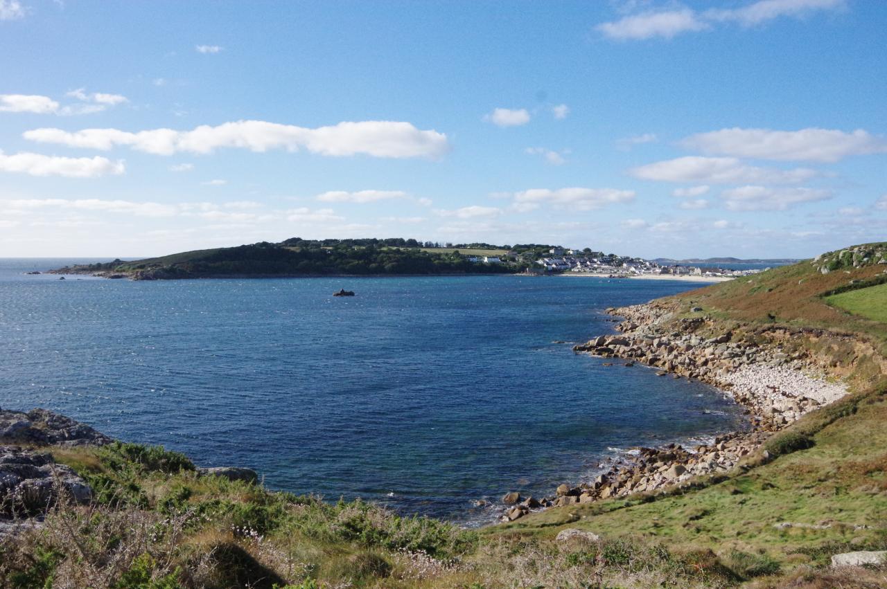
St Mary's is the largest of the islands, in both area and population, and is the main arrival point for visitors. The other populated islands are often referred to as the "off-islands".
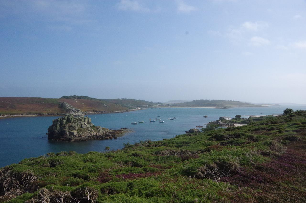
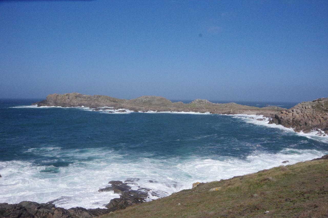
Bryher, Tresco and St Martin's are lined up to the north of St Mary's, while St Agnes and The Gugh lie to the south-west, just 150 metres apart and joined by a sandy causeway at low tide. The majority of the islets are in three clusters: the Eastern Isles, between St Mary's and St Martin's, the Norrard Rocks, just west of Bryher, and the Western Rocks, which stretch westward for seven kilometres from St Agnes to the tiny Crim Rocks.
Crim Rocks are the most westerly land in England, with the next solid ground to the west being Newfoundland in Canada, more than 3,300 kilometres away. Another of the Western Rocks, the tiny Pednathise Head, is the southernmost point in the entire United Kingdom. Near the Crim Rocks, the lonely Bishop Rock is topped by a tall granite lighthouse, while smaller lighthouses stand in the centre of St Agnes, the southern tip of St Mary's and the uninhabited Round Island to the north of Tresco.
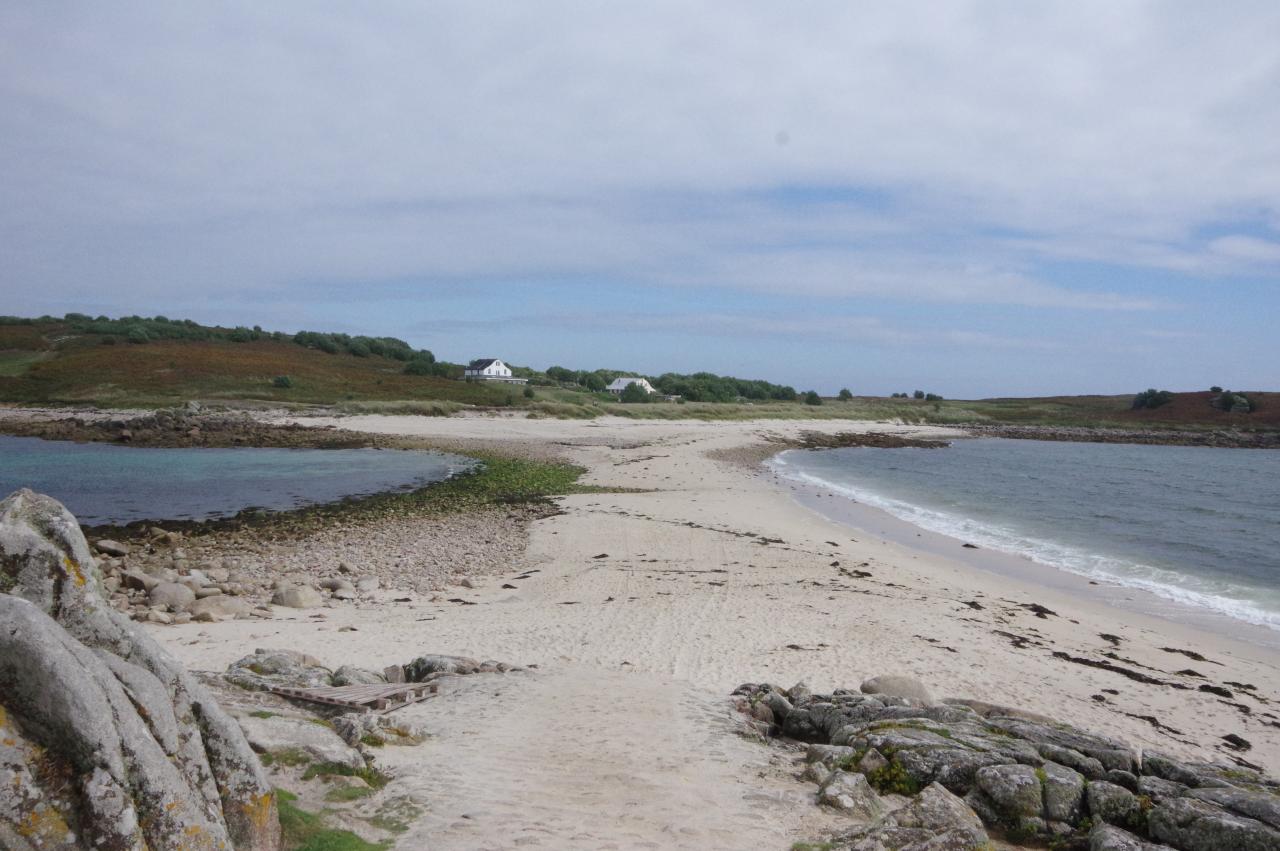
The geology of the Isles of Scilly is very similar to that of Devon and Cornwall, with which the islands were probably connected by dry land during past Ice-Ages. The islands are part of the same granite mass that surfaces on Dartmoor, Bodmin Moor and the Penwith Peninsula. Consequently, the islands are dotted with impressive granite tors and outcrops, and are fringed by low cliffs and white sandy beaches made from broken down granite.
Once they became isolated from the mainland at the end of the last Ice-Age, the Isles of Scilly remained as a single land-mass until the central plain was inundated, perhaps as recently as 1,000 AD. Ancient field boundaries have been discovered in the waters off the formerly occupied but now deserted island of Samson and on very low spring tides the sea is still shallow enough for people to wade between some of the islands. The land that remains above the water today was once a range of low hills, the highest point of which, at Telegraph on St Mary's, is just 51 metres above sea-level.
The Isles of Scilly were occupied in the Neolithic and Bronze-Ages, with a high concentration of surviving prehistoric remains, including several prominent burial chambers, standing stones and ancient settlements. The Romans largely ignored the islands during their occupation of Britain, but later Vikings and bands of pirates found a haven here before the islands became the property of the Duchy of Cornwall in the 14th century. Legalised piracy, a.k.a. privateering, continued sporadically in later centuries, resulting in a Dutch admiral declaring war on the Isles of Scilly in 1651, with a peace treaty only being signed in 1986, though no shots were ever fired in anger during the conflict. Today, the Duchy still owns the Isles of Scilly, which are part of the ceremonial country of Cornwall but have their own local government separate from the Cornwall County Council.
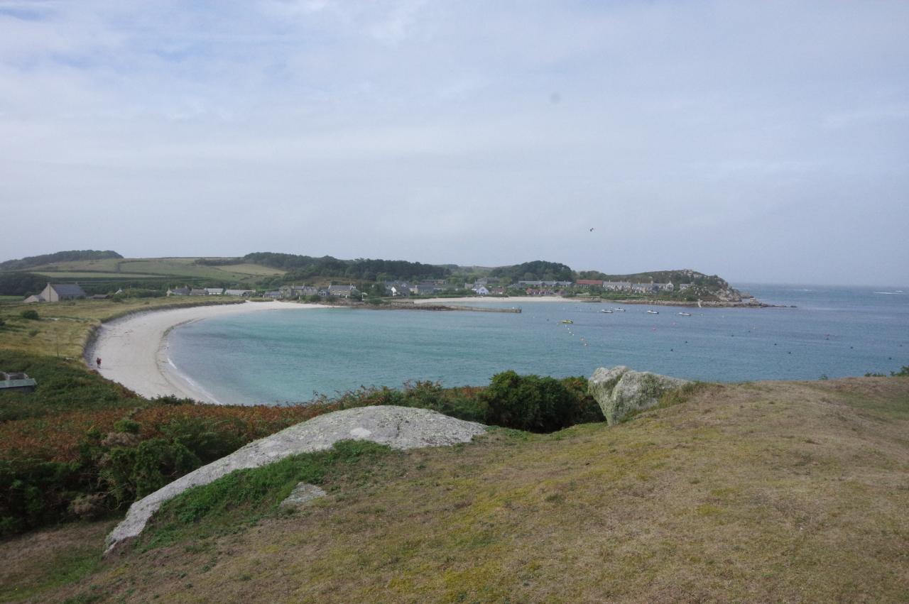
The principal settlement on the Isles of Scilly is Hugh Town, which sits on a sandy isthmus between the bulk of St Mary's and the low, fortified hill of The Garrison. The bay on the north side of Hugh Town is the main harbour for the islands, while the sheltered bay on the south side provides a safe swimming beach.
The large Scillonian III ferry is the main form of transport from the mainland, taking around three hours for the journey from Penzance, though visitors with deep pockets can instead take a much quicker flight from Exeter, Newquay or Land's End to St Mary's. Both of my trips on the ferry were in fairly calm weather, and it was quite pleasant to spend most of the journey sitting on the deck and admiring the cliffs of West Cornwall and the approach to the islands. However, a regular passenger told me that in wilder weather the ferry is worthy of it's nickname — "the great white stomach pump".
The Scillonian III arrives at The Quay in Hugh Town, from which smaller boats depart for the off-islands and for sightseeing and wildlife-watching trips around the uninhabited parts of the archipelago, where seals and rare birds can be seen. A chalkboard on The Quay lists the boat services available each day. On a calm and sunny day there are usually multiple boats to and from each of the off-islands and one or two sightseeing trips, while in poor weather the choices can be much reduced or non-existent.
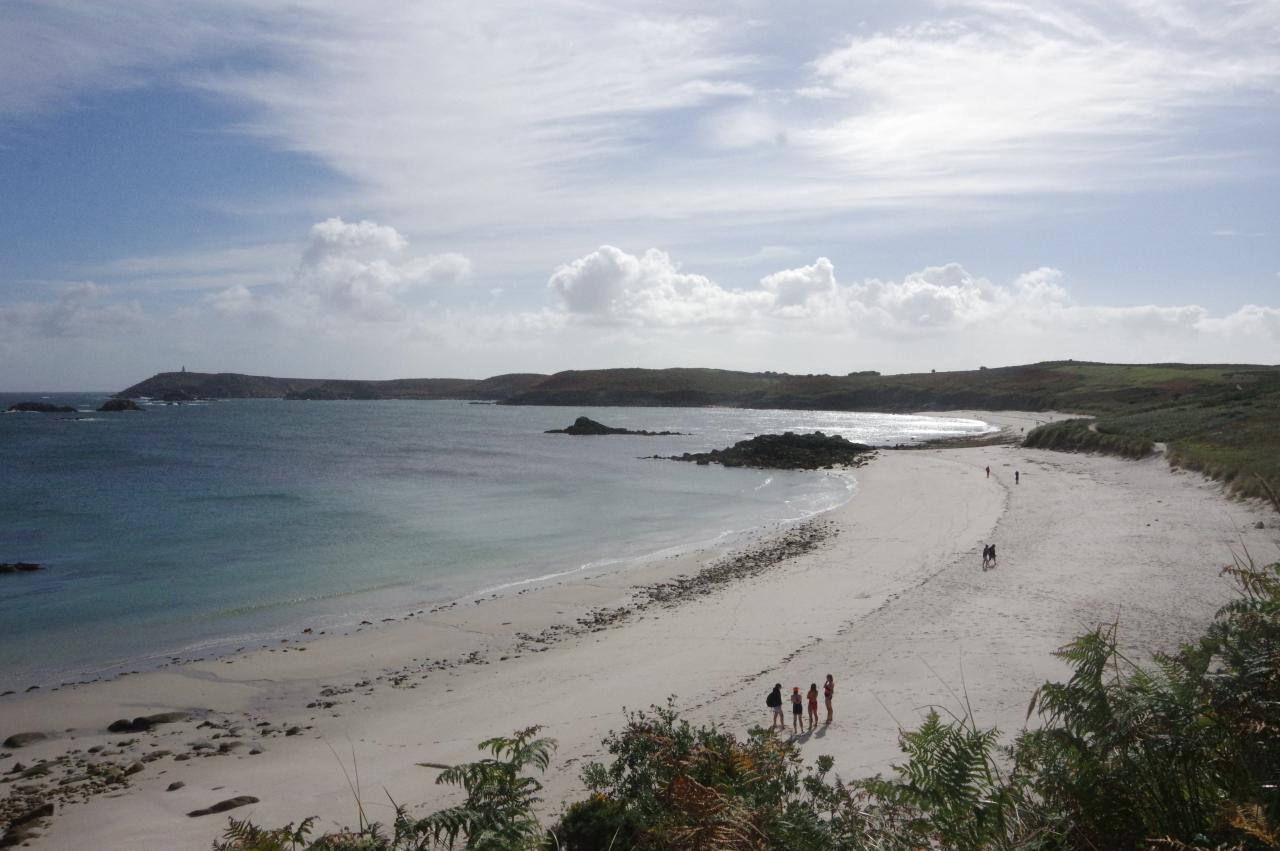
There are no official long-distance walking routes on the Isles of Scilly, but there are plenty of public footpaths, making it possible to circumnavigate each of the inhabited islands on foot. Given the low elevation of the islands, none of these walks are particularly taxing. The route around St Mary's can be comfortably completed in a day and the circuits of each off-island are easily walkable in under four hours, including a combined route around St Agnes and The Gugh if visiting when the causeway is not submerged. This leaves plenty of time to explore the interior of each off-island before the last boat returns to Hugh Town.
The weather was very mixed during my visit and there were a couple of days where the inter-island boats weren't running at all due to very rough seas. I would therefore advise anyone looking to visit all of the islands in one trip to leave a few spare days to avoid their plans being spoiled by poor weather. I can also heartily recommend the sightseeing boat trip that explores the Western Rocks and goes out to Bishop Rock for a closeup view of what the skipper called " the lighthouse at the end of England".
Day 1
St Mary's
16 Sep 2018
19.8km
Day 2
St Agnes and The Gugh
17 Sep 2018
10.2km
Day 3
Bryher
18 Sep 2018
9.5km
Day 4
Tresco
19 Sep 2018
11.4km
Day 5
St Martin's
21 Sep 2018
10.5km