OFFA'S DYKE PATH NATIONAL TRAIL
Stage 8: Mellington Hall to Pool Quay
Friday, June 21, 2019
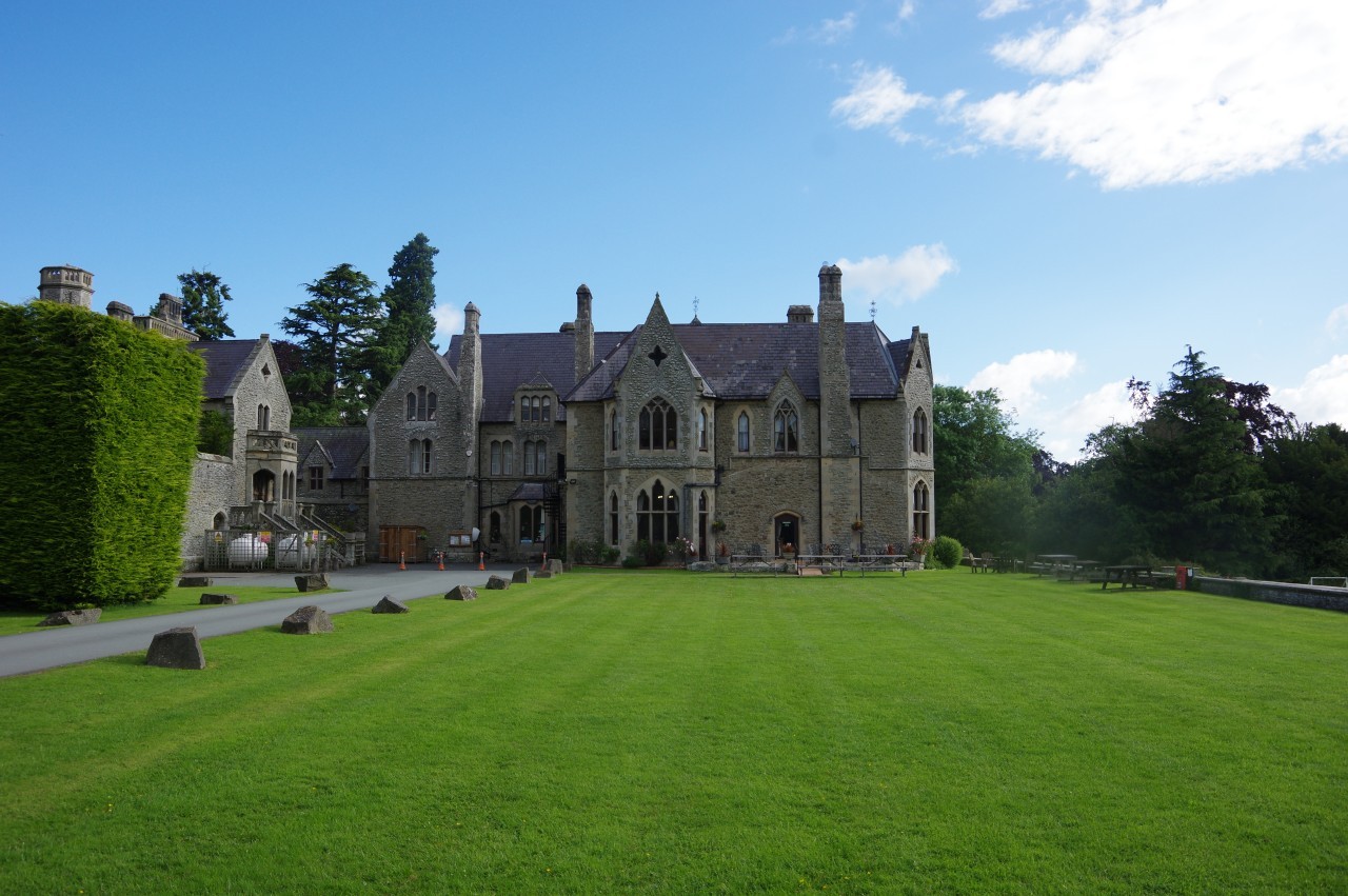
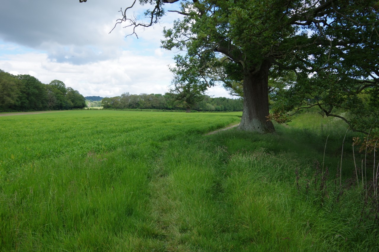
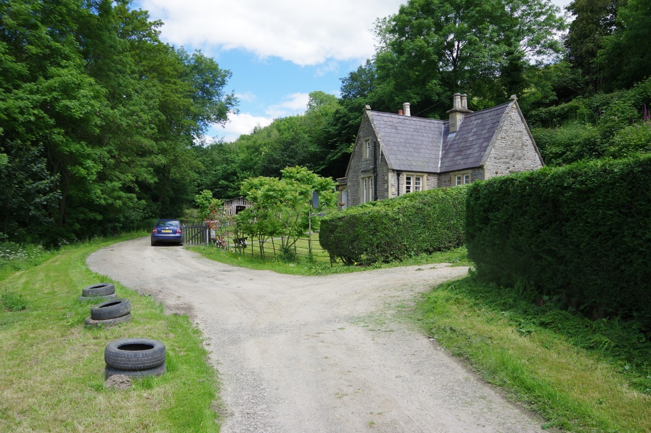
(1) Mellington Hall
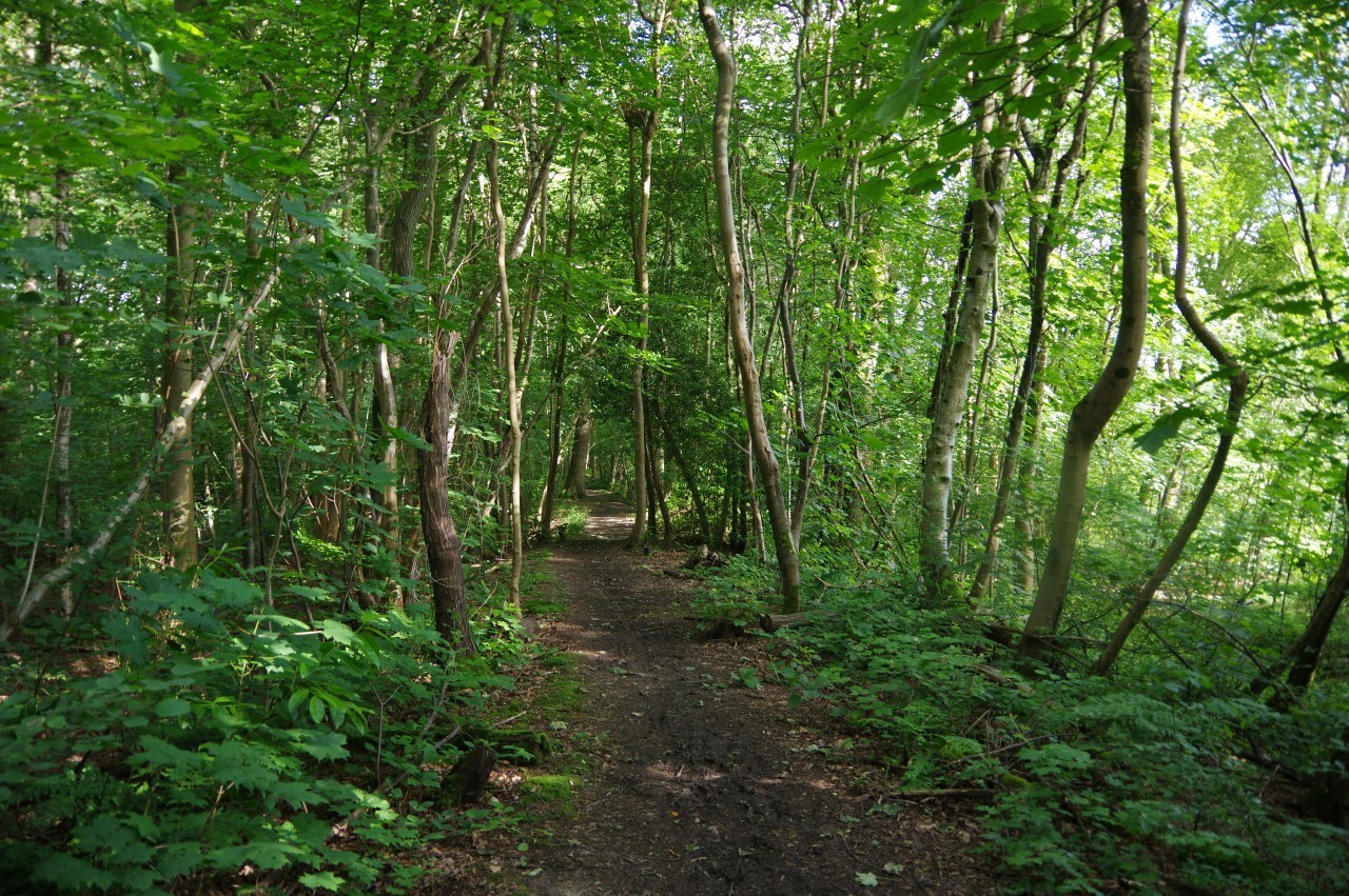
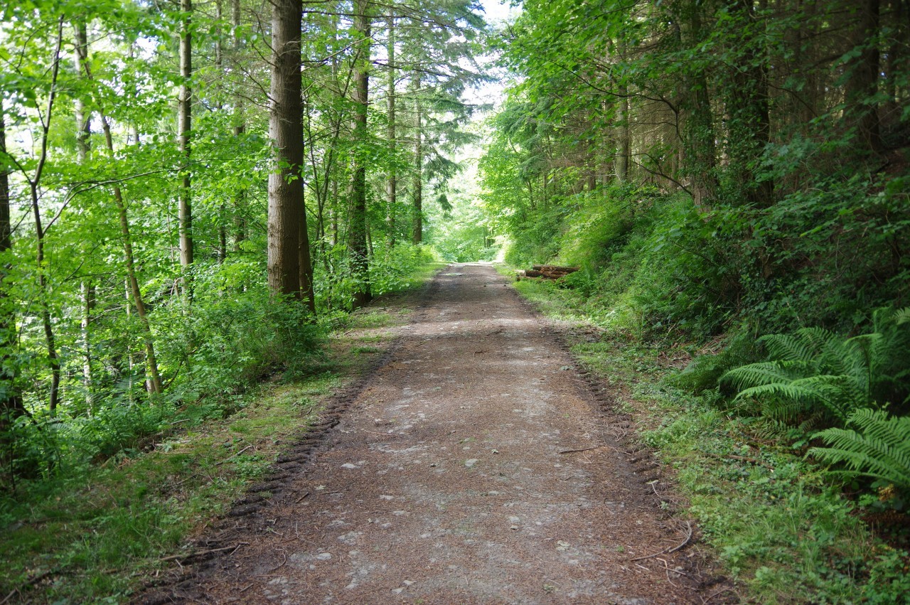
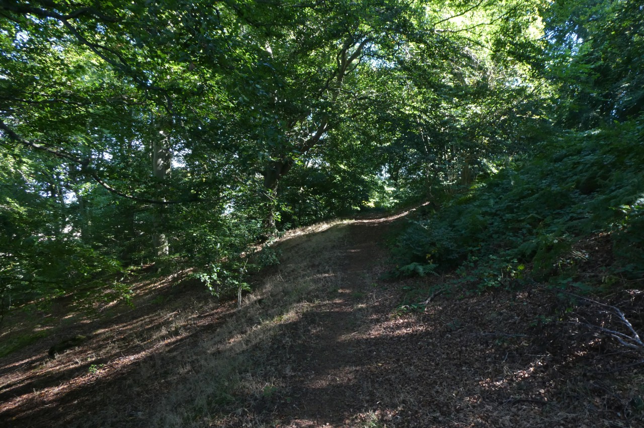
(2) Mellington Wood

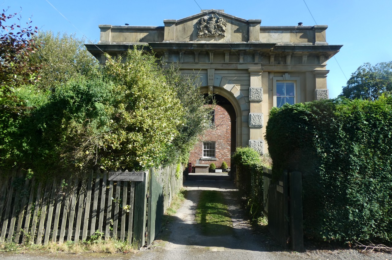
(3) Gatehouse by the B4385
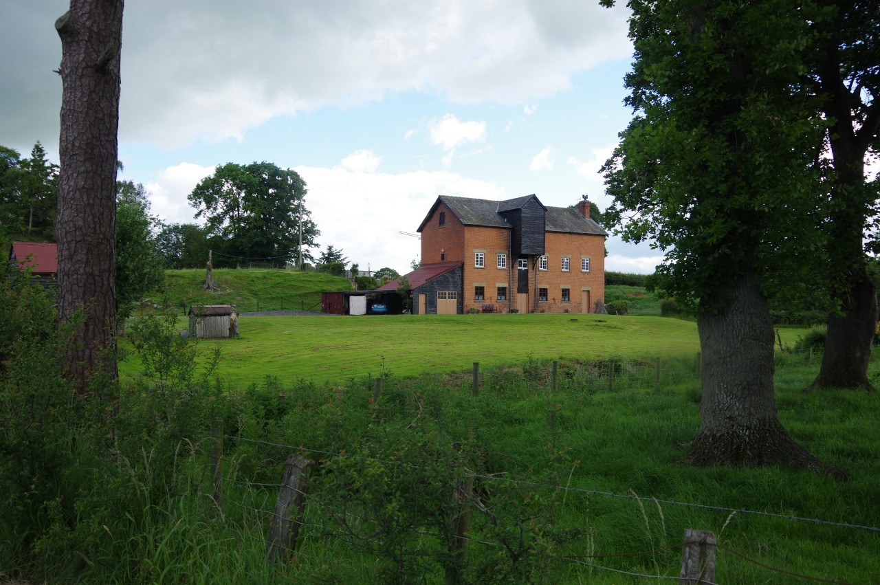
(4) Brompton Mill
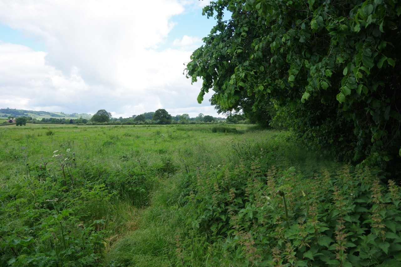
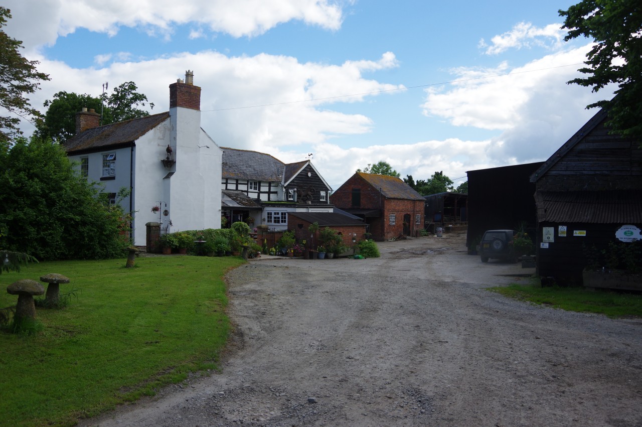
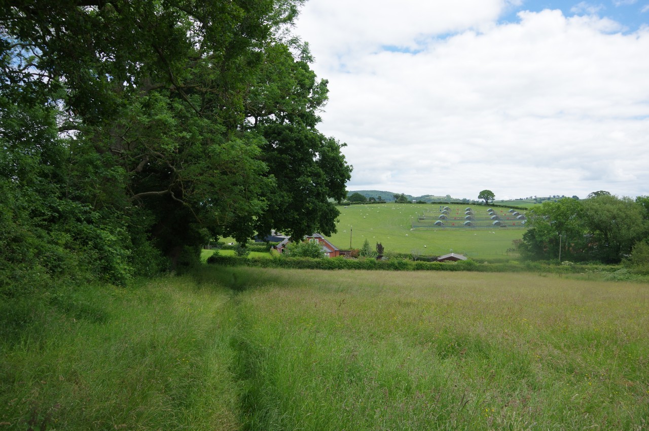
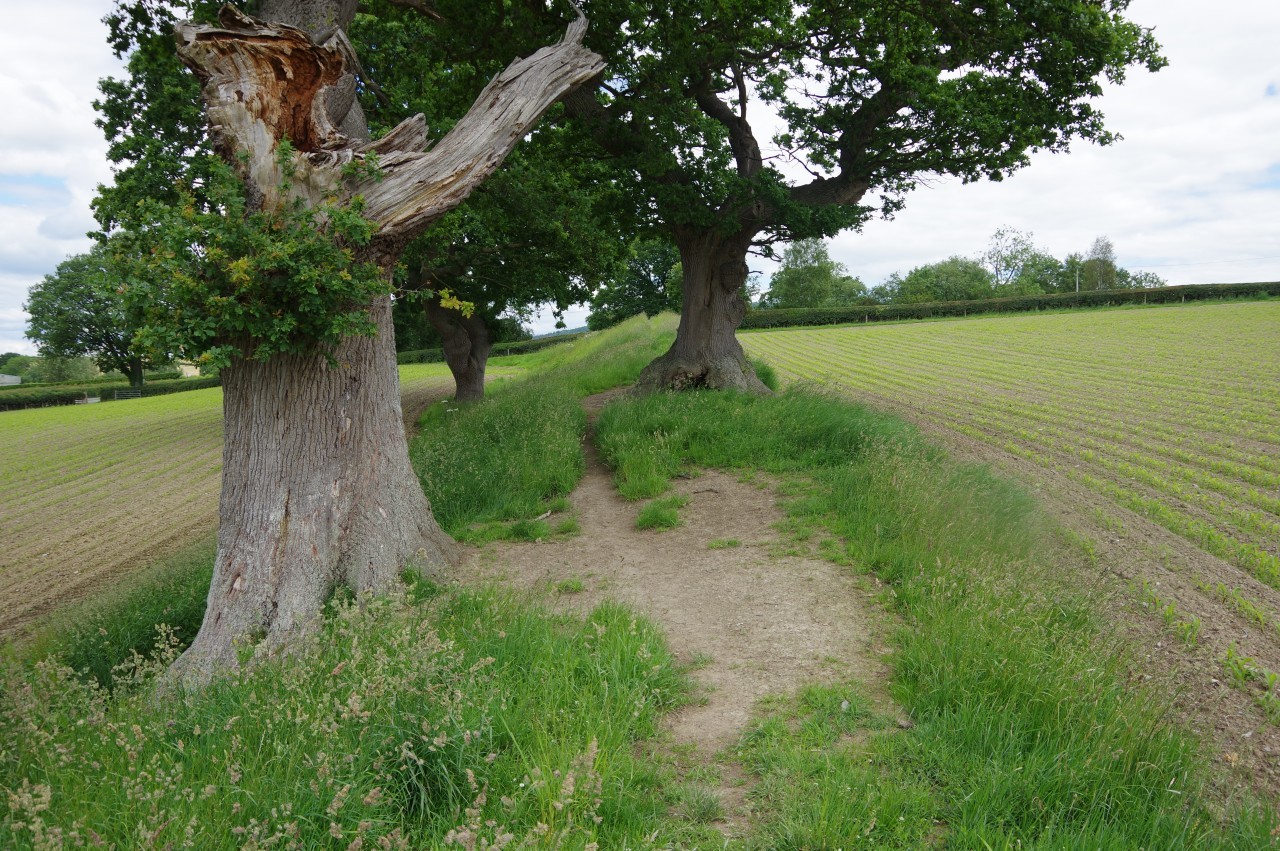
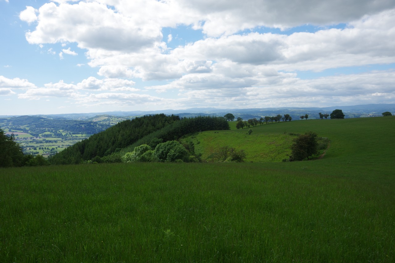
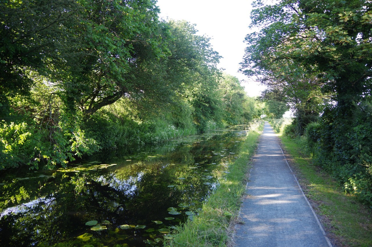
After the previous day's walk over the switchback hills, I made a rather sluggish start to my walk across the Vale of Montgomery. It was well after eight o'clock by the time I had packed away my tent and set off from Mellington Hall (picture 1) along the track into Mellington Wood to rejoin the shady path atop Offa's Dyke (picture 2).
After weaving around a few trees growing right on the middle of the earthwork, the path emerges from the wood via a gate and drops down beside the Dyke, running along the edge of a large meadow and through a smaller wood to join the caravan park's access road. Almost immediately the road bends right, but the Path goes straight ahead through a stand of trees on a track with a concrete barrier preventing vehicle access.
The track soon leads under an arch in the middle of a lodge by a bend in the B4385 (picture 3). Ahead along the narrow road, the stone Brompton Bridge crosses the Caebitra River by Brompton Mill (picture 4), re-entering Shropshire.
(5) Brompton Crossroads
(6) Overgrown path near Brompton Hall
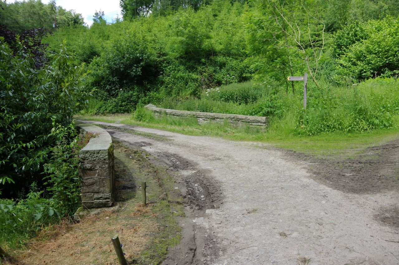
(7) The Ditches

(8) Irish road signs
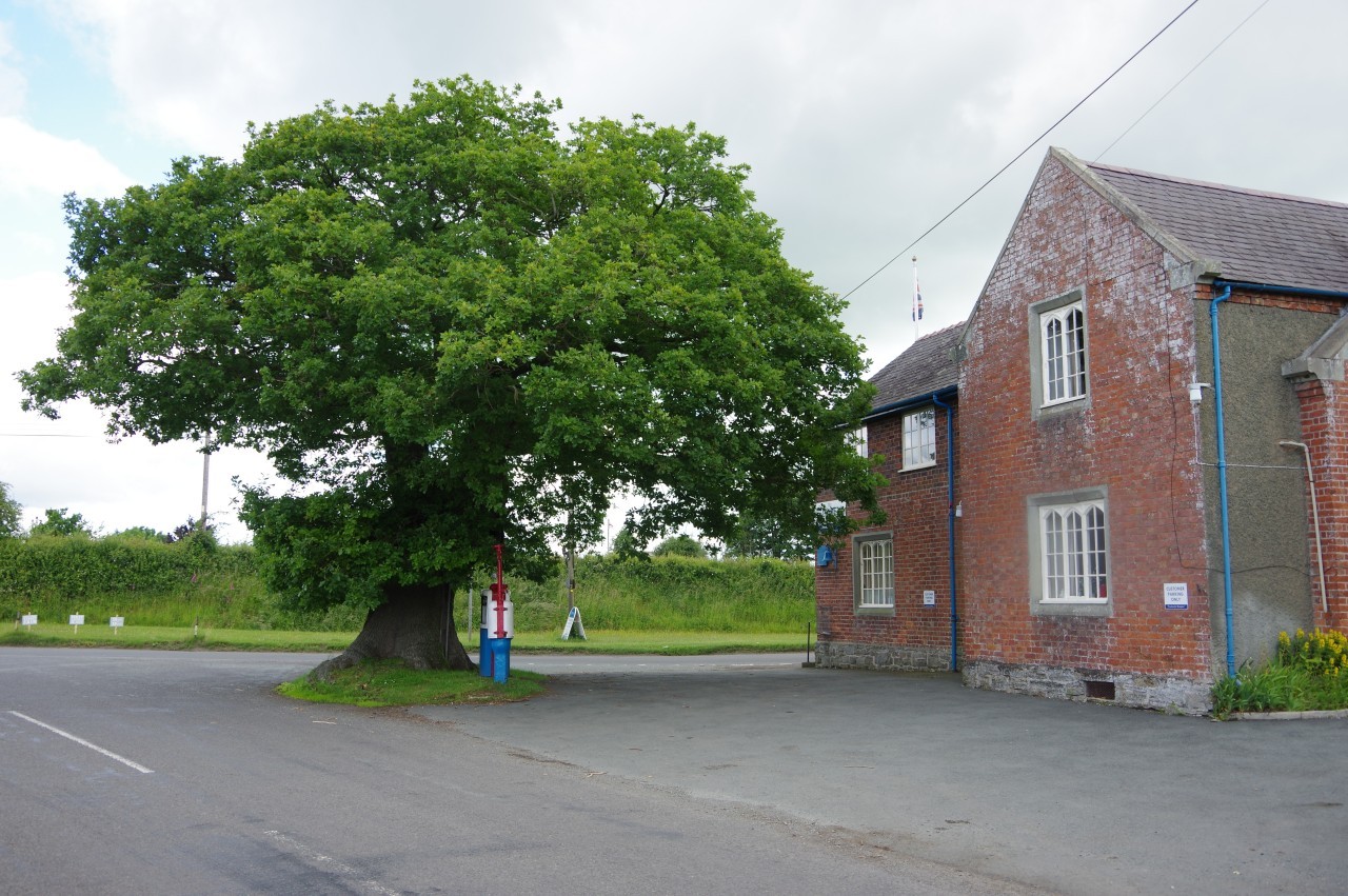
A little further ahead, the B4385 reaches the A489 at Brompton Crossroads, where a rusty old petrol bowser stands under an ancient oak outside the Blue Bell Hotel (picture 5).
Over the crossroads, Offa's Dyke Path continues along the B4385 to the first farm gate, turning along the driveway of Brompton Hall. Just before the farmyard, a gate on the left takes the Path into a field bordered by the next tree-covered segment of Offa's Dyke.
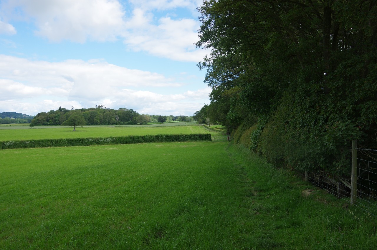
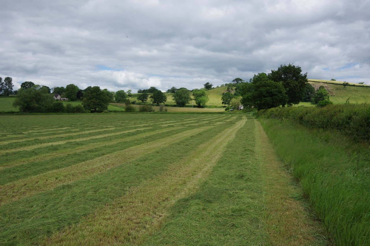
For the next few kilometres, Offa's Dyke consistently heads just west of north across the farmland of the Vale of Montgomery. The first stretch runs along field edges just to the left of the Dyke, one used for sheep-grazing, the next fallow and overgrown (picture 6), and the third growing barley. Long grass in the corner of the latter field had a large patch of red poppies growing by a stile leading into the farmyard of The Ditches (picture 7).
The gate where the Path leaves the farmyard has a couple of road signs that appear to be rather a long way from their rightful home in County Cork in the south-western corner of Ireland (picture 8). Perhaps there's an interesting story to explain how they ended up in rural Shropshire.
(9) View toward Pen-y-Bryn Hall
(10) Approaching New Covert
(11) Approaching Boardyhill Wood

(12) Descending to the B4386
Beyond The Ditches, the path continues along the left side of the Dyke over a meadow before getting on top of a section of the Dyke that is not covered by trees to cross the next meadow. The Path crosses a stile and drops off the left side of the Dyke to cross a footbridge over a tiny stream where the Welsh border comes up from the left and beyond here the Dyke once again marks the national border.
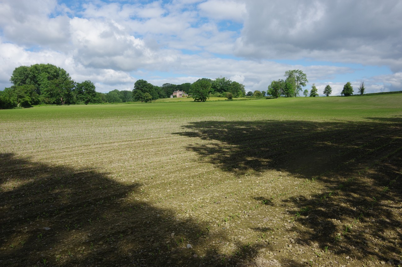
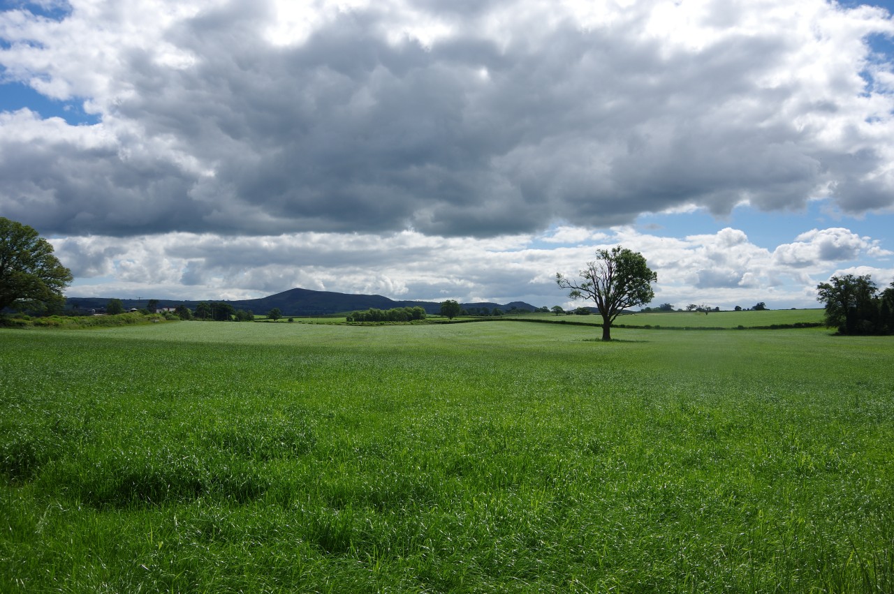
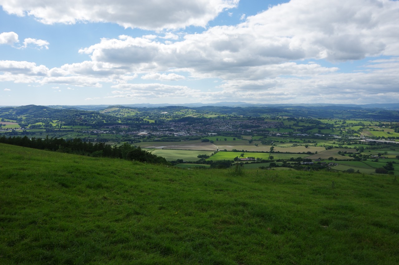
Over another meadow and another footbridge, the Path enters a large crop field with Pen-y-Bryn Hall standing atop a hillock over to the left (picture 9). The Path continues beside the Dyke, however, crossing an unsealed road then continuing to follow the Dyke across a long series of fields with the rectangular wood of New Covert in the middle of the patchwork of fields stretching out to the left of the path (picture 10). Further over to the left, the town of Montgomery stands on the wooded lower slopes of Ffridd Faldwyn, though from here only the top of the church's tower and the ruined castle further up the hillside are visible among the trees.
The view of Montgomery is soon lost as the path eases past New Covert then follows the Dyke under several mighty oaks (picture 11) and along the edges of a few more fields to reach a cross-track at a corner of Boardyhill Wood. On my southbound journey, I used this track to walk the two kilometres through the Lymore Estate to visit Montgomery.
For those heading northward, the Path turns across a cattle grid to follow the edges of crop fields along the Shropshire side of the Dyke and past the long wood. When the woods end, the Path switches back to the Welsh side of the Dyke and climbs over a slight rise in a crop field. At the next field boundary, the border leaves the Dyke to follow a tiny stream snaking through fields to the left, while the Path sticks by the Dyke as it descends gently across sheep pastures (picture 12) to reach the B4386.
(13) View eastward to Corndon Hill

(14) Crossing the River Camlad at Devil's Hole
(15) Approaching Pound House
(16) View back to Montgomery
Over the road, the Path goes ahead down a farm track beside crops of barley and beans, passing the little wood of Rownal Covert in the third field before switching sides of the Dyke to run up one more field to the farm buildings of Rownal. From this field there is a good view eastward across the pancake-flat fields to the silhouetted outline of Corndon Hill (picture 13).
At Rownal, the Path kinks a short distance to the right to a signposted five-bar gate adjacent to the farmhouse. Through the gate, the Path runs down the right edge of a field while the Dyke runs down the opposite edge. At the bottom of the field another five-bar gate opens onto a long tunnel of foliage that gradually converges with the Dyke once again. The path emerges back into the light on the left side of the Dyke, following it along the edge of a couple of fields to cross a footbridge over the River Camlad, which here marks the Welsh border, at Devil's Hole (picture 14).
A few paces to the left, the Path goes through a gate into a huge field that had recently been cut for hay (picture 15). About a third of the way along the edge of the field, another little footbridge takes the Path through a gap in the overgrown field boundary. I missed this turn at first and wandered up to the next corner of the field, where I was blocked by a little stream opposite Pound House. As I turned around to backtrack, a French couple came up to me, having made the same mistake, or perhaps they just followed me on the dangerous assumption that I knew where I was going.
Back on the correct route, I followed a farm track passing to the right of Pound House and out to a quiet country lane. From a gate across the lane, the Path makes a short but rather steep climb up a grassy hillside, gaining a view back and to the left towards the town of Montgomery nestling below its neighbouring ridge (picture 16). A little sign attached to the next gate informs walkers that in 1644 the intervening fields in the view were the site of the Battle of Montgomery, a bloody Civil War clash in which five hundred Royalist soldiers lost their lives.
(17) Offa's View
(18) Path on Offa's Dyke
(19) Parklands
(20) Approaching Kingswood
The Path soon levels out and swaps sides of the Dyke yet again, running along the edge of one fairly level grassy meadow then descending a couple more through the hamlet of Offa's View (picture 17), though most of the houses are on the other side of the Dyke, hidden by the trees growing on the bank. After crossing a driveway, the Path rises again, initially beside a hedge on a very worn-down section of the Dyke and then atop a short, but better preserved, bank (picture 18).
Through a gate, the path kinks left well below the buildings of Parklands (picture 19) to follow the Dyke along the edge of one more field to a lane. The Dyke temporarily runs out here, having been entirely obliterated by farming activity for the next eight hundred metres, so the Path turns left down the lane then right along a pavement beside the busy B4388 (picture 20), heading for a junction with the A490 just south of the village of Kingswood.

(21) Roman Road
(22) Heading into Green Wood
(23) Pole Plantation
(24) Offa's Pool
The Path briefly follows the A490, turning left just before the first house to rejoin the line of Offa's Dyke. The Path now heads north-east through a series of small fields and short enclosed paths, mostly on top of the Dyke, skirting the edge of Kingswood. Along this stretch of the path I was overtaken by the Yorkshireman I had met the previous day. He had spent the previous night in Bishop's Castle, so he had already walked about eight kilometres more than me so far today.
By the last of Kingswood's houses, Offa's Dyke Path joins a narrow lane, once a Roman road, at the foot of Long Mountain, a long but not particularly tall ridge stretching north-eastward from Kingswood and extending over the border into Shropshire. The Roman road soon begins to climb as a sunken lane, with the Dyke providing the high bank on the left (picture 21).
My progress up the lane was rather laborious, as I had to keep finding safe places to stand aside to allow farm tractors to squeeze past. Over the eight hundred metre climb, I counted eleven tractors, each hauling a large trailer. With some relief, I left the Roman road where the Path forks left onto a track passing a lodge and heading into Green Wood (picture 22).
The next few kilometres of the Path are on the large Leighton Estate, which stretches away to the north and west, encompassing the wooded hillsides of Long Mountain and the farmland below.
The forestry track rises steadily through the tranquil native woodland of Green Wood before taking a more level course among the conifers of Pole Plantation (picture 23). In the middle of the latter, the Path turns off the track to run along a section of the Dyke before joining another, very muddy, forestry track that circles around the top of a combe labelled Offa's Pool on the OS map (picture 24). This is the last the Path sees of the Dyke for a while, as the fragmentary remains of the earthwork bear away to skirt around the western slopes of Long Mountain.

(25) Roundabout Plantation

(26) Phillips's Gorse

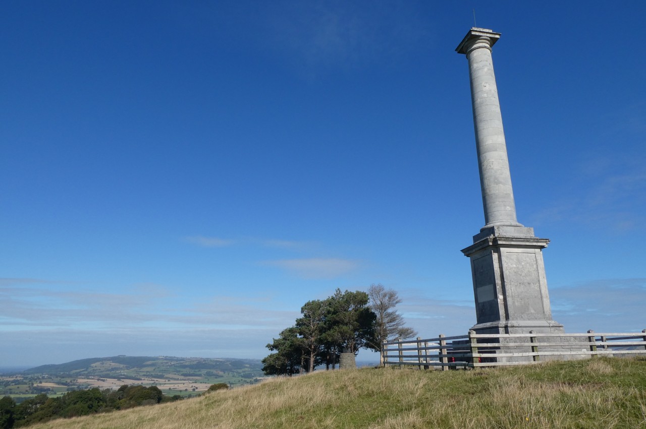
(27) Beacon Ring
(28) View toward Y Golfa
Now in Roundabout Plantation (picture 25), the Path follows the level forestry track around the contours of the hillside as far as a large pond of a rather unnatural colour. Here the Path leaves the forestry track to climb past the right-hand side of the pond to a bend in a narrow lane.
Following the lane around the bend to the left, the Path soon reaches a fingerpost indicating a sharp right turn up a narrow lane climbing into the woodland of Phillips's Gorse (picture 26). The tarmac runs out in a clearing where a metal barrier bars the track bearing left into the woods and a sign asks visitors to stay out of the woodland to avoid spreading the highly-contagious Ash Dieback disease.
From here, the Path follows the edge of a field just outside the next section of the wood, turning left to climb up the far end of the wood and onward up a couple of large fields toward the Iron-Age hillfort of Beacon Ring (picture 27), which crowns the 408 metre summit of Long Mountain.
In the last field, the Path crosses a stile to swap sides of the field boundary before climbing the rest of the way to the fort. The large oval earthwork bank once enclosed an Iron-Age settlement, thought to have been occupied from around 600 B.C. to 50 A.D., but now encloses a wood planted in 1953 to commemorate the coronation of Queen Elizabeth II. What isn't apparent from ground level is that the centre of the beech wood was planted with conifers so that when viewed from above the contrasting foliage spells out the initials EIIR.
Offa's Dyke Path follows the earthwork bank and ditch around the west and north sides of the hillfort. From the western side it is clear why this site was chosen, with far-reaching views westward over the hills and valleys of mid-Wales. Nearer to the west is the ridge of Y Golfa, the last hill traversed by Glyndŵr's Way before it descends to its finish in the town of Welshpool, part of which is also visible from this vantage point (picture 28).

(29) Cwmdingle Plantation
(30) Cwm Dingle
(31) View over Welshpool
(32) View over Crowther's Hill
On the north-eastern side of the hillfort, the Path comes up to an enclosure housing a tall telecommunications mast and several small brick sturctures. Here the path turns left to snake its way through Cwmdingle Plantation, where I had to slow down to carefully pick my way around several very muddy patches (picture 29).
Mercifully, the path exits the plantation via a gate where a fingerpost points vaguely half-left across a huge grassy meadow with no obvious path. The correct route circles around the top of the deep combe of Cwm Dingle (picture 30) before going diagonally across the remainder of the meadow to a gate in the far corner. The curvature of the hilltop here means that the target is out of sight until one is quite close to it, and I ended up going too far left and following the fence along the end of the meadow to get back on track.
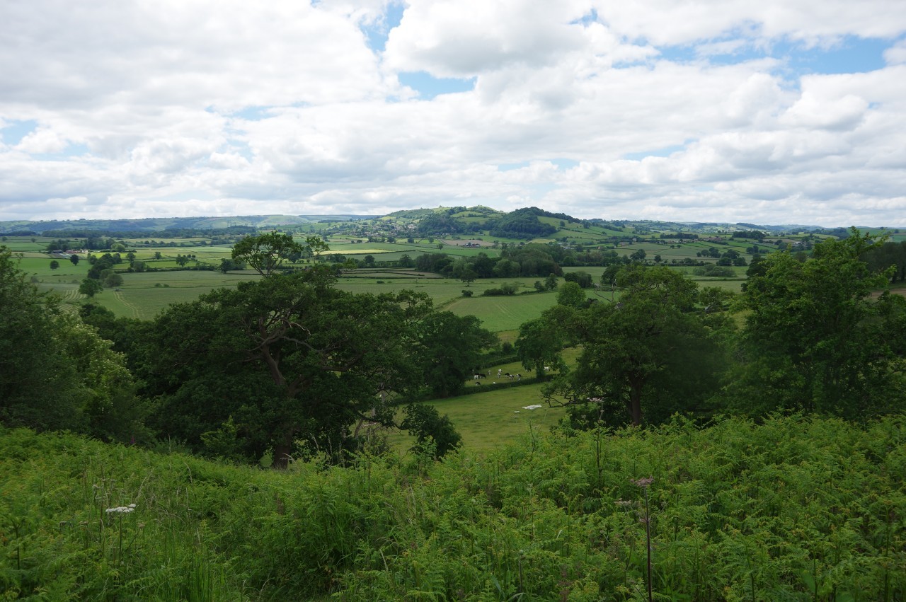
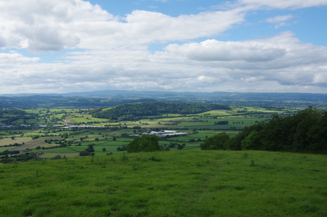
Navigation gets much easier from here, with the path going down the right edge of a small field and then a much larger one to a gate at the top of a field on the edge of the escarpment with fine views over the Severn Valley to Welshpool (picture 31) and, further right, the remainder of the day's walk through the village of Buttington and along the foot of the wooded Crowther's Hill (picture 32).
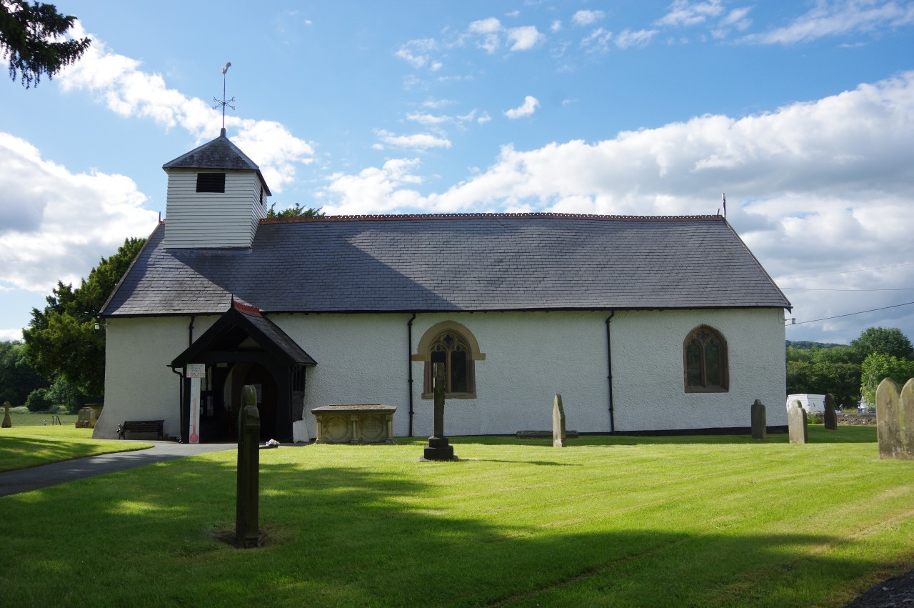
(33) Church of All Saints, Buttington
(34) The Green Dragon
(35) Buttington Bridge
(36) Tal-y-bont Farm
Offa's Dyke Path bears half-right down the steep field then follows the fence down the right edge of the next field to reach a farm track at the bottom. Turning right through a gate, the track is followed round a bend before the steep descent across fields resumes, crossing a lane after two fields then descending another to join a farm track by a brick cottage on Stone House Farm. From here the gradient reduces as the track descends past farm buildings and passes through a hedge before the Path bears off to the left to follow a stream down two grassy meadows. After turning across a shallow ford, the Path goes diagonally across two more fields then turns left along an enclosed track to reach the B4388 by the corner of the Offa's Dyke Business Park, which adjoins the village of Buttington.
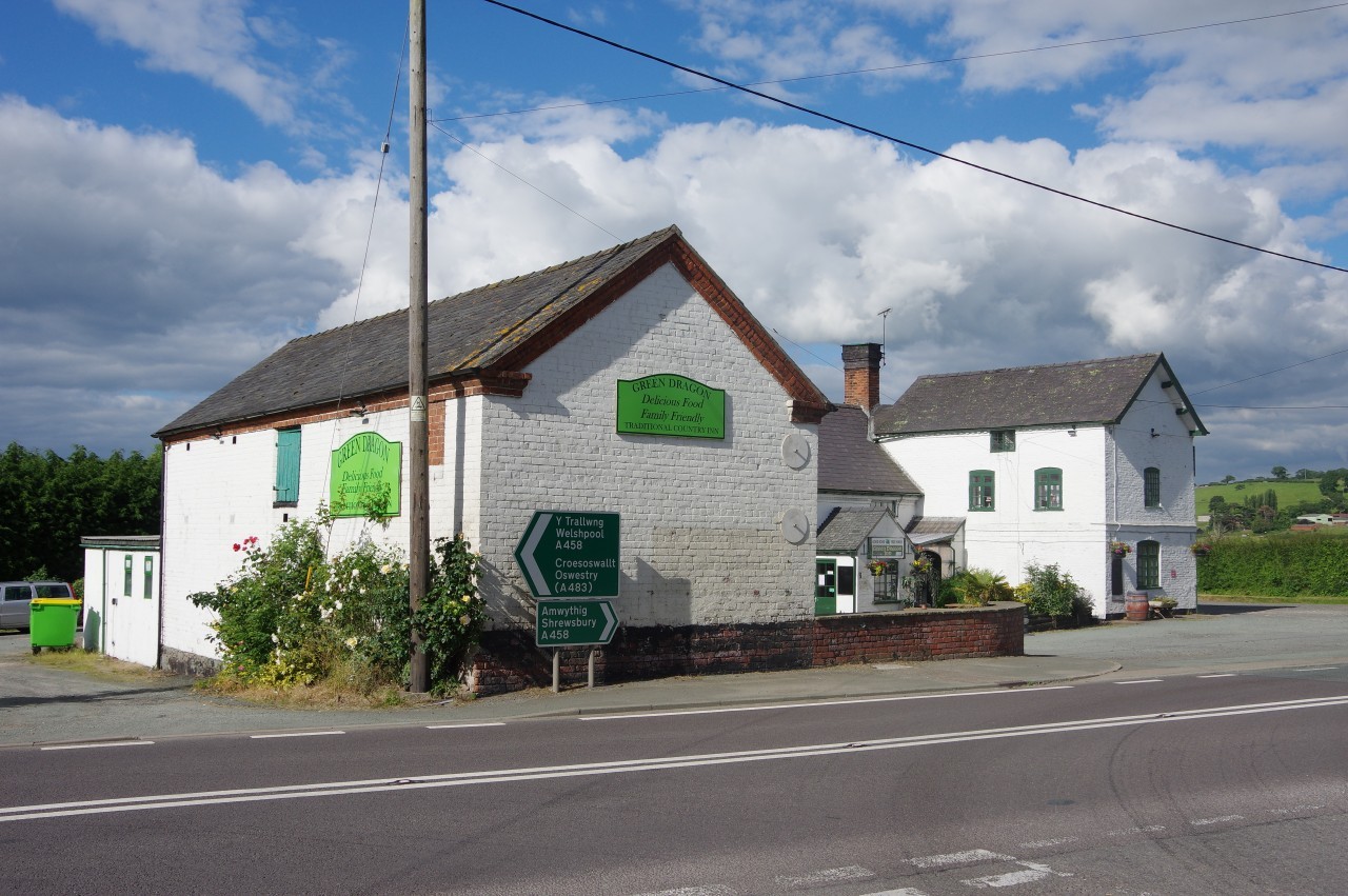
Up the road to the right, opposite the next corner of the business park, the Path turns off the road just before the first house. I took a short diversion from the Path here, continuing up to the junction at the end of the road, where All Saints' Church (picture 33) and the Green Dragon pub (picture 34) face each other across the busy A458. The latter has it's own campsite for walkers, but I was planning to walk a few kilometres further, so after stopping for a pint I walked back down the road to rejoin the trail.
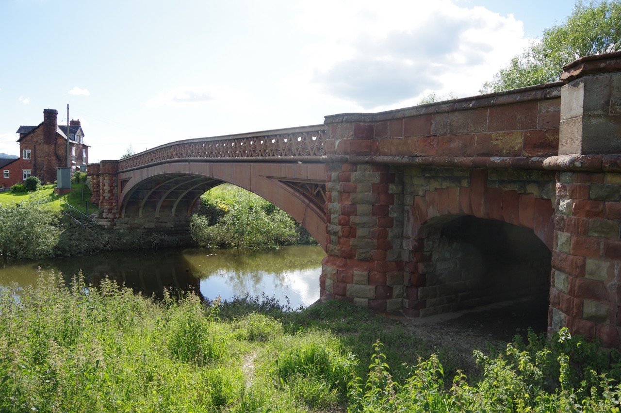
From the B4388, Offa's Dyke Path is signposted across three fields, over the embankment of the Shrewsbury to Aberystwyth railway line, and across one more field to Buttington Bridge (picture 35), where the Path meets the River Severn for the first time since the very start of the walk at Sedbury Cliffs.
Steps climb up onto the bridge, which carries the A458 and Offa's Dyke Path over the Severn, but there is no pavement, so one must be very careful here. Just off the bridge, the Path crosses the road to head up the driveway of Tal-y-bont Farm, but first I made another, somewhat longer, diversion along the A458 to Buttington Cross, where a petrol station opposite the Welshpool cattle market has a small supermarket where I acquired some supplies for the next day's walk.
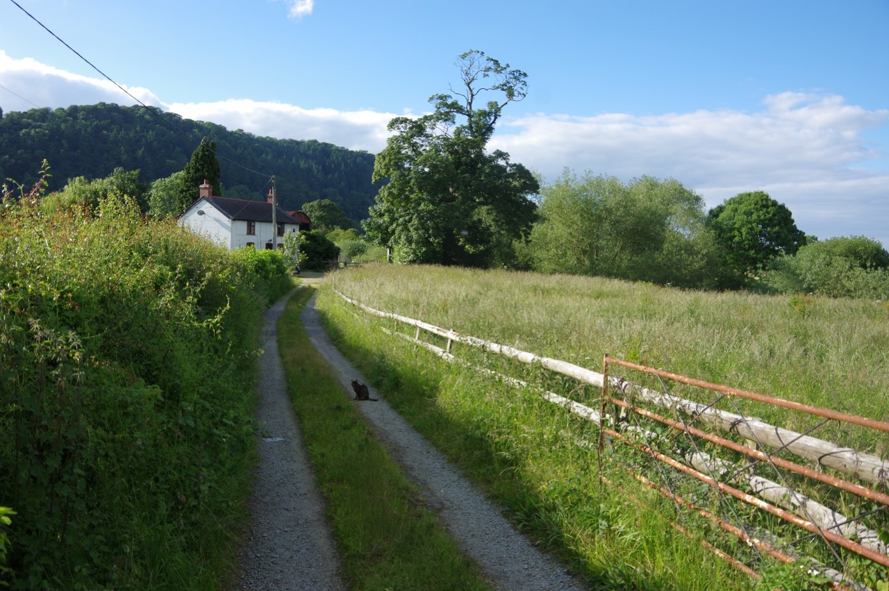
From Buttington Cross, one could walk a couple of kilometres south-west along the Severn Way path to the centre of the large town of Welshpool, but I backtracked to Tal-y-bont Farm, where a friendly little tortoiseshell cat (picture 36) demanded some attention before allowing me to proceed past the farmhouse and through a gate into pastures.
(37) River Severn below Crowther's Hill
(38) Montgomery Canal
(39) Montgomery Canal

(40) Pool Quay Lock
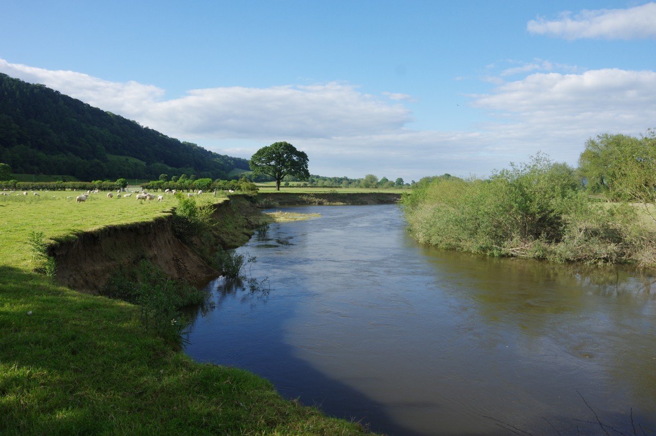
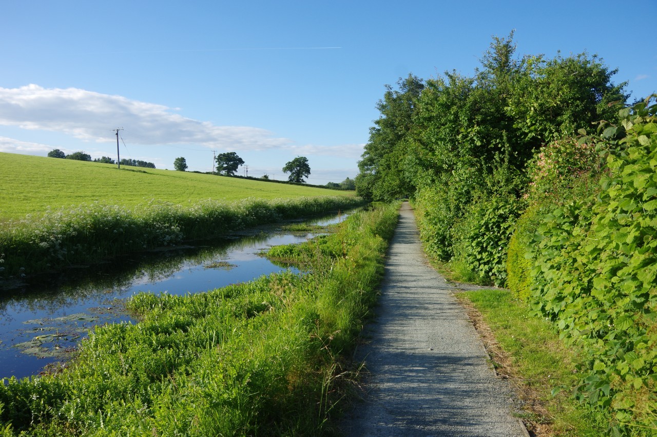
Now traversing a long series of sheep pastures below Crowther's Hill, the Path follows the bank of the Severn around a bend (picture 37) to meet the next segment of Offa's Dyke, which shortcuts the next two meanders of the river to come up beside the A483. The Path runs along the verge on the other side of the road, soon converging with the Severn Way, which arrives from the left on the towpath of the Montgomery Canal (picture 38).
The Montgomery Canal, originally the Montgomeryshire Canal, was constructed in stages between 1794 and 1821, branching off the Llangollen Canal at Frankton Junction in Shropshire and eventually providing a fifty-three kilometre transport route via Llanymynech and Welshpool to Newtown, on the River Severn in mid-Wales. Despite its present name, the canal never went to the town of Montgomery.
The Montgomery Canal was officially abandoned in 1944. Since then, some stretches have become quite overgrown and in a few places it has been filled-in to make new road crossings. Various restoration efforts have made the eastern quarter of the canal from Frankton navigable once more along with a couple of short stretches in Welshpool and Llanymynech, both of which have museums related to the canal.
The canal parallels the A483 for a little while then diverges from the road to take Offa's Dyke Path and the Severn Way below open fields (picture 39) to the hamlet of Pool Quay, where the canal passes through a narrow lock (picture 40). Just before the lock, Offa's Dyke Path bears right down a short track then right again down a lane to meet the A483 once more.
Offa's Dyke Path turns left along the road, but I departed from the National Trail here, having walked 24.9 kilometres, and followed the road in the opposite direction for a couple of minutes to reach my overnight stop at the Powis Arms pub.
By the time I had settled in and came down for dinner, the charming country pub had begun to fill with friendly locals who like to while away their Friday evening playing darts and cryptic pub trivia quizzes. I was poor at the former and average at the latter, but managed to ingratiate myself with the darts players by being very fast at subtraction.
Addendum: Montgomery, Wednesday, September 18, 2019

(41) Broad Street

(42) Church of St Nicholas
(43) The New County Gaol
(44) Monty's Brewery
On my southbound walk, I spent a couple of nights in Montgomery, just twenty minutes walk from Offa's Dyke Path. Montgomery is a very visitor-friendly little town of around 1,300 residents that served as the county town of Montgomeryshire before the historic county was absorbed into Powys in 1974.
Montgomery was established in 1223, at the same time as the castle that stands on a rocky promontory above the town. While the town retains its medieval street pattern, most of the architecture is Georgian, though there are still a few older buildings. Chief among the Georgian buildings is the Town Hall, which stands at the top end of the aptly-named Broad Street (picture 41). Just behind and to the left of the Town Hall is the Dragon Hotel, a large Tudor inn, where I was lucky enough to score a room with a view over the Town Hall and Broad Street.
The Montgomery Civic Society has gone to considerable effort to make the town attractive to visitors. At several points around town, including the Dragon Hotel, one can find a series of free leaflets detailing walking and cycling trails in and around the town.
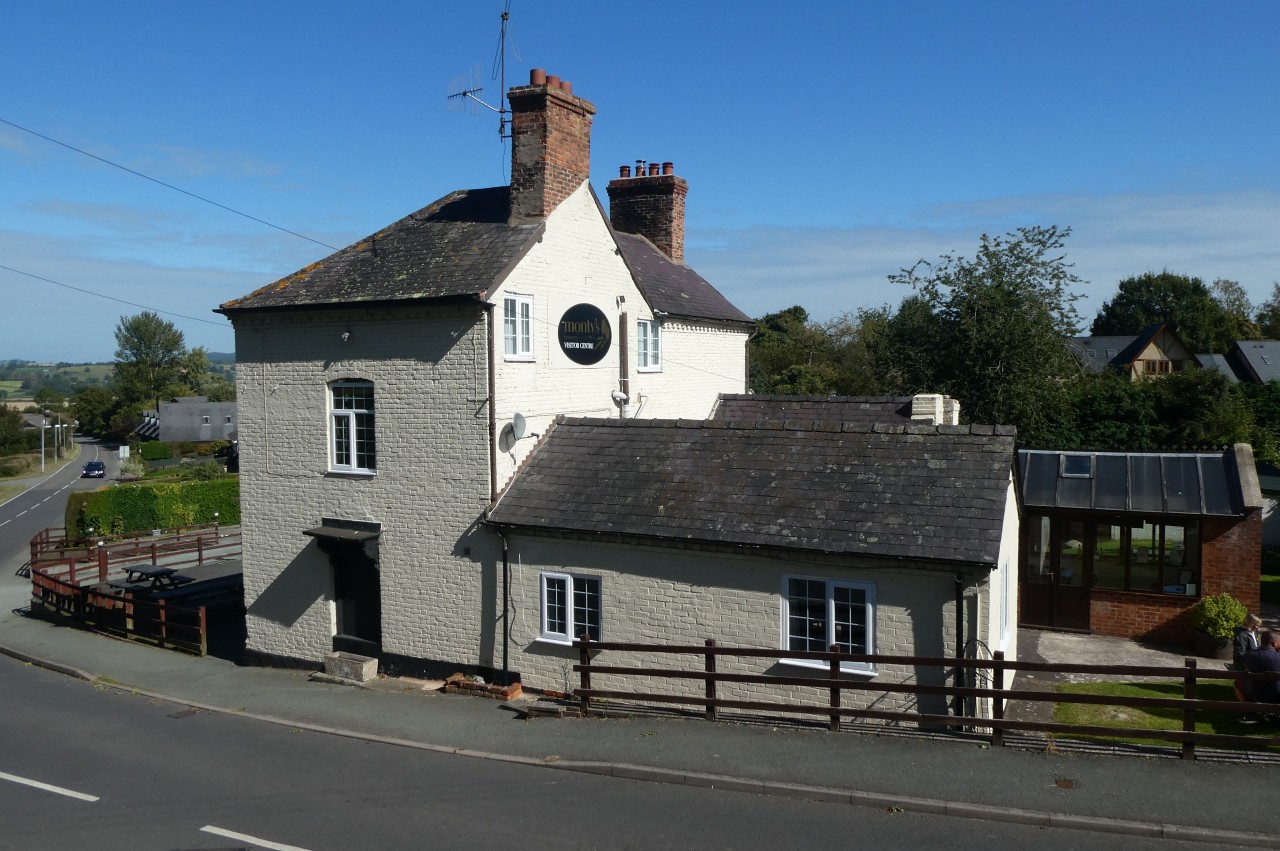
On my first afternoon in town, I walked the three-kilometre Heritage Trail, a circuit of the town that begins at the Town Hall and takes in many of the interesting buildings including the Church of St Nicholas (picture 42), the former New County Gaol (picture 43), which closed in 1878, and, most importantly, Monty's Brewery (picture 44), where the brewster let me in on the secrets of making delicious gluten-free beer.
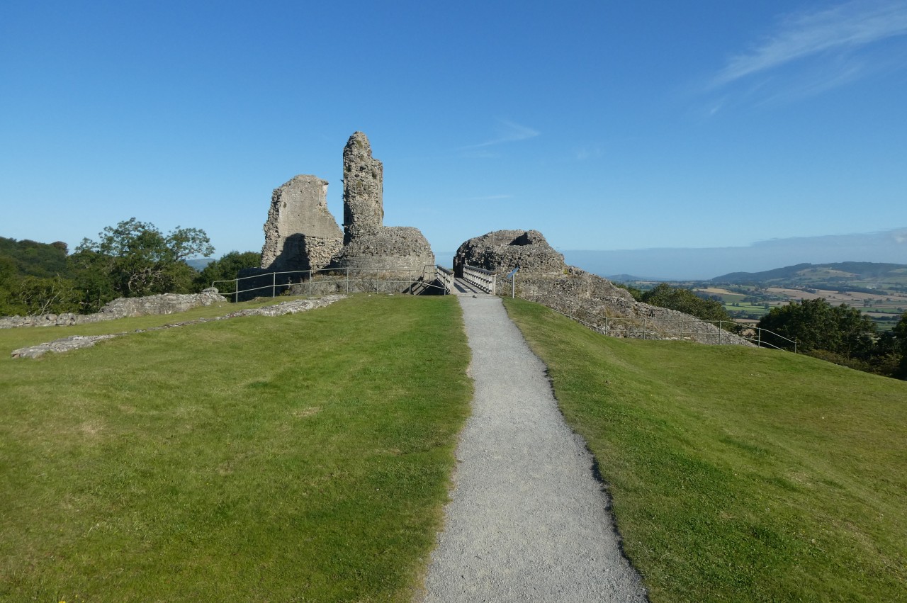
(45) Middle and Inner Wards, Montgomery Castle
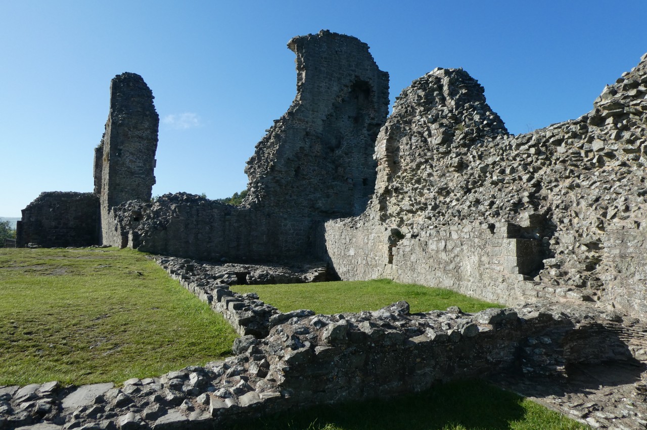
(46) Inner Ward, Montgomery Castle
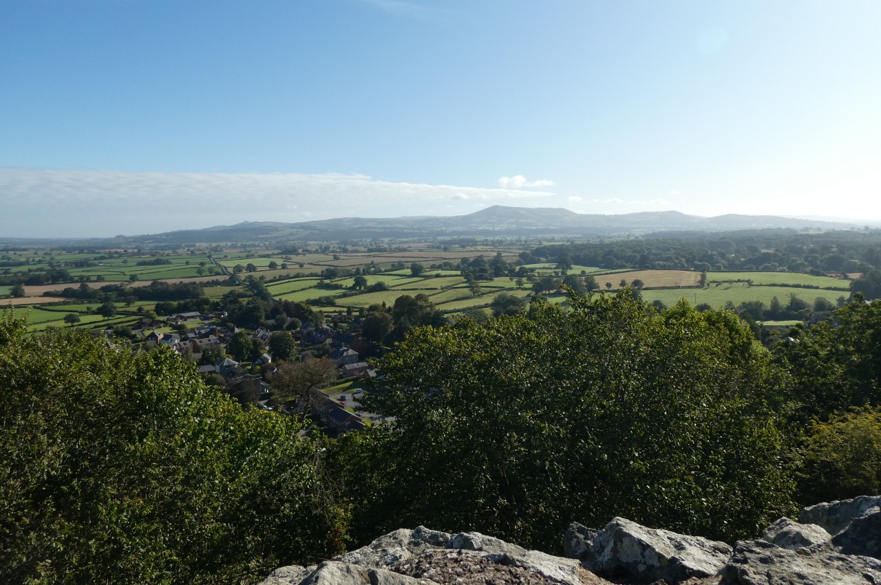
(47) View east from Montgomery Castle
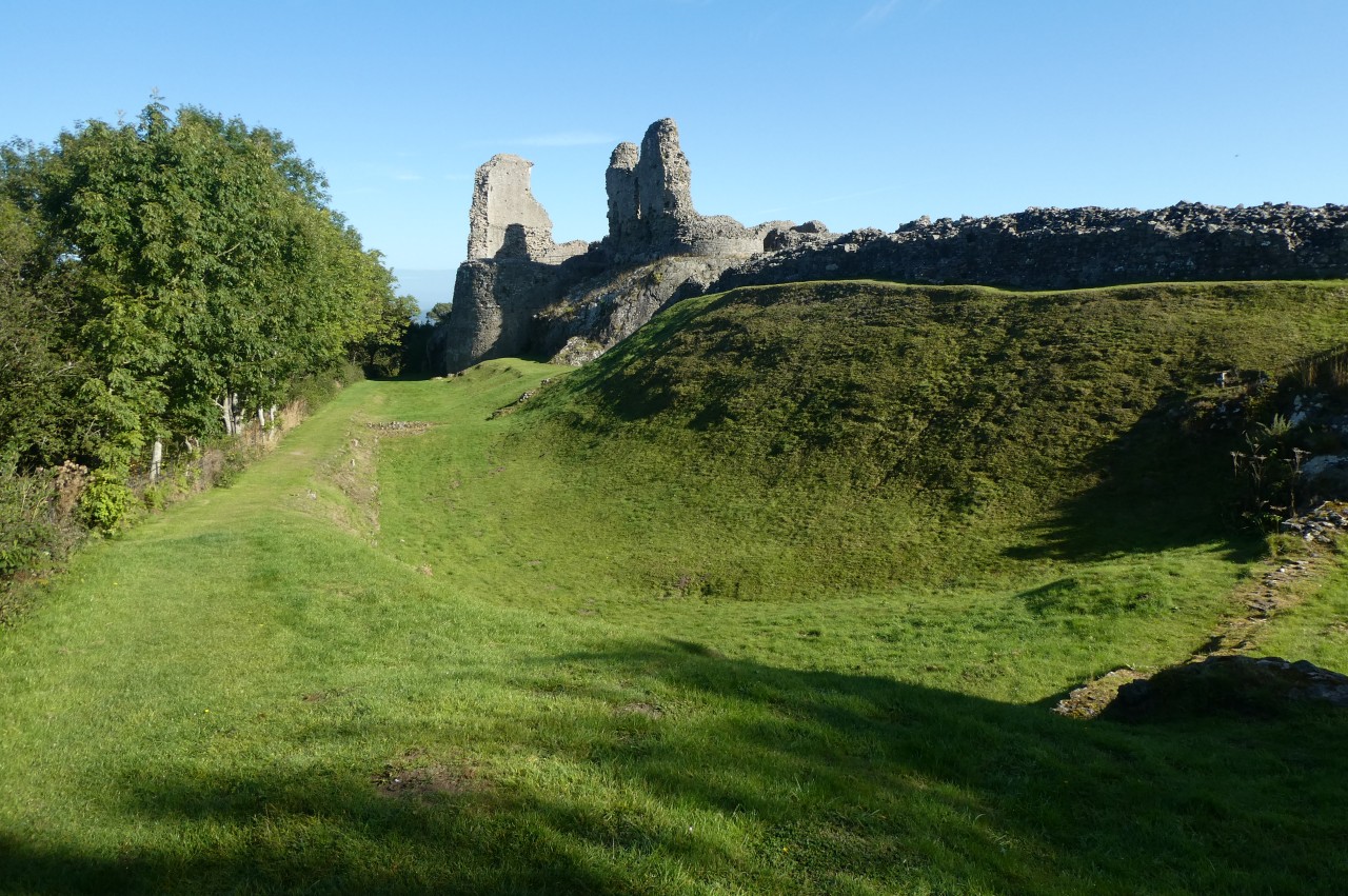
(48) Moat walk, Montgomery Castle
The next morning, I made the short but stiff climb up the lane behind the Town Hall, past the Old County Gaol and up to the ruins of Montgomery Castle high on the hillside of Ffridd Faldwyn. The castle consisted of an outer ward, middle ward and inner ward, each built on separate rocky outcrops and connected by bridges (picture 45). Most of the residents lived in buildings lining the curtain wall of the inner ward (picture 46), which was only accessible through the fortified outer and middle wards. After the Battle of Montgomery in 1644, the castle was surrendered to the Parliamentarians, who slighted it in 1649 to prevent it from having any further military use.
The views eastward from the inner ward are particularly good, stretching across the Vale of Montgomery to the Shropshire hills, where the distinctive outline of Corndon Hill stands out (picture 47). From this vantage point, one can also easily trace most of the route of Offa's Dyke Path across the low ground between the Kerry Ridgeway and Long Mountain.
One can also walk a circuit of the castle's dry moat (picture 48) to get an impression of how impregnable the castle would have seemed when the walls stood to their full height.

(49) The Old Bell Museum
(50) Ffridd Wood
(51) Montgomeryshire War Memorial, Town Hill
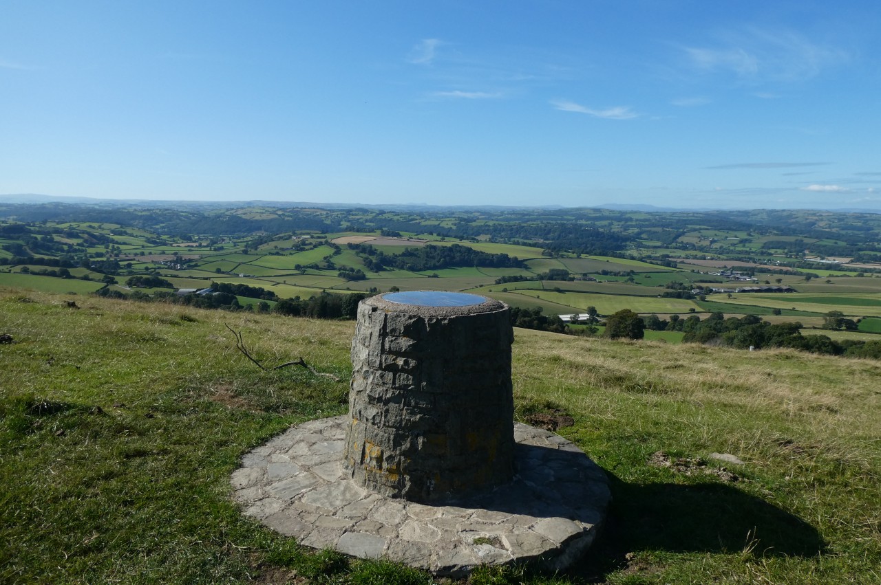
(52) Toposcope on Town Hill
After a visit to the Old Bell Museum (picture 49), housed in a former 16th century temperance inn on Arthur Street, I spent the afternoon walking the Civic Society's eight-kilometre Rolling Marches trail.
The trail follows the main road to the northern edge of town, below the castle, then circles up through woods on the north side of Ffridd Faldwyn (picture 50) to the site of an Iron-Age hillfort on the hilltop behind the castle. The trail descends south-west along the side of the ridge, crossing several farms, then skirts around the west side of Town Hill before climbing the south side of the hill to the Montgomeryshire County War Memorial (picture 51), which was erected on the 320-metre summit of the ridge in 1923. A toposcope next to the war memorial (picture 52) helps visitors to pick out landmarks in the panoramic views, which stretch far into England and Wales. After drinking in the views, it's all downhill to return to the centre of town.
Montgomery turned out to be one of my favourite stops on Offa's Dyke Path and I could easily have kept myself occupied there for another couple of days exploring the town and walking more of the Civic Society's trails.