SOUTH WEST COAST PATH NATIONAL TRAIL
Stage 45: Tintagel to Bude
Saturday, June 27, 2015

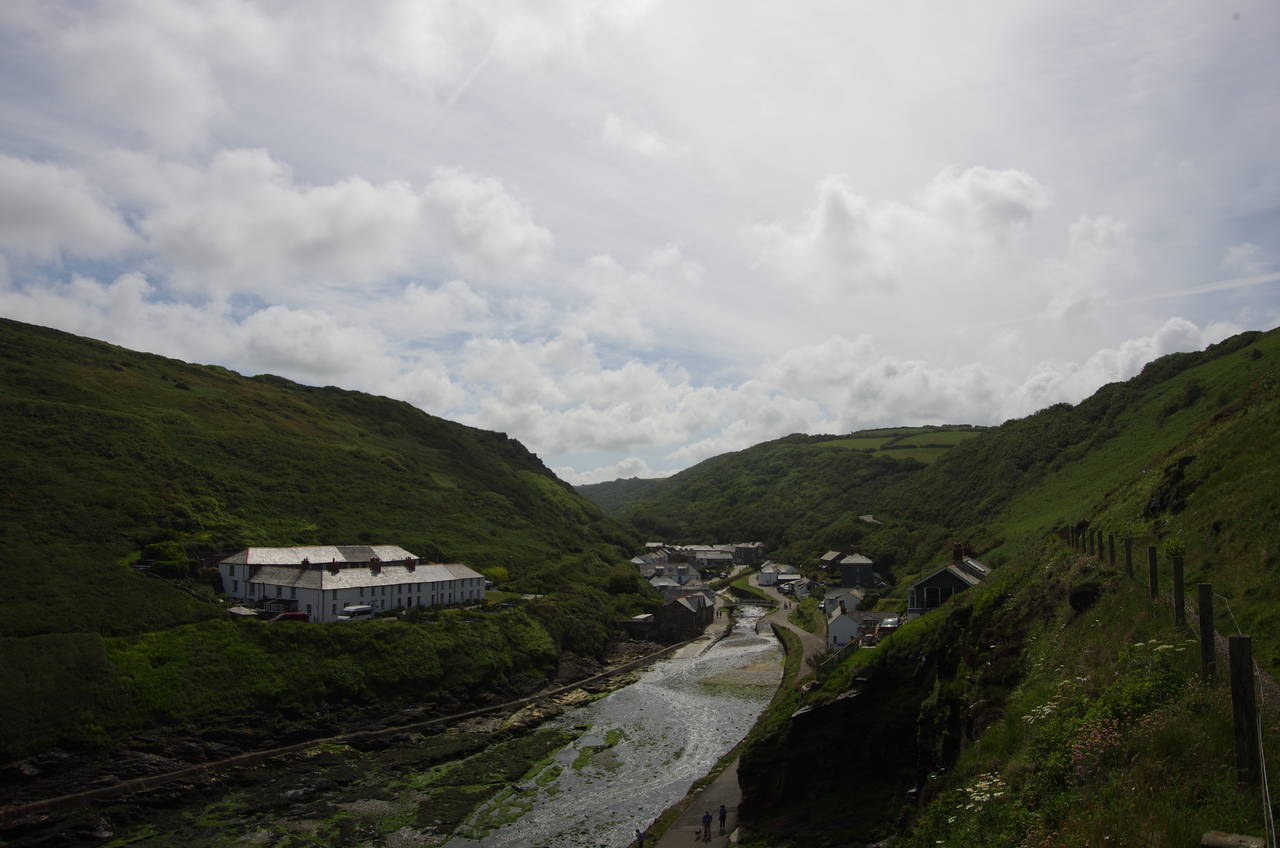
(1) Tintagel Haven

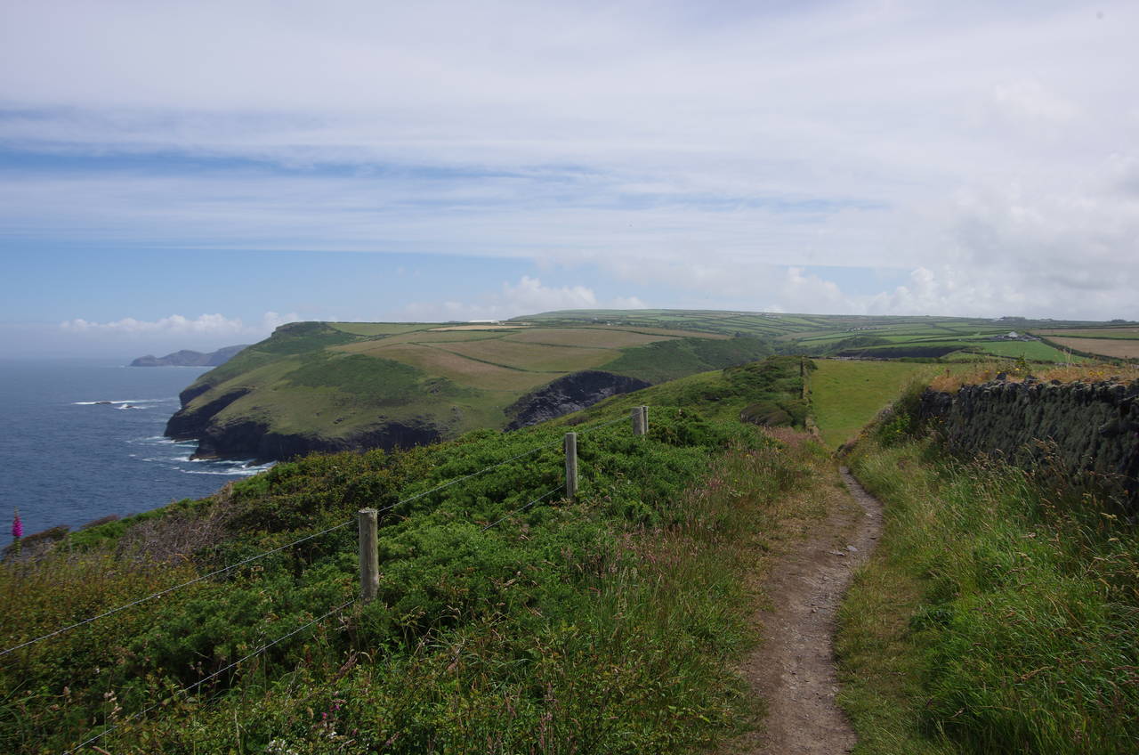
(2) Barras Nose

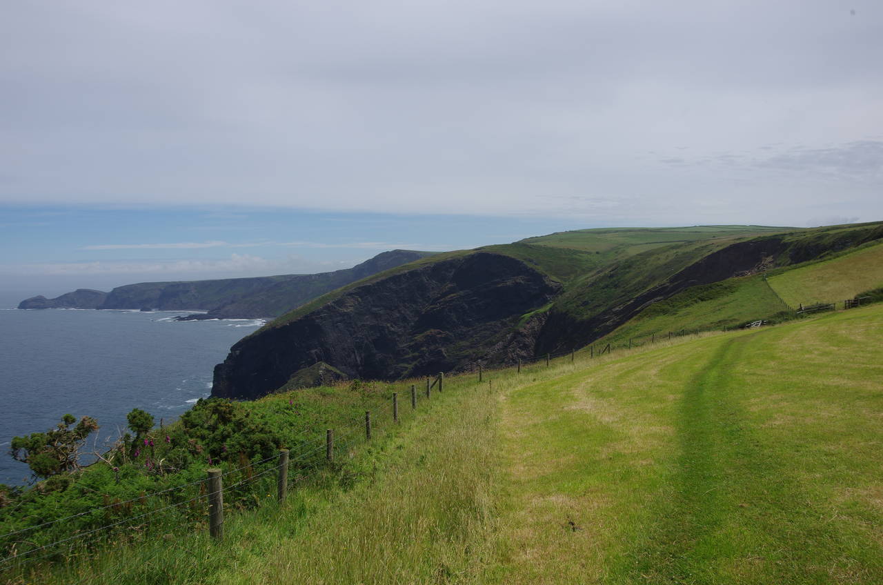
(3) Smith's Cliff

(4) Willapark
After ten days exploring inland Cornwall, I resumed my walk along the Coast Path on a sunny Saturday morning, setting off from Tintagel Haven, below the castle ruins (picture 1), just after eight in the morning.
From the edge of the haven, the path climbs steps to a viewing platform then follows a well-worn trail along the hillside in the direction of the headland of Barras Nose (picture 2). The official route doesn't go onto the headland however, instead taking a shortcut over the neck of the headland to Smith's Cliff (picture 3), where a fairly level path follows the contours of the hillside for a while before climbing gently beside a field boundary to the next headland; the National Trust-owned Willapark. This was the site of an ancient settlement, though there is little visible evidence of it today aside from the stone wall across the narrowest point (picture 4).

(5) Bossiney Haven

(6) Bossiney Haven

(7) Rocky Valley

(8) Rocky Valley
Again, the Coast Path eschews the windswept headland, instead turning right on entering the National Trust property and crossing a grassy meadow to rejoin the clifftop overlooking the small inlet of Bossiney Haven (picture 5), named after Tintagel's neighbouring (in fact, almost conjoined) village of Bossiney, which lies just a short distance inland across a couple of fields.
The path dips down to cross a grassy valley above Bossiney Haven, climbing a long flight of steps up the other side before crossing over a sunken track that once carried donkeys down to the tiny beach far below (picture 6). The Coast Path ignores that track, continuing ahead past the end of the almost identical inlet of Benoath Cove and running along the hillside for a few hundred metres more to reach the aptly-named Rocky Valley (picture 7).
The Coast Path descends into the narrow gorge, briefly heading up it to find a footbridge over the little stream (picture 8) and then a rather steep and slippery path that scrambles up through ferns and gorse to regain the clifftop beside a large caravan club site.

(9) Long Island

(10) Passing above Short Island

(11) Western Blackapit

(12) Entrance of Boscastle Harbour
Mercifully, the caravan site is soon left behind as the path follows field boundaries along Trevelga Cliff for the next kilometre, passing above the pyramidal Long Island (picture 9), just as the path starts to cut across the little headland of Firebeacon Hill. Next, the path climbs over an unnamed promontory, below which Short Island is a slightly smaller version of its near neighbour (picture 10).
The path continues along the clifftop, crossing another little valley above the inlet of Grower Gut before climbing around the top of the cove of Western Blackapit, which is sheltered by the headland of Willapark (picture 11), the second headland of that name in just a few kilometres. Just like the other Willapark, this one was once topped by an Iron-age fort (but now has a coastguard lookout on its summit), and again the Coast Path cuts straight across the back of the headland to head downhill towards the L-shaped entrance of Boscastle Harbour, which is protected by the narrow, bent finger of Penally Point (picture 12).
(13) Boscastle

(14) Boscastle

(15) Boscastle Harbour
(16) Penally Point
Around the corner, the village of Boscastle comes into view, straddling the little River Valency, which feeds into the top of the harbour (picture 13). After passing above a cottage, the path forks left to join a driveway leading down to an arched bridge over the river, the lower section of which is walled in (picture 14).
Having crossed the bridge, the route bears left, climbing a driveway and passing along the left side of a row of cottages to join a path that gradually climbs onto Penally Point. At the spot that has arguably the best view of the harbour mouth (picture 15), the Coast Path leaves the main path out to the tip of the point, instead bearing right to climb up and over the ridge, losing sight of Boscastle and soon switching back sharply to the right to resume the journey eastwards along the clifftops beside a drystone wall (picture 16).
The village of Boscastle made headlines around the globe on August 16, 2004, when torrential rainfall on the surrounding plains sent a massive wall of water, mud, cars and other debris down the narrow valley and out to sea, destroying or damaging many of the shops, pubs and homes. Dozens of locals and tourists had to be rescued from rooftops by a small fleet of helicopters, but amazingly no lives were lost. Within a few months of the disaster most of the buildings had been rebuilt or repaired to their former appearance and today Boscastle remains a popular destination for visitors to Cornwall, and not just because of the flood.

(17) Pentargon

(18) Beeny Cliff
(19) Fire Beacon Point

(20) Rusey Cliff and High Cliff
The path follows the stone wall along the undulating cliffs for a kilometre to reach the deep cove of Pentargon, skirting around two sides of it before dropping down a long flight of steps to cross the valley above the cove. On the lush floor of the valley the path crosses a footbridge into the National Trust's Beeny Cliff property then climbs along the third side of Pentargon (picture 17) before rounding the next point onto Beeny Cliff and continuing to climb steadily along the hillside towards the peak of Fire Beacon Hill (picture 18), not to be confused with the earlier Firebeacon Hill.
The last stretch of the path up to the summit is a rather steep and stony path up through patches of ferns, wildflowers and gorse. On reaching the top, the path becomes a grassy strip between two wire fences outside a field then crosses two more fields (picture 19). The going isn't easy for long though, as the path soon turns back into a well-worn furrow snaking its way over rough and undulating ground for the next two kilometres to the promontory of Buckator.
From Buckator onwards, the geology changes, and there is a large band of undercliff sloping steeply away from the edges of the farmers fields. The path makes its way a bit further along the field edges before heading down into the gorse-covered undercliff below Rusey Cliff, snaking its way down to about fifty metres above sea-level before making a rather taxing climb up to the top of High Cliff (picture 20), which at 223 metres is the highest sea-cliff in Cornwall.

(21) View ahead from High Cliff

(22) Cambeak

(23) Crackington Haven

(24) Crackington Haven
From the top of High Cliff there are far-reaching views along the coast in both directions. Despite the afternoon having become a bit hazy, I could make out Tintagel Head and Port Isaac Bay to the south-west and the silhouetted outline of Lundy Island far out on the horizon in the Bristol Channel to the north (picture 21).
More immediately, the path descends to cross through the upper part of another section of gorse-covered undercliff known as The Strangles, continuing ahead on the clifftops for another two kilometres, with the clifftop walking only interrupted by one steep-sided combe not long before the path reaches the spectacular headland of Cambeak (picture 22).
The Coast Path climbs up the near edge of the headland's curved back to the highest point before turning back down the far edge, which offers views across the bay of Crackington Haven towards the village of the same name, which shelters in the far corner (picture 23).
The steep descent off Cambeak is immediately followed by a steep climb over another peak, then the path takes on less taxing gradients as it circles around the bay and descends past tennis courts to join the main road through the small village opposite the Cabin Cafe, where I stopped to replenish my supplies. The Coast Path follows the road over a bridge and then around a hairpin bend and on about 100 metres inland to a signpost by the left side of the road, just in front of a large thatched cottage. The signpost indicates a path that squeezes past the end of the cottage and then angles up the side of Pencannow Point, climbing fairly steeply for about 500 metres, with good views over the village (picture 24).

(25) Pencannow Point

(26) Aller Shoot

(27) Castle Point

(28) Lower Tresmorn
About fifty metres short of the end of Pencarrow Point, the land narrows and the path to the end has been fenced off, though that didn't stop at least two brave (and probably foolhardy) walkers from heading along the narrow spine of the point for a closer look (picture 25). After admiring the scenery from safer ground, I stuck to the official route, which follows a wire fence around the edge of a large, grassy meadow and then down a steep zig-zag path into the valley of Aller Shoot (picture 26).
The path climbs diagonally up the steep side of the valley, gaining almost one hundred metres in height by the time it reaches the tip of Castle Point at the end of a ridge that runs parallel to the coast (picture 27). Following the level and straight trail along the ridge for about 500 metres leads through a gate onto National Trust land, signed as Cleave. A line of trampled grass skirts the edge of a field into a second, which another National Trust sign calls Lower Tresmorn, beyond which the path crosses a relatively shallow valley (picture 28).

(29) Chipman Strand

(30) Bynorth Cliff

(31) Bynorth Stream

(32) Cancleave
Once again the path follows the clifftop around the edge of a large pasture, crossing a stile beyond which it first appears that the path goes straight over the edge of the cliff above the small crescent of sand at Chipman Strand (picture 29). Fortunately, it's just a trick played by the shape of the land and the path turns sharp right before getting too close to the vertical cliff edge, instead descending only slightly less steeply into the next valley. Having gone almost all the way down to sea level, the path immediately climbs steeply up to the top of Chipman Point, at a height of around 140 metres.
This is the last serious climb for a while, as the path spends most of the next two kilometres following the edges of rolling meadows along the aptly-named Dizzard Long Cliff and the adjoining Bynorth Cliff. For the first two-thirds of this the views of the sea are mostly hidden by tall clifftop hedges, but after passing a trig pillar at the highest point of the cliff (at 164 metres above sea level), the view returns as the land starts to fall away gently (picture 30).
At the end of Bynorth Cliff, the path heads into a shallow wooded combe to cross the tiny Bynorth Stream (picture 31) before joining another field edge path at Cancleave (picture 32).

(33) Millook and Bridwill Point
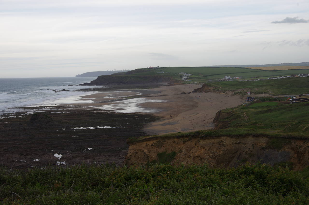
(34) Widemouth Bay

(35) Tom's Cove

(36) Upton
For the next kilometre the path winds its way along the gently undulating clifftop towards the hamlet of Millook (picture 33), joining a quiet road for the last 300 metres down to the cluster of houses behind the little shingle beach, where about a dozen people had gathered for an evening wedding ceremony.
The road is followed inland for about 100 metres to find a signpost on the left that points out the last big climb of the day -- a steep and slippery ascent up the very stony side of Bridwill Point. When the path levels out it follows a wire fence outside a field before being forced to join a narrow road that comes up close to the cliff edge. The road snakes it's way along the cliffs for a kilometre to the hamlet of Wansom Mouth, which consists of an outdoor adventure centre and a few scattered houses.
Outside the adventure centre the Coast Path ignores an obvious public footpath that goes straight ahead. Instead it follows the road inland for about 100 metres until a signpost on the right indicates a path on the left that heads through a small wood, across the trickling brook of Wansom Water, and then makes a short climb up to a stretch of low, crumbling cliffs approaching the long, sandy beach of Widemouth Bay (picture 34).
The path heads down to a large beachside carpark, crossing it to find one of several trails across a stretch of dunes and then heading through three more large parking areas. There weren't many cars present on this particular evening, but the generous allocation of parking spaces suggests that Widemouth Bay must be quite popular at times.
At the far end of the carpark, the route bears left past a hut to join a track that climbs gently through dunes, passing to the landward side of a house before following the ragged clifftops out onto the small point of Lower Longbreak. Tom's Cove (picture 35), which the path skirts between Lower Longbreak and Higher Longbreak, is one of several places along this stretch of the path where the low tide reveals large expanses of rock that have been eroded by the sea to show the ends of parallel, tilted layers. From Higher Longbreak, the path hugs the clifftops of the Cornwall Wildlife Trust's Phillip's Point Nature Reserve for another kilometre to the small village of Upton (picture 36).

(37) Efford Ditch

(38) The Compass Tower

(39) Summerleaze Beach

(40) Summerleaze Beach
The Coast Path squeezes between the cliffs and the back fences of the village, continuing over a grassy meadow to cross the Efford Ditch and then climbing over Efford Down (picture 37), from which the town of Bude comes into view. The grassy path descends gently across the downs to Compass Point and passes close to the Compass Tower (picture 38), an eight-sided folly tower known to many of the locals as the Pepper Pot. The compass directions inscribed on the eight faces of the tower have been eight degrees out of alignment since the tower was relocated here in 1880, about 50 years after its initial construction.
Just beyond the tower, the path reaches the tip of Compass Point, overlooking the breakwater that protects Bude's Summerleaze Beach (picture 39). The beach is really a large, shallow cove, which is mostly covered with water at high tide, but virtually empty at low tide. Most of the town of Bude is set well back behind the beach (picture 40).

(41) Bude Lock
(42) Bude Canal
(43) The Bude Light

(44) Bude Castle
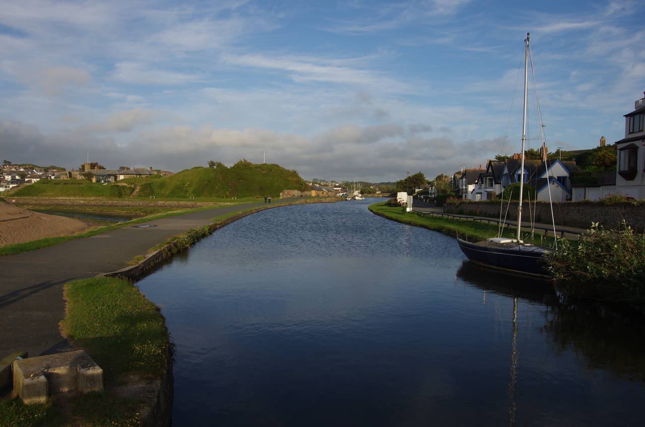
A little further along the cliff, the Coast Path heads down steps to the end of Breakwater Road and in a few paces down more steps to the side of the lock at the end of the Bude Canal (picture 41). After crossing the lock gates, the Coast Path follows a broad strip of tarmac along the canal (picture 42), with a loop of the River Neet (which the canal bypasses), soon bending away on the left.
The 56 kilometre long Bude Canal was dug in the early 1820's, primarily to allow mineral-rich beach sand to be transported inland to enrich the poor soil of North Cornwall's farms. Like many of England's canals, it fell into decline with the advent of the railways and eventually closed in 1891, after which it quickly fell into disrepair and much of its course has now been ploughed over or has become overgrown. Ironically, the railway to Bude itself closed in 1966, and Bude is now said to be further from a railway than any other town in England, with the nearest National Rail station being 46 kilometres away at Okehampton.
In 2009, the first four kilometres of the canal was restored and is the only section that remains navigable. The towpath beside this stretch makes for a very pleasant stroll through the Bude Marshes Nature Reserve, which I had enjoyed a couple of evenings earlier.
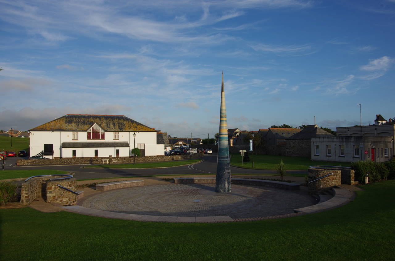
Beyond a long stone building, the route bears away from the canal and across a carpark to reach the conical obelisk known as the Bude Light (picture 43). This seemed like an appropriate landmark to finish the day's walk, so I checked my GPS, which showed 34.7 kilometres walked from Tintagel Haven, making this the longest stage of my walk along the South West Coast Path by a whisker. The GPS also showed that I had climbed a whopping 2270 metres, the most of any stage by quite a margin. Surprisingly, I didn't feel very tired after such a strenuous walk. Since the halfway point at Crackington Haven I had gotten into a good rhythm and could have walked further if I had needed to.
The Bude Light was built as a memorial to local inventor Sir Goldsworthy Gurney who in 1830 discovered how to make an oil lamp much brighter by feeding the flame with a steady stream of oxygen. His invention was dubbed the Bude Light and was used to light the Houses of Parliament until electric lighting was installed in the 1890's. Gurney soon adapted his lights for use in lighthouses, mounting them in rotating frames to create the characteristic flashing lights that quickly became the standard in lighthouses around the world. Despite being a keen admirer of lighthouses, I didn't know the origin of their rotating lights until I read the plaque on the side of the obelisk.
At night, the obelisk is lit from within by 130 optic fibre lights that show the positions of the constellations and the visible planets as they were on May 17, 2000, when the planets aligned closely for only the sixth time in 1000 years. Behind the monument stands Bude Castle (picture 44), the house that Gurney built in 1830 and where he first installed his light. The castle is now Bude's heritage centre.