SOUTH WEST COAST PATH NATIONAL TRAIL, Stage 54
and SOMERSET COAST PATH, Stage 1:
Lynmouth to Minehead
Saturday, July 18, 2015

(1) Lynmouth Harbour

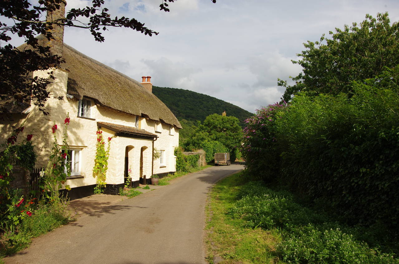
(2) The Rising Sun Inn

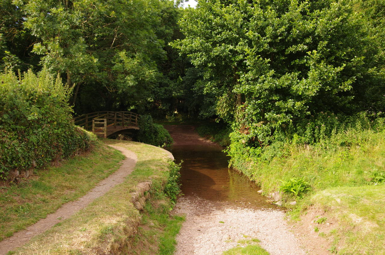
(3) East Lyn River

(4) East Lyn River
After the previous stage of the walk I took a couple of days off the Coast Path to explore the town of Ilfracombe, including its small museum, to visit the marvellous Lynton & Barnstaple Railway, and to move to accommodation further along the coast in Minehead, from which the eastern half of Exmoor is a little easier to reach by public transport.
The Lynton & Barnstaple Railway currently operates from Woody Bay Station, which can be found high on the moor a few kilometres inland from Woody Bay, running narrow-gauge steam trains along a very scenic two-kilometre stretch of track with views over the Heddon Valley and across the Bristol Channel to South Wales. The original railway operated from 1898 to 1935, crossing the moor from Lynton to Barnstaple Town Station, which I passed at the beginning of stage 51 of walk. The L&B has ambitious plans to reinstate more of the original route and I hope to go back in a few years to see how they get on.
On a cool Saturday morning, I returned to Lynmouth, rejoining the South West Coast Path at the Rhenish Tower, on the western side of the small Lynmouth Harbour (picture 1). This stage of the South West Coast Path also doubles as the first stage of the Somerset Coast Path, which covers the entire coastline of Somerset and the seven kilometres of Devon coast between Lynmouth and the county border.
The Coast Path follows Riverside Road south for a short distance alongside the harbour, and opposite the historic, thatched Rising Sun Inn (picture 2), to cross the slipway at the back and reach a footbridge over the East Lyn River (picture 3). Upstream, one can see some distance up the valley of the East Lyn (picture 4). The West Lyn, which joins the East Lyn just downstream of the next bridge after tumbling down from the moor via the wooded West Lyn Gorge, is used to generate the town's electricity supply.
The rivers haven't always been so kind to the town however. On 5th August 1952, the town was hit by a terrible flash flood, which claimed 34 lives and destroyed many of the buildings. Some of the buildings around the harbour are reconstructions of the originals, and the river has been embanked to protect the town from a repeat of the disaster.
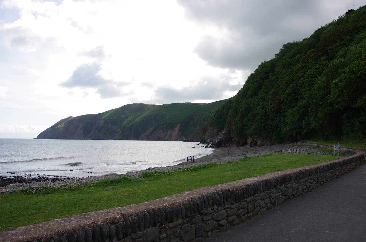
(5) Postern Beach

(6) Point Perilous

(7) NT Foreland

(8) Gun emplacement, NT Foreland
From the footbridge, a tarmac path goes behind the small Rock House Hotel and across a lawn in front of houses to the near end of Postern Beach (picture 5). The tarmac skirts around the end of the row of houses, behind which some steps lead up into the woods on the evocatively-named Point Perilous (picture 6).
The path winds its way uphill through the woods, eventually meeting the A39 Countisbury Hill, which is followed for a couple of minutes up to a lay-by where a trail leaves the road to enter the National Trust's Foreland property (picture 7). The trail crosses the grassy sloping hillside, soon passing a small concrete shelter bult into the hillside and the foundations of an old gun emplacement (picture 8).

(9) View back to Lynton

(10) Countisbury

(11) Church of St John the Evangelist, Countisbury

(12) Earthworks near Countisbury
The path steadily gains height as it continues across the hillside, not far below the road. Shortly after climbing the second of two flights of wooden steps cut into the hillside, the path passes by a small cairn from which there are good views back across the Foreland towards the town of Lynton, sitting in its sheltered hollow high above Lynmouth (picture 9).
Below the path to the right, as it runs alongside stone field walls, is the hamlet of Countisbury, which mainly comprises a National Trust bunkhouse, the Blue Ball Inn (picture 10) and the Parish Church of St John the Evangelist (picture 11). On the hillside above the church, the Coast Path bears left across a low earthwork ring (picture 12).

(13) Foreland Point

(14) Coddow Combe
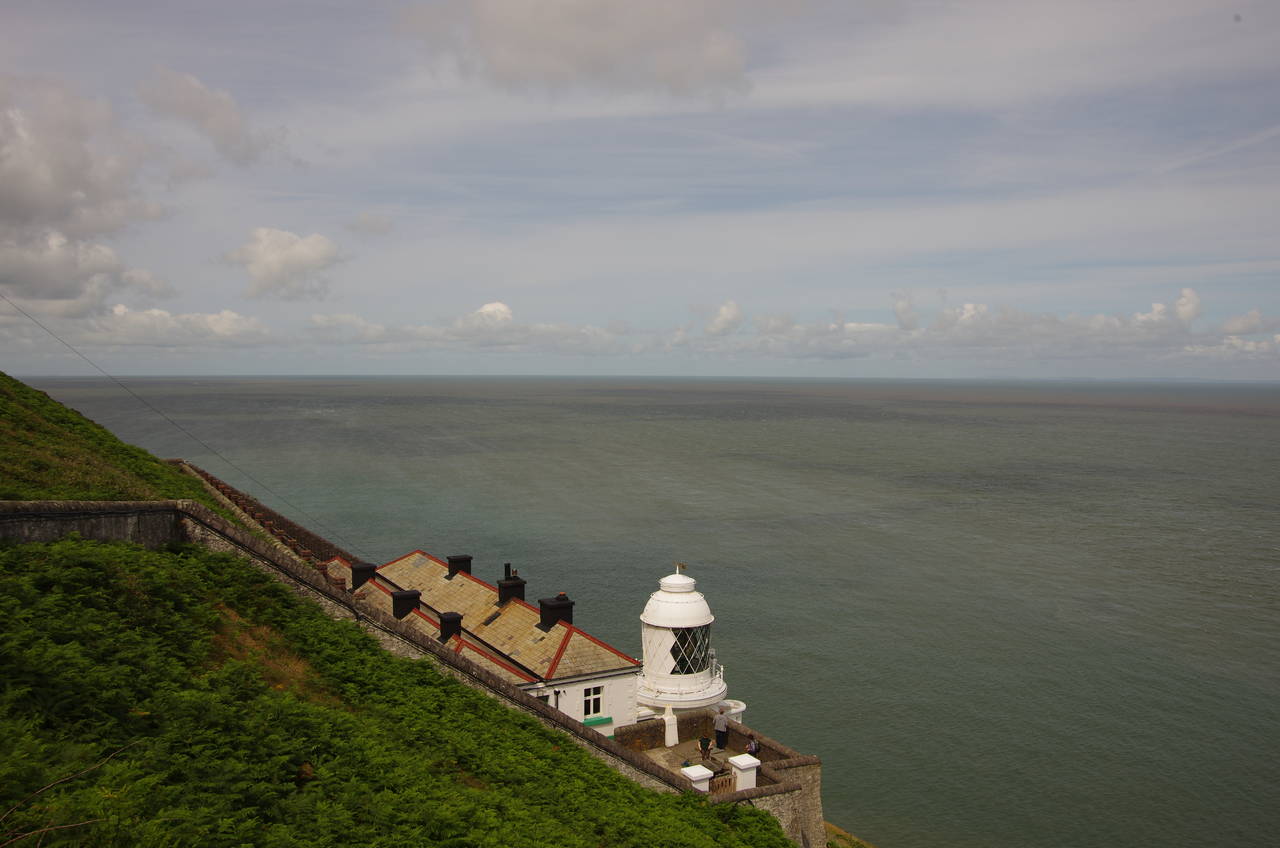
(15) Foreland Point Lighthouse
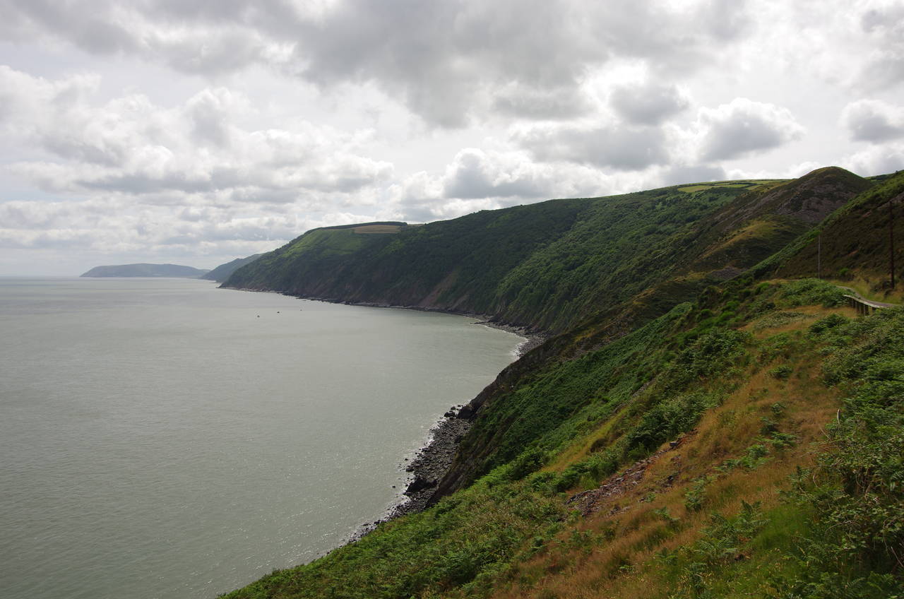
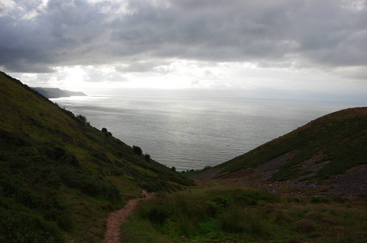
(16) View east from Foreland Point
The path now heads onto Butter Hill, ignoring a path up to the little hut and radio mast on the summit to instead take a path a little further to the seaward side. The paths join up again on the other side of the hill, heading towards the large hump of Foreland Point (picture 13). The Coast Path doesn't go out onto the point however, instead curving around to the right in the dip between Butter Hill and Foreland Point to come up above the deep dry valley of Coddow Combe (picture 14), which runs parallel to the coast.
The path descends steeply to meet the narrow road that runs down the combe. The route turns right here to follow the road up to the far end of the valley, but first I turned along the road in the other direction. The road curves around the lower slopes of the scree-covered Foreland Point, Devon's northernmost headland, for about 400 metres to end at a little carpark overlooking the Foreland Point Lighthouse (picture 15). From this vantage point one can also view the stretch of cliffs that are hidden from the official route of the Coast Path on its way up Coddow Combe (picture 16).
The lighthouse was built in 1900, with the original oil-powered lamp only being replaced by an electric light in 1975. A curious fact about this lighthouse is that its position on a steep, north-facing cliff means that it only receives direct sunlight for three months of the year. Before the light was automated in 1994, the lighthouse keepers were stationed here for no more than three years each, lest they should suffer ill-effects from the long-term lack of sunlight.

(17) Coddow Combe
(18) Chubhill Combe

(19) Swannel Combe

(20) Pudleep Gurt
After my visit to the lighthouse, I returned along the road to rejoin the Coast Path for the long slog up Coddow Combe, looking a little less picturesque and a little more like hard work from the road than it had appeared from above (picture 17). Near the top of the combe, the road turns sharply to the right, but the Coast Path continues ahead, following a rough vehicle track over the next rise and briefly regaining the view of the sea before arriving at a wooden gate and stile on the edge of the National Trust-owned Glenthorne Cliffs.
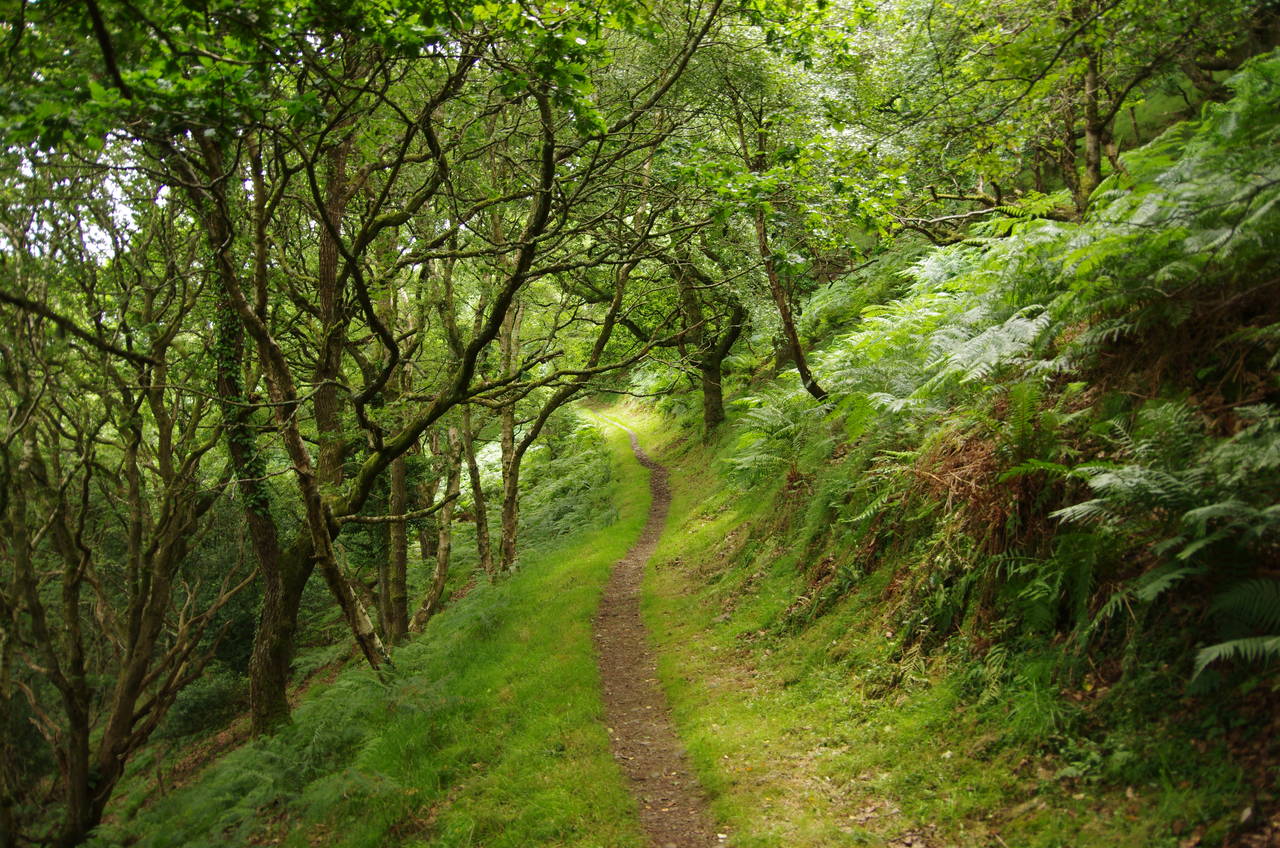
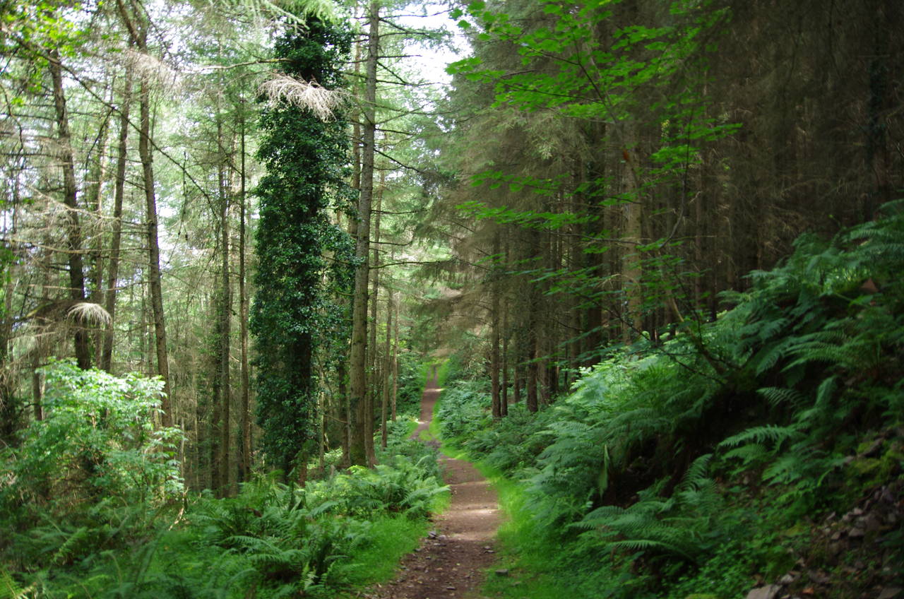
Just over the stile, a signpost points up some steps on the right, leading up onto a narrow, undulating footpath. For the next four kilometres, this path runs across the wooded, steeply sloping hillside, crossing a series of small, sheltered combes, starting with Chubhill Combe (picture 18), Swannel Combe (picture 19) and Pudleep Gurt (picture 20).

(21) Dogsworthy Combe

(22) Grotto on Old Barrow Hill

(23) Sister's Fountain
(24) Coscombe
After a flatter stretch of path come Dogsworthy Combe (picture 21) and Wingate Combe before the path crosses the seaward face of Old Barrow Hill where a small, dark stone-built grotto is dug into the hillside to the right of the path (picture 22).
On the far side of Old Barrow Hill, the path meets an unsealed driveway, turning inland to follow it past a large stone house and between gateposts topped by carved boars' heads. Just beyond the gate the path leaves the driveway, continuing inland through the woods to reach Sister's Fountain, a small spring covered by a cairn topped by a rough stone cross (picture 23).
The Coast Path turns left again, taking a forest track across the shallow Coscombe (picture 24), where one steps across a little stream and at the same time across the county boundary from Devon into Somerset.
A few minutes further on, where the path zig-zags to cross another small stream, I was engaged in conversation by a walker coming the other way. It turned out that he was also Australian, the first countryman I recall meeting on the South West Coast Path. He had set out from Minehead very early in the morning for his first day on the path and was on a pre-set itinerary with a luggage transfer company, planning to walk the entire path in 38 days with only one day off in Falmouth, just beyond the halfway point. If that wasn't enough, he was then heading up to Scotland for an additional ten days on the Coast to Coast Walk.
I looked into a few of those package deals when planning some of my walks. They would certainly save a lot of effort on planning and finding accommodation and would mostly or wholly eliminate the need to rely on public transport to get to and from the path each day. So far I've eschewed such arrangements because I prefer to go at a more relaxed pace and spend plenty of days exploring near the path as well as the days walking the path. I also dislike the idea of having to stick rigidly to a pre-planned schedule regardless of the fickle British weather.
(25) Sugarloaf Hill

(26) Wheatham Combe

(27) Holmer's Combe

(28) Silcombe Farm
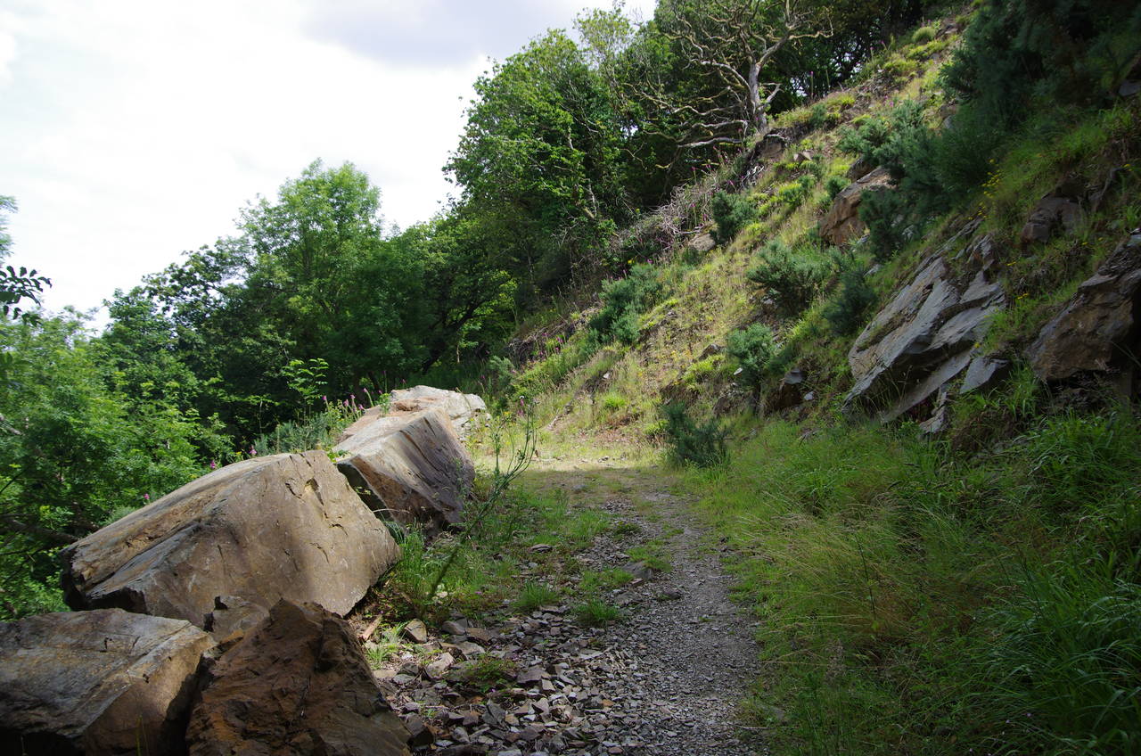
Setting out on the path again after a long chat with my new friend, I walked across the face of Sugarloaf Hill, where the path passes a row of large boulders (picture 25) before reaching a fork in the path. As with the previous stage of the walk, the two guidebooks I had read disagree on which of the two choices is the primary route and which is the alternative route. The guidebook I was carrying remarks that the four-kilometre lower, more coastal route is subject to landslides, so I decided to take the higher route, though it's about a kilometre longer, to avoid the possibility of getting most of the way along the lower route and being forced to backtrack.
The higher route climbs steeply up a stony path, briefly emerging from the woods at Guildhall Corner then bearing away from the coast and continuing to climb up Wheatham Combe to a junction of paths in the meadow above (picture 26), now just over a kilometre inland and just over 300 metres above sea-level.
At the junction, the route turns left, taking a much flatter, mostly enclosed path between meadows to reach Broomstreet Farm. The route briefly joins a track past the farm buildings, at the end of which the leftmost of a pair of wooden gates takes the route onto another long enclosed path that crosses Twitchin Combe and Holmer's Combe (picture 27) before threading its way between several more large fields to reach Silcombe Farm (picture 28).
(29) Descending into Withy Combe

(30) Withy Combe

(31) Culbone Church

(32) Yearnor Wood
The path joins a narrow lane that curves around the farm buildings, but leaves it again after a little more than 100 metres where the lane bends away to the right and a Coast Path signpost points ahead through a wooden gate and onto a vehicle track. This track briefly climbs over the next rise at the top of Withy Combe (picture 29) before beginning a long but fairly gentle descent on a pleasant woodland path on the left flank of the combe, with the woods that fall away steeply to the right of the path dominated by oak and a rare species of whitebeam (picture 30).
Near the bottom of the combe the two Coast Path routes reunite and swing back up into the floor of the combe, where the little hamlet of Culbone sits in a clearing. The centrepiece of Culbone is the pre-Norman Church of St Beuno (picture 31), which seats just 30 people and is reputed to be the smallest parish church in England (though a few years ago I visited a little church on the Isle of Wight that also claims that distinction).
After going for a wander around the churchyard I returned to the Coast Path, which crosses a bridge in front of a stone house before swinging back around into the oaks of Yearnor Wood (picture 32).
(33) Porlock Weir

(34) Porlock Beach

(35) Abandoned stables

(36) US Bomber Memorial
The well-signposted path meanders through the woods for about one and a half kilometres, passing through two stone arches amongst the trees before reaching the stone Worthy Toll Cottage, where the path goes through another arch to join the Worthy Toll Road. The toll road is only followed for about 100 metres before a signpost on the left indicates a public footpath that runs downhill to the edge of the wide shingle beach at Porlock Weir then along the edge of a field and a short enclosed path to emerge in the middle of the village between the Anchor Hotel and the Ship Inn.
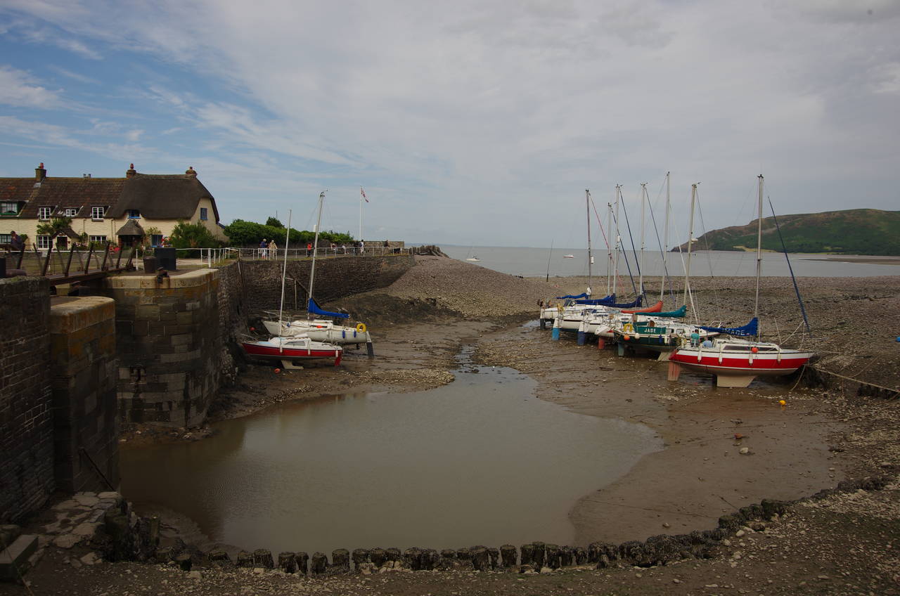
Porlock Weir was once a port of some note, but is fighting an endless battle against the constantly shifting shingle that forms a significant bank all the way around Porlock Bay. Visiting near low tide, I could see how the large tidal range here leaves the little boats high and dry on the shingle (picture 33).
Porlock Weir had been my original destination for the day, but as I still had around four hours of daylight left and wasn't feeling very tired, I decided to press on to Minehead. making this the last day of my walk on the South West Coast Path. After stopping off at the village stores to replenish my supplies I set off again, following the coastal road eastwards until it swings away and the Coast Path steps down on to the shingle with the rounded hump of Bossington Hill ahead across Porlock Bay (picture 34).
The next 400 metres along the shingle bank was slow going and I was rather glad to come across a short signpost pointing inland to a track along the edge of a large open area of saltmarsh. The marshes are actually quite new, created when the sea breached the shingle bank in 1996, flooding productive farmland and quickly transforming it into a rather barren looking tidal marsh. The breach also cut off the original route of the Coast Path, which ran along the shingle bank all the way around the bay to the foot of Bossington Hill.
The route to Bossington Hill is now a bit longer, though undoubtedly easier on the ankles, with the path having to skirt along the right hand edge of the marshes for about 800 metres then turn left to follow the long back edge, which passes some abandoned stables (picture 35) and a memorial to the crew of an American bomber that crashed here on October 29th, 1942 (picture 36).

(37) Approaching Bossington
(38) Bossington
(39) Horner Water

(40) Porlock Bay
Not far beyond the monument, the path crosses a rickety little footbridge over a small tree-lined stream. Now on the inside of the next field, the path runs along the left-hand side to reach a wooden gate taking the path back out onto the edge of the marshes. Reaching a stubby signpost the path shifts about 50 metres to the right before resuming its previous course to pass the short ends of four more fields. Another similar shift to the right takes the path along the inside edge of a larger field with the little village of Bossington nestling under the hill up ahead (picture 37).
After one more shift to the right, the path joins a farm track, now between hedge-lined fields with little to see save the bulk of the hill for the next 600 metres until the path turns right along a narrow lane to run up through the village, which has a number of attractive little cottages (picture 38).
The village lies within the National Trust's Holnicote Estate, which the Coast Path entered on its way across the marshes. Covering 5026 hectares, this is one of the Trust's largest properties, stretching about six kilometres east and even further south and southwest.
At a junction in the middle of the village, the Coast Path turns left to join a track past a National Trust car park and up to a ford across Horner Water, where a footbridge saved me from getting my boots wet (picture 39).
The track from the ford briefly follows the lazy stream before branching off to the right to make a long, steady climb up through the edge of a shady wood onto Hurlstone Point. Beyond a wooden gate, the path emerges above the trees to reveal a fine view over Porlock Bay and climbs a little further to reach a stone cairn bearing a National Trust sign, about 200 metres short of the point.
The Coast Path doesn't go all the way out to the point, but rather turns right at the cairn, beginning a fairly steep climb up Hurlstone Combe. Before the steep sides of the combe closed in, I paused to admire the view back across the bay (picture 40).
(41) Hurlstone Combe

(42) View inland from Bossington Hill
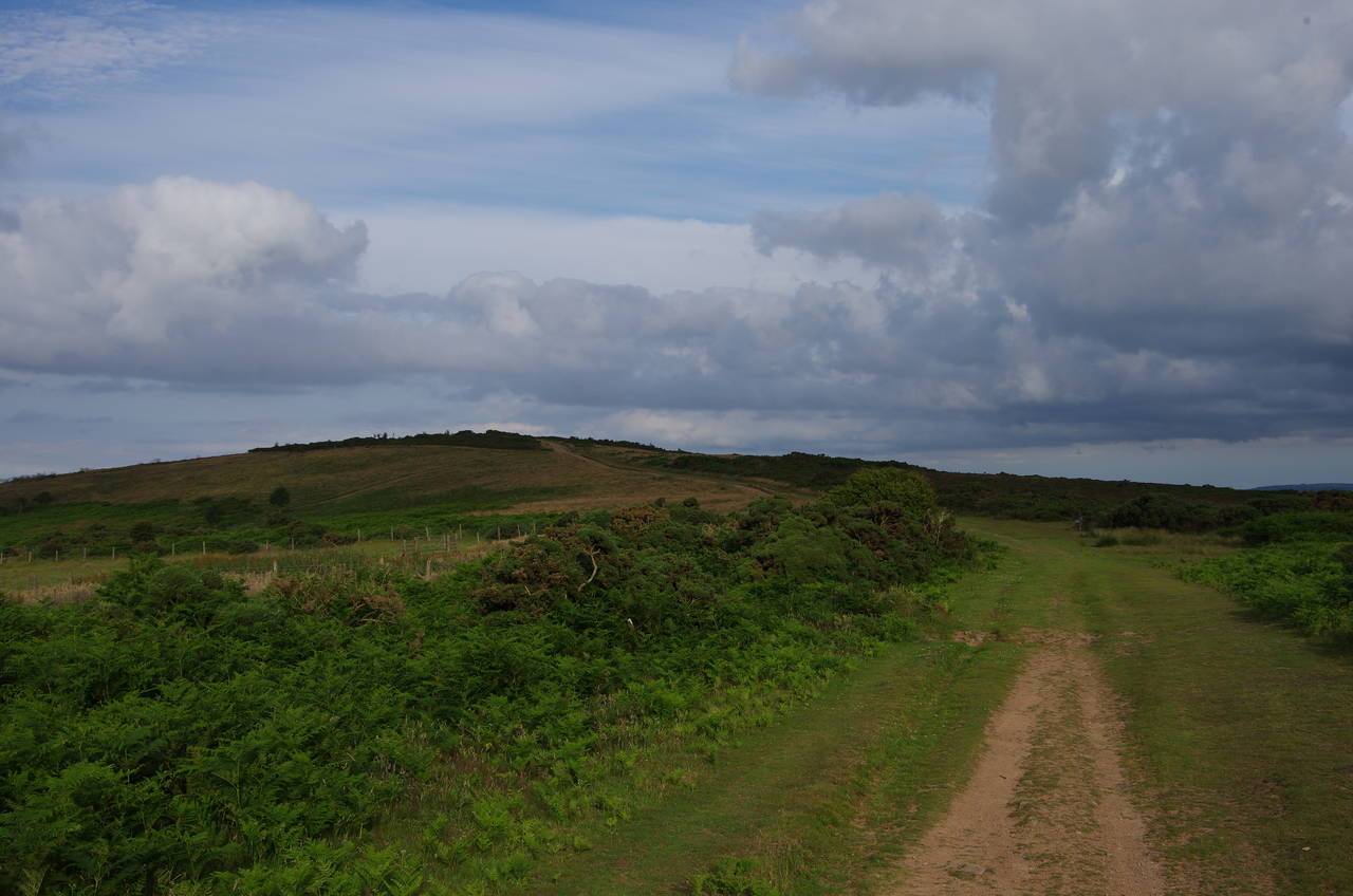
(43) Selworthy Beacon

(44) Bramble Combe
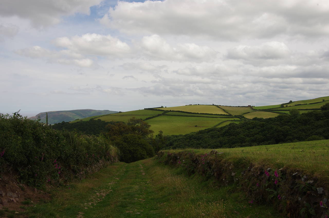
The climb up Hurlstone Combe was quite strenuous and I had to pause for breath about half way up (picture 41). The path emerges from the top of the combe at about 290 metres above sea-level, with a good view inland over the green valley that shelters the town of Porlock, situated a couple of kilometres inland from Porlock Weir, and far beyond to the peak of Dunkery Beacon, the highest point on Exmoor and southern extent of the Holnicote Estate (picture 42).
Passing a signpost showing 5 miles (8 kilometres) to the end of the Coast Path, the route now heads along a well-worn track towards the peak of Selworthy Beacon (picture 43). Somewhat inexplicably, the official route of the Coast Path doesn't go over the top of Selworthy Beacon but instead branches off at a fork in the path about 400 metres before the summit. The path heads around seaward side of the Beacon, sticking to the 290 metre contour, with acres of gorse on the right covering the 308-metre peak and large swathes of grassy hillside to the left sloping down into Henners Combe. (The more direct path over the summit meets the Coast Path again about two kilometres further on.)
About a kilometre beyond the fork, the official route crosses over the end of Dean's Lane then continues along the edge of the huge expanse of gorse above sheep-grazed hillsides. After another kilometre the path passes above Grexy Combe and then after a similar distance again, it passes above Bramble Combe (picture 44). Along much of this stretch of the path there are views across the Bristol Channel to the hills of South Wales.

(45) North Hill

(46) Greenaleigh Point
(47) Culvercliffe Walk

(48) Minehead
Passing through a wooden gate, the path finally leaves the Holnicote Estate, now on North Hill, where the track forks. The Coast Path takes the left branch, briefly heading seaward over a small rise before turning back parallel with the coast.
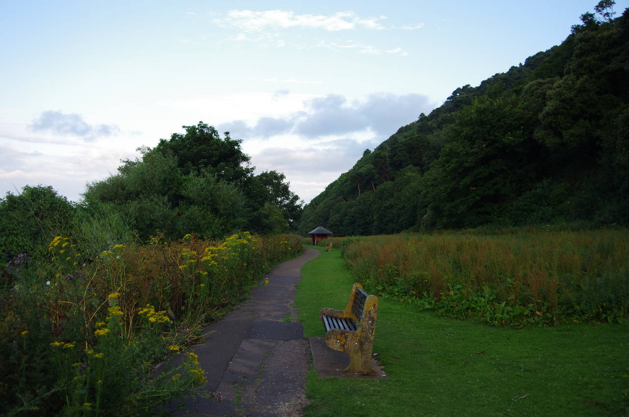
From this point, again around 300 metres above sea-level, there are far-reaching views across to Wales and along the Somerset coast towards the nuclear power stations at Hinkley Point. As far as the Coast Path is concerned, it's just about all downhill from here, and the view is soon lost as the path descends gently across the fern-covered hillside of Greenaleigh Farm.
At a signpost by a wooden bench, the route turns sharp left to zig-zag a little lower down the hill, heading into trees above Culver Cliff. After a few hundred metres the Coast Path turns sharp left again, leaving the broad woodland track to take a narrower path down to the Greenaleigh Lower Road on Greenaleigh Point (picture 46). The road, which is really just a long driveway, is followed for a short distance until a signposted woodland path bears off downhill to the left.
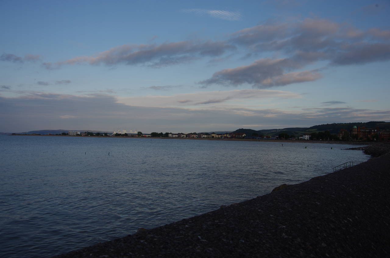
At the next fork the path bears left again, descending to a park just above the shore and joining a tarmac footpath along the edge of the park, known as Culvercliffe Walk (picture 47). At the far end of the park, the path passes a small children's playground to reach a cul-de-sac at the western end of Quay Street on Minehead's seafront (picture 48).

(49) Minehead Harbour
(50) Minehead seafront

(51) SWCP sculpture
(52) SWCP sculpture
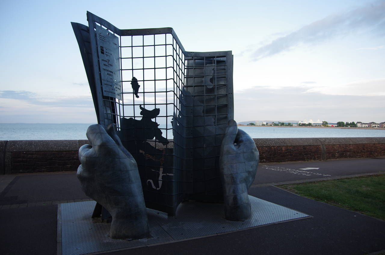
The final 400 metres of the South West Coast Path follows Quay Street past Minehead's little harbour (picture 49), beyond which the seafront stretches out ahead (picture 50). In a little strip of parkland behind the sea-wall, a large metal sculpture of hands holding a map (pictures 51 and 52) marks the official end of the South West Coast Path, 33.5 kilometres from the start of the day's walk in Lynmouth and at least 1,014 kilometres from the not-quite-so-grand sculpture at the other end of the Coast Path by Poole Harbour.
It was almost half past nine when I reached the sculpture in fading daylight a few minutes after sunset, having been walking for just over eleven hours. Fortunately I was still able to find a fish and chip shop open a bit further along the seafront to obtain a suitable reward for a long day's coastal walking and for having completed my fifth National Trail.
It seemed like such a long time since I had caught the chain ferry across the mouth of Poole Harbour to South Haven Point to begin the first stage of the Coast Path 815 days previously. The man I met going the other way in the morning had quite a journey ahead of him.