THE NORTH DOWNS WAY
Stage 6: Otford to Wrotham
Saturday, July 31st 2010
I walked this section of the North Downs Way on Saturday, July 31st 2010. I arrived at Otford Station (picture 1) just before noon, knowing that this short stage would allow me time to explore Otford and to visit one or two of its pubs.
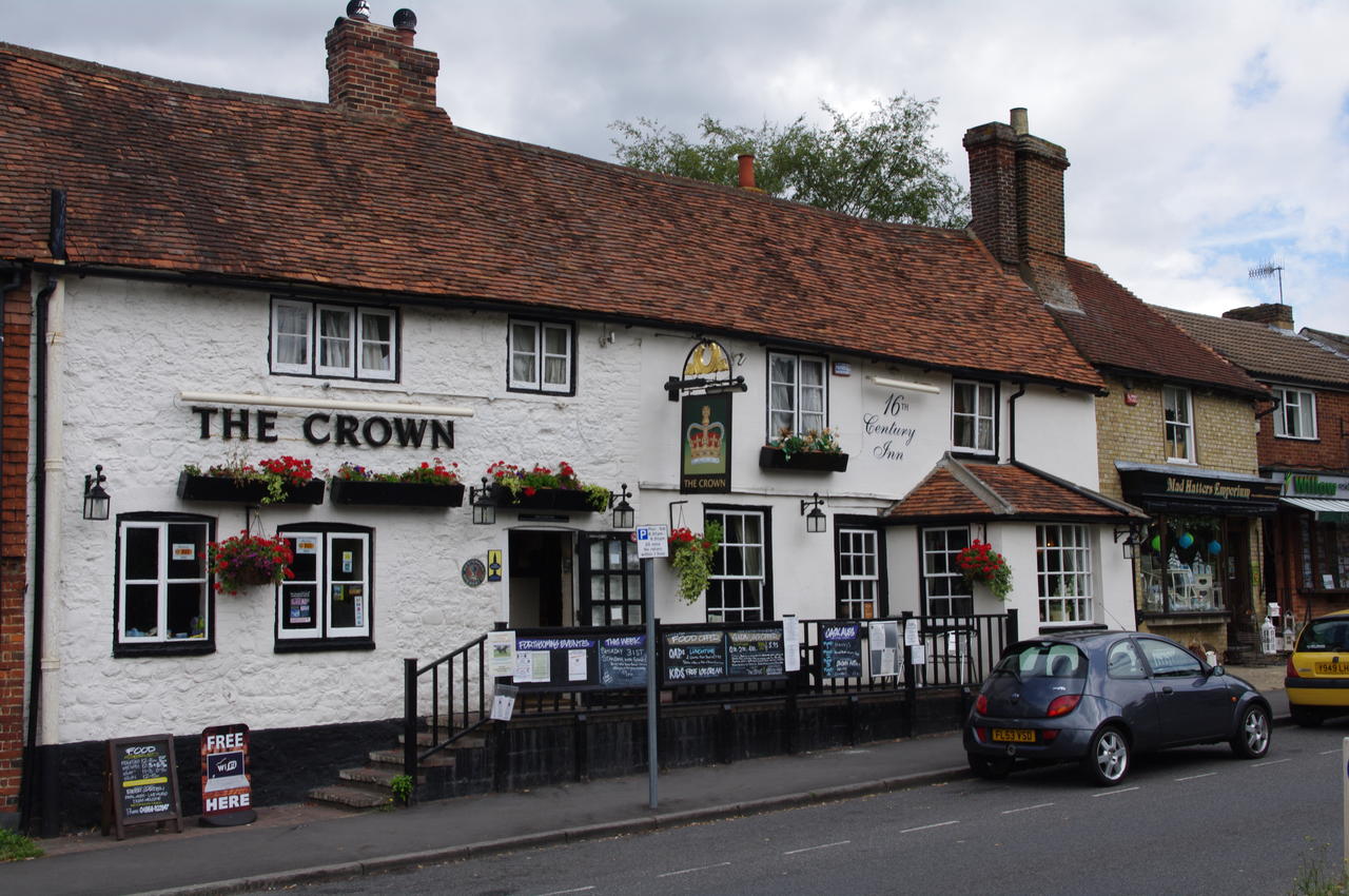
I spotted four pubs on the High St, choosing The Crown (picture 2) for lunch. The Crown is a nice low-beamed pub, where you can dine next to an impressive looking suit of armour. The pub overlooks the duck pond on the roundabout in the middle of the High St (picture 3). A sign nearby claims that the duck pond is a listed building -- the only listed duck pond in England.
After polishing off a huge plate of Nachos, washed down by a pint of Woodford's Wherry, I set off to find more of Otford's solar system model.
Most of the model can be found at the far end of Otford's recreation ground (picture 4), a few hundred metres along the High St, west of the pond. The 1:5 billion scale model was made as part of the town's millennium celebrations, representing the positions of the Sun and planets at one minute past midnight on January 1st, 2000.
A polished metal dome represents the Sun (picture 5), while each of the planets is represented to scale on a sun-sized disc (such as that of Jupiter in picture 6). The planets as far as Jupiter are represented on the recreation ground, with the others scattered farther afield around the town -- the pillar for Neptune is on the North Downs Way on the outskirts of town.
Completing the model, metal globes representing three of the Sun's nearest neighbouring stars are located in Sydney, Los Angeles and the Falkland Islands, making this by far the world's largest scale model.
After rejoining the North Downs Way at the railway station, the trail crosses a bridge over the railway lines and briefly follows a road to the right to an information board and a signpost that points across the road (picture 7). Here the trail climbs a steep footpath through woods onto the downs above Otford. About half way up, the path passes a bench where there are views back to Otford between the trees. When the track levels out it passes through a wooden gate (picture 8) and crosses a large field before joining Birchin Cross Road.
A short distance later the trail veers off the road to the right and passes through several more gates in the woods before emerging onto a field with a cottage downhill to the left (picture 9).
The trail follows the edge of this field until it joins another road next to a thatched cottage called Silverdale (picture 10). The trail turns right along the road, but soon leaves the tarmac to the left along the driveway of Otford Manor, where it crosses a stile and follows an overgrown path beside another field and then through some woods. The path soon emerges from the trees onto Kemsing Down, with views over the village of Kemsing (picture 11).
The trail then continues along the downs alternating between woodland and fields, some of which are divided into paddocks for grazing horses (picture 12). Along the way the path crosses about 10 stiles.
The trail again briefly joins a road before turning right through a new kind of stile next to a farm building (picture 13). The trail then crosses a couple of large fields where hay had recently been harvested (picture 14), before going through a gate in the corner of the second field and briefly back into the woods.
Beyond the woods the path crosses another open field with views off to the south, where I could see some rather dark clouds forming (picture 15). These ominous looking clouds hung around in the distance for the rest of the day, but fortunately it didn't rain. The trail continues along the edges of more fields, before crossing a road and heading steeply downhill through some woods (picture 16).
At the bottom of the woods, the path reaches a sloping field with good views over the surrounding farmland (picture 17). Here I passed a family having an afternoon picnic.
The path continues downhill across two fields. At the bottom of the second field the path turns left along a track between fields (picture 18). This path continues more or less straight ahead for almost three kilometres before joining a paved road on the edge of the village of Wrotham (pronounced "root-ham").
Just after the path joins the paved road, a driveway to the left leads to some allotment gardens (picture 19), while the North Downs Way continues along the paved road, passing houses and a sports field before leaving the road near a recycling point.
Here I left the trail, having covered a little less than nine kilometres, and continued into the middle of Wrotham, where there are four pubs: The Bull, The Three Post Boys, the Rose & Crown and the George and Dragon (picture 20).
From Wrotham it is a twenty-five minute walk to the nearest railway station in Borough Green, where I caught the train back to London.


