THE NORTH DOWNS WAY: Stage 13
THE SAXON SHORE WAY: Stage 11
Dover to Etchinghill
Wednesday, August 11th 2010
I walked this section of the North Downs Way on Wednesday, August 11th 2010, beginning at around 11am. The day started out cool and cloudy, but before long some darker clouds began to gather. This section of the walk is in common with the route of the Saxon Shore Way, another long distance walking trail that I completed on a later visit to England.
Rejoining the North Downs Way at the fountain in Dover's Market Square (picture 1), I made my way along King Street, then right into Queen Street and across York Road via a pedestrian crossing. From here the route begins to climb the Western Heights along Adrian Street, from which there are good views across Dover to the castle, perched high on the cliffs on the other side of the town (picture 2).
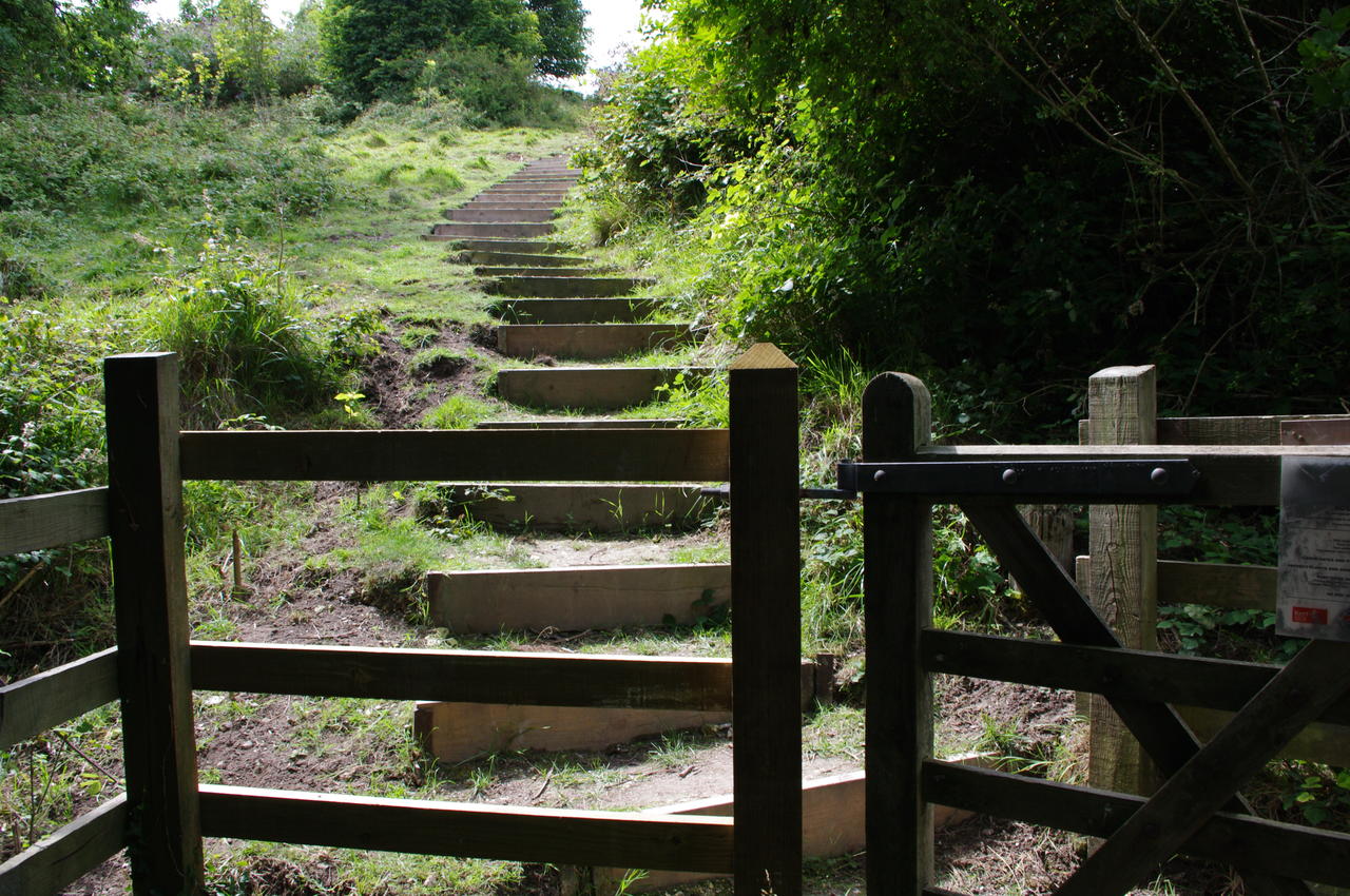
Next to a Western Heights information board, the route leaves the street and climbs a long steep flight of concrete steps. At the top of the steps, the path passes through a wooden gate and climbs yet more steps, this time wooden ones cut into the hillside (picture 3).
Eventually the steps end and the path continues up the hill to the outer edge of the Drop Redoubt Fort (picture 4), built during the Napoleonic Wars in the early 19th century to defend the Western Heights.
Looking back from the top of the Western Heights, there is a superb view over Dover and the harbour (picture 5). The North Downs Way turns right here, skirting around the outside of the fortifications, but by following another path to the left, it is possible to get down into the grassy moat of the fort (picture 6), where several locals were walking their dogs.
Back on the trail, I followed the path along the fenceline, with the fort on the left and a good view over Dover Priory Station and the bulk of the town on the right (picture 7). Beyond the fort, the path descends some more wooden steps to a road, which it follows uphill to the left. Near the top of the hill the route turns along a street to the right, where a large sign indicates the way to the Dover Immigration Removal Centre (picture 8).
A bit further on, the road forks and the North Downs Way takes the left fork, where the tarmac soon gives way to a grassy track (picture 9). A little way down this track, the route turns left off the well-worn path and begins to descend. Unfortunately, this turn is easy to miss as it is completely unmarked and so overgrown that it's barely recognisable as a path (picture 10). About a hundred metres down this path, a waymarker will confirm that this is the correct route. Following the obvious, well-worn path instead for another thirty metres or so leads into a meadow with a large building up ahead (picture 11) -- if you see this, you've come too far.
Descending the correct path, the village of Aycliff comes into view, and beyond it is Shakespeare Cliff (picture 12), mentioned by the Bard in King Lear -- a fact reflected in several street names in the village.
The overgrown path descends to join a concrete path next to a playground, and then down some steps to join a street in Aycliff (picture 13). The route goes along the street until it joins another street to the left and then uses an underpass to cross to the other side of the A20 where the path begins the steep climb up Shakespeare Cliff.
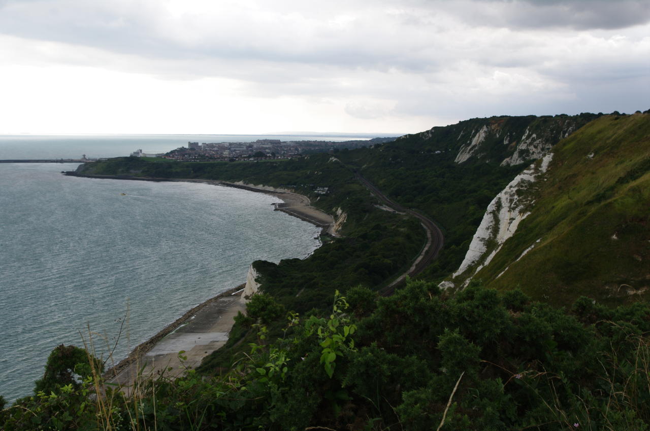
The first part of the climb takes a narrow tarmac footpath along the cliff edge with the coastal railway line below and views back to Dover Harbour (picture 14). As the path climbs higher it becomes a grassy track, passing a strangely shaped wooden seat and continuing uphill alongside a wire fence (picture 15). At the top of the strenuous climb, I was rewarded with the wonderful view in picture 16, with the coast stretching away to Folkestone in the distance, the A20 snaking over the hills behind the cliffs and Aycliff down to the right.
From here the path continues close to the cliff edge, passing a couple of brick ventilation chimneys belonging to the Channel Tunnel, which passes under the cliff and out under the English Channel here. Near the second chimney, the path passes another of the concrete North Downs Way milestones, this time showing 32km covered since Canterbury (picture 17).
The path then climbs along Round Down, with Samphire Hoe Country Park at the foot of the cliffs below (picture 18). The park is a large flat area built from some of the earth excavated during the construction of the Channel Tunnel.
From the top of Round Down, which is a little higher than Shakespeare Cliff, there is a spectacular view all the way back to Dover Harbour and out over the Channel (picture 19). The path continues along Round Down between the A20 and the cliff edge, passing the first of several World War II pillboxes (picture 20).
The path soon passes another pillbox built into the edge of the cliff with grass growing on its roof (picture 21). Along this part of the walk there are several sections of dense, prickly bush to negotiate, making me glad I'd worn jeans and carried a jacket.
Over the next rise, the route joins a narrow cycle track. where there is a good view ahead towards Folkestone on the left and the town of Capel-le-Ferne on the right. Here I could see that the dark clouds that had been hanging in the distance for most of the day had gotten quite a lot thicker (picture 22). Next to the path here, I noticed some sort of sign about some of the local flora laying in the long grass (picture 23).
A little further along the path I found one of the large concrete "sound mirrors" used to detect incoming aircraft before the invention of radar (picture 24). There had obviously been an attempt to cover up some graffiti on the mirror, but somebody called Geoff had covered that with more graffiti.
This part of the route is shared with the National Cycle Network, and the path soon heads inland, passing by a NCN milemarker (picture 25). After passing behind a couple of houses, the North Downs Way leaves the cycle path and takes a narrow footpath beside a wooden fence back towards the cliff edge, where it turns right and passes a clifftop caravan park on the edge of the town of Capel-le-Ferne. From the clifftop here there are good views down into the Folkestone Warren (picture 26).
The path continues along the cliff edge above The Warren, passing just above the Cliff Top Cafe (picture 27), where I stopped for a snack while I waited for a light shower to pass by. Beyond Capel-le-Ferne, the path goes down some steps past some houses, then down some steeper steps and immediately back up again to pass by the Battle of Britain Memorial. The centerpiece of the Memorial, which opened in 1993, is a sculpture of a seated pilot looking out over the Straits of Dover (picture 28).
The Memorial also features a wall showing the names of all the British airmen who fought in the Battle (picture 29), replicas of the Spitfires and Hurricanes flown in the Battle (picture 30) and a small visitor centre.
Leaving the memorial near the cliff edge, the North Downs Way passes through a wooden kissing gate and alongside a high mesh fence. At the end of the fence the route turns right and heads away from the cliffs, but there were no signs or waymarkers here (reaching a another pillbox at the top of a steep descent, I knew that I had come too far and turned back to find the correct path).
The path emerges onto the B2011 road next to the Valiant Sailor pub (picture 31), crosses the road into Crete Road East and enters a long, narrow field on the edge of the downs above Folkestone. One must be wary of the new fingerpost next to the pub, which points slightly left of the route and could mislead people into walking down the hill -- there is another fingerpost showing the correct route directly across the road from the pub.
The path goes along the field, parallel to Crete Road East, passing a trig point on the summit of Dover Hill at a height of 170 metres above sea level, from which there are views over Folkestone and further along the coast to Hythe (picture 32). The path continues along the Creteway Downs and passes another WWII pillbox before the field narrows and the path is enclosed by thick bushes on both sides.
The path soon rejoins Crete Road East, and here I could see parts of the route ahead (picture 33) -- the route heads downhill to the right of the picture, crossing the A260 Canterbury Road, passing behind Sugarloaf Hill in the middle of the picture and circling halfway up Castle Hill in the left of the picture.
On the way to Castle Hill, the path first crosses Round Hill, where the A20 enters a tunnel under the downs below the path (picture 34), though I couldn't see the tunnel entrance yet. Descending a little from Round Hill, the path briefly parallels Crete Road West across from some houses before bearing left and clinging to the steep sides of Castle Hill, from which I could see the tunnel entrance and look back along the path all the way to Dover Hill (picture 35).
The path continues around Castle Hill, where the earthworks of Caeser's Camp, one of the largest remaining Norman motte and bailey castles, sits atop the hill. As the path circles the hill, the Channel Tunnel Freight Terminal and the tunnel entrance come into view (picture 36). The path then descends from Castle Hill, rejoining Crete Road West near some boarding kennels.
For around one and a half kilometres, the route goes along the fields on the edge of the Folkestone Downs, paralleling Crete Road West, with the constant sounds of trains and machinery coming from the Channel Tunnel Terminal below. Some of the fields contain grazing cattle (picture 37), so at times it might be safer to use the road instead.
Towards the end of Crete Road West, the Way rejoins the road, but the exit from the field is easily missed and the well-worn path goes on ahead for a short distance into some bushes where it becomes obvious that this isn't the right path.
When the road heads off to the right, the path leaves it and continues along the edge of the downs, following the edges of several large wheat fields and passing another concrete pillbox along the way. The path then enters the chalk basin of Peene Quarry Country Park (picture 38) and follows a well-worn path which leads into a field. In the middle of the picture, you can just see the radio mast on top of Tolsford Hill -- the end of this stage of the walk.
The path skirts around the edge of the field before leaving via a gap in the hedge and crossing a minor road onto a fenced path, much of which is lined with trees and brambles (picture 39).
After around 500 metres, the North Downs Way leaves this path to the left through a gate in the fence and follows the edges of several fields until it reaches the top of a grassy coombe (picture 40). Unfortunately the waymarking here is poor -- the well-worn path leads past the top of the coombe, and the only clue to the correct route is a broken marker disc nailed to a tree about five metres to the left of the path, where it is obscured by the foliage.
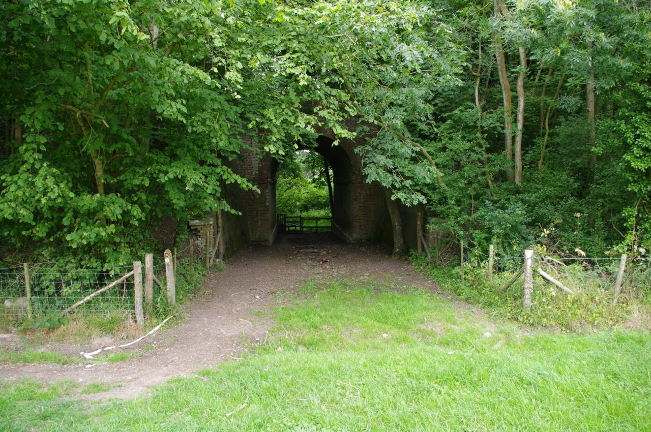
The path heads down to the bottom of the coombe, then curves around to the right through the edge of the trees, crosses a stile and then crosses a field past an electricity pylon to a tunnel under a disused railway line (picture 41).
The path then crosses a narrow wooden footbridge and a stile before climbing across a field to the right of a farmhouse and joining a lane by the front gate of Coombe Farm. The lane quickly leads uphill to a road, and about 30 metres along the road to the right the North Downs Way leaves the road again. The path soon passes through a metal kissing gate, following the right-hand edge of a field before another gate takes the path back into the edge of the woodland, where the path gradually climbs with the village of Etchinghill visible downhill to the right of the track.
Before long, the woodland path reaches another kissing gate, and turns right, where a sign indicates that the path goes through a military training area. The path continues climbing with many hawthorn trees lining the track, and after 500 metres reaches the Tolsford Hill radio mast (picture 42), where the route crosses a stile onto the end of Westfield Lane. This is the point at which the North Downs Way and the Saxon Shore Way diverge, with the North Downs Way heading roughly northwest towards Wye and the Saxon Shore Way heading south towards Sandling.
Here I left the Way for the day and followed the lane downhill for around a kilometre into the village of Etchinghill, where I caught a bus back to Canterbury just as night fell. This section of the walk had covered approximately 20.5 kilometres on the National Trail.


