THE SAXON SHORE WAY
Stage 12: Etchinghill to Hamstreet
Monday, February 28th 2011
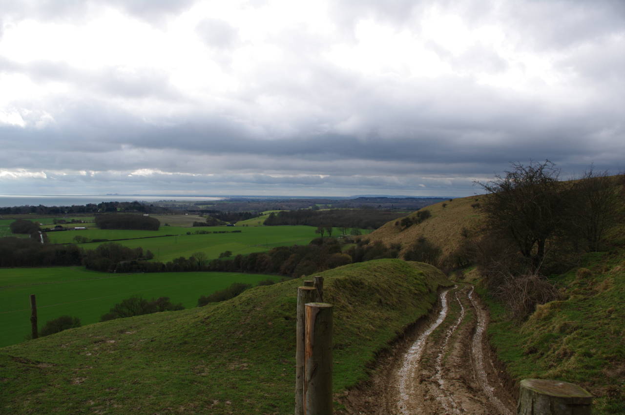
I began the day by getting the #17 bus from the stop near Folkestone Central Station to the village of Etchinghill, then walked along Westfield Lane for about ten minutes to the Swingfield Radio Station on the top of Tolsford Hill (picture 1). The weather was mostly overcast and I was expecting the trail to be quite muddy as it had rained heavily a couple of days earlier.
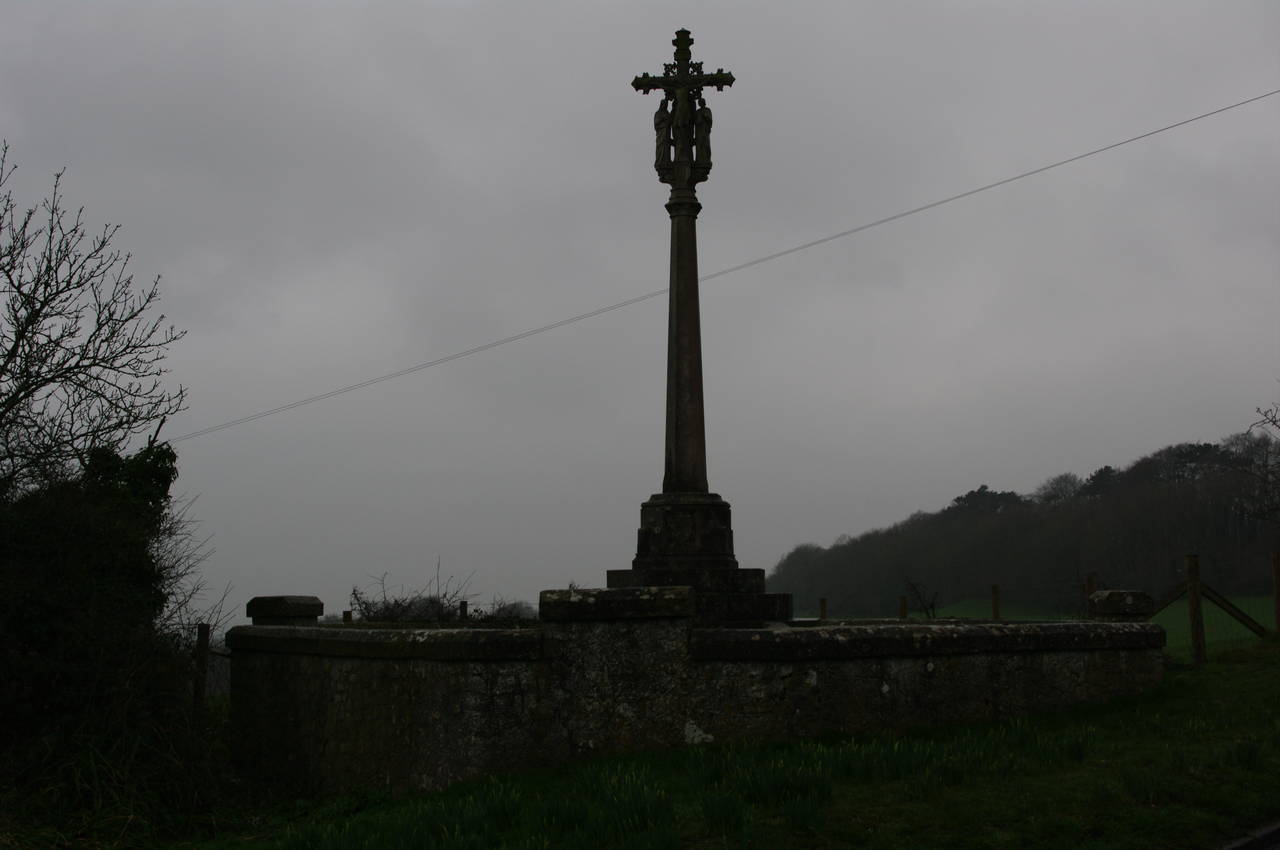
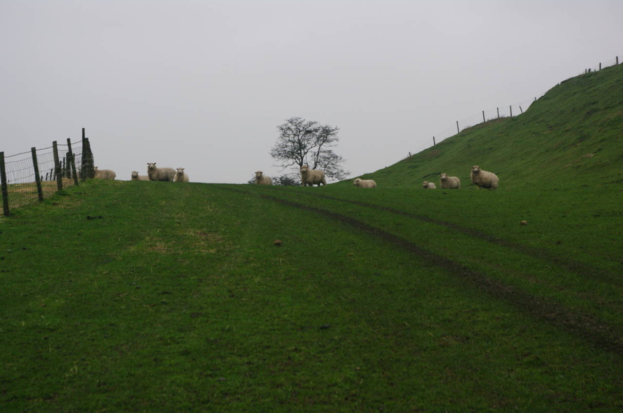
At the end of Westfield Lane, the Saxon Shore Way parts company from the North Downs Way (picture 2), the two having followed the same route between Dover and Tolsford Hill. The latter heads off to the right, while the Saxon Shore Way continues straight ahead along a concrete path and then bears left along a muddy track and across a field. In the middle of the field the track passes a weathered triangulation pillar (picture 3), which stands some 181 metres above sea level.
At the far side of the field, the track starts to descend steeply. From the top there were good views south towards the English Channel and along the coast as it curves away towards Dungeness (picture 4), where the nuclear power station was clearly visible on the horizon. There was a patch of sun shining on the channel in the far distance, but above me the dark clouds were rolling in.
The track down the hill was very wet and muddy and it took me quite a while to pick my way safely down the slippery slope. By the time I reached the bottom of the track, where it joins a rough lane, the weather had become quite gloomy.
The lane passes a house and soon afterwards the route goes through a gap in the trees on the left and into a field. The route follows the field edge parallel to the lane until reaching a marker post, where the route bears left along a well-worn and very muddy footpath that runs diagonally to the opposite corner of the field (picture 5). The route then crosses the A20 Ashford Road and follows a bitumen path that leads to a footbridge over the M20 motorway and then to a second bridge over the Channel Tunnel rail line.
The route then heads along a rough lane past an orchard and a couple of houses, then follows a muddy footpath that climbs to the right of the lane and heads into Heane Wood (picture 6).
The path winds its way through Heane Wood and then through Willow Wood to eventually reach Sandling Road, which the Saxon Shore Way crosses to pass through a wooden gate about ten metres along the road to the left (picture 7). The route then follows the right edge of a large grassy field to another wooden gate that leads into Chesterfield Wood. A short distance into the wood, the path turns left and continues gradually downhill to cross a footbridge over a small stream (picture 8) before climbing gradually to the far edge of the wood.
The path emerges from the wood via a wooden gate and crosses a field towards the hamlet of Pedlinge, passing between the two buildings on the far side of the field (the leftmost of which is Pedlinge Chapel) and out to Hythe Road. Across the road and 20 metres to the left, the route follows a farm driveway for a short distance and then crosses a field diagonally between two wooden gates, before joining a rutted farm track across a larger field. When the track meets another, the Saxon Shore Way continues ahead on a worn footpath across another field before joining the B2067 road, which heads gradually uphill past the Cinque Ports War Memorial (picture 9), also called the Shepway Cross.
The Way follows the road uphill until turning left along a lane that leads past Lympne Castle (picture 10). Beyond the castle the Way joins a footpath into woodland, soon reaching the top of the cliff that overlooks Romney Marsh (picture 11). By now the weather had deteriorated and the view across the marsh was not very clear (picture 12).
The path continues along the cliff edge for a little while before angling away, following a well-worn footpath between pairs of wire-fences to eventually arrive back at the B2067 road, where the route immediately turns sharply left and heads down a farm driveway. The driveway becomes an unsurfaced track and soon turns left along a brief flat section before turning right and continuing downhill between the two halves of the Lympne Wild Animal Park. Through the fences I was able to see a few of the residents, including zebras (picture 13), bison and ponies. Unfortunately the gloomy light and thick vegetation along the sides of the path made it difficult to get any good photos.
The path downhill was quite steep and extremely slippery in places after a few days heavy rain and I had to make my way down very carefully, taking almost half an hour to negotiate roughly six hundred metres before the path crosses a bridge over a drainage ditch and climbs up onto the banks of the Royal Military Canal. The northern bank of the canal is covered in trees and there isn't much opportunity for a good view of the canal as the path winds its way along the bank until, after about a kilometre the path reach a bridge over the canal (picture 14). The route doesn't cross the bridge however, but instead continues along a rough farm track for a little over two kilometres.
On reaching the driveway of Honeypot Cottage (picture 15), the route crosses a stile beside the driveway, passes to the left of the cottage and begins to climb uphill.
A long climb over spongy, sheep-grazed fields follows. A little to the right of the route, near the top of the hill, I stopped at the ruins of an old stone chapel to rest for twenty minutes and eat my lunch.
Rejoining the official route, I soon turned left at a marker post and followed a trail across the face of the hill above some farm buildings before joining a farm track where there were hazy views of Romney Marsh below (picture 16).
A short distance down the track, the route crosses a stile next to a cattle grate and leaves the farm track to once again cross the face of the hill over several large rolling fields, just below a steep embankment (picture 17).
Eventually, the route reaches a small patch of woodland known as Dunk's Wood, skirting around the lower edge of the woods before turning left and following a fence downhill and some distance beyond another patch of woodland before the route turns sharply to the right and through a gate into a triangular field. The Way follows the lower edge of this field and the next, then crosses two waterways via plank bridges and stiles to emerge into a steeply sloping field where a new crop was just starting to take hold (picture 18). About 100 metres up the hill, another stile takes the path into Curtis Wood.
The trail through Curtis Wood leads to another stile, beyond which the route turns right and follows the next field edge back to the B2067 road at the tiny hamlet of Copperhurst. A short distance along the road to the right, beyond a house, a signpost points uphill across another field (picture 19). Unfortunately, the signpost is a bit misleading, pointing out into the middle of the field. The correct route actually runs around behind the trees on the right of the picture and uphill to a stile beside a telegraph pole, and then across the field to another minor road.
The Way follows the road for about 500 metres, over Ruffin's Hill and past some farm buildings, with the village of Aldington and the square tower of its church visible away to the right. Just past the farm buildings, a signpost points downhill across a large field before crossing a plank bridge over a narrow stream and following two sides of the next field to join a path through Blackthorn Wood. The path soon emerges from the wood, crosses a stile, then climbs a grassy hill to the left of a drainage ditch (picture 20). At the top of the hill, the route turns left then right to skirt around some houses to a road.
A short distance along to the left the road forks and the route takes the right branch, heading uphill past some more houses. A couple of footpath signs should be ignored until the road reaches a Saxon Shore Way signpost that points down a driveway. The driveway leads through a wooden gate and into a field, where the route heads diagonally to the right to another gate. The route continues in the same direction across the next field, eventually reaching yet another wooden gate and a lane, which the route follows to the left.
A little way further on, the lane is blocked by a white gate labeled "Hungry Hall" (picture 21). A post a few metres before the gate has a button to open the gate and another post beyond the gate has a button to close it.
The route continues down the lane and across the gravel forecourt of the aforementioned Hungry Hall, through a wooden gate and along the left edge of two small fields. A stile then leads to a path across a farm, complete with duck pens, and then along a narrow and very overgrown path to emerge onto a road. A few metres to the right the road reaches a T-junction where the route turns left for a short distance before a signpost points to the right along the edge of a horse paddock.
At the far side of the paddock a stile leads into Park Wood. The path through the wood was barely discernable, but I guess I managed to follow it correctly, as I soon reached the far side of the wood, where a marker post pointed uphill along a broad, grassy path with the wood on the right and a property clearly used for something related to horses on the left (picture 22).
After a few minutes, the path turns left along Priory Road, the field on the left containing a number of horse jumps. About four hundred metres later the route leaves the road to the right and enters Priory Wood. The route through Priory Wood was much longer than the one through Park Wood (around a kilometre), but was much easier to follow. This stretch of woodland walking was also more colourful with a lot a brightly coloured moss growing on the trees and along the edges of the path (picture 23). The wood was also very quiet with no traffic noise and very few sounds of animal or bird life. When the path eventually emerges from Priory Wood, it crosses a road and follows a fence uphill to the left along the edge of a freshly ploughed field (picture 24).
When the fence ends, the route continues to follow the field edge around the next side of the field and along the edge of the next field to enter Dyne's Wood. Along this section of the path, most of the regular Saxon Shore Way marker discs have been replaced by standard yellow Public Footpath discs with "SSW" hand-written on them.
On the other side of Dyne's Wood was another freshly ploughed, and very muddy field, with many pools of water on the surface and no obvious path across it (picture 25). I was able to spot a stile at the edge of Norland Wood on the opposite side of the field and headed directly towards it with the mud sticking to my boots in huge clumps. The path through Norland Wood was rather hard to follow, but fortunately it was marked on my GPS and I soon reached a dirt track where a marker disc on a post pointed to the right. Several stiles were hidden in the trees on the left side of the track, and I think it was the third one that was the correct one for the Saxon Shore Way. From here the route crosses a large field and then a smaller one to meet a road in front of a house at Horton Green (picture 26). Again, there is no obvious path across the fields, but heading straight for the house is a good approximation, as the stile through the hedge is on the right side of the picture.
Along the road on the left of the house, a stile leads across another field, and in a second field the path follows a fenced-off footpath along the right side of the field. This path soon leads to the paved driveway of Gill Farm, passing an oast house part of the way along the driveway (picture 27).
At the end of the driveway, the route turns left along Gill Lane, joining up with the Greensand Way, which soon becomes an unsurfaced path into Ham Street Woods National Nature Reserve. After a little over a kilometre walking through the woods, the route emerges onto Bourne Lane on the edge of the town of Hamstreet and follows the lane to the left.
Reaching the end of Bourne Lane, the route turns right along the B2067, soon reaching an intersection by the Dukes Head Free House (picture 28). Here I left the Saxon Shore Way for the day, with my GPS showing 24.5km covered on the trail.
After a having a quick look around the town and a pint in the pub, I walked up to the railway station, where I caught the train just after sunset.
This stage of the Saxon Shore Way had been quite different to the previous stages of the walk, with quite a lot of the day spent crossing large fields and walking through woodland (the only significant stretches of woodland on the Saxon Shore Way so far).


