CAPITAL RING
Stage 2: Grove Park to Streatham
Thursday, May 31, 2012

(1) Bridge over London to Kent railway line
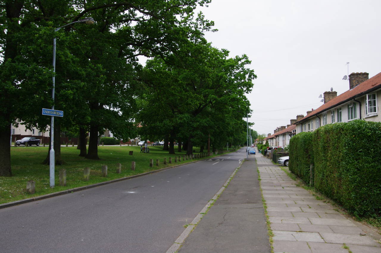
(2) Undershaw Road, Downham
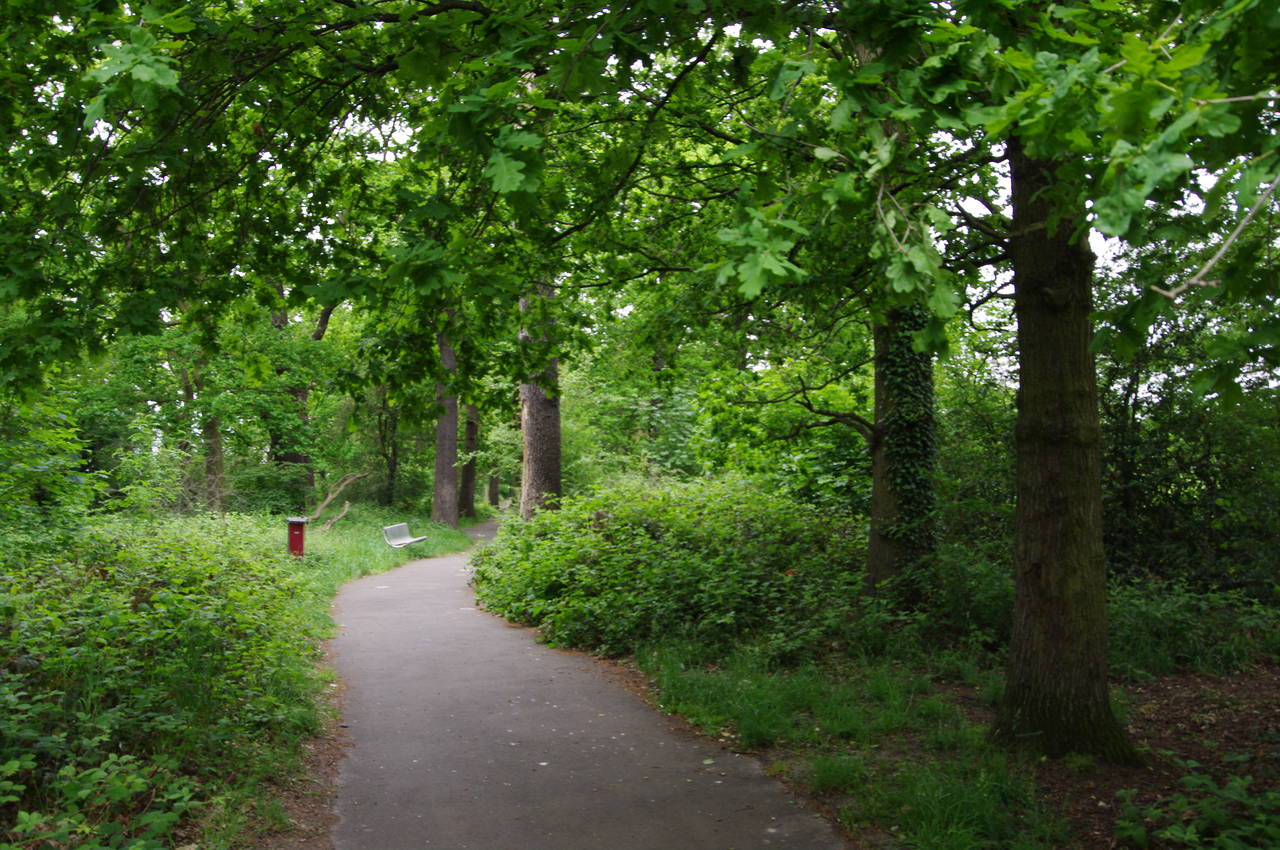
(3) Downham Woodland Walk

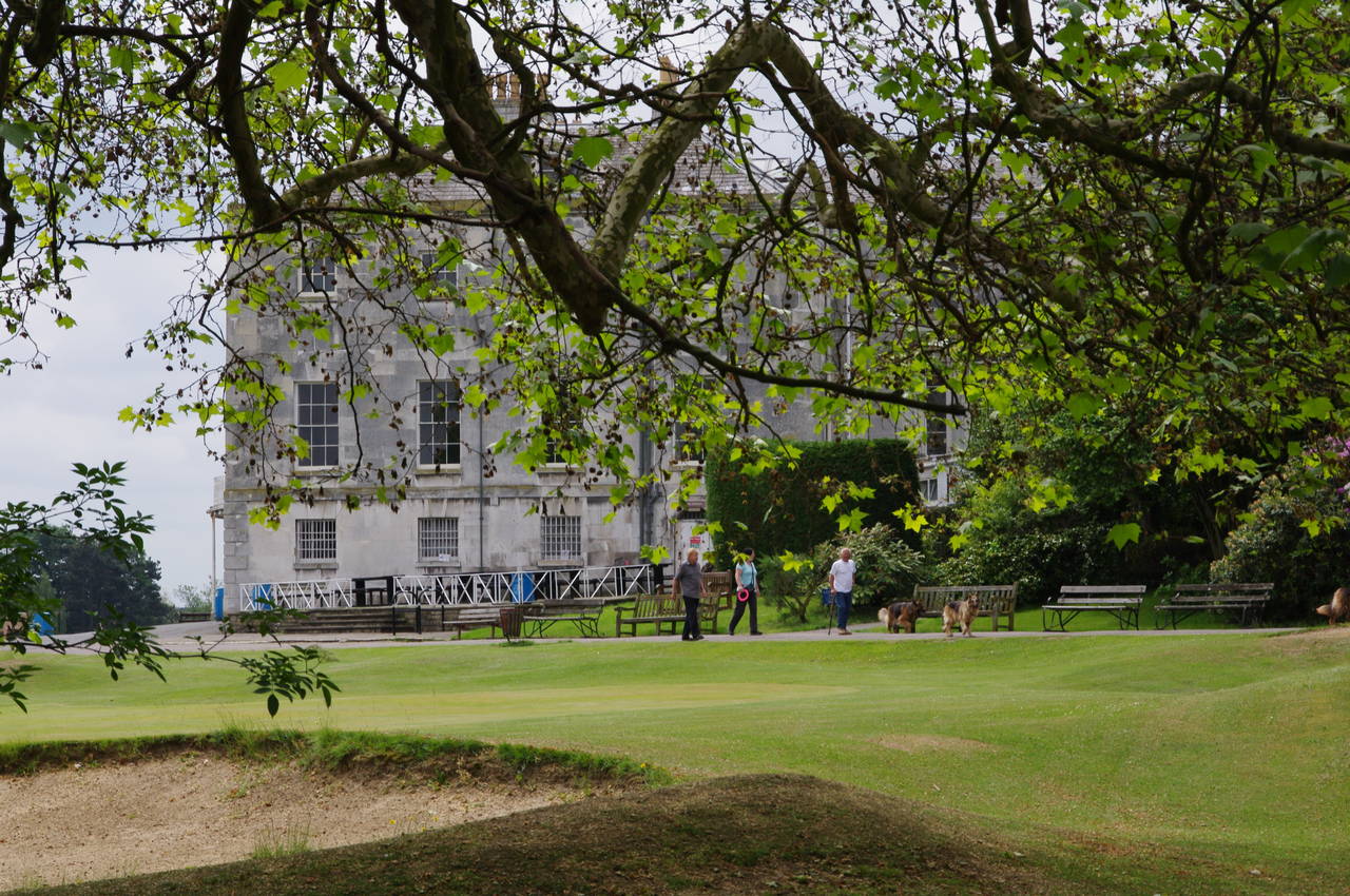
(4) Beckenham Place Park
Returning to Grove Park station, I retraced my steps of the previous evening to rejoin the Capital Ring at the main signpost on Marvels Lane, in the London borough of Lewisham, just before ten on a rather overcast morning.
I set off in a north-westerly direction along Marvels Lane, which soon bends left then right before the Capital Ring turns left onto Coopers Lane. In about 200 metres, at the far end of the street, the route turns right along Baring Road, crossing over at the second pedestrian refuge and then joining a concrete path between houses which is signposted as "Railway Children Walk", named after a well-known children's book written in 1905 by Edith Nesbitt, who lived nearby.
The path leads up to a footbridge that crosses the main railway lane between London and the county of Kent (picture 1). In both directions along the line are large train depots and ahead on the right is the large Hither Green Cemetery. On the far side of the railway line, a tarmac path leads to Reigate Road which is followed ahead across Northover and into Whitefoot Lane. After 150 metres, the Capital Ring turns left into Woodbank Road, which is divided into two by a pleasant narrow park. The Capital Ring takes the third street on the right, Undershaw Road, which is similarly divided from Shaw Road (picture 2).
At the far end of Undershaw Road, the route continues ahead across Moorside Road and onto the Downham Woodland Walk (picture 3), a path that runs for about one and a half kilometres along the middle of a Z-shaped strip of woodland in an otherwise densely suburban area. This woodland is one of the handful of remaining fragments of the vast Great North Wood that once covered much of what is now south-east London. Looking at how narrow the strip of woodland appears on the map, it's hard to believe how sheltered and full of birds and other wildlife it is. I saw a number of grey squirrels scurrying through the undergrowth but none would stay still long enough for me to get a decent picture. Three minor roads are crossed along the length of the Woodland Walk, but these do little to detract from the peacefulness of this section of the Capital Ring.
The Capital Ring eventually returns to the urban environment at the junction of Oakridge Road and the A21 Bromley Road, using a nearby zebra crossing to cross the busy main road before bearing left along Old Bromley Road. After about 200 metres, just before the road bends left, the Capital Ring turns right into Beckenham Place Park, following a tarmac footpath along the right edge of the park and across a little bridge over the River Ravensbourne (picture 4), a minor tributary of the Thames.
(5) Beckenham Place
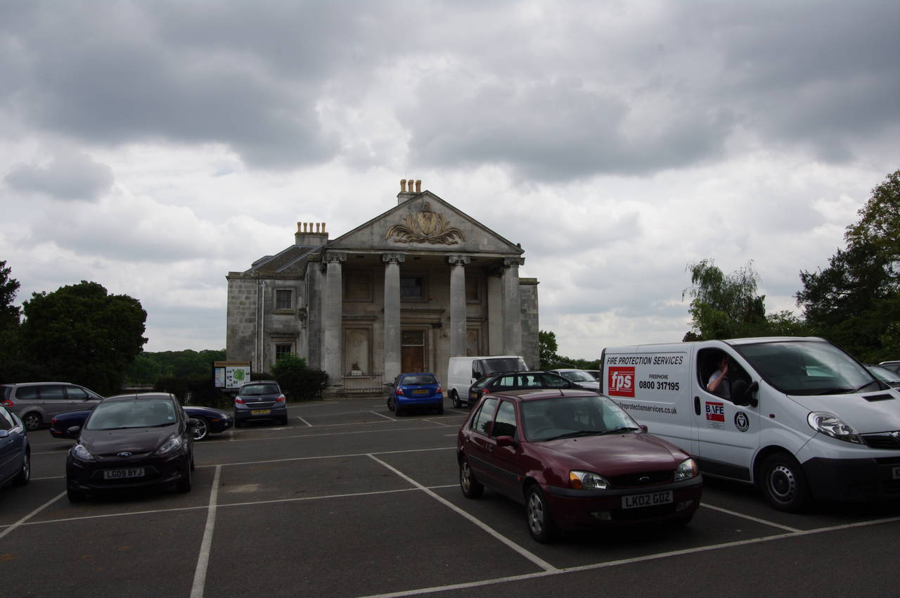
(6) Beckenham Place

(7) Kent County Cricket Club

(8) Cator Park
One hundred metres further along the edge of the park, the Capital Ring turns left and crosses a bridge above a railway line. The tarmac soon ends and a well-signposted earth path winds its way through the edge of woodland next to the Beckenham Place Park golf course. Reaching a main signpost after climbing a long series of steps, the path turns sharply right through more woods before gradually curving left on a long but gentle climb up towards the large former mansion, Beckenham Place, that is now the clubhouse for the golf course (picture 5).
The Capital Ring turns right just before the mansion, then left along the opposite edge of the carpark from the grand portico of the house (picture 6), soon turning right to follow a tarmac path through the small Stumpshill Wood to reach the A2015 Southend Road and the beginning of one of the longer stretches of road walking on the Captial Ring. Heading left along the road, the Capital Ring crosses over at a pedestrian refuge before continuing a little further to a right turn down Stumps Hill Lane. Reaching the bottom of the road, the meaning of the name became apparent as I found myself standing opposite the gates of the Kent County Cricket Club (picture 7).
The Capital Ring turns left here, following Worsley Bridge Road to its end then turning right along Brackley Road to its end and a left turn into the curiously named Copers Cope Road. The first street on the right, Park Road, takes the Capital Ring through a subway under New Beckenham Railway Station then briefly ahead on Lennard Road to a left turn into Kings Hall Road.
250 metres along the quiet street, a signpost points to the right along a path running between houses and into Cator Park (picture 8). The path through the park crosses two streams that merge a short distance to the right before eventually flowing into the Ravensbourne, which I crossed earlier in the walk, before the path reaches a main signpost in the middle of the park. Here the Capital Ring bears right, following the tarmac path to the corner of the park where it rejoins Lennard Road, heading left.

(9) Alexandra Recreation Ground

(10) Maitland Road
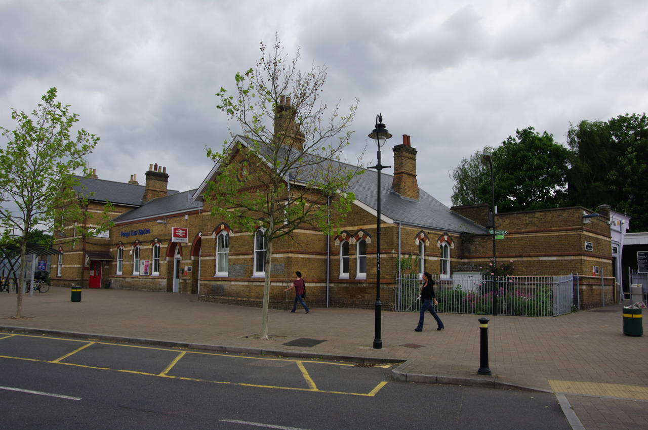
(11) Penge East Station

(12) Bridge House pub, Penge
The Capital Ring follows Lennard Road as far as a right turn into Kent House Road, following the latter for about 200 metres until a signpost on the left-hand pavement points along a narrow, fenced path between playing fields. This path passes by a small school before emerging to turn right on Cator Road. In around 250 metres, a path between houses on the left leads into the Alexandra Recreation Ground (picture 9). The Capital Ring follows a tarmac footpath down the left-hand side of the park before curving right beyond a bowling green then left again to leave the park and join Maitland Road, where a long row of terrace houses stands opposite a pleasant little park (picture 10).
At the end of Maitland Road, the Capital Ring encounters Lennard Road for the third and final time, following it to the right as far as a left turn into Penge East Railway Station (picture 11). After crossing the line via a footbridge at the station, the Capital Ring heads right along Station Road then left along Kingswood Road to reach Penge High Street. Crossing over and heading right along the High Street, I soon passed under a pair of railway bridges with the Bridge House pub hiding between them (picture 12). The first bridge carries the main railway line from London to Brighton, while the second carries a branch line to Crystal Palace Station.

(13) Crystal Palace Park

(14) Crystal Palace Park
(15) Crystal Palace Park
(16) Crystal Palace Park
Just beyond the railway bridges the Capital Ring crosses Thicket Road and bears left to enter Crystal Palace Park, passing a carpark to reach a main signpost at the beginning of the park's central avenue (picture 13). The park was part of Penge Common until 1854, when it became the new site of the Crystal Palace, a giant 92,000 square-metre exhbition hall built of glass and iron for the Great Exhibition of 1851 which was held in Hyde Park. The palace was relocated to the far side of Crystal Palace Park, where it stood until it was destroyed on 30 November 1936 in a fire so spectacular it was said to be visible from eight counties and that 100,000 people came to the area to watch.
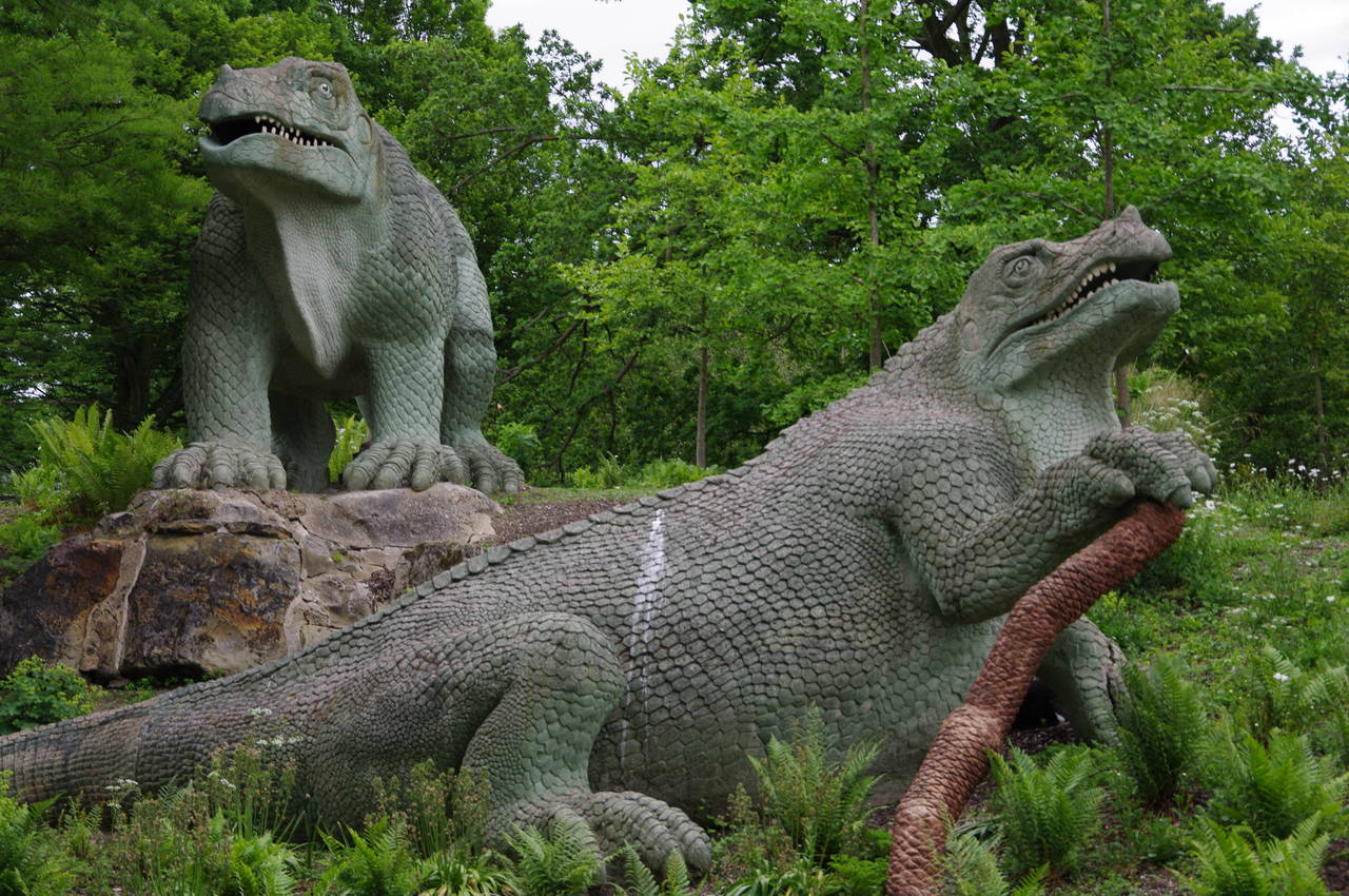
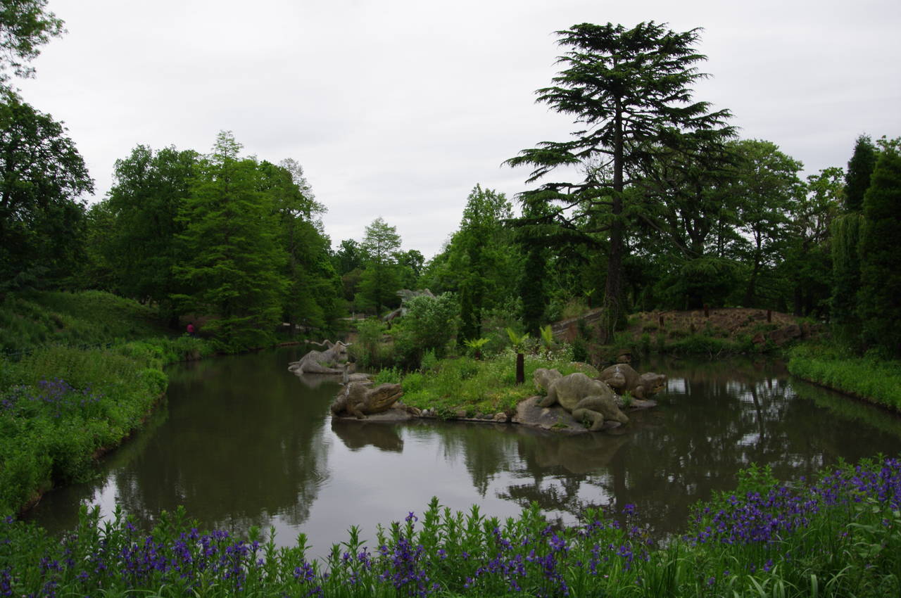
From the main signpost, the Capital Ring ignores the park's central avenue and instead bears left, passing a café before entering the park's Dinosaur Area. A well-signposted route follows winding paths among a series of ponds where several dozen large sculptures of dinosaurs and other pre-historic animals can be found (pictures 14, 15 and 16).

(17) Crystal Palace Station

(18) Crystal Palace Transmitter

(19) Westow Park, Norwood
(20) Upper Norwood Recreation Ground
Eventually the path leaves the Dinosaur Area next to the Crystal Palace Athletics Stadium and follows a path around to Crystal Palace Railway Station (picture 17). Across the park to the right stands the 219-metre high Crystal Palace Transmitter Tower (picture 18), one of the tallest structures in London, which carries most of London's TV and radio channels.
Turning left through the station concourse and then ahead down the short access road, the Capital Ring reaches Anerley Hill, crossing over at lights on the left then heading right across Palace Road then left into Pleydell Avenue. After bending right then left, the road ends at a cul-de-sac and the Capital Ring follows a steep footpath past a playground to reach Belvedere Raod. Turning right, this is followed to a left turn into Tudor Road and at the far end of that is a right turn into Fox Hill, which soon comes up to a T-junction with the A212 Church Road.
Here the path crosses at a refuge a short distance to the right and then goes straight ahead into Westow Park (picture 19), crossing from the borough of Bromley to the borough of Croydon and also entering the suburb of Norwood, named after the Great North Wood. A tarmac path leads downhill to a gate where, rather than leaving the park, the Capital Ring turns left and continues inside the park, bearing right when the path forks then passing by a playground to reach a road called College Green. A short distance to the right College Green reaches Harold Road, crossing over and heading left for a few metres to a right turn into Chevening Road, which runs alongside the Upper Norwood Recreation Ground.
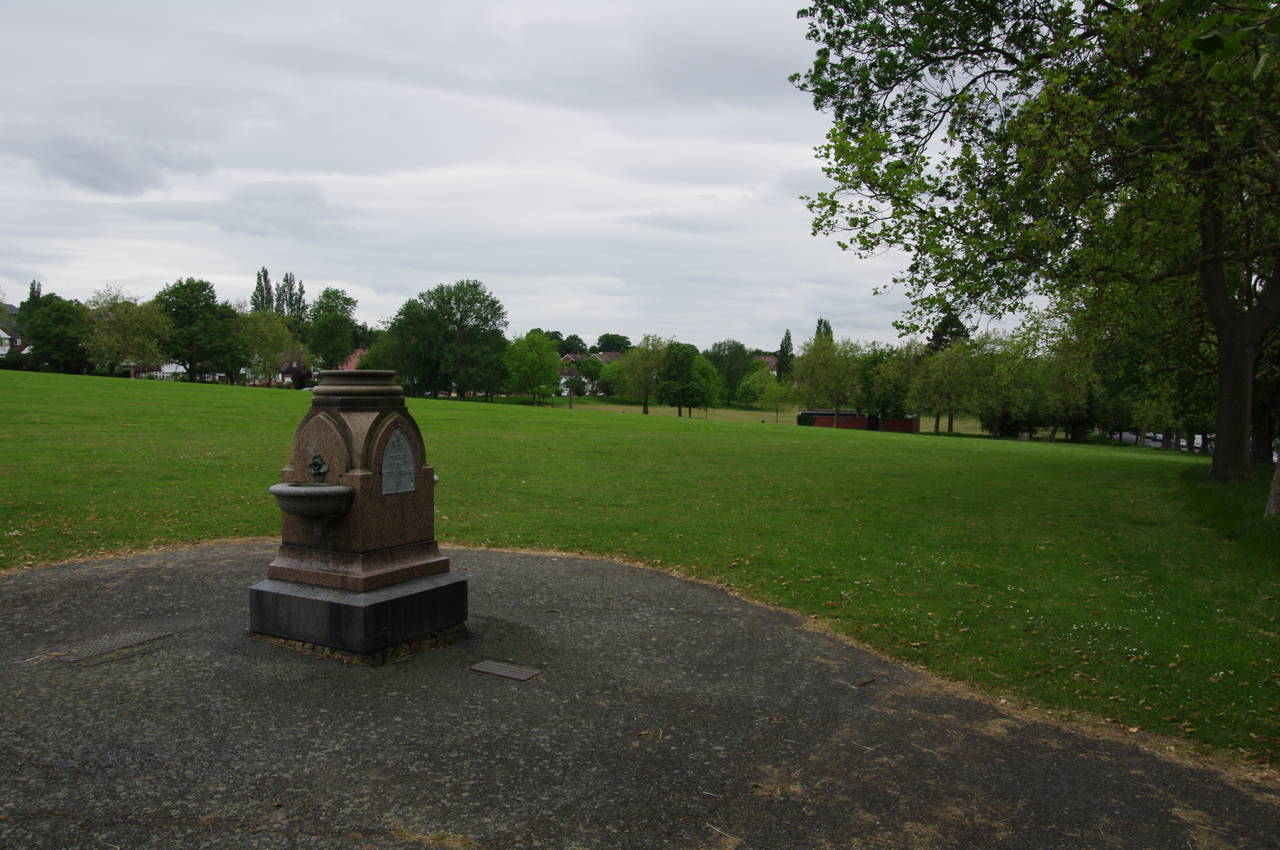
About 100 metres along the road a path enters the park, curving right to run parallel with the road, passing by a granite drinking fountain on which a plaque is dated 1891 (picture 20) before the path returns to the road. A little further along the road, another footpath cuts all the way across the park with the South Norwood Transmitter Tower, a backup for the Crystal Palace transmitter, visible over the ridge. On the far side of the park, the Capital Ring turns right along Eversley Road, then left up Hermitage Road to climb gently to the A215 Beulah Hill.

(21) View from Biggin Hill

(22) Biggin Wood
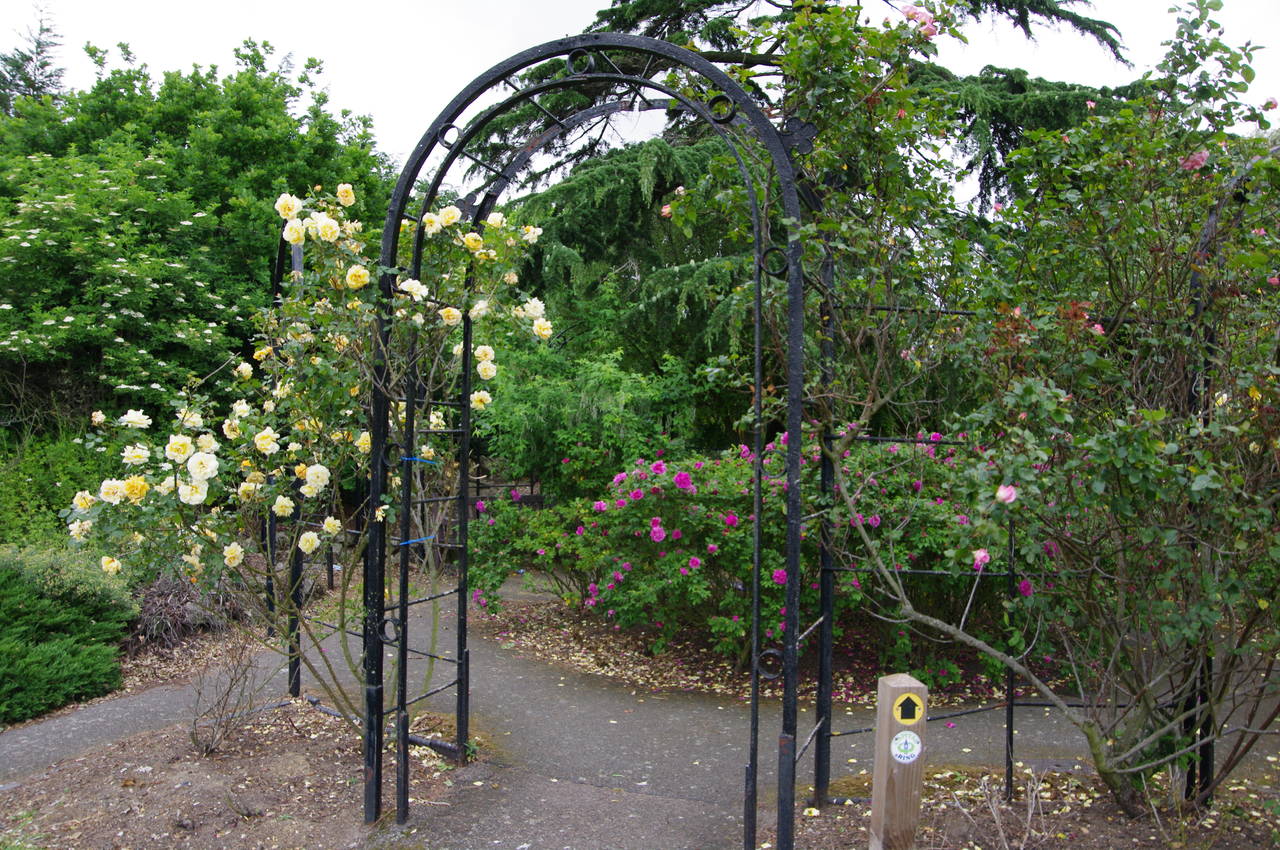
(23) Rose Garden, Norwood Grove
(24) Norwood Grove
The Capital Ring crosses over the main road and turns right, following it for around 500 metres before turning left down Biggin Hill. After passing half a dozen houses, a large area of allotments is laid out on the right while ahead is a good view over south London (picture 21). At the end of the allotments the Capital Ring turns right off the road and follows a path into Biggin Wood (picture 22), another fragment of the Great North Wood.
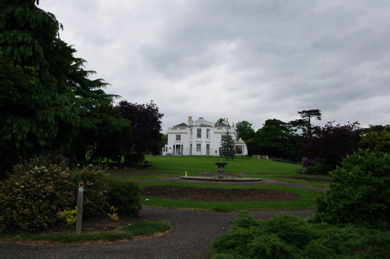
The path heads straight through the middle of the wood before emerging back into suburbia and continuing ahead on the residential Covington Way, crossing several perpendicular streets before arriving at a park on the right signposted as Norwood Grove. A tarmac path winds its way uphill through the park, passing through several pretty gardens (picture 23) on its circuitous route up to a large white house, also called Norwood Grove (picture 24).
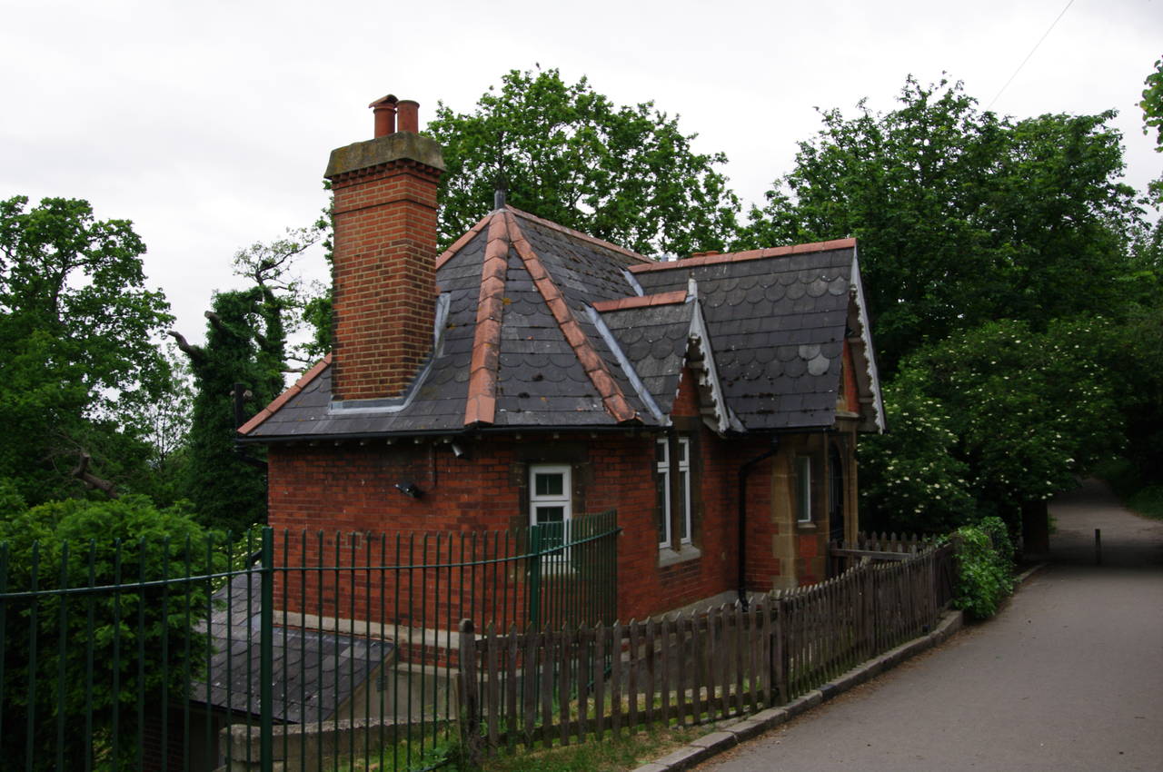
(25) Lodge by Copgate Path

(26) Streatham Common
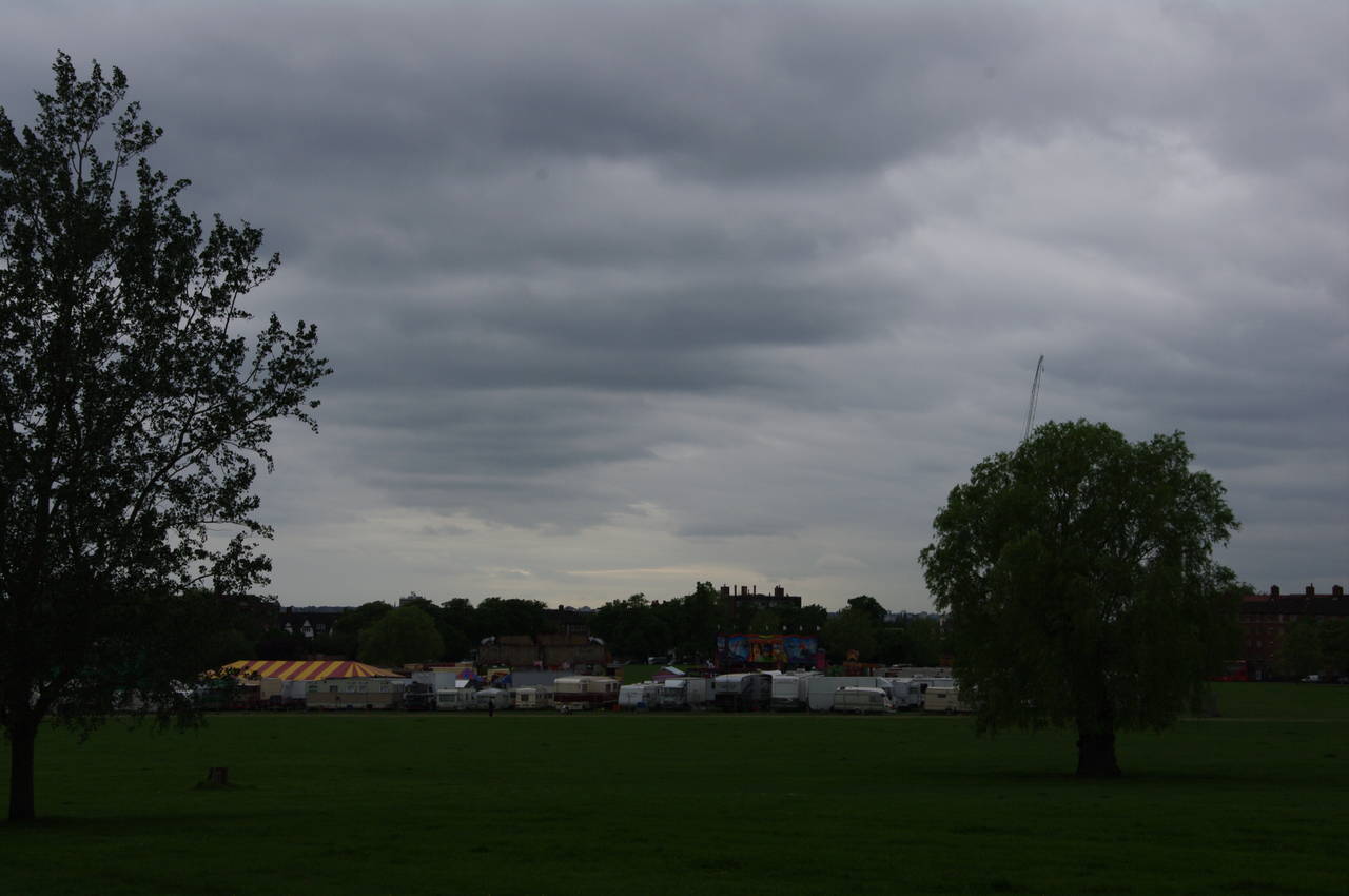
(27) Benson Family Funfair, Streatham Common
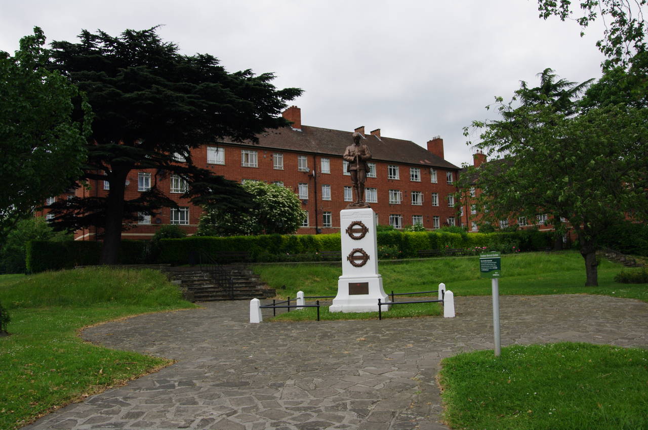
(28) Streatham Memorial Garden
Reaching the corner of the house, which looked a bit run-down on closer inspection, the path heads across the front terrace and then left around the side of the house to join the fenced Copgate Path, which leads gently downhill past a small brick lodge (picture 25) and across a small stream that marks the boundary between the London boroughs of Croydon and Lambeth. No longer fenced on the Lambeth side, the path continues ahead for about 200 metres before curving left past a carpark and a café to reach a main signpost by the road that skirts the southern edge of the large Streatham Common.
Crossing over the road, the Capital Ring follows a narrow footpath down the left-hand side of the common under a long line of trees (picture 26). Half way down the hill, I could see that much of the lower part of the common was fenced off and occupied by the many trucks, caravans and tents of the Benson Family Funfair (picture 27), though this did not obstruct the route of the Capital Ring. Not quite reaching the end of the common, the Capital Ring forks right, cutting off the corner of the common then bearing right again on reaching the Streatham High Road.
A short distance ahead the path crosses the end of the A214 Streatham Common North to reach the Streatham Memorial Garden (picture 28), which was established in 1922 and commemorates the dead of the two world wars. Here I left the Capital Ring for the day, having completed a further 19.2km, and continued ahead another 300 metres along the High Road to Streatham Station, where I only had to wait a couple of minutes for a train back to central London for an evening pub walk.