OFFA'S DYKE PATH NATIONAL TRAIL
Stage 10: Trefonen to Trevor
Wednesday, September 4, 2019

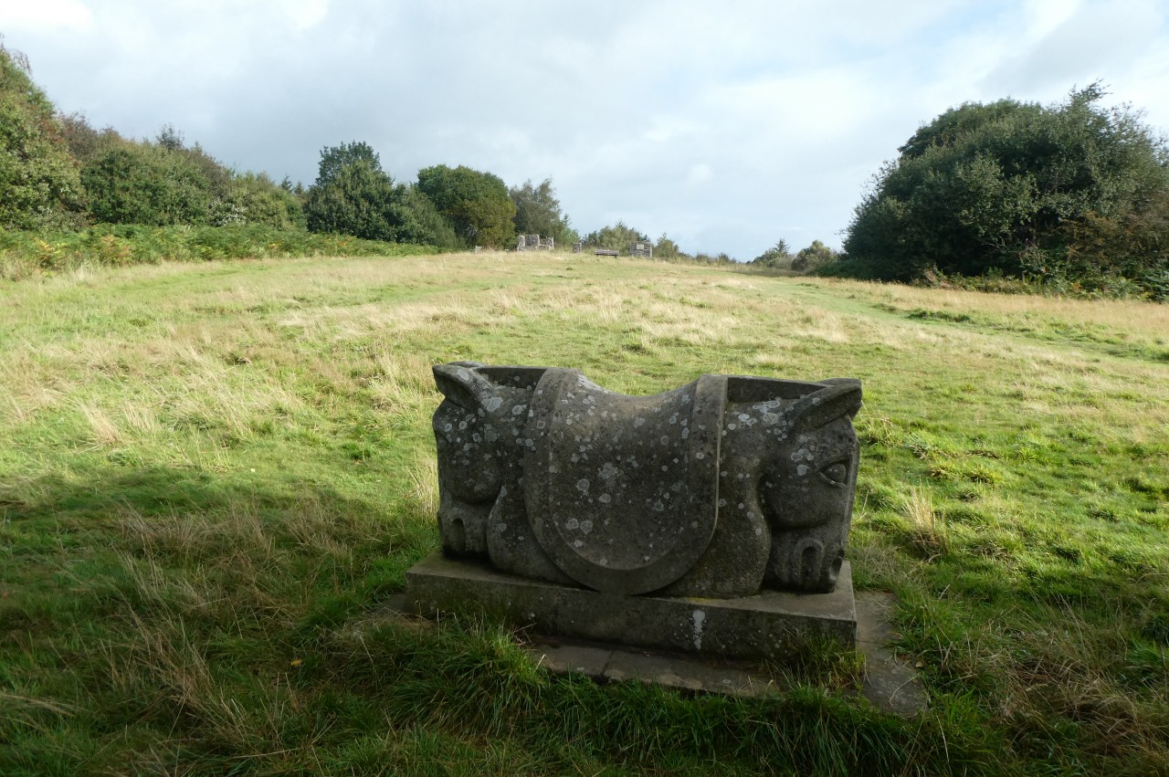
(1) Parish Church of All Saints, Trefonen

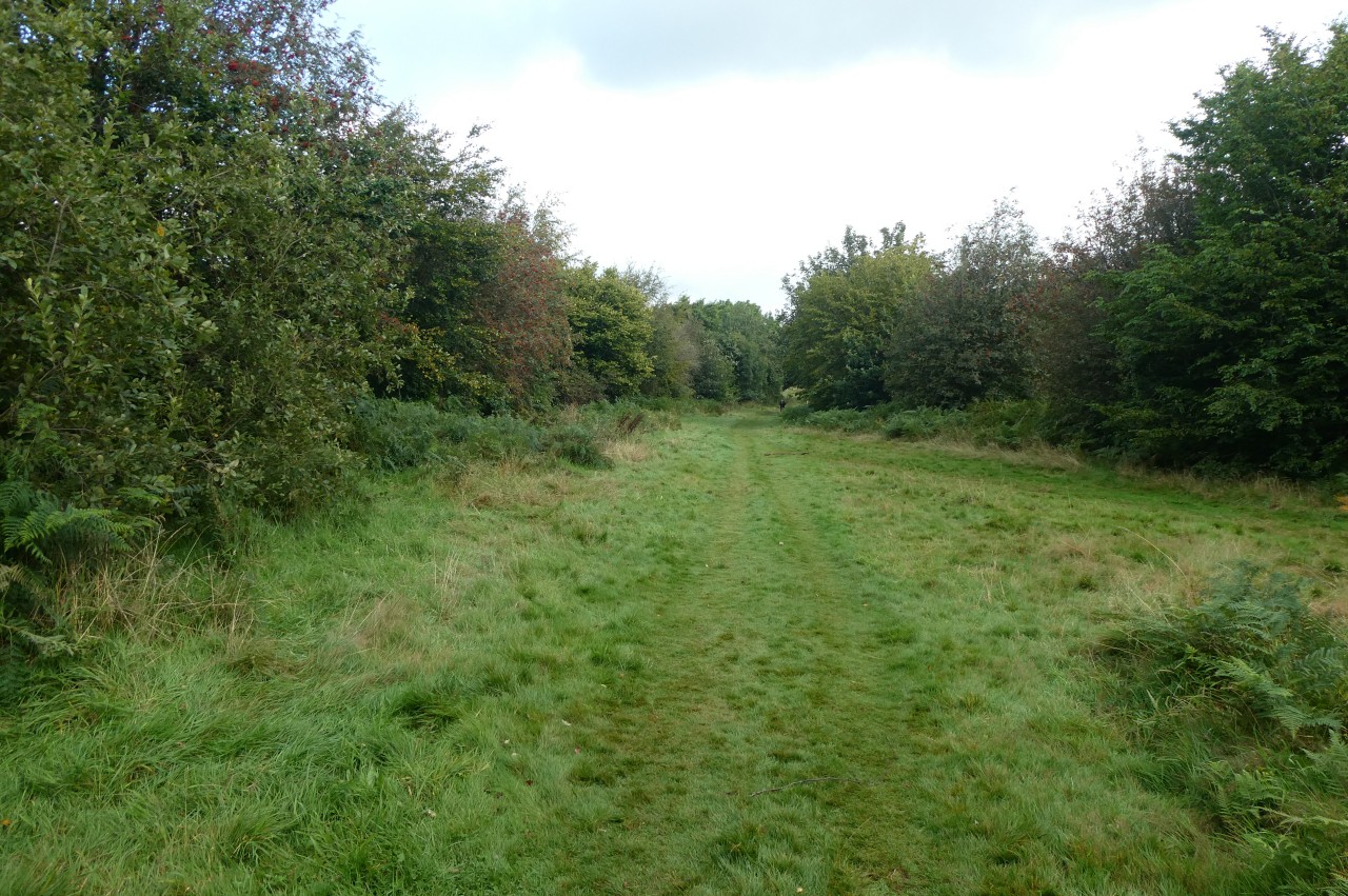
(2) Path beside Offa's Dyke
(3) Crossing the River Morda
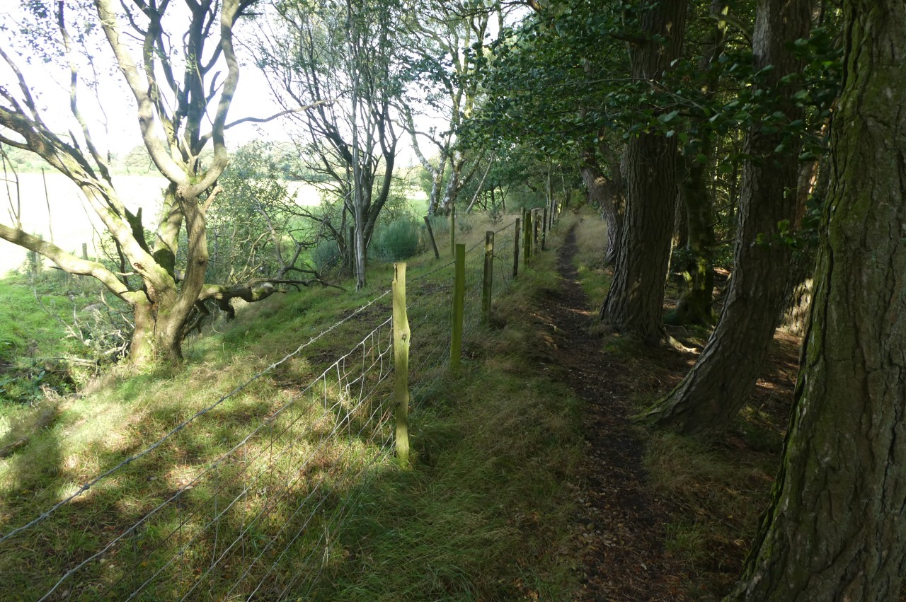
(4) Candy Wood
After ten weeks away, I returned to England to complete my walk along Offa's Dyke Path. By some quirk of the train ticketing system, a first-class ticket from London to Gobowen was significantly cheaper than a standard-class ticket, so I ended up travelling a little more comfortably than I had expected.
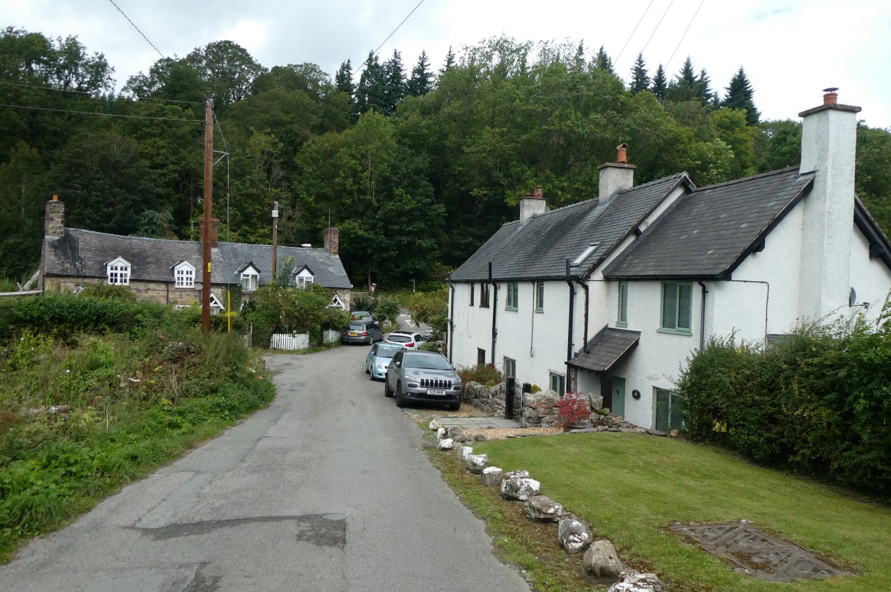
After a night in Oswestry, I departed early and trekked the four kilometres back along the road to the village of Trefonen, where I stopped for a rest on a handy bench in the churchyard of All Saints' Church (picture 1)
Past the Barley Mow Inn and up Bellan Lane, I rejoined Offa's Dyke Path at the foot of Malthouse Lane. Beyond a few houses, the lane forks and the Path goes straight ahead between the two lanes on a footpath enclosed by hedges then down a long driveway to cross Chapel Lane on the northern fringe of the village.
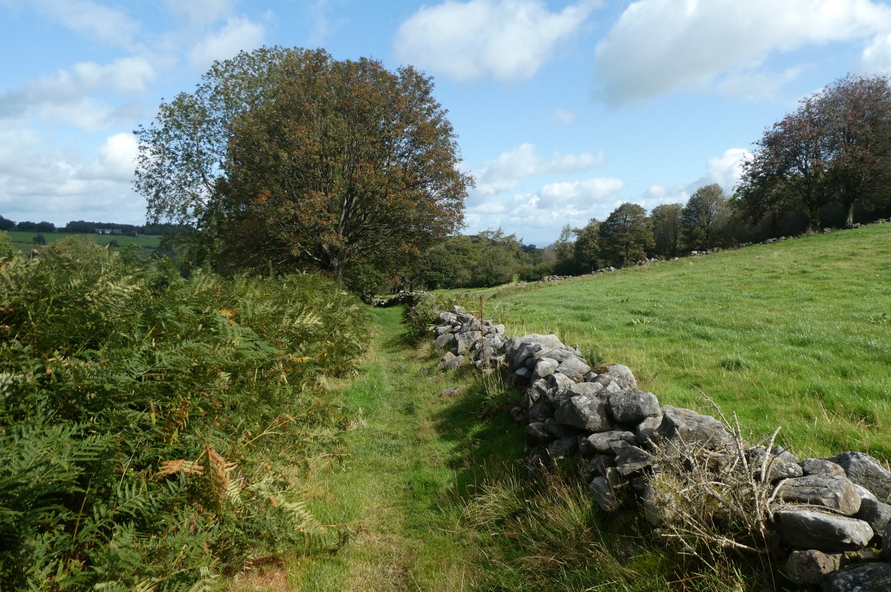
Across the road, the Path turns half-right through a wooden gate and crosses a meadow to meet Offa's Dyke by another gate. The Path turns left, ignoring the gate, and keeps the earthwork on its right as it runs along the edge of a field to a narrow lane. A few steps to the left, the Path enters another field and follows the Dyke part of the way up its right edge before a stile allows the Path to swap sides of the Dyke and run along the length of a narrow cow paddock (picture 2) to reach another minor road just to the right of a junction.
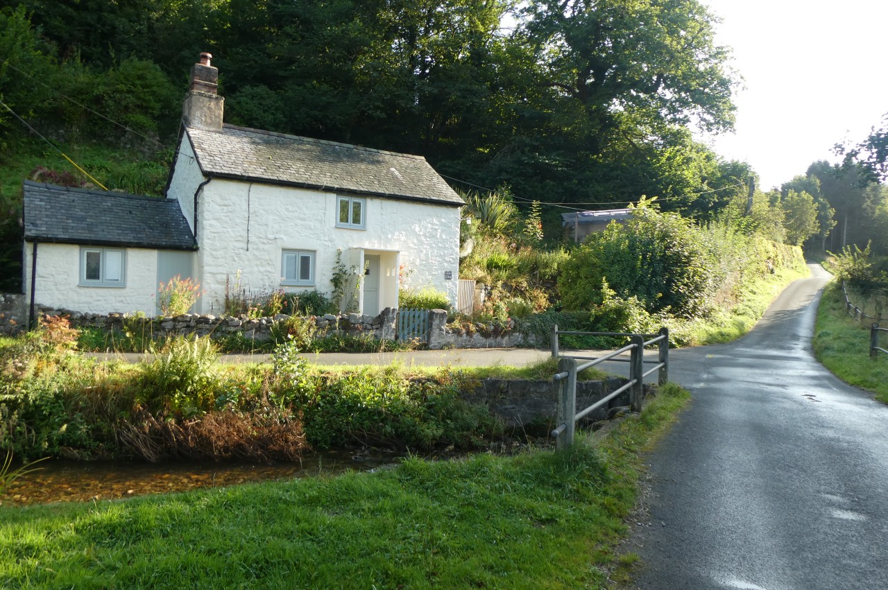
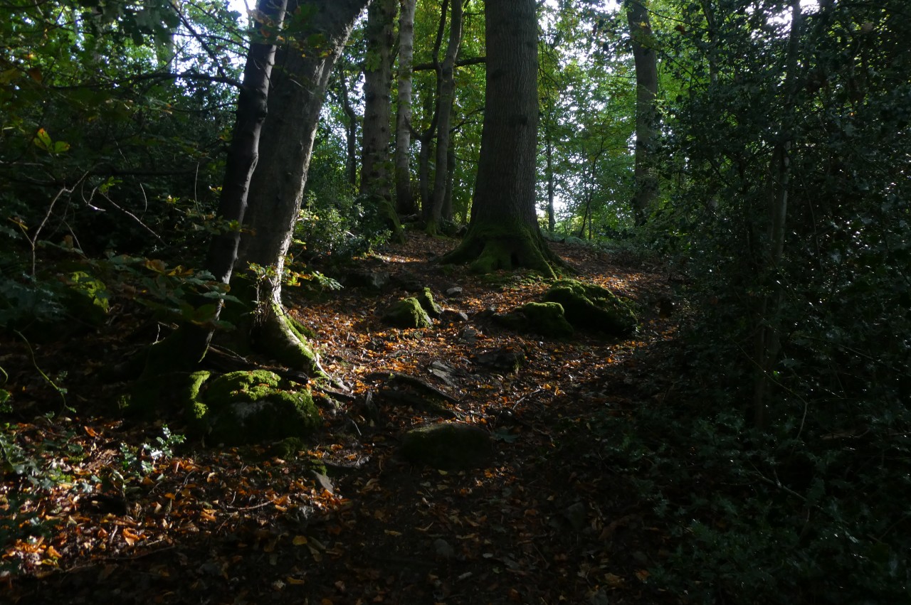
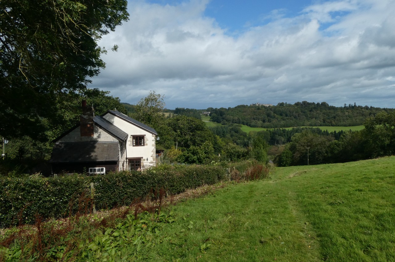
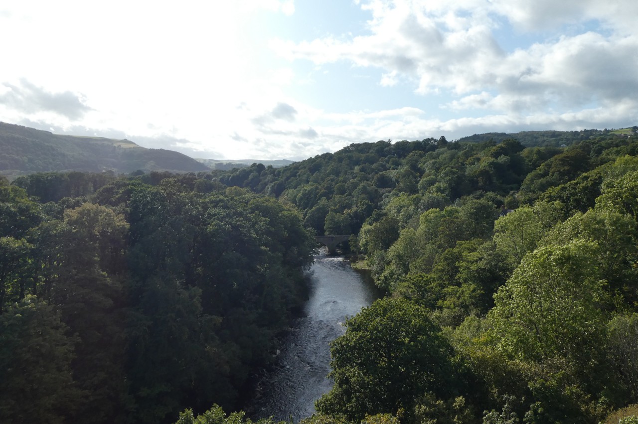
The Path turns onto a lane signposted for Candy, but instead of leading to a source of sweet treats the lane snakes down into the valley of the River Morda. At the next junction the Path turns right to cross the river, really just a trickling stream, then immediately left in front of a whitewashed stone cottage (picture 3) and along the drive of Glan-Yr-Afon. At the end of the driveway, beside the house, a footpath begins to climb through Candy Wood (picture 4).
(5) Offa's Dyke on Craig Forda
(6) Racecourse Wood
(7) Racecourse Common
(8) Racecourse Common
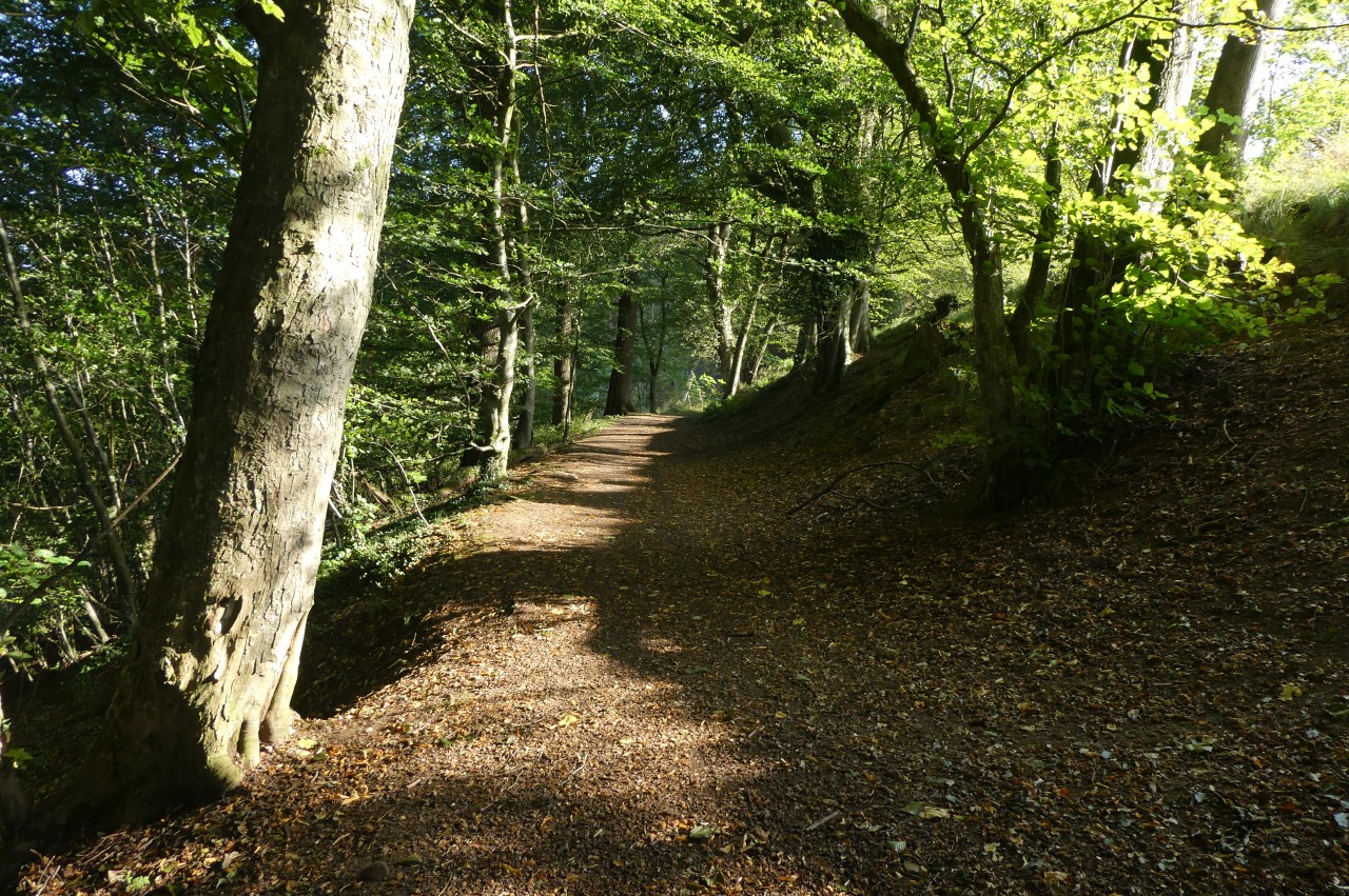
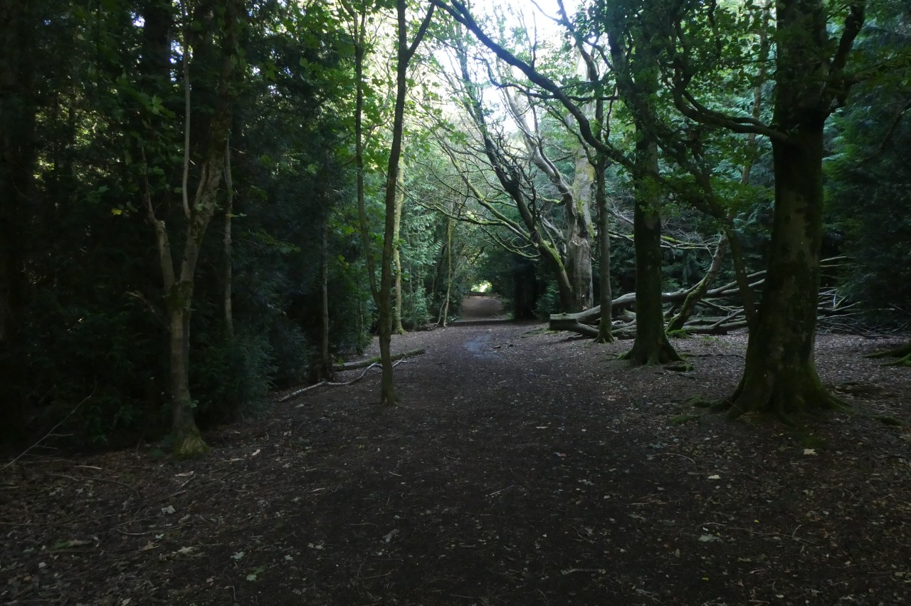
The Path rises through the wood to rejoin Offa's Dyke and follows it along the edge of the ridge of Craig Forda, mostly in the Dyke's ditch (picture 5). When a forestry track cuts through the Dyke at the boundary of Craig Forda and Racecourse Wood, the Path gets on top of a short stretch of the Dyke overlooking a bare hillside that had recently been cleared of plantation timber. Before long, the Path drops off the right side of the Dyke and climbs gently through the dark Racecourse Wood (picture 6) to emerge in the open on the plateau of Racecourse Common (picture 7).
The Common was the site of the Oswestry Racecourse from 1777 until the last race meeting in 1848 and the southern half of the figure-eight track is now common land. Offa's Dyke Path heads northward across the common, passing the remains of the old grandstand then following a broad path through tall scrub that is criss-crossed by numerous other tracks and paths (picture 8), eventually reaching the B4580.

(9) Descending to Carreg-y-Big Farm
(10) Path atop Offa's Dyke
(11) Approaching Selattyn Hill
(12) Selattyn Tower
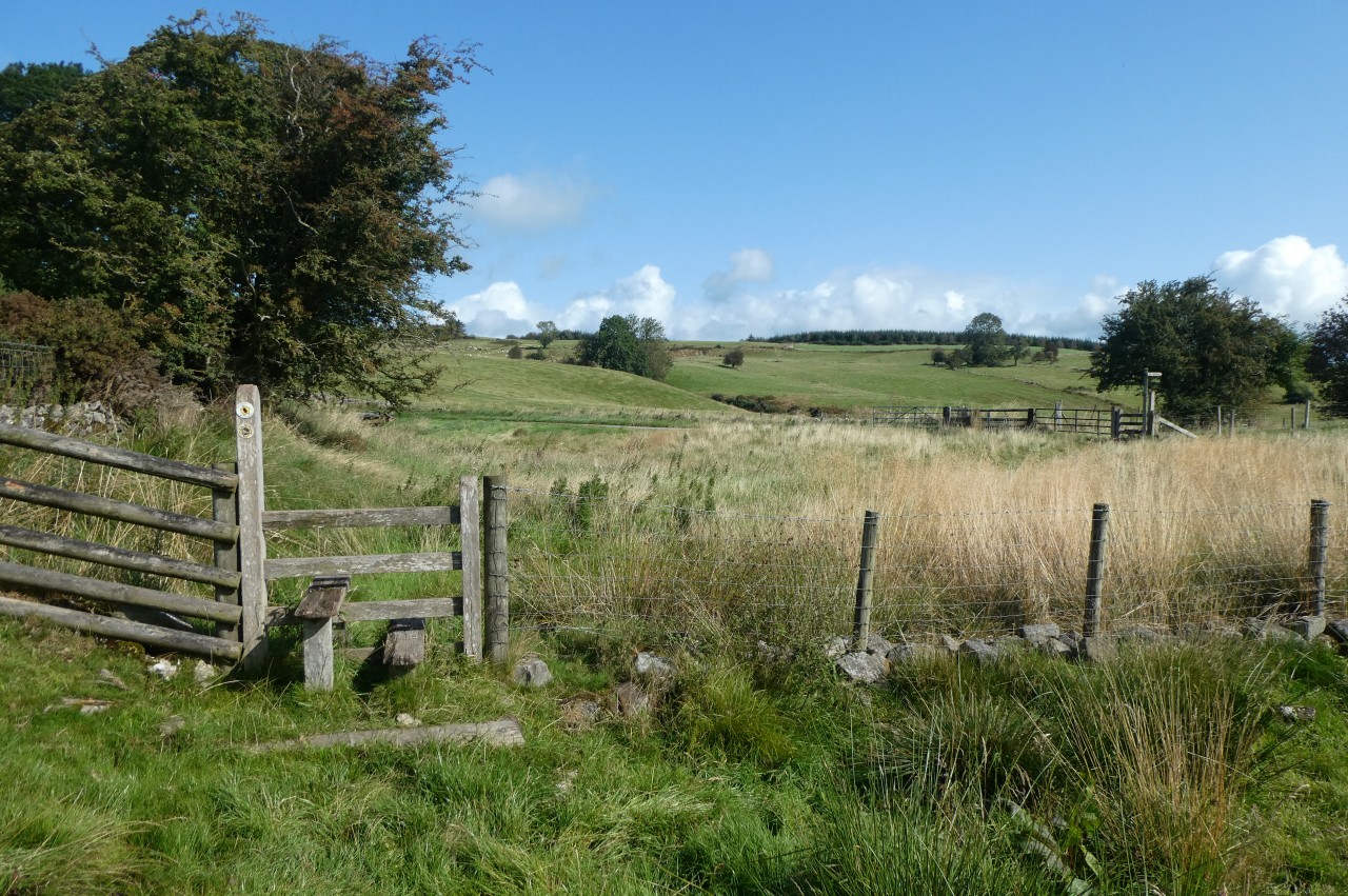
For the next one and a half kilometres, Offa's Dyke Path is on tarmac, traversing Baker's Hill on a quiet lane that eventually descends to a junction by Carreg-y-Big Farm (picture 9). The Path turns left at the junction and follows the road to a stile on the left a few paces beyond the next junction.
The Dyke resumes here and the Path follows it along the left edge of a couple of rough pastures before getting on top of the bank to run along the edge of a small wood (picture 10). Before long the Path is back in the grass to the right of the Dyke, following it over two more fields, across a wooded gully and over one more field that has a good view ahead to the large conifer plantation on the top of Selatyn Hill (picture 11). The Path leaves the Dyke for a while here, bearing right across the next meadow to meet the driveway of Orseddwen Farm.
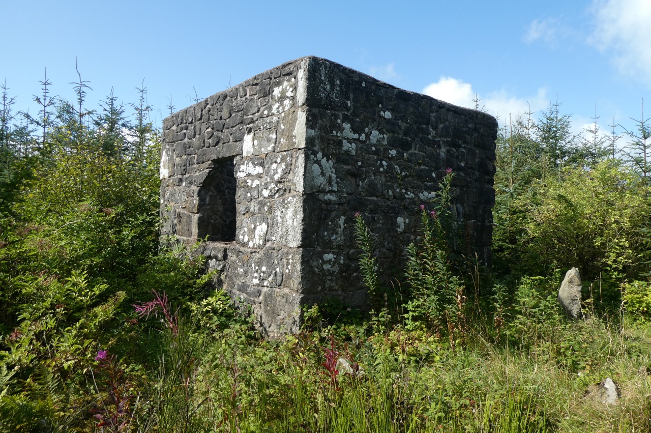
Fifty metres down the driveway, the Path turns off onto a farm track that follows a long wire fence up the hillside to the south-western corner of the plantation. From here I made a diversion off the Path, heading about five hundred metres eastward across the hill to visit the Selatyn Tower (picture 12).
The word "tower" is perhaps a little too grandiose to describe the roofless stone cube of about three metres per side. It was built in the centre of a large Bronze-Age ring cairn on the summit of Selatyn Hill in 1847, when the hilltop was covered in heather rather than the forestry plantation, which wasn't planted until the mid-20th century. Nobody knows whether the structure was just a Victorian folly or had some more mundane purpose. It was eventually put to a practical use in the Second World War, when the Home Guard used it as a lookout post for a large gun stationed nearby.
(13) Descending from Selattyn Hill

(14) View over Upper Craignant

(15) First view of Chirk Castle
(16) Descending past Croft Cottage
From the corner of the plantation, Offa's Dyke Path heads northwest across a pasture, turning right at a fingerpost to join a path heading downhill beside the remains of a stone wall (picture 13). Much of Selatyn Hill was once divided up by these walls, but most are now in a similar state to this one.
At the end of the wall, the Path continues ahead down a farm driveway that eventually descends through a wood to meet the B4579. Just ahead, the Path turns sharp left down a lane then sharp right by the gate of Thornhill. The lane ends beside the farmhouse of Yew Tree Farm and Offa's Dyke Path climbs ahead on an enclosed footpath to a lane, turning left for a little more than one hundred metres to a gate beside Offa's Dyke.
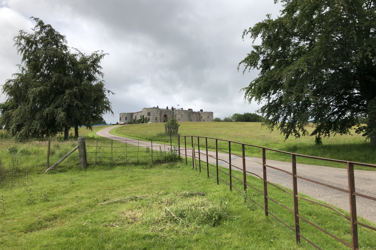
The Dyke forms the England-Wales border here and the path climbs steeply up two fields on the English side, overlooking Upper Craignant (picture 14). Across a lane, the Path gets back on top of the Dyke, which soon crests the hill, briefly gaining a view over Chirk Castle and the flat plain of northern Shropshire and southern Cheshire (picture 15) before the Path begins to descend into the valley of the River Ceiriog.
The Path drops off the Dyke again to cross a deep dell, with a footbridge in the bottom and around forty steps on each side, then climbs back up to cross a lane, beyond which the path soon gets back atop the Dyke. There are several thick tree trunks and many roots and badger holes on this part of the Dyke, so one must tread carefully.
When a rutted farm track cuts through a gap in the bank, the Path takes to the English side and descends the edge of a field past Croft Cottage (picture 16) to join a hedge-lined track that ends abruptly at a five-bar gate bearing a Private Property sign.
(17) Bronygarth
(18) Castle Mill

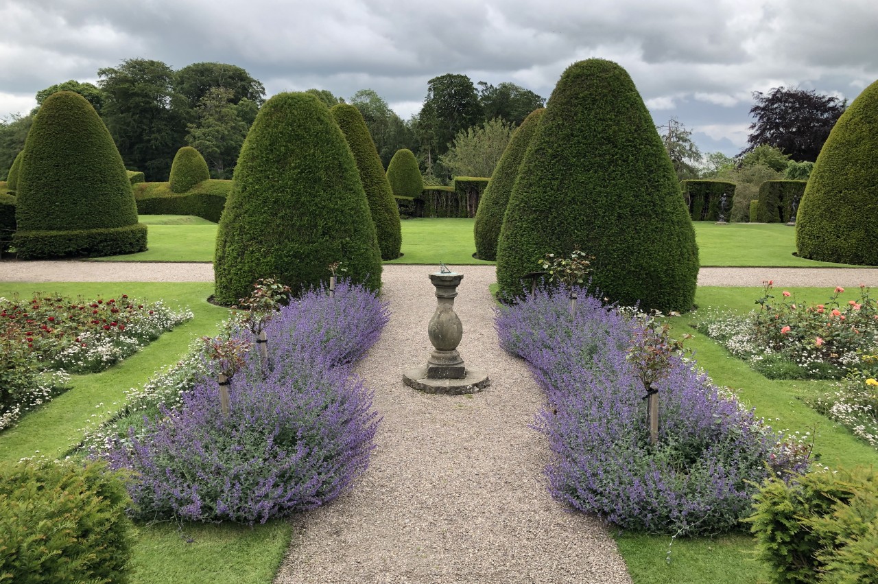
(19) Ceiriog Valley

(20) Climbing between Warren Wood and Mars Wood
A narrow and overgrown footpath to the left of the gate snakes down between houses to the main street of the small village of Bronygarth. The bulk of the village is to the left (picture 17), but Offa's Dyke Path goes ahead down a lane to cross a stone bridge over the River Ceiriog, leaving Shropshire and England for the last time to enter Wales and the Wrexham County Borough.
Just over the bridge, the hamlet of Castle Mill (picture 18), consisting of only three houses, stands by a junction with the B4500, which is the main road along the Ceiriog Valley.
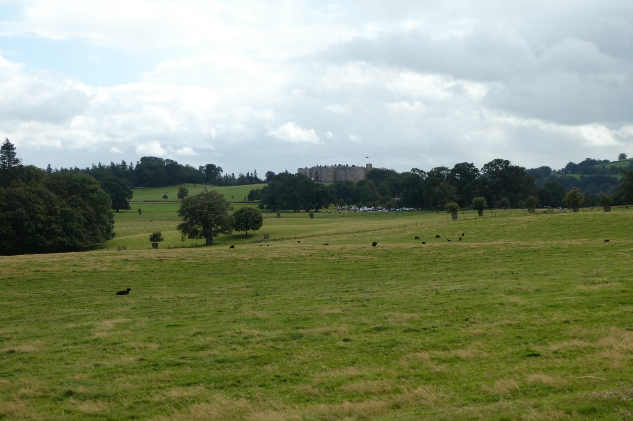
The Dyke climbs north-north-east up the side of the valley, passing through the grounds of Chirk Castle, a little to the west of the castle itself, which is only six hundred metres from Castle Mill. This is not the official route of Offa's Dyke Path, however, because the castle and its grounds are only open to the public from April to September. The official route instead circles around well to the west of the castle and the path alongside the Dyke can be used as a "permissive alternative route" when the castle is open.
On this walk I decided to stick with the official route, though I did walk the path through the castle grounds on the southbound leg of my journey.
Across the B4500 from Castle Mill, Offa's Dyke Path is signposted up a narrow lane that angles up the side of the valley, forking right at the large white farmhouse of Ty-Brickly and gaining a view across the Ceiriog Valley (picture 19) before bending right to pass Crogen Wladys, where the tarmac runs out and the lane becomes a stony track. When the track reaches a left-hand bend, the Path is signposted up stone steps on the right and into a meadow of pale grass to climb up the middle of the gap between Warren Wood on the left and Mars Wood on the right (picture 20).

(21) Descending to Rose Cottage
(22) View toward Chirk Castle
(23) View over Chirk

(24) Llangollen Canal
Over the saddle, the Path descends, aiming for a gate just to the left of Rose Cottage (picture 21). Turning right for a few paces then left, the Path follows a lane along the northern edge of the grounds of Chirk Castle. The castle itself now lies about a kilometre to the south across fields grazed by black sheep and black cattle (picture 22).
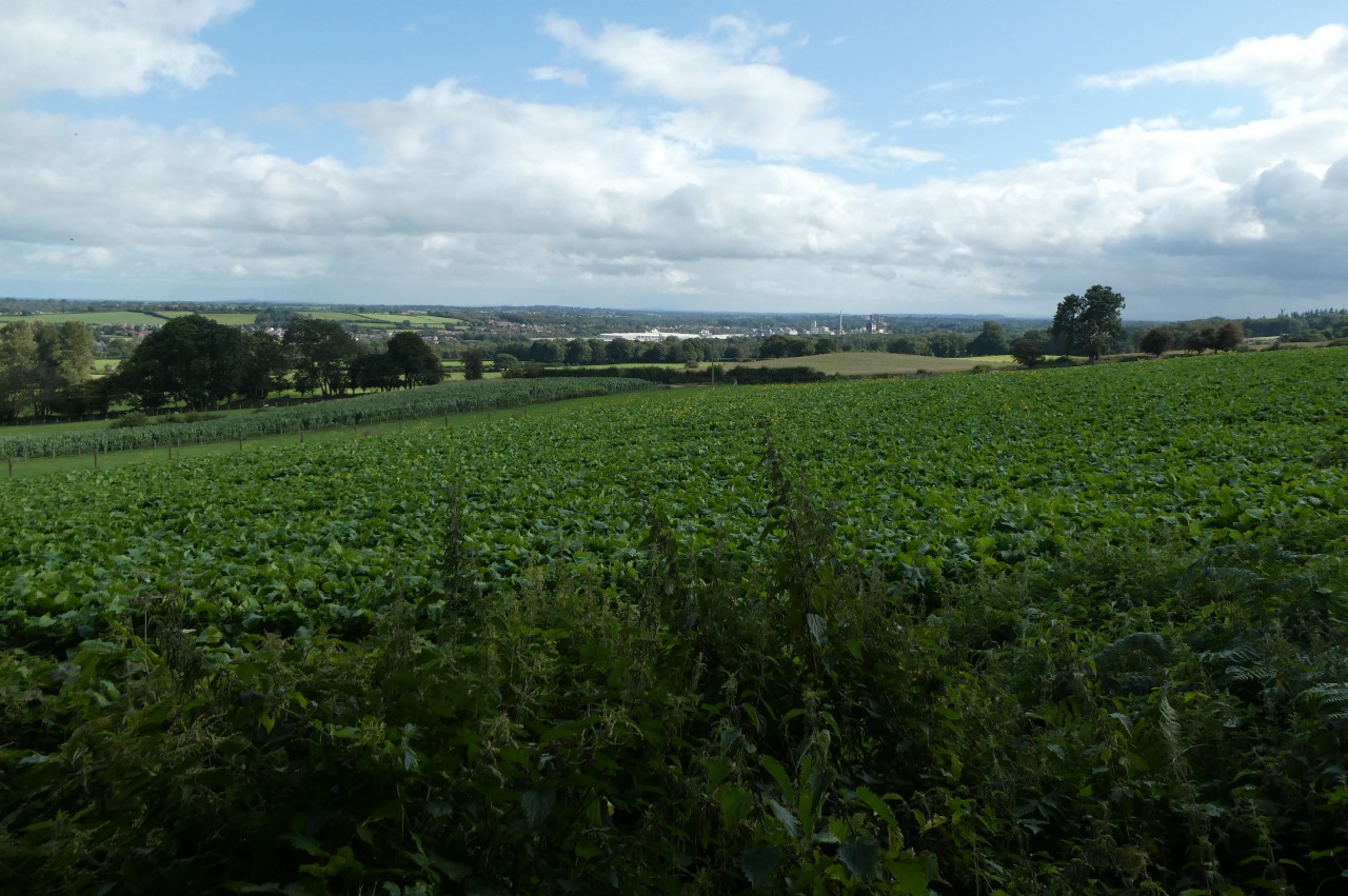
When the lane bends right, the Path goes through a gate on the left, heading diagonally across two fields to join another lane, Stryt Y Veri, by the farm buildings of Caeaugwynion. Turning left, the Path follows the lane for slightly more than a kilometre. At several points along this stretch of road walking, gaps in the hedges reveal the view to the right across farmland to the town of Chirk, which is dominated by a large and noisy particleboard factory (picture 23).
Beyond a lonely crossroads, the lane bends left then comes to a kissing gate on the right. A short footpath leads to a second gate, from which the Path descends to the opposite corner of a large pasture then follows the right edge of the next pasture up to steps beside the very busy A5, where I had to wait for what seemed like at least half an eternity to cross the road safely.
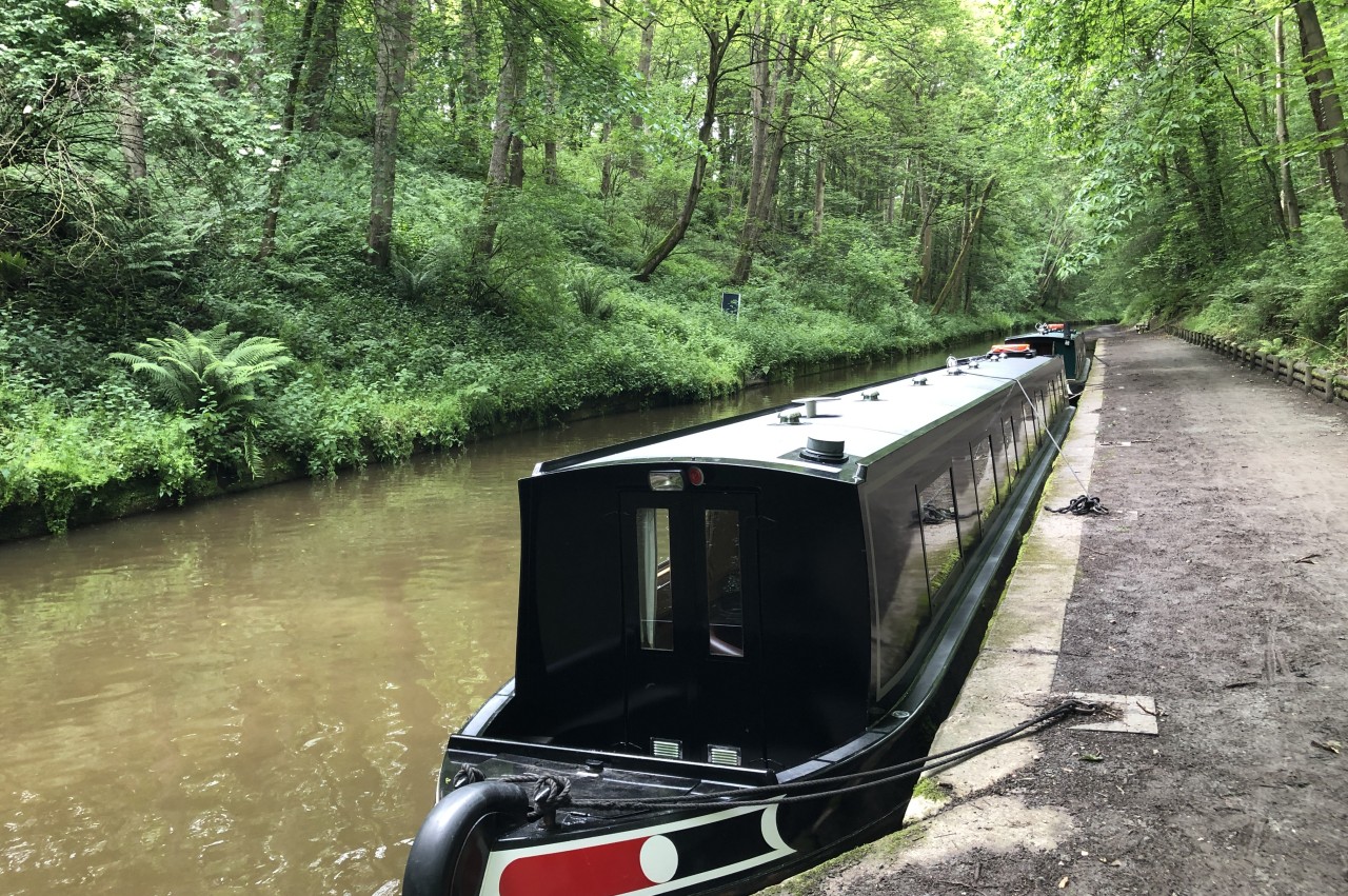
Forty metres to the right, a track climbs away from the road beside the Cloud Hill B&B and in the ditch of Offa's Dyke. At the top of the track, the Path continues downhill beside the Dyke, ignoring the first gate on the right, which is incorrectly shown as the route on the OS map. The correct route turns right across the Dyke into the next field down the hill, crossing it to reach the B5605 beside Irish Bridge, which spans the Llangollen Canal.
Turning left over the bridge and left again down a ramp, Offa's Dyke Path joins the wide tarmac towpath beside the canal (picture 24). Three hundred metres along the towpath, Offa's Dyke Path crosses the line of the Dyke at right-angles. This is the Path's very last encounter with the Dyke, which now heads off across the Dee Valley and through the industrial surrounds of Wrexham, where much of the earthwork has been destroyed by development.

(25) Lifting bridge at Froncysyllte

(26) Mining memorial
(27) Pontcysyllte Aqueduct

(28) View down the Dee Valley
The towpath is lined with shady trees for the next kilometre until it reaches the town of Froncysyllte, where a walker on Offa's Dyke Path must make a decision by the time they reach the footbridge and lifting bridge that cross the canal (picture 25). Those who don't enjoy heights should cross over with the main route of the National Trail, while those who don't mind heights can stay on this side on an alternative route visiting one of the engineering wonders of the Industrial Revolution. Or, if you are a completionist like me, you can do both.
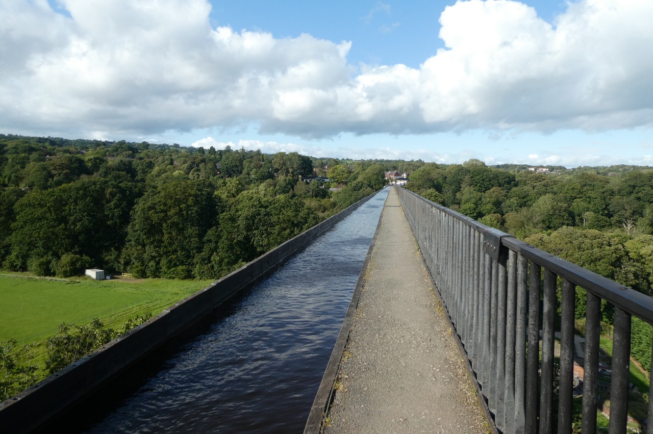
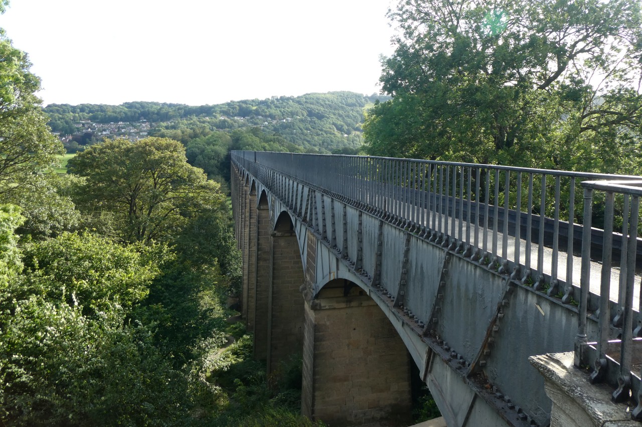
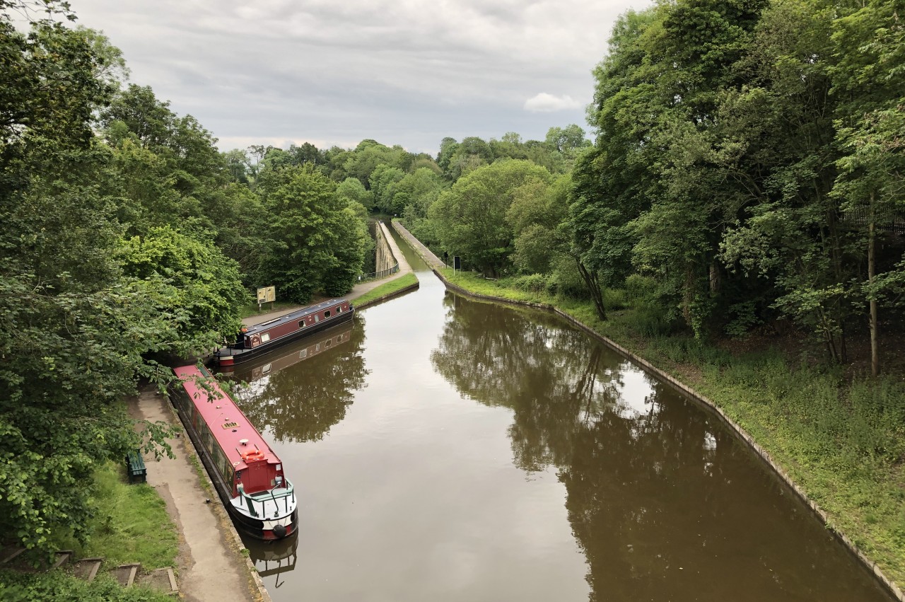
Today, it was the alternative route, which passes a small memorial to the Dee Valley's historic mining industry (picture 26) before following the towpath around a bend opposite Froncysyllte's old canal wharves. The next tree-lined stretch of the canal runs atop a long man-made bank to the southern end of Thomas Telford's magnificent Pontcysyllte Aqueduct (picture 27).
Nineteen arches carry the Llangollen Canal three hundred and seven metres across the Dee Valley, thirty nine metres above the level of the river. It is both the tallest navigable aqueduct in the world and the longest in Britain. This marvel of engineering took a decade to construct, opening in 1805. The aqueduct and the stretches of canal westward to Horseshoe Falls, near Berwyn, and south to Gledrid Bridge, near Chirk, form the Pontcysyllte Aqueduct and Canal World Heritage Site. This stretch of canal is itself a significant feat of engineering, plotting a lock-free course through hilly countryside and falling only fifty centimetres over a distance of eighteen kilometres.
From the narrow footpath across the aqueduct, one can gaze down the Dee Valley to the Traphont Cefn Mawr Railway Viaduct (picture 28), which crosses the valley a stone's throw from Irish Bridge, where the Path first joins the Llangollen Canal.
(29) River Dee
(30) Pontcysyllte Aqueduct
(31) Trevor Basin
(32) Alternate route rejoins main route
Towards the north end of the aqueduct, those not prone to vertigo can peer over the side with no handrail to view the tree-lined River Dee rushing under the aqueduct, thirty nine metres below (picture 29).
Stepping off the end of the aqueduct, one can get a good view of the aqueduct's revolutionary design, with tapering sandstone piers supporting cast-iron arches and a cast-iron trough (picture 30). This made the structure much lighter than one built entirely from stone or brick. This view also reveals that the canal is actually quite shallow, providing just enough depth of water for canal boats to move safely. Minimising the depth of the water, and therefore its weight, was important. Even so, the aqueduct has to support 1,500 tons of water in addition to the structure's own weight.
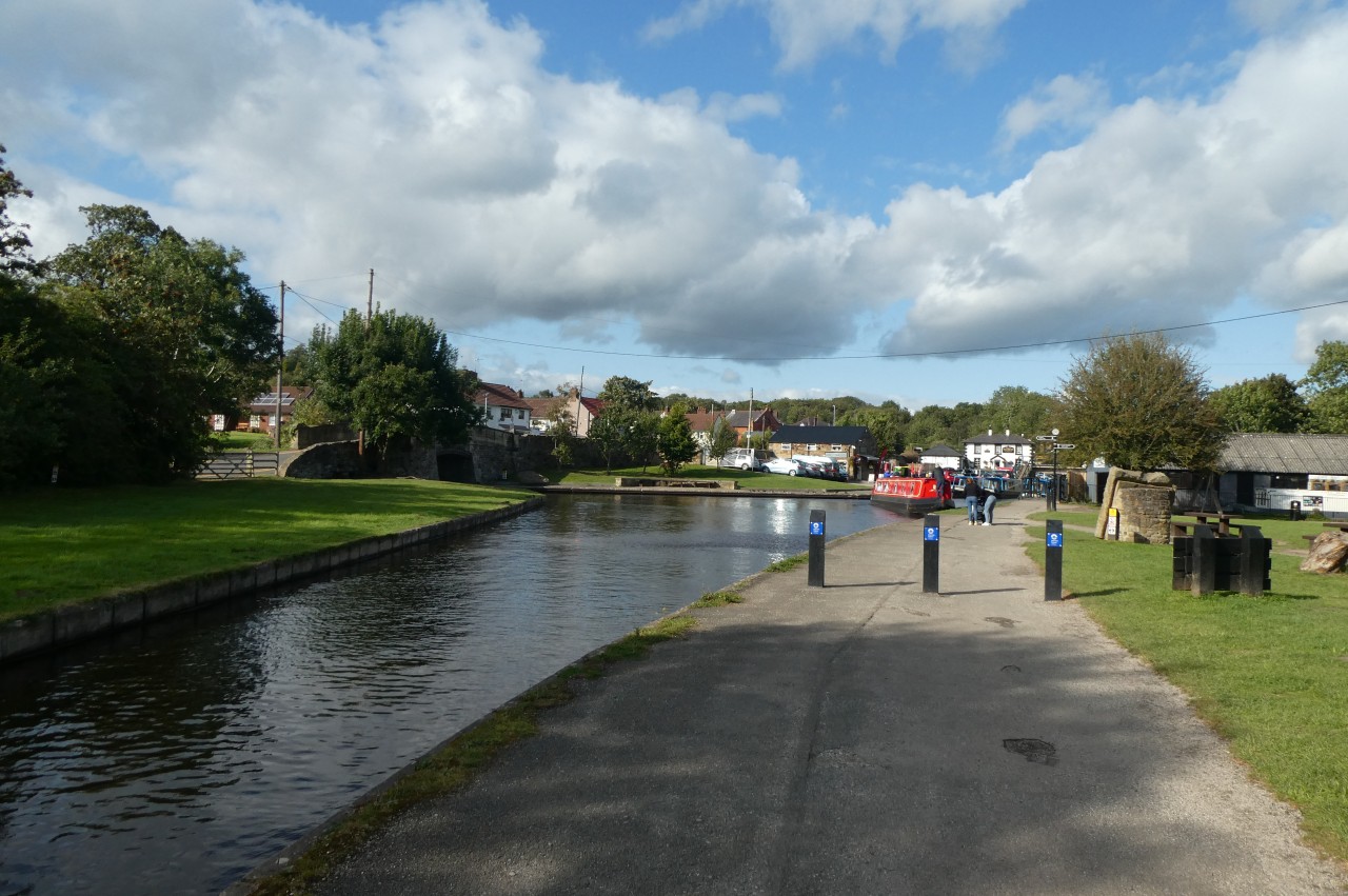
Just off the north end of the aqueduct is Trevor Basin (picture 31), where the Llangollen Canal turns westward. The basin was originally intended to be a major junction, from which another canal would have gone northward though Wrexham and Chester. That project was abandoned while the Llangollen Canal was still being constructed and only a three-hundred metre long dead-end branch was built. This now provides moorings for a few dozen narrowboats.
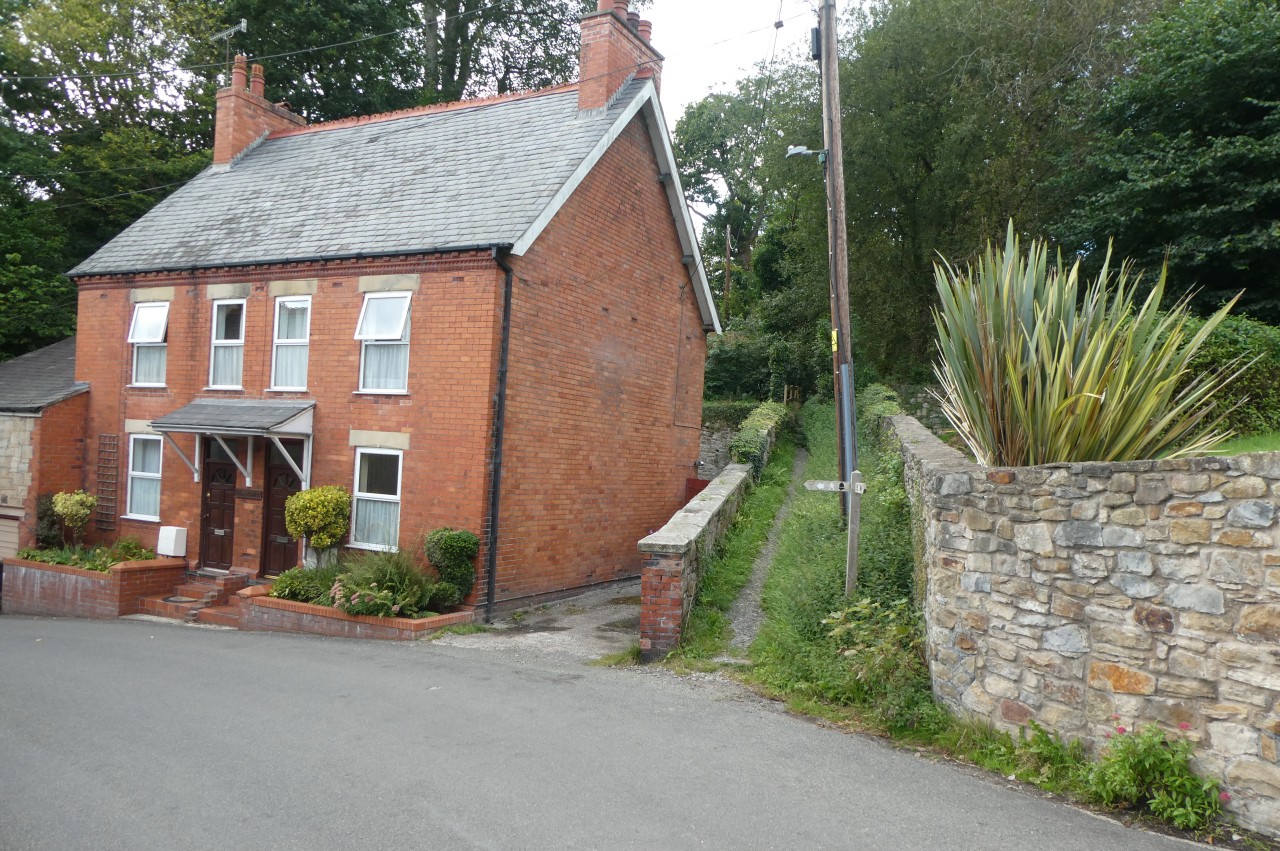
From the basin, the alternate route of Offa's Dyke Path circles round to the right to pass under the aqueduct and back up to the B5434 on the other side of the basin. Downhill to the left, the alternate route rejoins the main route where it turns up an enclosed path beside a pair of cottages (picture 32).
Having walked 23.7 kilometres from Trefonen, I left Offa's Dyke Path here and backtracked the short distance to Trevor Basin to have a quick look around the small Pontcysyllte Aqueduct Visitor Centre. A couple of minutes walk from the visitor centre, the Telford Inn provided a cozy and convenient dinner stop before I headed for my accommodation.
Addendum: Chirk, Tuesday, June 18, 2019
(33) Chirk Castle
(34) Chirk Castle
(35) Chirk Castle
(36) Long Gallery, Chirk Castle
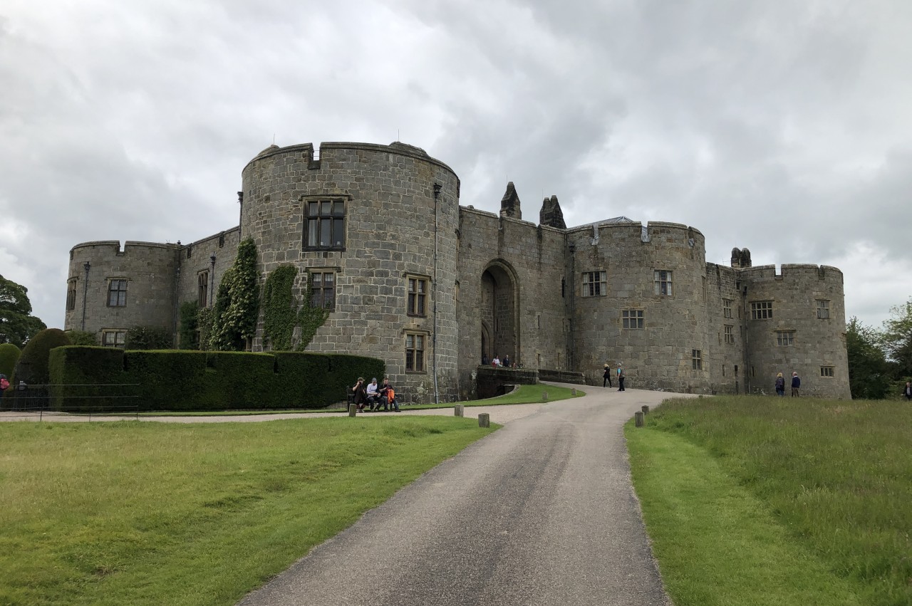
Back in June, while I was waiting in Shrewsbury for the saturated hills to dry out and the flooded River Severn to recede, I made a day-trip to Chirk on the train. From Chirk Station, there are two ways to walk to Chirk Castle, two kilometres to the west. I chose to walk to the castle via the more northerly route across open fields and return by the more wooded southerly route. The northerly route passes below the castle (picture 33) to reach the National Trust Visitor Centre and ticket office.
Chirk Castle is one of a chain of English strongholds built across North Wales during the reign of King Edward I to intimidate and subdue the rebellious Welsh. The main part of the castle, dating from 1295, consists of a courtyard surrounded by thick sandstone walls with five projecting drum towers allowing archers to defend every inch of the exterior (picture 34).
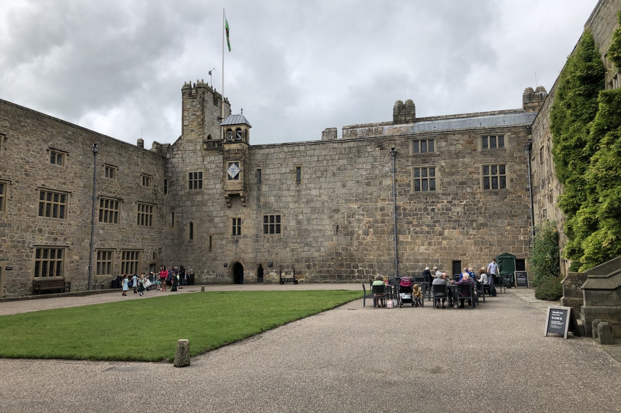
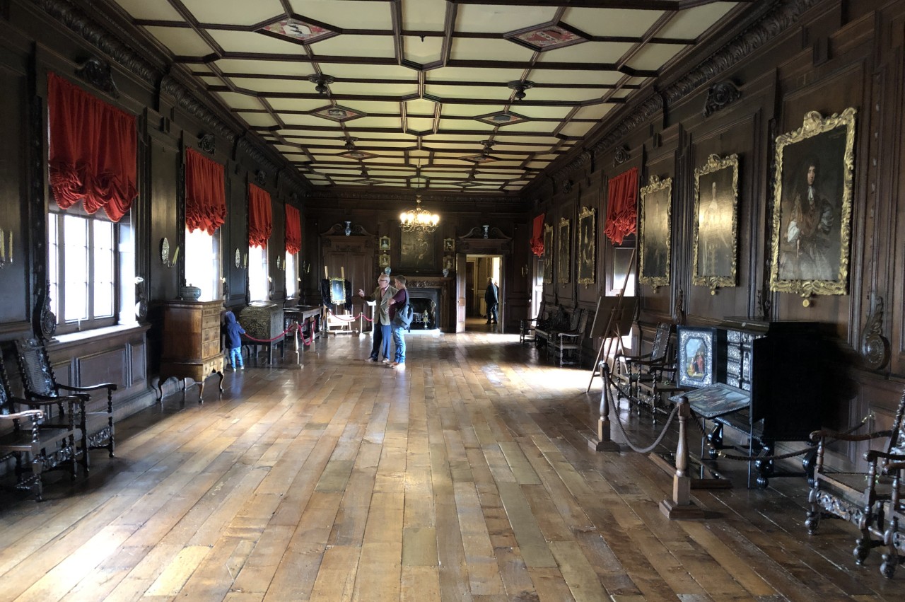
The internal courtyard, with it's ornate 17th-century clock tower (picture 35), gives access to the castle's many rooms, as well as the cold and somewhat spooky dungeon. The most impressive room is the thirty-metre Long Gallery (picture 36), created in the 1670s.
(37) Pleasure Ground
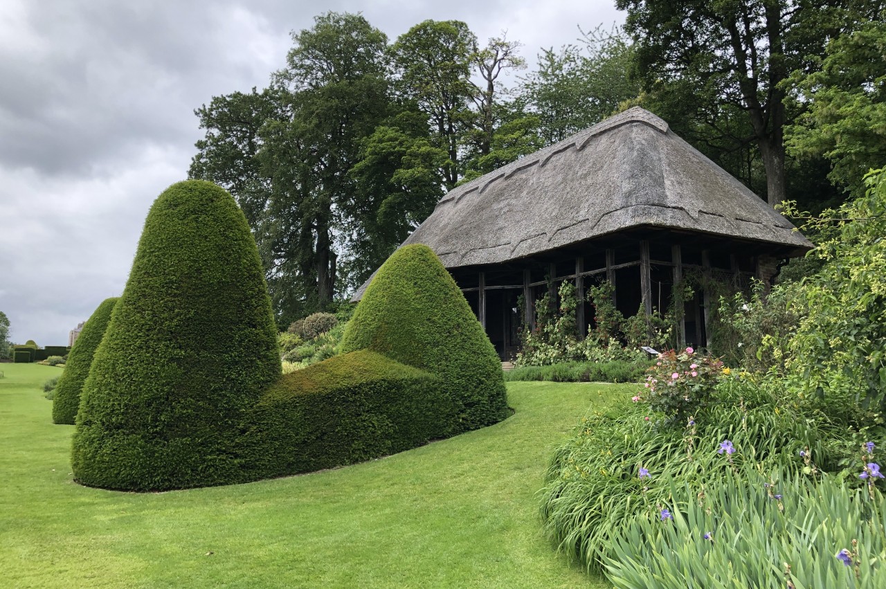
(38) Pleasure Ground

(39) View from the garden terrace

(40) Garden Wood
To the castle's east is a large pleasure ground that takes almost as long to explore as the castle. The pleasure ground is laid out with immaculately manicured hedges (picture 37), a formal garden with a thatched pavilion (picture 38), a promenading terrace with views into Shropshire and Wrexham (picture 39), and pleasant woodland (picture 40).
(41) Llangollen Canal
(42) Chirk Aqueduct

(43) Chirk Aqueduct and Chirk Viaduct
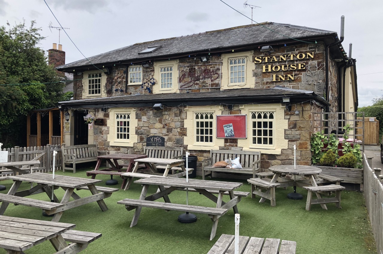
(44) Station House Inn
On the way back to town, I visited a stretch of the Llangollen Canal that passes just west of Chirk Station. These quiet moorings are adjacent to the northern portal of the Chirk Tunnel, which takes the canal under a hill to emerge just on the other side of the Shrewsbury to Chester railway line. Unusually, the towpath goes through the four hundred and twenty one metre tunnel, but I chose to walk over the hill instead, gaining a good view over the canal basin and the Chirk Aqueduct from the grassy slope above the southern tunnel portal (picture 42).
Completed in 1801, the two-hundred and twenty metre long Chirk Aqueduct takes the Llangollen Canal over the River Ceiriog and across the England-Wales border beside the later railway viaduct (picture 43). Like Pontcysyllte, it was designed by Thomas Telford, but is carried on stone arches and the cast-iron trough is also clad in stone. The Chirk Aqueduct is included in the Pontcysyllte Aqueduct and Canal World Heritage Site.
After walking across the aqueduct and another five hundred metres along the towpath to Gledrid Bridge, where the World Heritage Site ends, I returned to the canal basin and followed the B4500 into the middle of Chirk. A block north of the town's war memorial at the junction with Station Avenue, I found the Station House Inn (picture 44), where I enjoyed a very late lunch before ambling back to the station.