OFFA'S DYKE PATH NATIONAL TRAIL
Stage 11: Froncysyltte to Castell Dinas Brân
Thursday, September 5, 2019
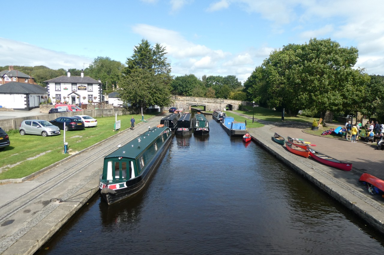
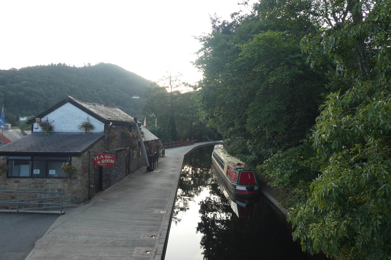
(1) Trevor Basin

(2) Canalboat on Pontcysyllte Aqueduct
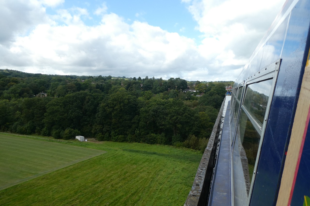
(3) Canalboat on Pontcysyllte Aqueduct

(4) Froncysyllte
After a wet morning spent indoors, I returned to Trevor Basin (picture 1) and signed up for a canalboat ride across the Pontcysyllte Aqueduct (picture 2). From the side of the aqueduct without a pedestrian footpath, there is a vertiginous view over the side to the valley floor some thirty-nine metres below (picture 3).
The forty-five minute trip goes as far as the wharves at Froncysyllte (picture 4) then turns around to return to Trevor Basin, from which I walked back across the aqueduct to the lifting bridge at Froncysyllte, where the main route of Offa's Dyke Path crosses the canal, splitting from the alternative route over the aqueduct.
(5) Pontcysyllte Aqueduct

(6) Cysylltau Bridge
(7) Llangollen Canal
(8) Trevor Hall Wood
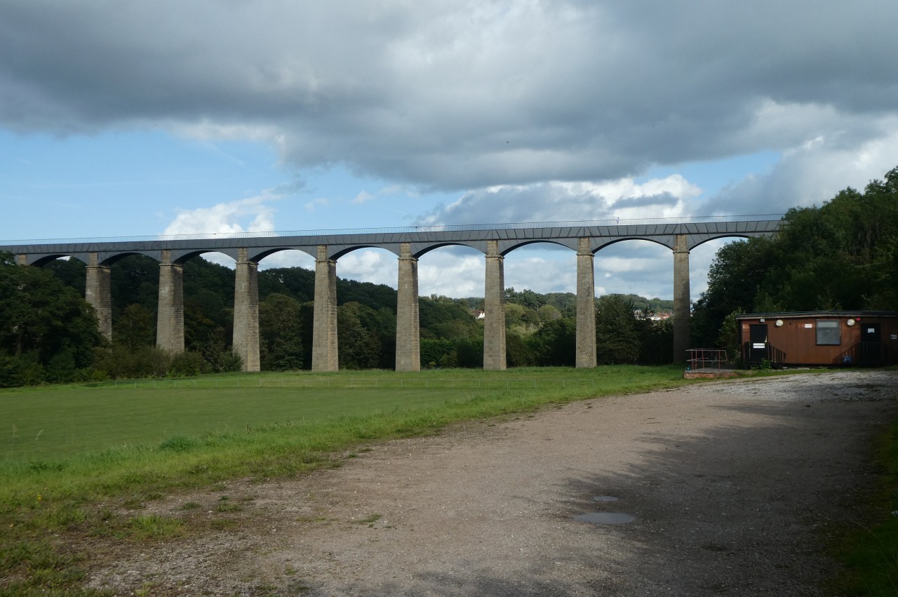
From the lifting bridge, the Path heads along to the corner of the wharves and turns right down the B5434 Gate Road, passing the Froncysyllte Community Centre on the way out of the village and down into the Dee Valley. Near the bottom of Gate Road, the aqueduct comes into view across a football pitch (picture 5).
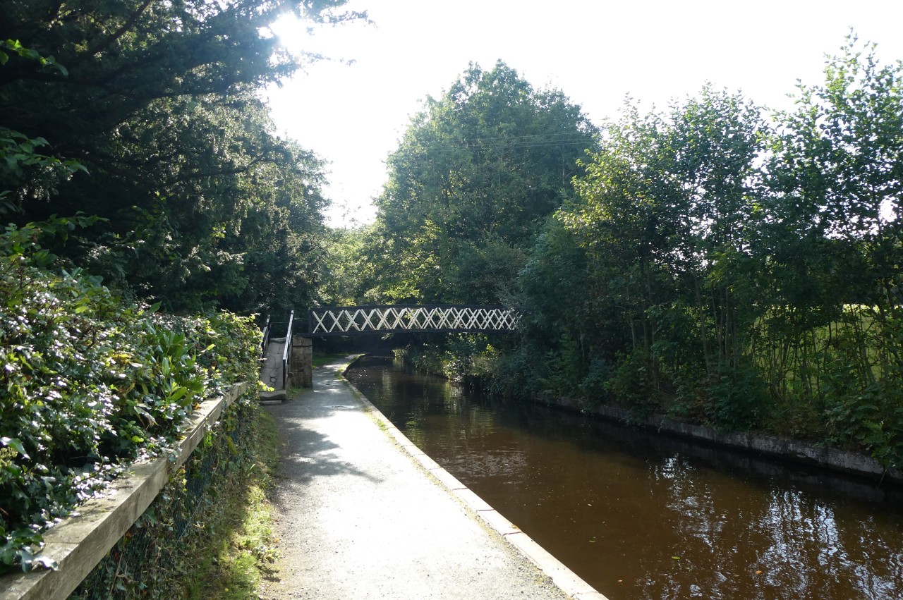
Entering the trees that line the River Dee, the road bends left past a fingerpost that was festooned with Liverpool F.C. supporters' gear then bends right to cross the Grade I-listed Cysylltau Bridge (picture 6), which is of partly 17th-century and partly 18th-century construction. The Path then climbs the B5434 to the first house on the left, where the alternate route rejoins the main route, turning up a footpath between stone walls and up steps to the towpath of the Llangollen Canal (picture 7).
The Path doesn't stay by the canal for long, instead crossing the footbridge just to the left and angling away from the canal across a grassy pasture. From a kissing gate on the far side, an enclosed path leads through trees to a narrow underpass beneath the embankment of the disused railway between Wrexham and Llangollen. On the other side, a fenced path leads around the edge of a field and up steps to the side of the A539 Llangollen Road on the western edge of Trevor.
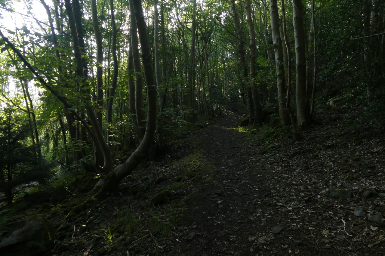
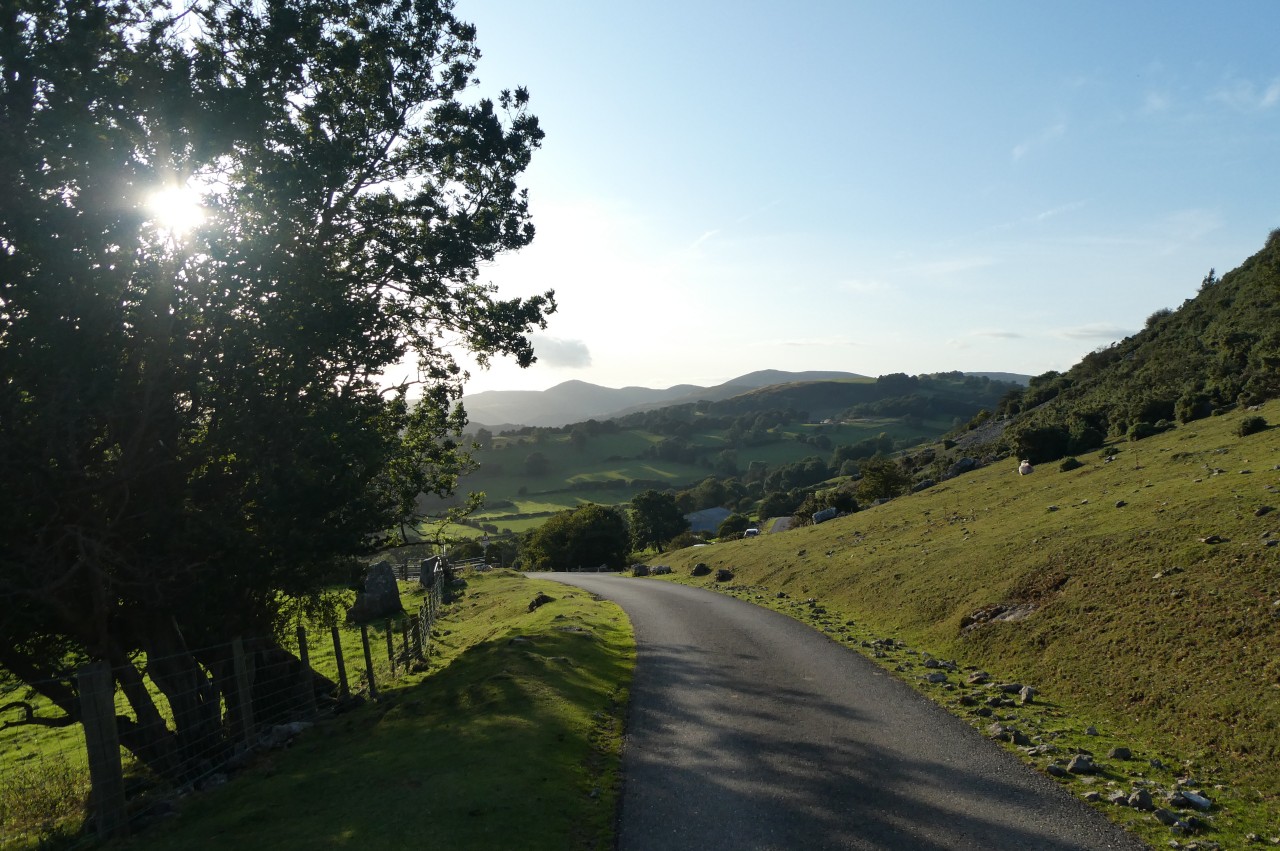
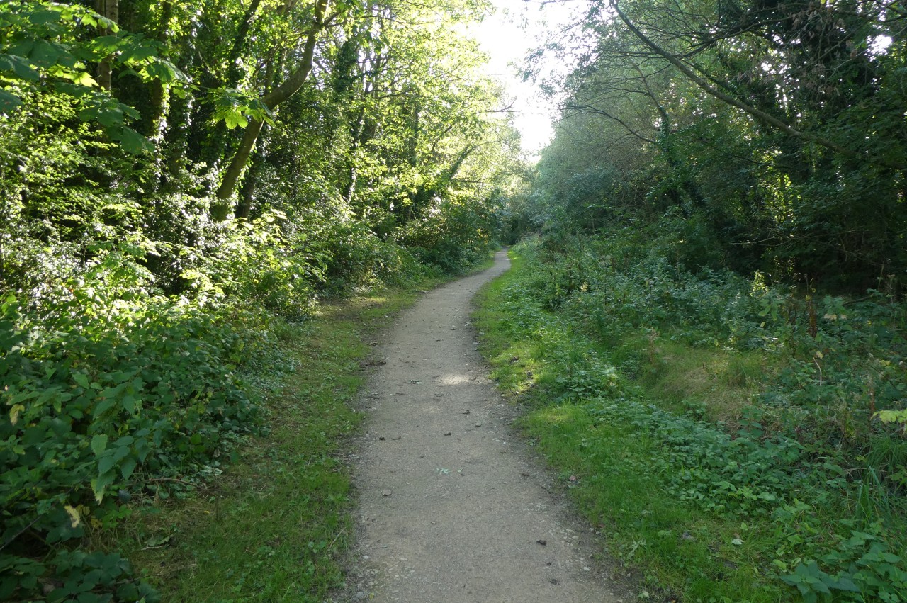
Across the road, a pavement leads to the left and around a bend to a junction where an ODP fingerpost points up Trevor Hall Road. The Path climbs the narrow road as far as the driveway of Trevor Hall, turning along the driveway for one hundred metres to a wooden gate by a large marker stone. The Path leaves Wrexham Country Borough here and enters Denbighshire, climbing through a mixture of plantation trees and darker natural woodland (picture 8) as it angles up the steep hillside above Trevor Hall.
(9) View over Llangollen and Castell Dinas Brân
(10) Panorama Walk
(11) Dee Valley

(12) Trevor Rocks
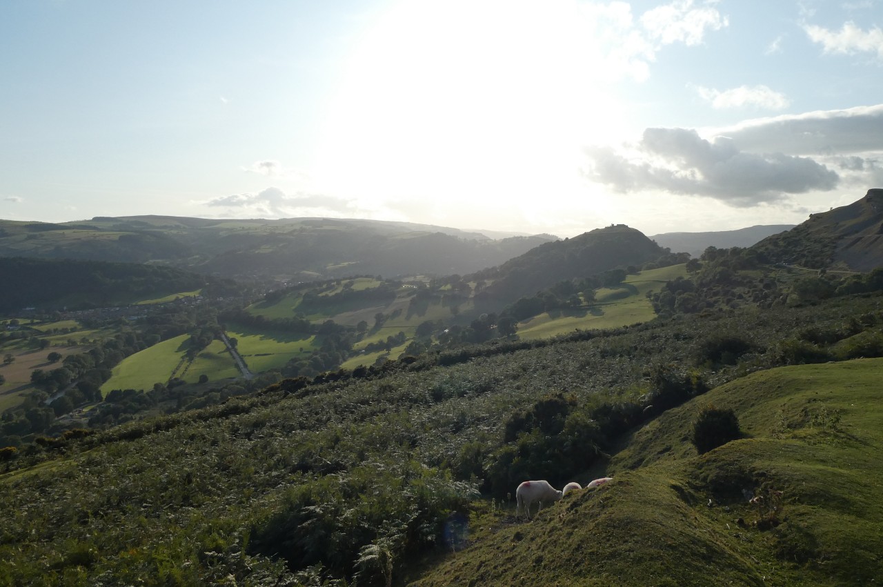
Above Trevor Hall, the Path runs along the top edge of the wood next to several horse paddocks before dropping back among closely-packed conifers. The undulating path now heads along the hillside for a kilometre to a wooden five-bar gate where the plantation timber gives way to natural woodland surrounding an isolated house. The Path passes a short distance below the house to emerge through a rickety gate and turn right to climb beside a drystone wall to the front gate of the house. The Path turns away from the house and climbs the long driveway, zigzagging up to a viewpoint beside the narrow tarmac lane of the Panorama Walk. From a handy bench one can gaze up the Dee Valley towards the town of Llangollen, tucked in below the prominent hill of Castell Dinas Brân, with its prominent castle ruins (picture 9).
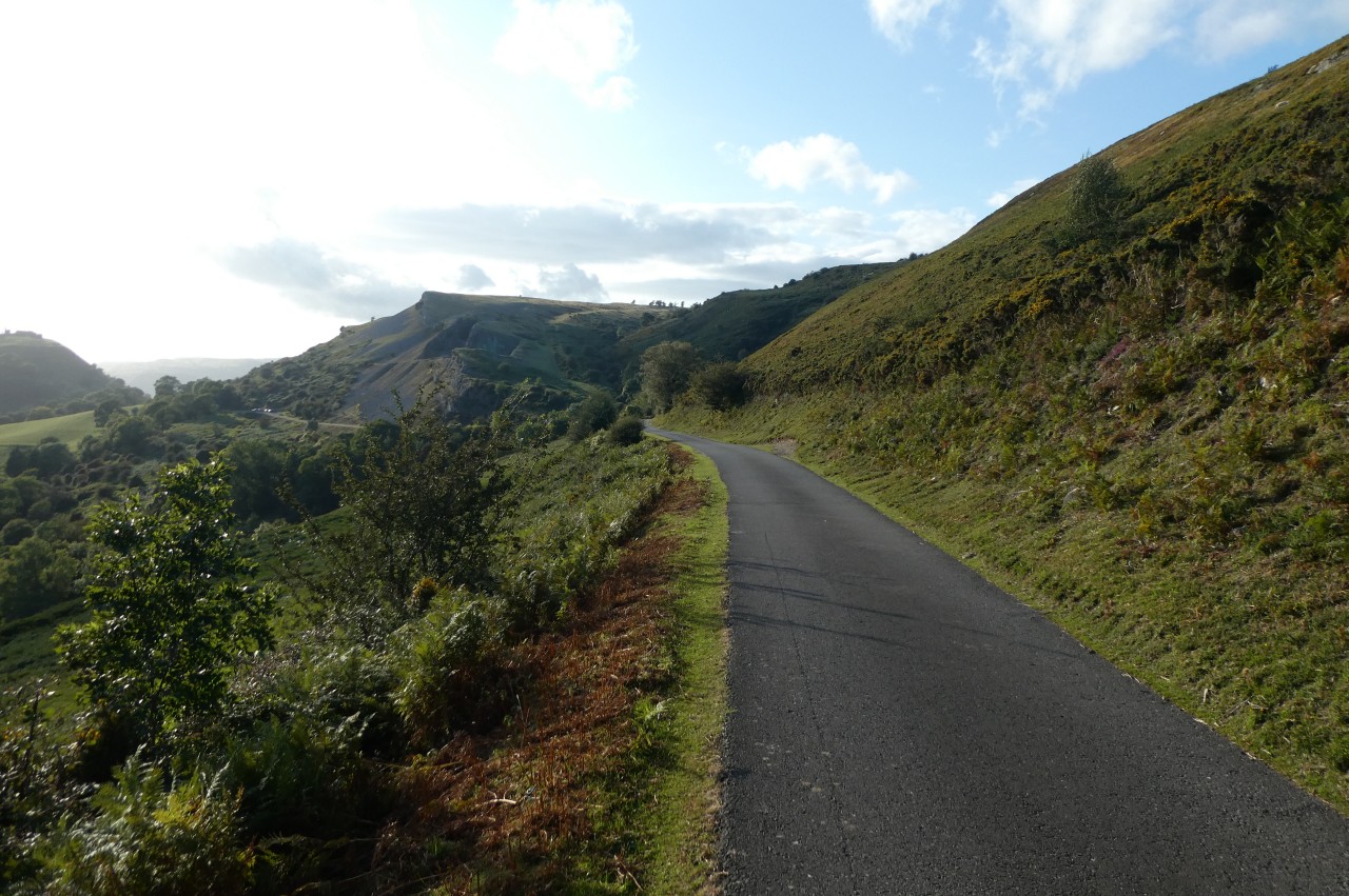
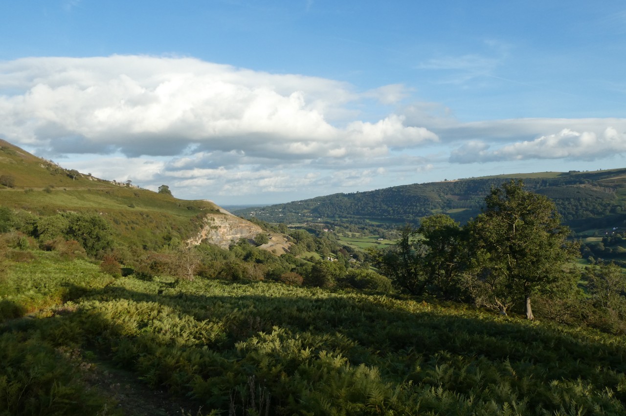
After pausing to take in the view, I headed westward across the heathery hillside on the Panorama Walk (picture 10). When the road moves a little lower down the slope via a long S-bend, the Path gains a view back down the valley towards Froncysyllte (picture 11), while the hillside above the Panorama Walk changes from heather and bracken to limestone boulders and scree (picture 12).
(13) Panorama Walk

(14) Castell Dinas Brân
(15) Llangollen Wharf
(16) Llangollen Bridge
After another lane merges in from the left, the Panorama Walk crests a small rise then drops away past a standing stone (picture 13) to a junction north-east of Castell Dinas Brân (picture 14). I left Offa's Dyke Path here, having walked a leisurely 6.6 kilometres from Froncysyllte.
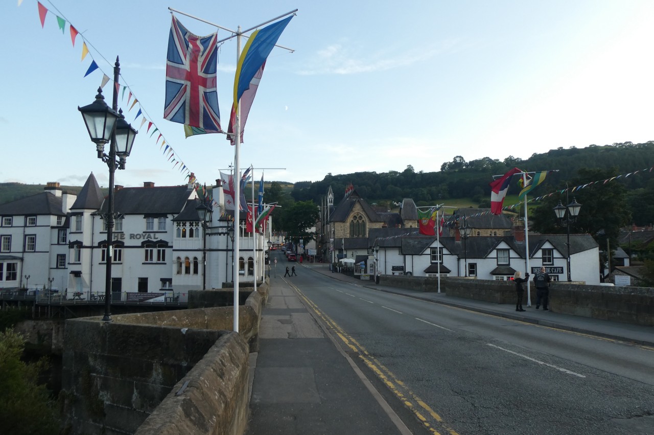
Turning left over a cattle grid, I followed the narrow Wern Road downhill for almost two kilometres to the town of Llangollen, passing the Wern Isaf Farm Campsite halfway down. At the bottom of Wern Road, I turned left over the Llangollen Canal, overlooking Llangollen Wharf (picture 15), then followed Wharf Hill down to the A539. Across the main road, I turned down Castle Street to cross Llangollen Bridge into the town centre (picture 16), where I was staying at the cozy Gales Hotel on Bridge Street.
Addendum: Llangollen Railway and Llangollen Canal
Friday, September 6 and Saturday, September 7, 2019
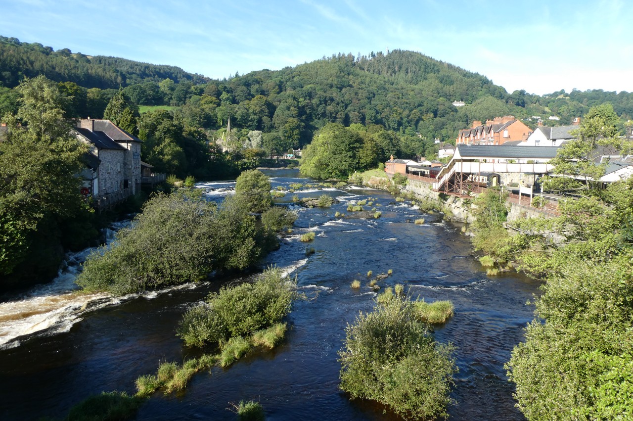
(17) River Dee from Llangollen Bridge
(18) Locomotive 6430 at Llangollen Station
(19) Berwyn Station
(20) Berwyn Bridge
On the recommendation of an old work colleague who spent much of his youth in and around the Dee Valley, I had arranged to spend a couple of extra nights in Llangollen to give me time to explore the area. On the first day, I visited Llangollen's excellent little museum then rode a circuit of the Llangollen Railway, exploring the villages along the line.
The Llangollen Railway uses part of the former Ruabon to Barmouth line, which carried passengers for a few months short of a century, from May 1865 until January 1965. Starting in 1975, the track up the Dee Valley from Llangollen was gradually reinstated in stages by volunteers, finally reaching the town of Corwen, sixteen kilometres up the Dee Valley, in 2014. At the time of my visit, major works at Corwen Station meant that the trains were only going as far as Carrog.
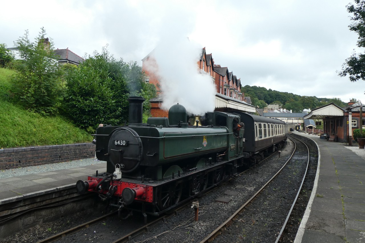
Llangollen Station is situated on a man-made embankment on the north side of the River Dee, just west of Llangollen Bridge, and part of the pedestrian bridge to Platform 2 actually overhangs the fast-flowing river (picture 17). On the day of my visit, the train was being hauled by steam locomotive 6430 (picture 18), one of several owned by the Llangollen Railway.
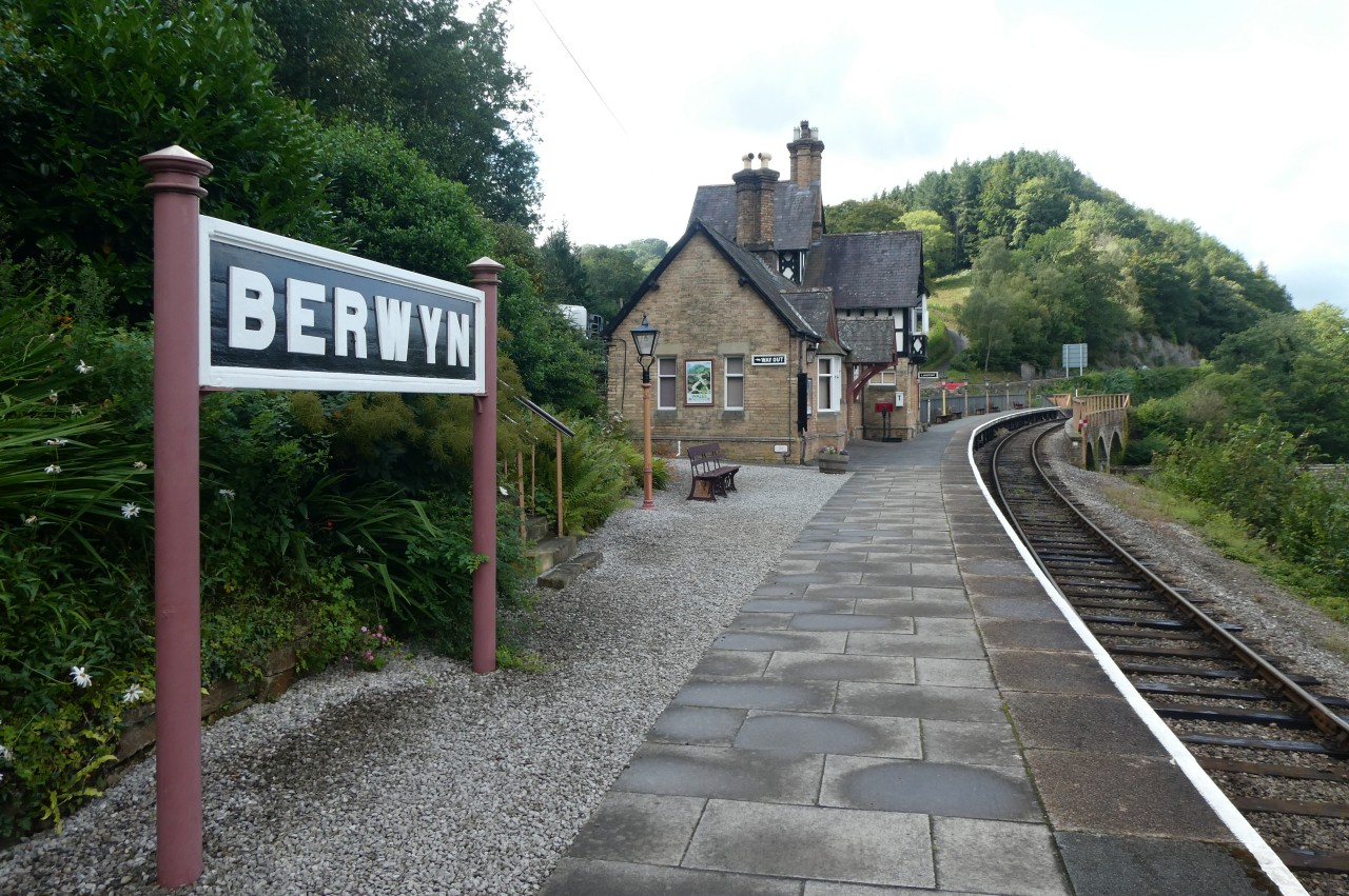
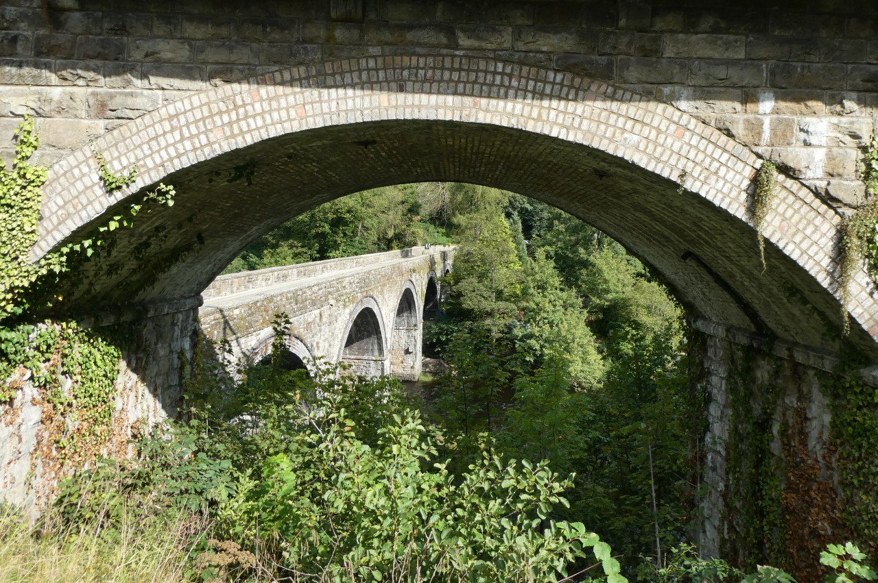
The first stop on the line is Berwyn, where the station house stands on a low cliff above the River Dee (picture 19). The station's one platform stretches along a viaduct, beneath which the B5103 squeezes through one of the arches and crosses the river on Berwyn Bridge (picture 20).
(21) The Chainbridge Hotel and the Chain Bridge
(22) Horseshoe Falls
(23) Glyndyfrdwy Station

(24) Carrog Bridge and the Grouse Inn
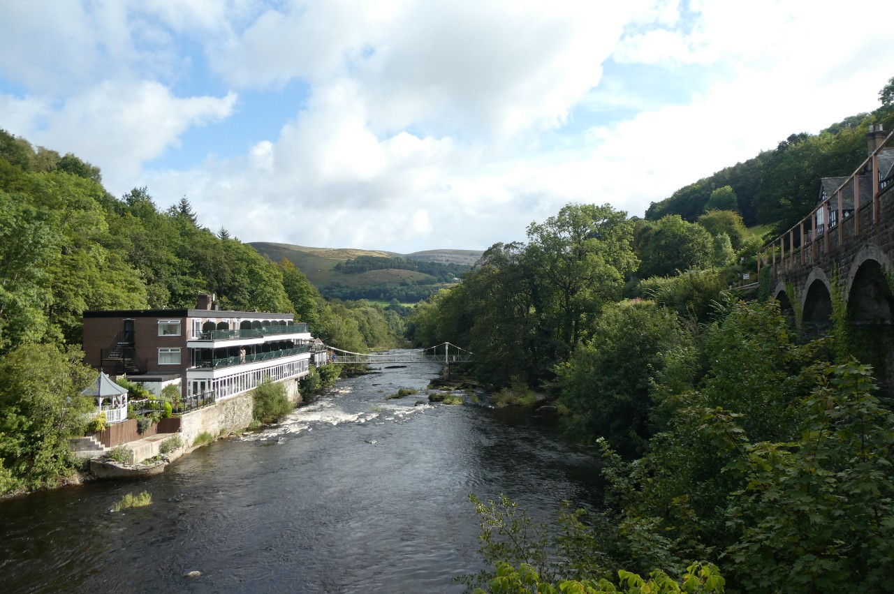
From Berwyn Bridge there is a fine view down the gorge past the Chainbridge Hotel and the Chain Bridge (picture 21). When the railway came to Berwyn, Victorian tourists flocked here for this view and several famous painters came here to commit the scene to canvas.
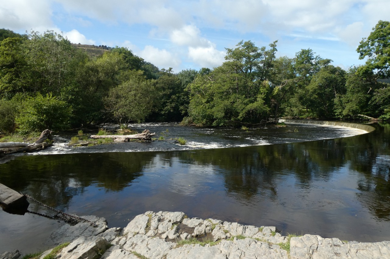
Off the end of the bridge, steps lead down to join the towpath of the Llangollen Canal behind the hotel, from which it's only a few minutes walk up to the start of the canal, just above Horseshoe Falls on the River Dee (picture 22). This semicircular weir was designed by Thomas Telford to guarantee that the river would always have a sufficient depth of water to feed the canal. Around sixty-two million litres of water flows down the canal every day, supplying much of the Shropshire Union Canal network.
A few minutes walk further upstream, I visited the Llantysilio Parish Church then circled back along the grassy hillside overlooking Horseshoe Falls to the Chainbridge Hotel and across the Chain Bridge to return to Berwyn Station. The current Chain Bridge, built in 1929, is the third footbridge built across the River Dee here, replacing earlier bridges of 1817 and 1876.
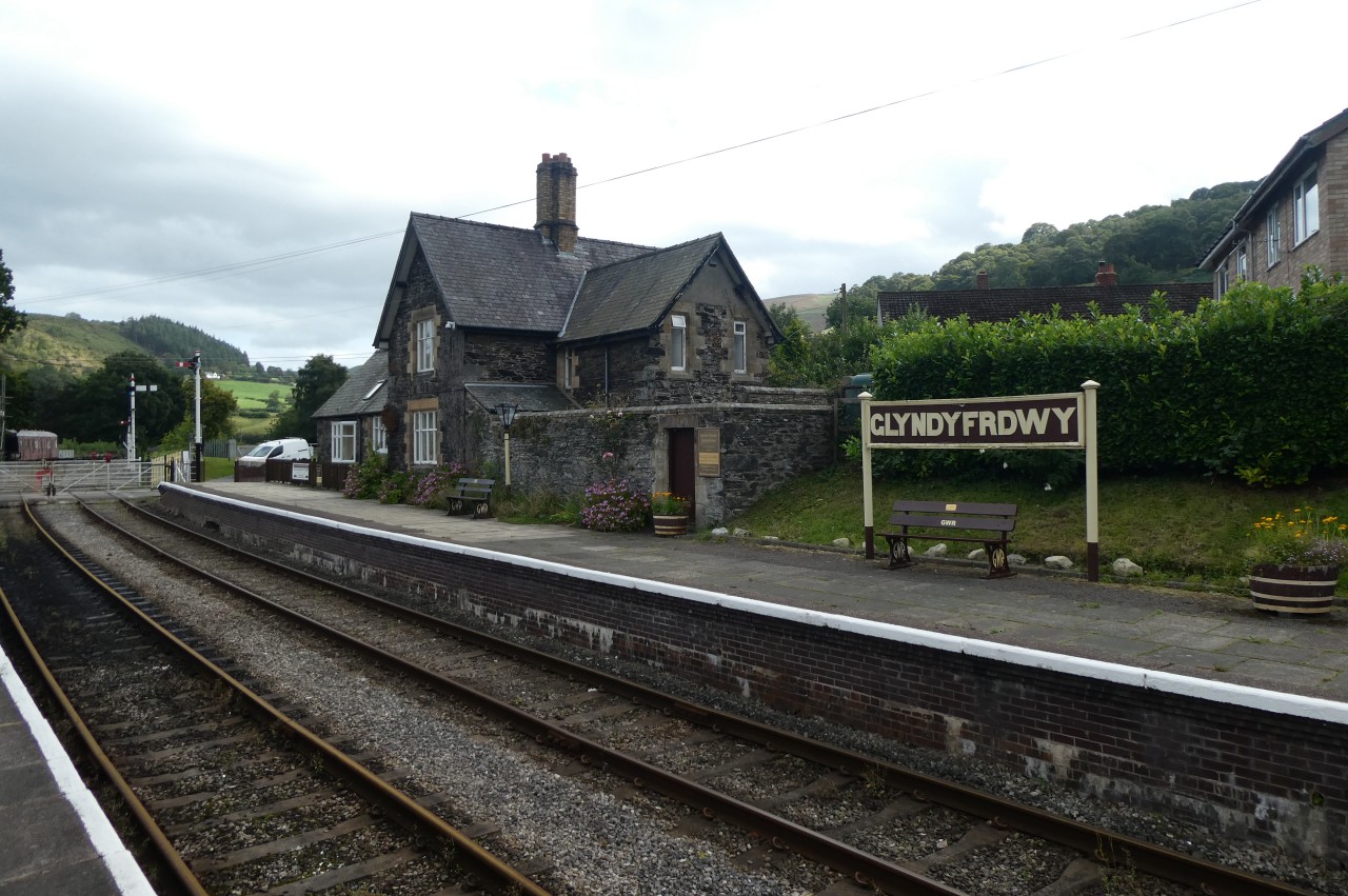
The next stop along the line is Glyndyfrdwy Station (picture 23), from which I walked up to the village hall by the A5, then westward along the busy road to visit the Berwyn Arms gastropub for lunch. I had to jog to make it back to the station in time to get the next train, but make it I did, and ten minutes later I alighted at Carrog Station.
Carrog village lies about four hundred metres north-west of the station, across the River Dee, and there was a procession of passengers down the road and over Carrog Bridge to the Grouse Inn (picture 24), where there was enough time to sink a pint before returning to the station to board the last train back to Llangollen.

(25) Llangollen Wharf

(26) Llangollen Basin

(27) Horseshoe Falls

(28) Llangollen Motor Museum
The following day, I went for a leisurely nineteen kilometre round-trip walk along the Llangollen Canal. I started at Llangollen Wharf (picture 25) and walked along the towpath past the Llangollen Basin (picture 26) and onward to the end of the canal at Horseshoe Falls. Here I found a group of people in kayaks and inflatable dinghys (picture 27) launching themselves into the River Dee and over the weir for a Saturday morning paddle among the boulders and whitewater.
Roughly halfway back to town, I stopped off at the Llangollen Motor Museum, which is just off the towpath. The building is absolutely crammed with vintage cars, motorcycles and memorabilia from the golden age of British motoring (picture 28).
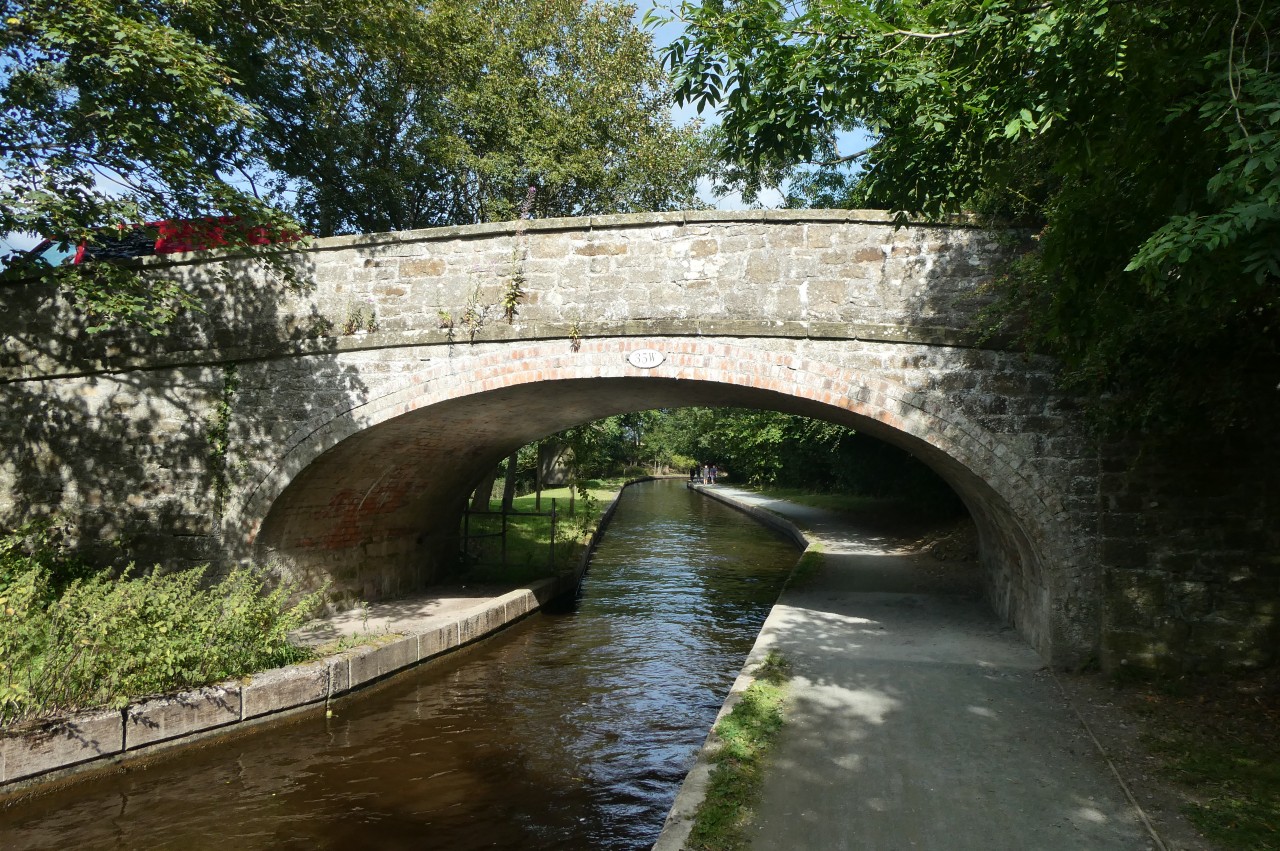
(29) Llangollen Canal
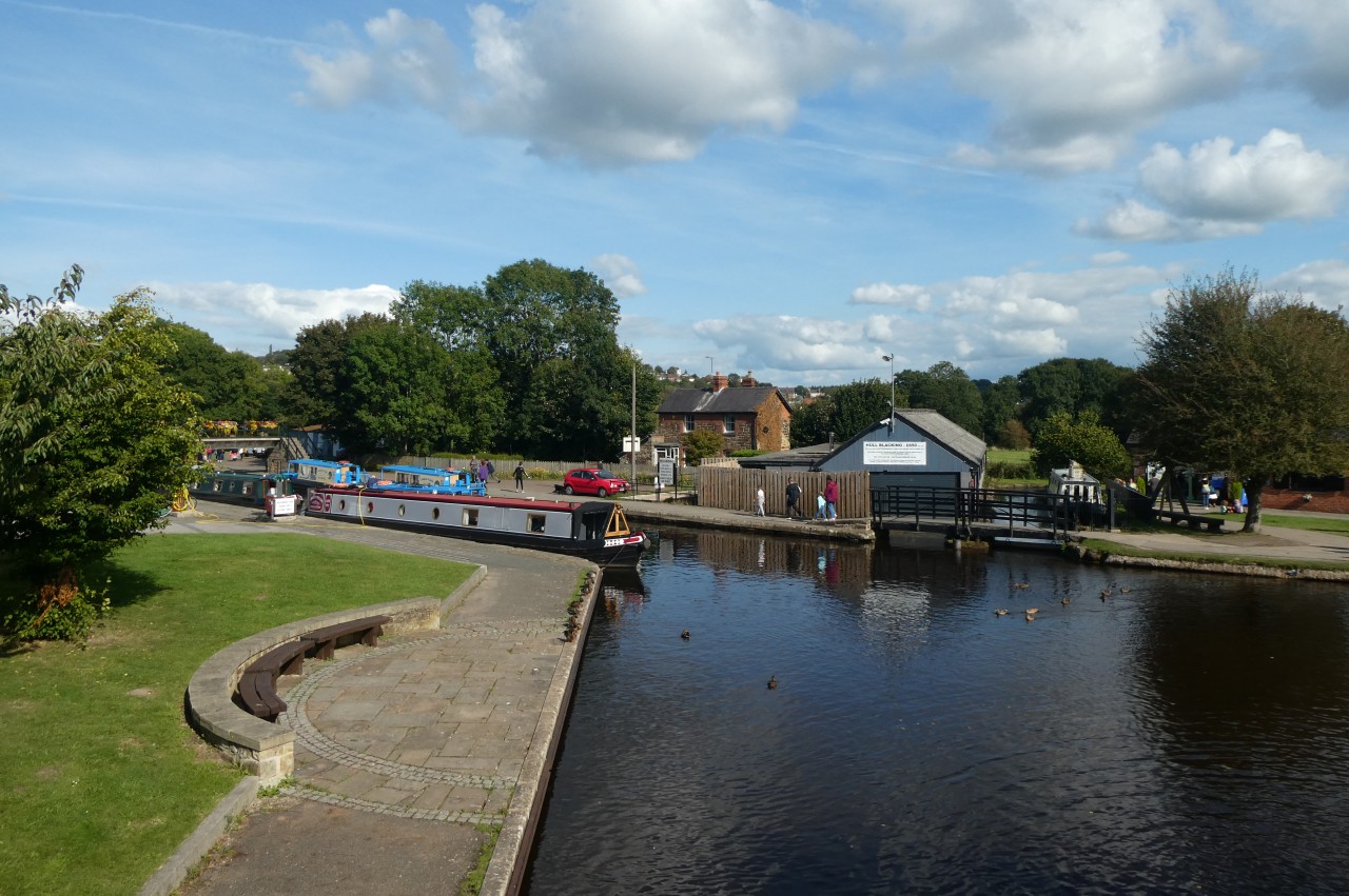
(30) Trevor Basin
(31) The Old Railway Path, Trevor

(32) Llangollen Canal
Heading back past Llangollen Wharf, it's an easy walk of a little less than seven kilometres along the shaded towpath (picture 29) to Trevor Basin (picture 30), where I stopped for a late lunch at the Telford Inn. For the return journey I looped up through the village of Trevor to walk a stretch of the abandoned Ruabon to Barmouth railway line (picture 31) before rejoining the canal towpath and strolling back to Llangollen in the autumn afternoon sun (picture 32).