THE SAXON SHORE WAY
Stage 5: Lower Halstow to Sittingbourne
Sunday, January 2nd 2011

(1) St Margaret of Antioch Church, Lower Halstow
(2) Path towards Stray Farm, Lower Halstow

(3) Orchard near Lower Halstow

(4) Path towards Funton Brick Works
I walked this section of the Saxon Shore Way on Sunday, January 2nd 2011. During the brief wait at Sittingbourne Station for the bus back to Lower Halstow, the sun broke through the cloud cover for the first time so far on the walk. Perhaps due to the clearer conditions, the temperature was also colder, just above freezing.
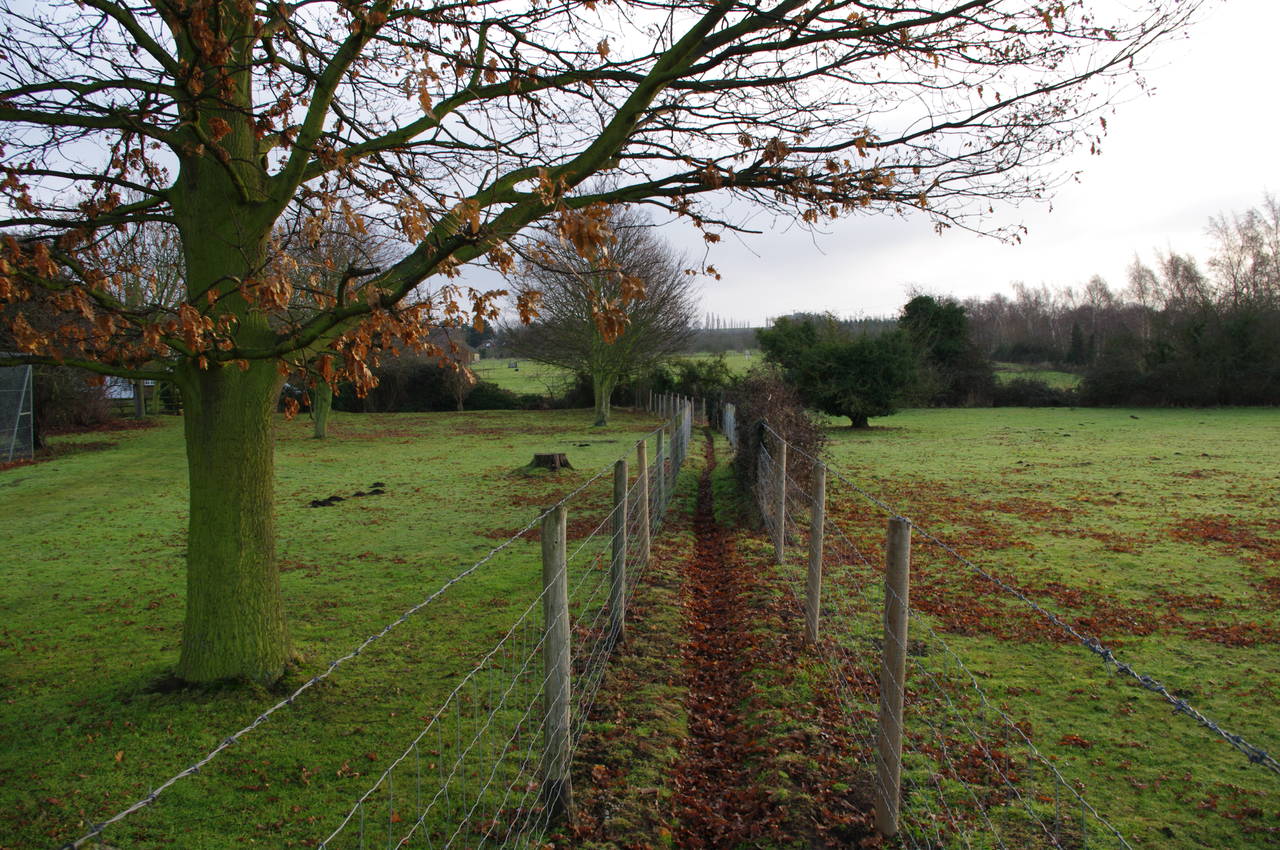
In Lower Halstow, I rejoined the route of the Saxon Shore Way beside the church of St Margaret of Antioch (picture 1). The route follows Church Path away from the church, crosses a road known as The Street, and takes a narrow path between a field and a house. The path heads slightly downhill between two wire fences (picture 2) and soon passes a small duck pond and the farmhouse of Stray Farm.
Continuing straight ahead, the path passes through a series of metal kissing gates that divide a large field into smaller paddocks. The last gate leads into an orchard, where there was no obvious path, though a marker post under one of the trees pointed vaguely straight ahead through the trees (picture 3).
On the other side of the orchard, a gap in the hedge just before a white house leads back onto The Street, which the route then follows until it forks into Raspberry Hill Lane and Basser Hill. Here the route leaves the road and crosses diagonally over a large field to a stile where a waymarker points across another field towards a metal kissing gate at the corner of the Funton Brick Works (picture 4). Both of these fields had recently been ploughed, leaving no obvious path.

(5) View to the Isle of Grain

(6) View to the Isle of Grain

(7) Path between ponds

(8) Turf Farm
Through the gate, the path follows the left edge of the next field to another gate that leads into a large, steep field behind the Brick Works. Again, the field had been ploughed and there was no obvious path across it. The Ordnance Survey map appeared to show the route heading roughly east, across the face of the hill. The route I took turned out to be a little too far up the hill, though this did give some good views across the Medway Estuary to the Isle of Grain, where I could make out the Grain Power Station and the cranes of the Grain Container Terminal around eight kilometres away (picture 5).
Getting back onto a more correct route lower down the face of the hill, I eventually found that the route reaches a farm track next to an untidy pile of discarded bricks at the field edge. The route follows the track downhill to the left for about 15 or 20 metres before turning right into an orchard and then immediately right again to join a muddy track that was virtually opposite the pile of bricks. In the corner of the orchard, I was able to take a good zoomed in picture of the Isle of Grain (picture 6).
The path soon passes between two ponds (picture 7) and then on across a turf farm where much of the turf had been harvested (picture 8).
The route then continues past a larger pond to a gap in the field edge where a waymarker points across another field. At the far side of this field was another marker post pointing to the right towards the village of Iwade, where a large number of similar looking houses were visible in the distance. Unfortunately, the correct route actually goes along the left edge of the field, bypassing the village -- it seems the marker post has been rotated by 180 degrees. The correct path leads to a farm, where the route joins a driveway, which gradually curves around to the left as it crosses the open expanse of Raspberry Hill.

(9) View over Chetney Marshes

(10) Floodbank

(11) View to Sheppey Crossing
(12) Old boats next to floodbank
When the driveway eventually joins Raspberry Hill Lane, the route follows the road to the left for a short distance to turn right through a metal kissing gate. From here the path heads down from Raspberry Hill with good views ahead over the Chetney Marshes to the Isle of Grain (picture 9).
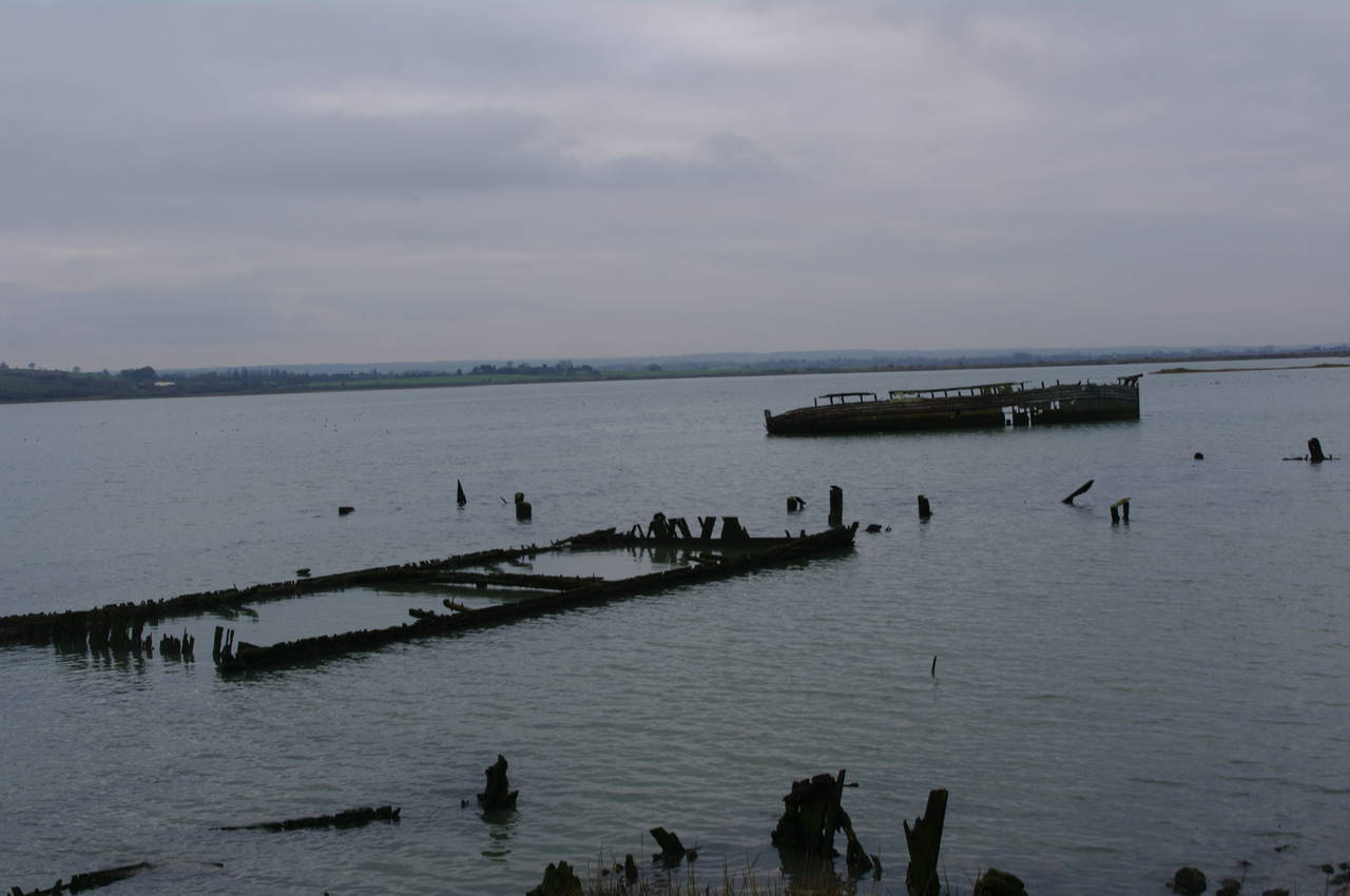
The path continues downhill to the floodbank on the edge of the Medway Estuary and follows the floodbank around the edge of the marshes (picture 10). Across the marshes to the right, the Sheppey Crossing Bridge was visible (picture 11), while in the waters to the left there were more old decaying boats (picture 12).
(13) Buildings on Chetney Marshes

(14) View to the Isle of Grain

(15) Path beside the Swale
(16) Sheppey and Kingsferry Bridges
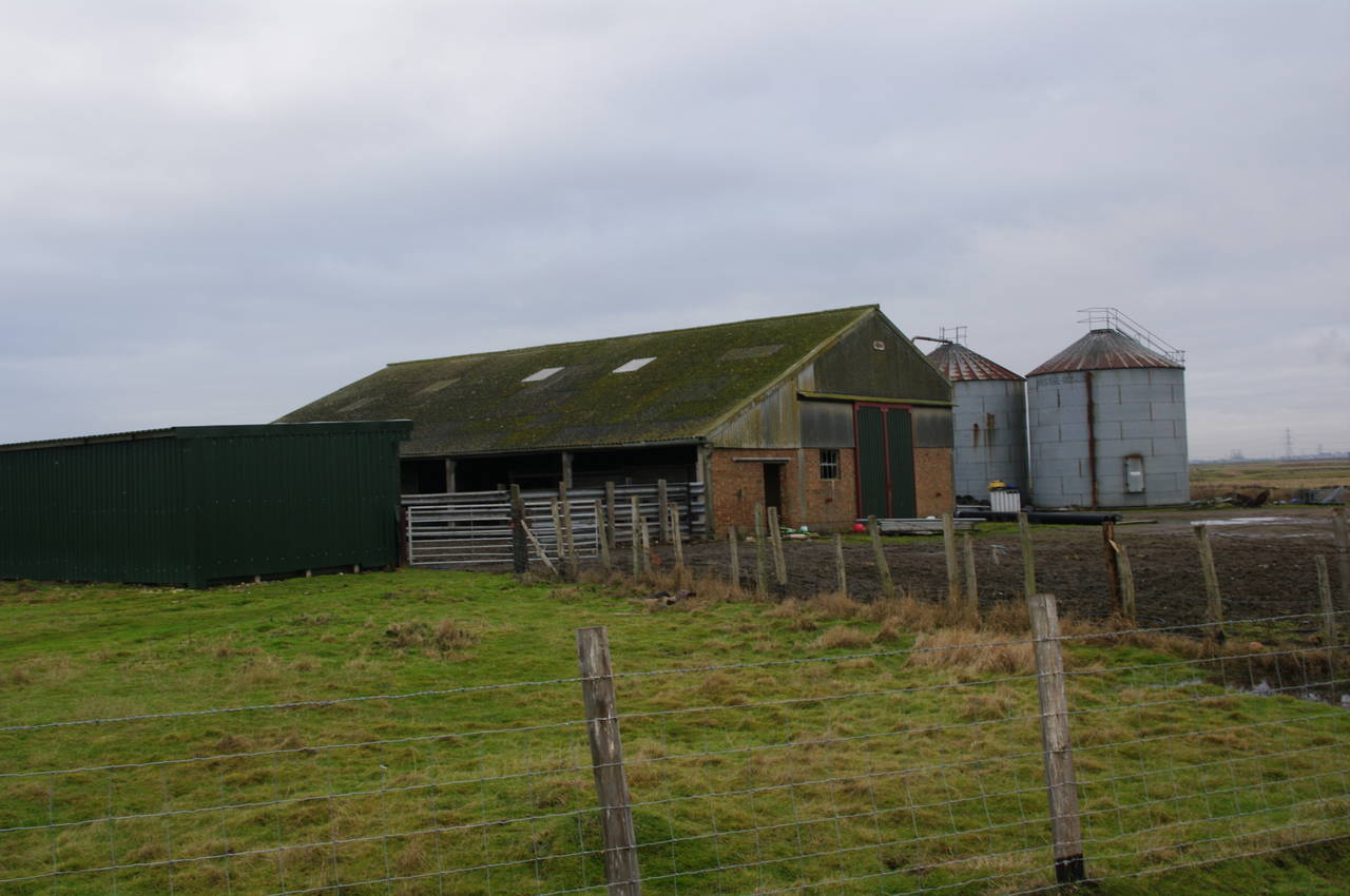
When the path reaches a waterway, it turns right and heads past a barn and some silos (picture 13) that seem to be the only significant structures on the marshes. The route then follows a raised farm track across the marshes to rejoin the floodbank beside The Swale; the waterway that separates the Isle of Sheppey from the mainland.
Off to the left, the Grain Power Station complex was much closer than earlier in the day (picture 14), but the route turns to the right following the floodbank beside the Swale for a little more than two kilometres to the Sheppey Crossing Bridge (picture 15).
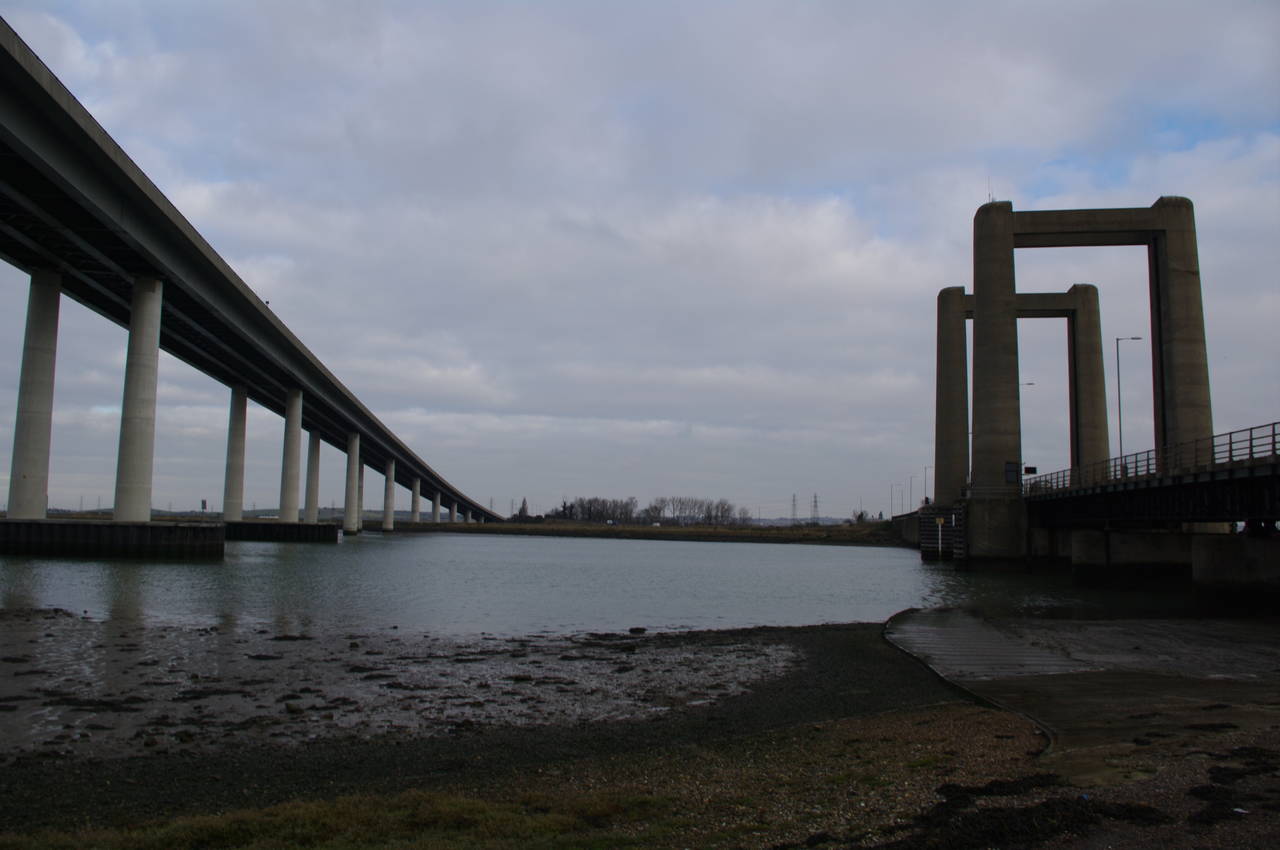
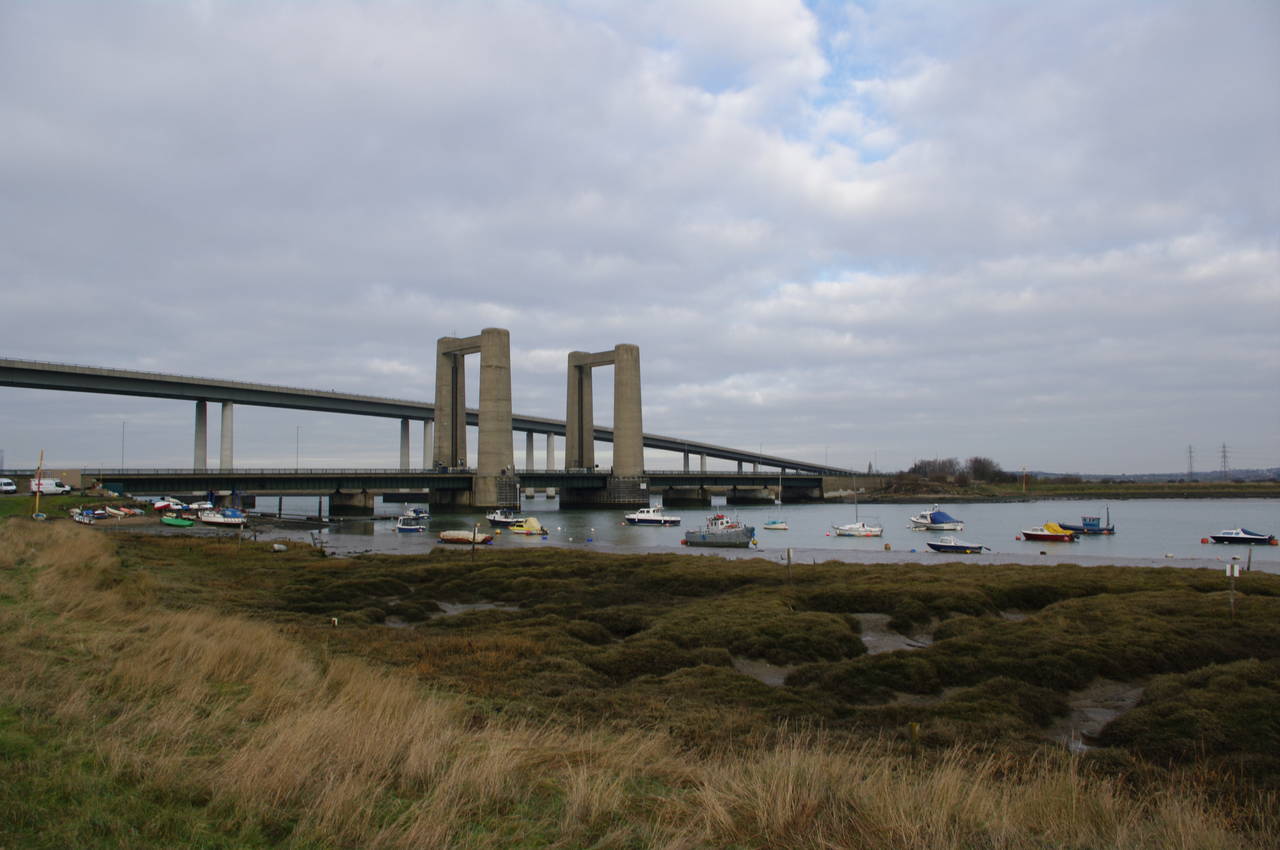
Getting closer to the Sheppey Crossing, it becomes apparent that there are actually two bridges; the higher Sheppey Crossing Bridge and the lower Kingsferry Bridge, which carries both a road and a railway line. The Saxon Shore Way heads under the two bridges (picture 16) and then back up onto the floodbank.
(17) Boats near Kingsferry Bridge

(18) Path beside the Swale

(19) Jetty and conveyor

(20) Milton Creek
Several dozen small boats were moored below the floodbank near the bridge (picture 17). The middle span of the Kingsferry Bridge can be raised up the pylons to allow larger boats to pass under it, but this did not happen while I was within sight of the bridge.
The route continues along the floodbank for about five hundred metres, then turns away from the water to skirt around two sides of a large factory complex before following a grassy, raised path back to the floodbank by the Swale. The route then follows the floodbank past several more factories and a jetty with a conveyor (picture 19).
Eventually the path along the floodbank leaves the Swale and follows the narrow stream of Milton Creek (picture 20) as it twists and turns on its way towards the town of Sittingbourne.
When the path nears the end of the creek, the floodbank ends and the route follows a narrow, litter-strewn path behind an industrial building. This path leads to Gas Road, which the route follows to the left until it passes under a bridge and turns left onto Mill Way. The route follows Mill Way as it curves to the left past a roundabout, and at a second roundabout, Mill Way becomes Eurolink Way.
At this roundabout I left the Saxon Shore Way for the day, turning right for a few metres to pass under the railway line then left for a short distance up to the front of Sittingbourne Railway Station. My GPS estimated that I had covered 21.3km of the Saxon Shore Way today.