SOUTH WEST COAST PATH NATIONAL TRAIL
Stage 11: Sidmouth to Exmouth
Thursday, May 16, 2013

(1) Sidmouth seafront

(2) Clifton Walkway

(3) Jacob's Ladder Beach

(4) Peak Hill
After a few days off, I returned to the Coast Path at Sidmouth in much better weather than when I last left the path.
From the sundial on The Esplanade, the route runs along the beachside promenade, with views back along the seafront (picture 1). When the road bears away from the coast, the path joins the Clifton Walkway (picture 2), which runs along the foot of low cliffs below Connaught Gardens.
Around a corner at the end of the cliffs the path reaches Jacob's Ladder Beach (picture 3). The Coast Path climbs a footpath that snakes up the hill behind the beach, then continues to climb westwards on a grassy path between the clifftop and Peak Hill Road.
After about ten minutes steady climbing, the path is forced to join the road for a short stretch to reach steps on the left that take the path into the National Trust's Peak Hill estate (picture 4).

(5) View inland from Windgates

(6) Approaching High Peak

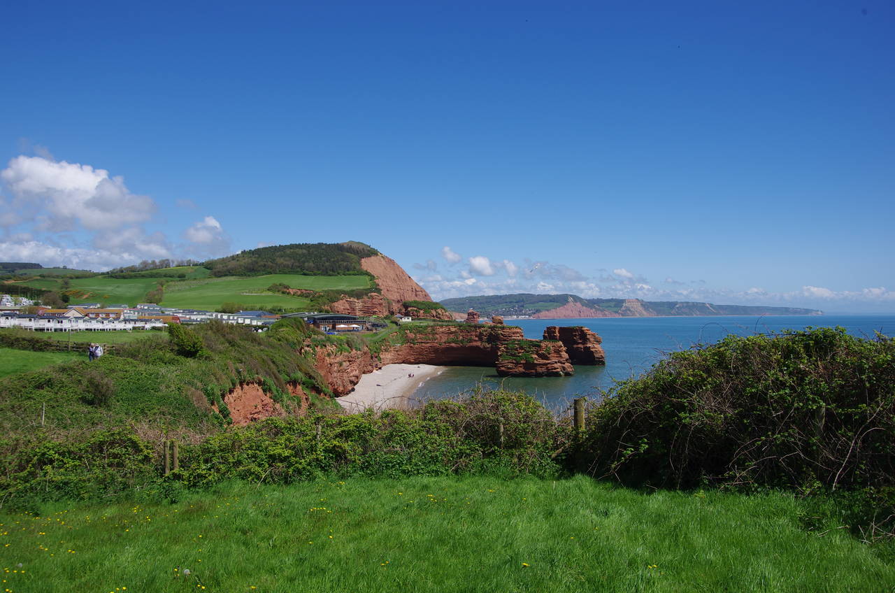
(7) Ladram Bay

(8) Ladram Bay
The shady path across the estate emerges into a field marked on maps as Windgates (though I saw no signs with that name on the path), where there are some good views inland over fertile farms (picture 5). The path continues along the clifftop towards High Peak (picture 6), where most of the trees had recently been cleared and replanted.
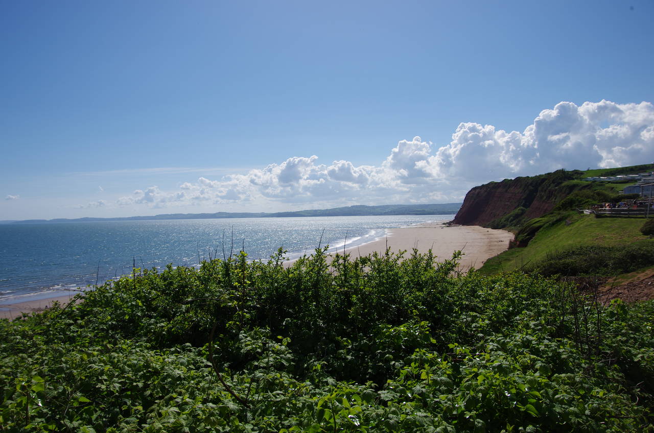
Heading down the other side of High Peak, there are good views across Ladram Bay (picture 7). When the path gets nearer the bay, one can see several impressive stacks of red Triassic sandstone (picture 8), that almost make up for the eyesore of the huge holiday park that covers the hillside above the bay. The rocks here are red due to the presence of iron oxide (rust) and are around 220 million years old.
(9) Ladram Bay

(10) Rock stacks, Ladram Bay

(11) Brandy Head

(12) Black Head
A fenced path leads around the seaward side of the holiday park and crosses the road leading down to the bay's little beach in front of a thatched and white-washed cottage. The path then climbs again, crossing a field with more views back across the bay (picture 9) and the sandstone stacks (picture 10, zoomed).
The path now shortcuts across the back of Smallstone Point, rejoining the clifftop above Chiselbury Bay for a very gentle climb up to Brandy Head, almost two kilometres away (picture 11). Near the top of the climb the path passes a derelict concrete observation hut, which was part of an airstrip sited here in World War II. An information board here describes how the area was used for testing aircraft guns and bombs in the early 1940's.
Once over the peak of Brandy Head, the path descends very gently to Black Head (picture 12), with the first glimpses of the Exe Estuary ahead in the distance.

(13) Danger Point

(14) Otter Estuary

(15) River Otter
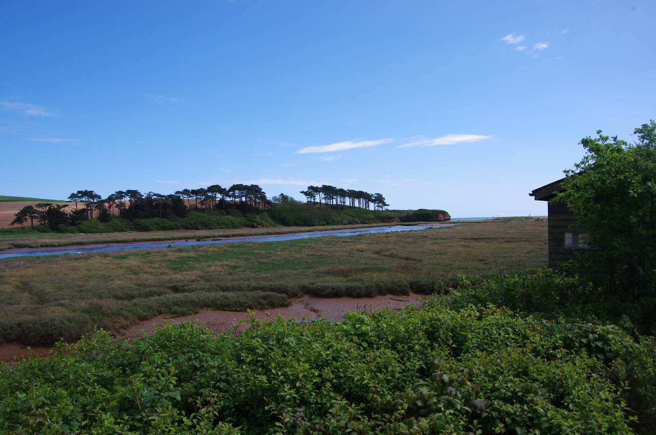
(16) Otter Estuary Nature Reserve
From Black Head the long gentle descent along the clifftops continues, passing just behind the little peak of Danger Point (picture 13), then turning inland to a line of trees beside the mouth of the River Otter (picture 14).
From this pleasant spot, the path heads northwards along a vehicle track, following the river about 1200 metres inland to find a road that leads westward to a bridge over the river (picture 15). On the other side, a footpath leads back downstream through the Otter Estuary Nature Reserve (picture 16), which is home to a variety of birds that are pictured in various information panels beside the path.

(17) Budleigh Salterton
(18) View from West Down

(19) Littleham Cove and Straight Point
(20) Landslip above Littleham Cove
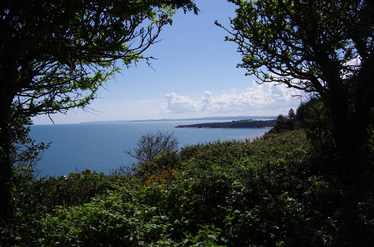
Nearing the coast once more, the path crosses to the far left corner of a large carpark on the edge of the town of Budleigh Salterton, climbing up onto the shingle bank that shelters most of the estuary from the open sea. Turning westwards, the Coast Path follows the promenade along the seafront (picture 17), passing many groups of beach huts before the path begins a long but gentle climb up to West Down, gradually leaving the town behind. For a while the path is shady, with occasional sea views (picture 18), before emerging beside the East Devon Golf Course.
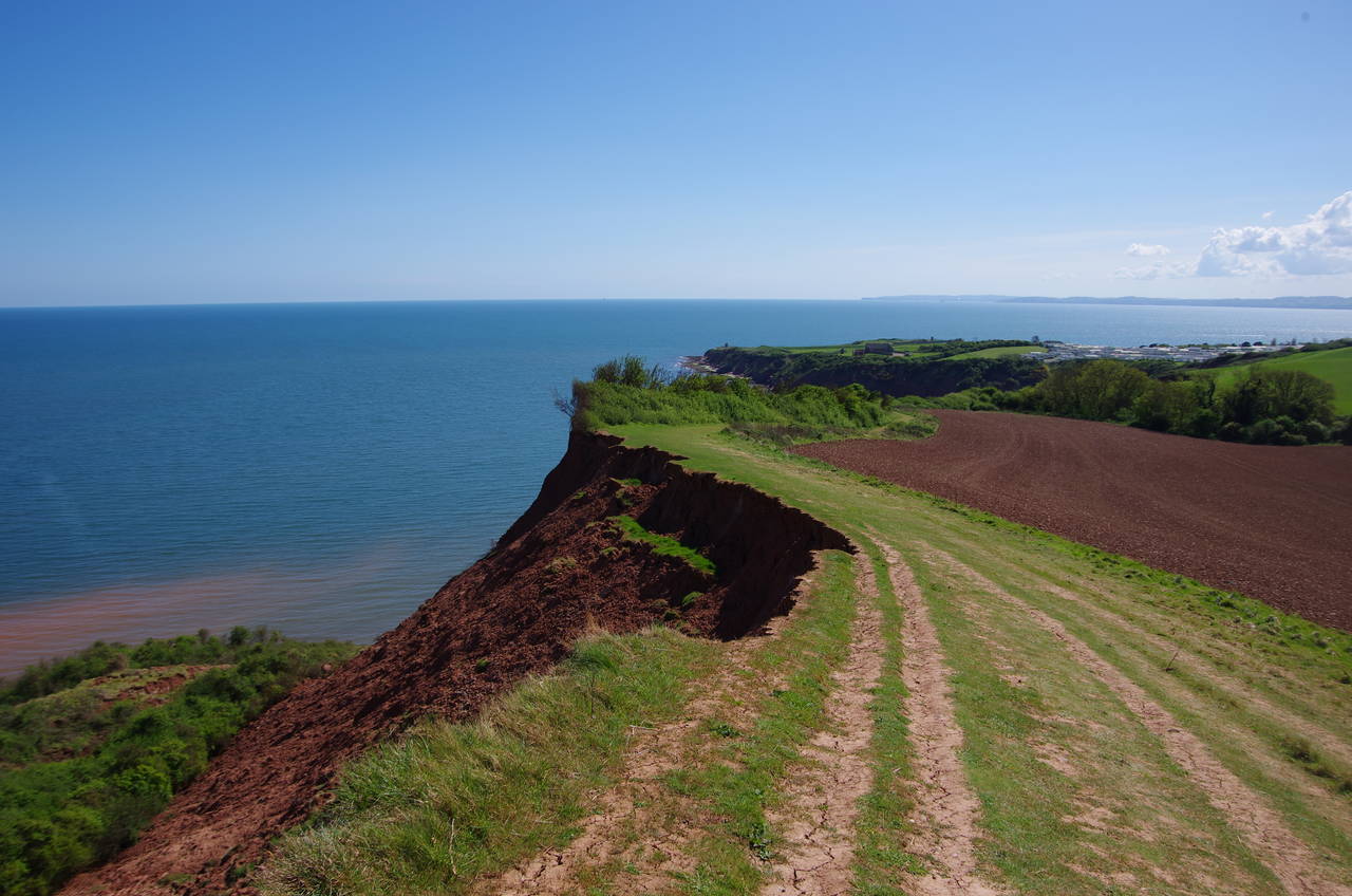
The next stretch of the path has some glorious views ahead across Littleham Cove to Straight Point and beyond to the South Devon coast stretching away into the distance on the far side of the River Exe (picture 19). The path follows the clifftop above the cove, passing a couple of spots where recent landslips were starting to nibble at the edge of the path (picture 20).
(21) Sandy Bay
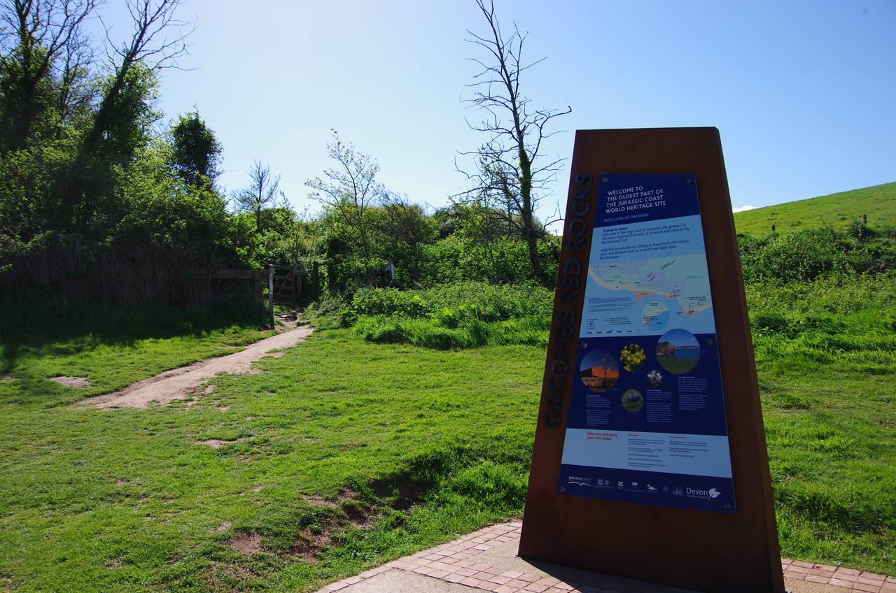
(22) High Land of Orcombe
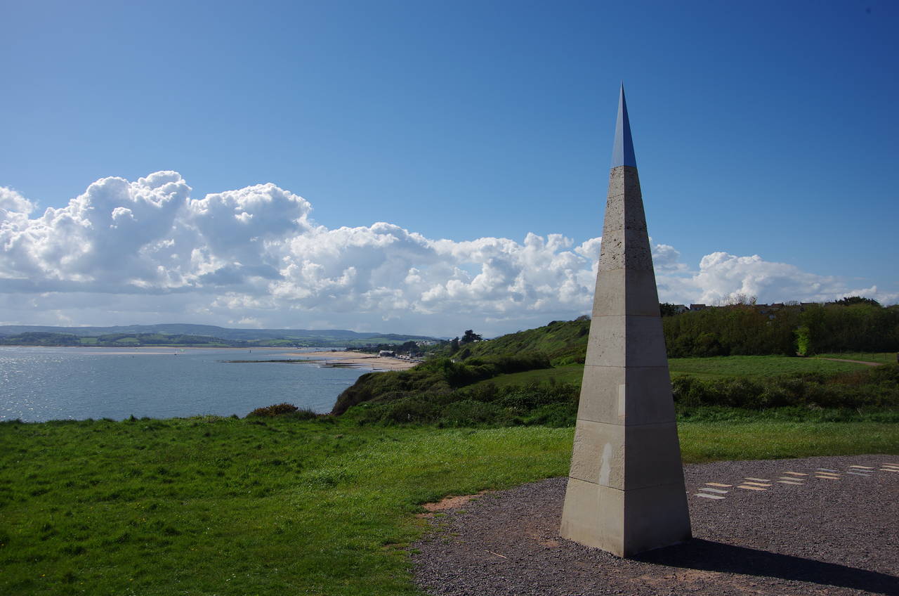
(23) The Geoneedle, Orcombe Point

(24) Foxholes Beach
After dipping down to cross a deep, shady gully, the Coast Path reaches the edge of the large Devon Cliffs Holiday Park. The path runs between the perimeter fence and the cliff edge down to a small carpark by a playground. Here the route turns right to cut across the neck of Straight Point to a larger carpark above Sandy Bay (picture 21), the headland being permanently closed to the public as it is occupied by a Ministry of Defence rifle range where live firing was taking place as I passed.
The clifftop path runs above Sandy Bay, still beside the enormous holiday park for some distance until it enters the National Trust's High Land of Orcombe (picture 22), where a number of information boards and stone plaques beside the path describe the local plants and animals. The red sandstone cliffs here are the oldest on the Jurassic Coast, dating back around 250 million years to a time when the rocks here were part of a desert.
From the high point of the cliffs by a rusty metal shelter, the path descends to Orcombe Point, where the River Exe meets the English Channel. Standing atop the point is the Geoneedle (picture 23), marking the western end of the Jurassic Coast World Heritage Site, which the Coast Path had been traversing all the way from Old Harry Rocks, 152 kilometres away in Dorset.
From Orcombe Point the path heads northwards for a few hundred metres, leaving the High Land of Orcombe on the edge of the town of Exmouth and following a narrow path through scrub above Foxholes Beach (picture 24).
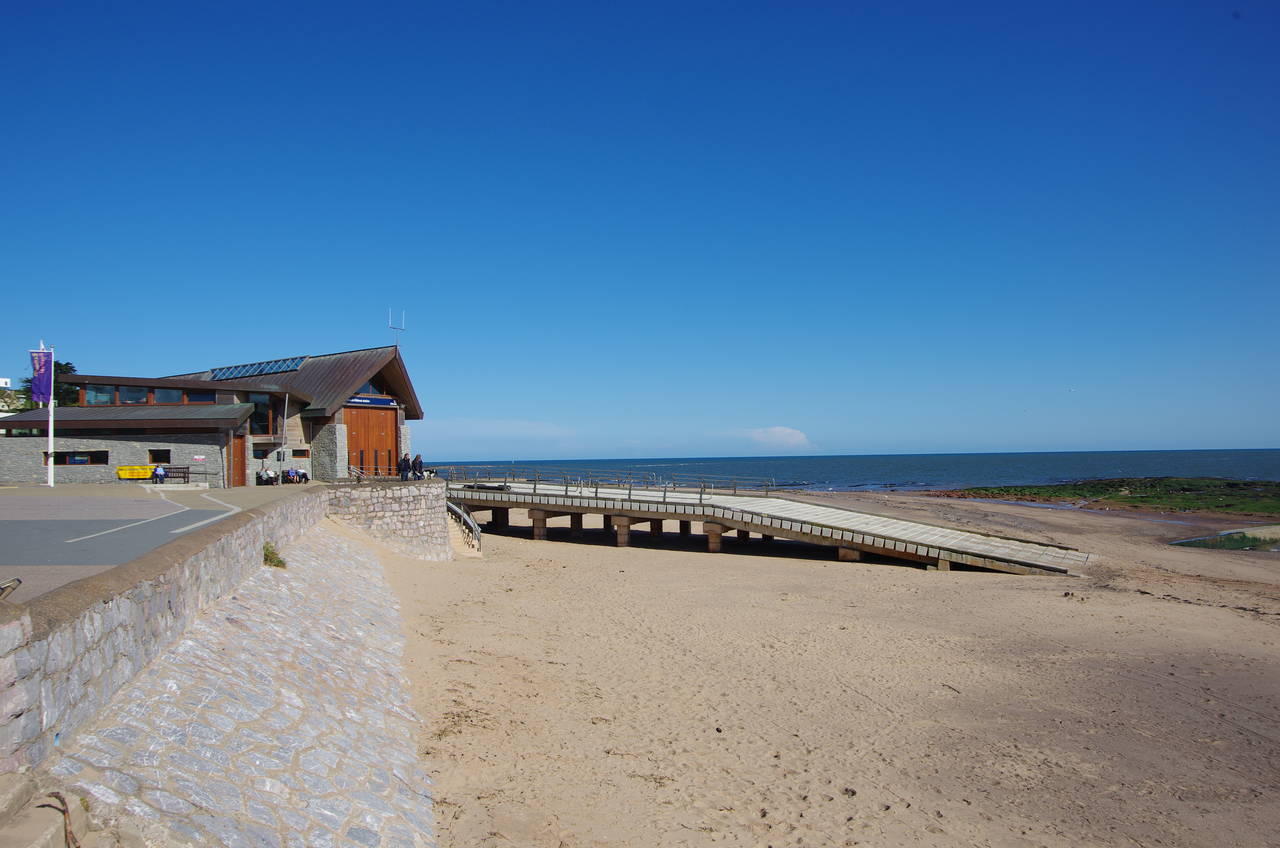
(25) Lifeboat Station, Foxholes

(26) Queens Drive, Exmouth

(27) Clock tower, Exmouth

(28) Exmouth Marina
At the far end of the beach the path joins a road behind a carpark and swings left at an intersection to follow Queens Drive, which returns to the beach by the RNLI Exmouth Lifeboat Station (picture 25). The path then follows the beachside promenade all the way along Exmouth's long waterfront (picture 26), passing the town's clock tower (picture 27) before reaching the marina (picture 28), where the Coast Path crosses the River Exe via the Starcross Ferry.
Here I left the path for the day, with 21.1 kilometres covered on a very enjoyable day's walking. A ten minute walk around the marina and north-eastwards through the town leads to the railway station, which is the terminus of a branch line that runs up beside the River Exe into the city of Exeter, where I would be staying for the next few days. The half-hour train journey offers some good views over the Exe Estuary before heading into the historic city.