THE THAMES PATH
Stage 8: Marlow to Windsor
Tuesday, June 14, 2011

(1) Marlow War Memorial

(2) Parish Church of All Saints, Marlow
(3) The Two Brewers, Marlow

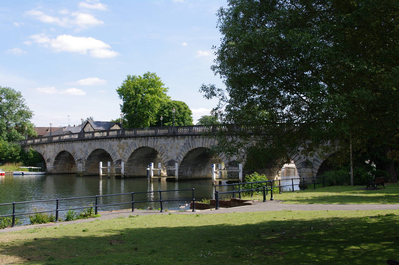
(4) Marlow Lock
After a good night's rest, I returned to Marlow on the branch line via Maidenhead and Bourne End, both of which I would pass on the Thames Path later in the day. Returning to the spot where I had left the Thames Path between the Victorian-era Church of All Saints and the war memorial, I noticed a sign celebrating Marlow's naming as Buckinghamshire's best kept village no less than eight times since 1987 (picture 1).
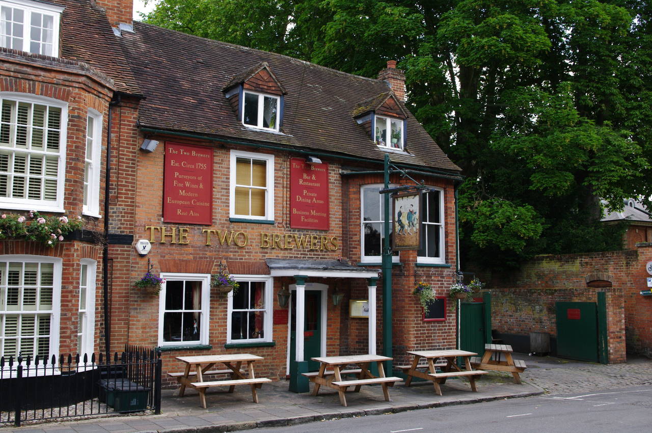
The Thames Path heads through the churchyard (picture 2) and along a short alleyway to reach St Peter Street with a pub called The Two Brewers just across the road (picture 3). To the right of the pub, a signpost points along another narrow alleyway between high brick walls, which emerges onto Mill Road. The route turns right and follows Mill Road as it curves left to run parallel to the river.
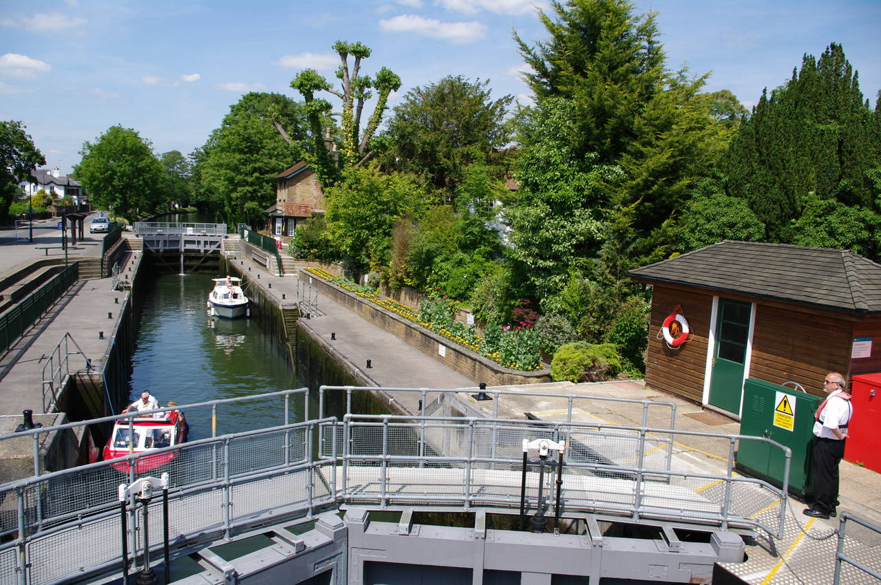
The Thames Path follows the road, but a short distance along it I diverted from the path briefly to follow a signposted path to Marlow Lock (picture 4).

(5) Riverside house near Winter Hill

(6) River Thames upstream of Bourne End

(7) Upper Thames Sailing Club, Bourne End

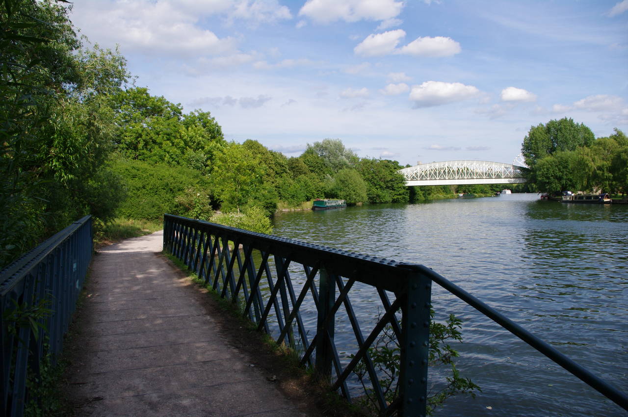
(8) Bourne End Railway Bridge
Returning to the path, I followed Mill Road past some houses that stand on the site of the old Marlow Mill, where the architecture is still quite reminiscent of a real mill. Soon Mill Road becomes Gossmore Lane, where a signpost points to the right between buildings and across a grassy park to reach the riverbank. The riverside path soon goes under the Marlow Bypass Bridge, which carries the A404 between Maidenhead and High Wyecombe.
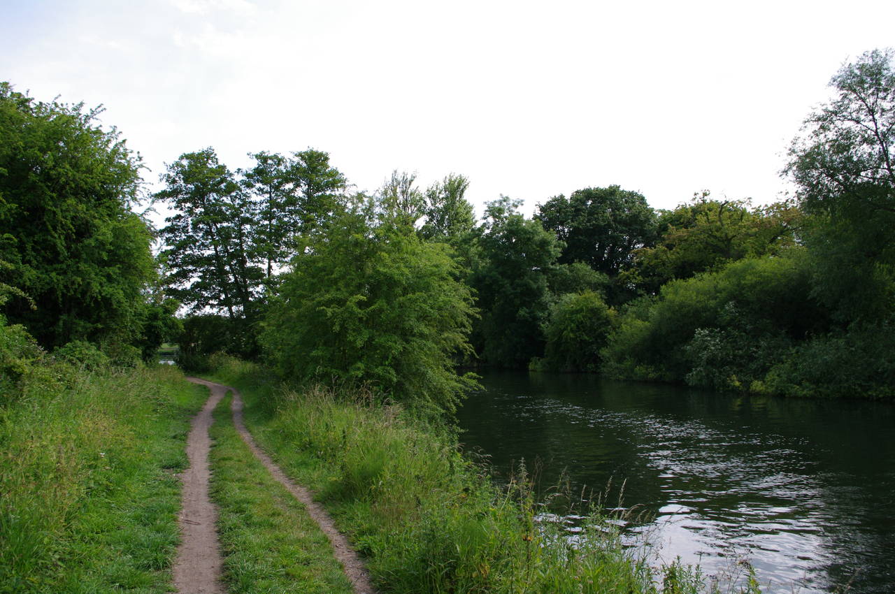
Beyond the bypass road, the Thames Path runs mostly beside large open meadows for around three kilometres to Bourne End. Along the way there are a number of grand houses and gardens perched on the side of Winter Hill across the river and an impressive castellated house on the riverbank (picture 5).
This was quite a peaceful stretch of path, with just the occasional passing boat for company (picture 6) until the path reaches Bourne End. On the edge of the village, the route joins a riverside footpath, passing some houses and the boathouse and clubhouse of the Upper Thames Sailing Club, where numerous small boats were moored (picture 7).
The path continues past a marina before heading between gardens just back from the river until the path leads up to the Bourne End Railway Bridge. Steps lead up to a footbridge attached to the upstream side of the iron railway bridge, by which the Thames Path crosses to the south bank of the river, where the path passes under the bridge (picture 8) and heads off downstream.

(9) Holy Trinity Church, Cookham

(10) The Tarry Stone
(11) Path rejoins the Thames below Cookham
(12) Thames Path above Maidenhead
The next section of the path runs beside a large meadow with a fairly continuous line of riverside homes occupying the opposite bank. After about 1500 metres, the path passes through a gate by a large boatyard on the edge of Cookham, and continues up towards Cookham Bridge. Just before the bridge, the path leaves the river to the right, following a path through the grounds of the Holy Trinity Church (picture 9).
The path leaves the churchyard on a lane between a couple of white cottages, reaching an intersection with Ferry Lane. By the intersection, the Tarry Stone, a chunk of sarsen stone (the same type of stone used at Avebury and Stonehenge) is embedded in the footpath in front of a memorial bench for a pilot lost in World War II (picture 10).
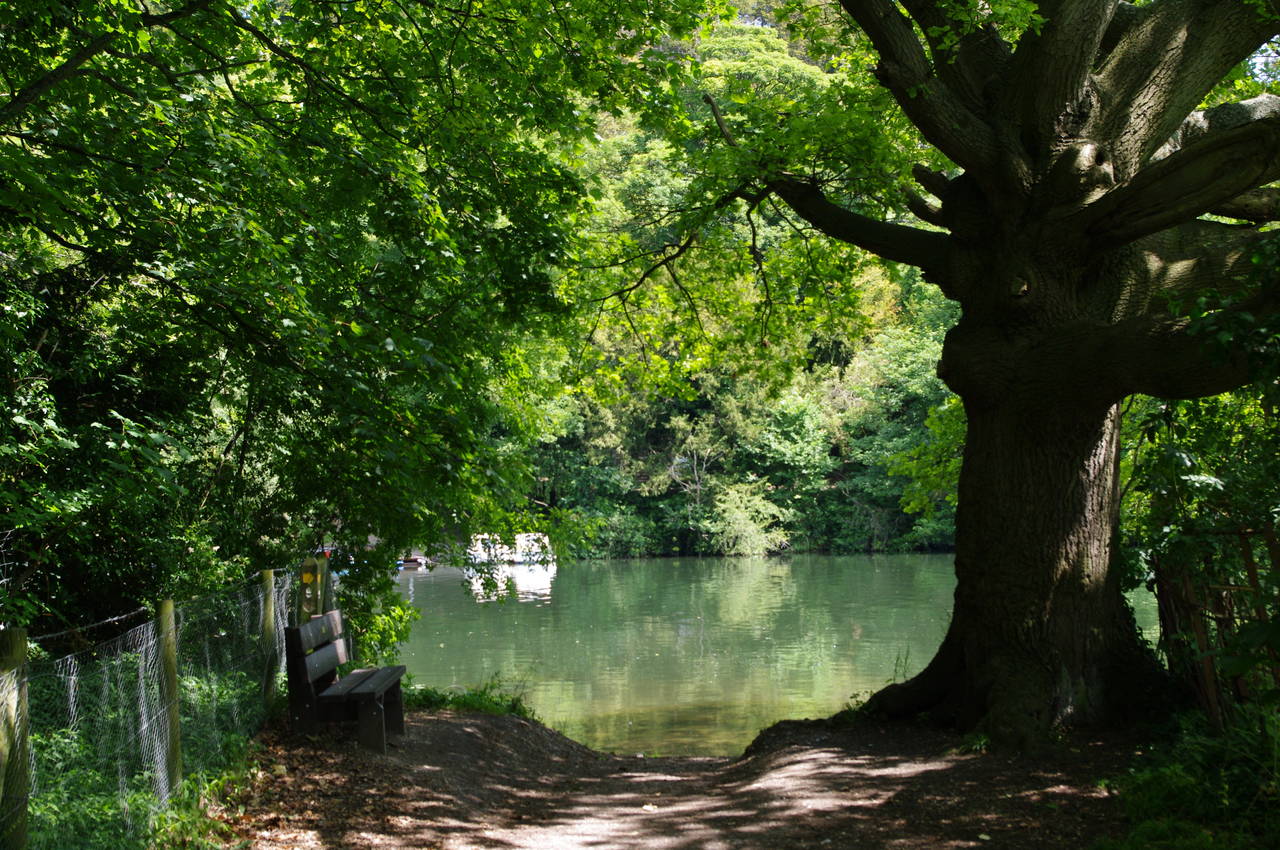
From here the route turns left and follows Sutton Road through the village of Cookham, eventually turning left onto Mill Lane. A short distance after passing a cricket field screened by a hedge on the left, the path leaves the lane next to a big white gatepost on the right and runs along the edge of a narrow strip of woodland to return to the riverbank. Where the path rejoined the river, a bench provided a handy, shady place to stop for lunch (picture 11).
While bypassing the section of river immediately below Cookham Bridge, the Thames Path had also bypassed Cookham Lock, which if I remember rightly is only the second lock the route has not passed within sight of.
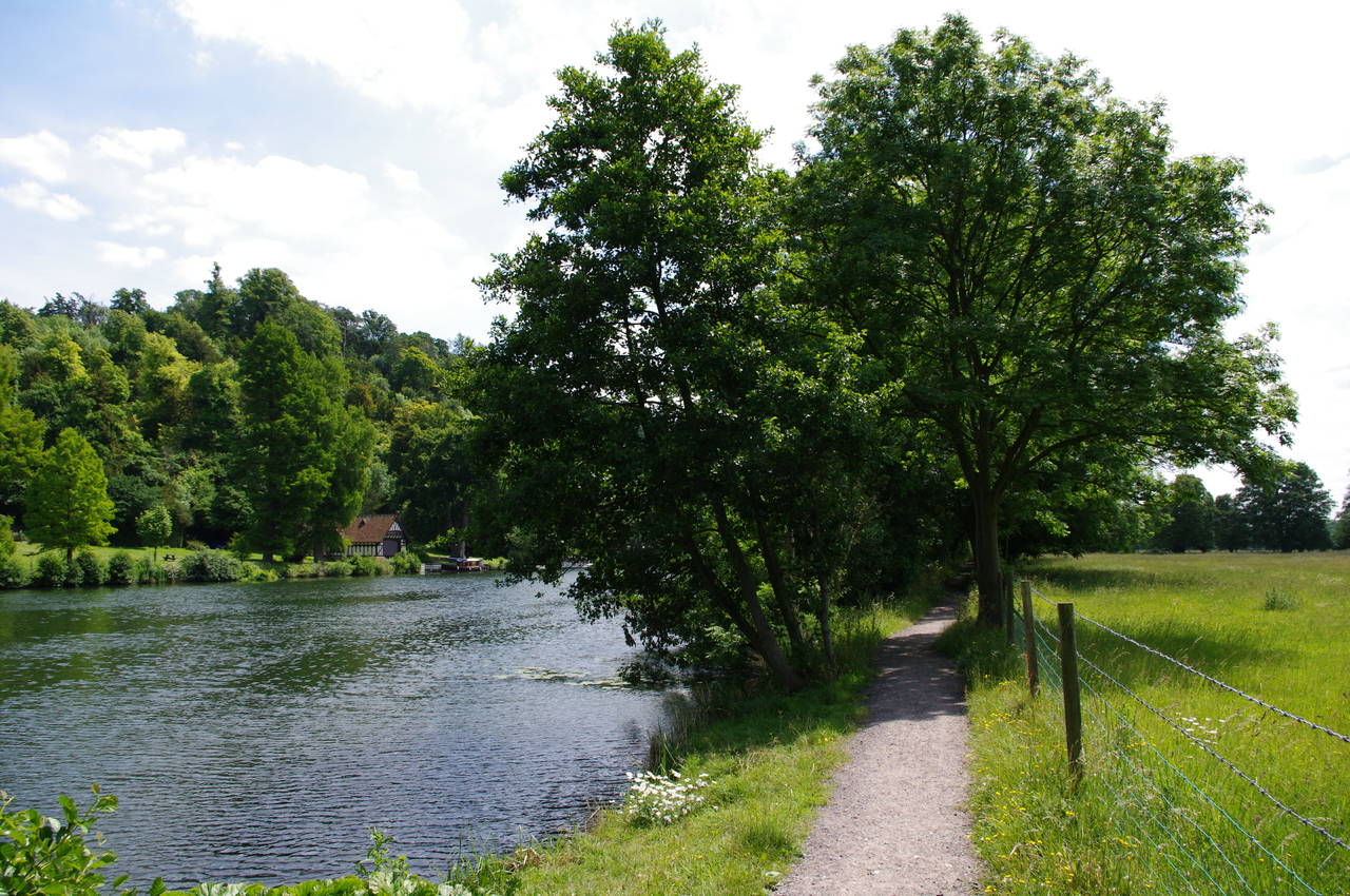
After polishing off my sandwiches, I continued along the shady riverside path, which passes several fields (picture 12) before reaching the outskirts of Maidenhead.
(13) Boulters Lock
(14) Maidenhead Bridge

(15) Maidenhead Railway Bridge

(16) Bray Lock
After passing several landing stages and some fancy riverside homes, the path joins a road which runs alongside the lock cut leading up to Boulters Lock (picture 13). The picture was taken from a bridge which crosses the lock cut just below the lock to reach a pub on the lock island. An earlier lock built on this site in 1772 was at that time the lowest lock on the Thames.
It wasn't that long since I'd had lunch, so I reluctantly decided to forego a visit to the pub and continued to follow the shady footpath along the riverbank until the path is forced to follow the road past a line of riverside houses before crossing a park to return to the river by Maidenhead Bridge (picture 14).
The path climbs up onto the bridge and crosses back into Buckinghamshire via the upstream footpath before turning left and circling around to follow the towpath under an arch of the bridge. Just downstream from the bridge, the path passes the Maidenhead Rowing Club, where a couple of fit young ladies were stowing several rowing boats in a rack.
The route then joins River Road and follows it along the riverbank and under the Maidenhead Viaduct (picture 15). The bridge was designed by Isambard Kingdom Brunel and constructed in 1838 to carry the Great Western Mainline across the Thames. At 39 metres, the bridge's two main arches are the longest and flattest brick arches in the world.
Below the viaduct, the road soon turns away from the river and the Thames Path continues along a shady and well-worn riverside path with green fields to the left and an almost continuous line of houses across the river. After almost two kilometres the path arrives at Bray Lock, where the lock-keeper was releasing a large cruiser from the lock on its way upstream (picture 16).

(17) M4 Motorway Bridge

(18) Summerleaze Footbridge
(19) Path opposite Queen's Eyot

(20) Chapel of St Mary Magdelene, Boveney
From the lock, the route follows a sealed footpath downstream and under the New Thames Bridge (picture 17), which carries the six lanes of the M4 Motorway over the river and the towpath. With the traffic noise fading away behind me I continued along the path past the gardens of the houses of Dorney Reach, soon passing by the Summerleaze Footbridge (picture 18).
From here, the path follows the river alongside the Dorney Lake Country Park. Dorney Lake is a 2200 metre-long rowing lake belonging to Eton College, which will be the rowing venue for the London Olympic Games. The Summerleaze Footbridge was originally built to carry a gravel conveyor during construction of the lake, but now carries pedestirans.
The path through the country park is mostly quite enclosed by trees, so there weren't many good views of the lake. The path does however pass a small wooded island in the middle of the river called Queen's Eyot (picture 19), which is a popular wedding and conference venue.
Eventually the river bends left around the end of the rowing lake and the path crosses the forecourt of a modern boathouse. A short distance further, as the river curves back to the right, the path passes by the riverside Chapel of St Mary Magdelene (picture 20), parts of which date back to the 1100's.

(21) Boveney Lock

(22) South Field

(23) Queen Elizabeth Bridge
(24) Approaching Windsor Railway Bridge
A few minutes further along the riverside path, I reached Boveney Lock (picture 21), which is interesting for having a ramp with rollers running parallel to the lock so that small rowing boats can bypass the main lock.
For the next kilometre the route follows a broad footpath past South Field (picture 22), leaving Buckinghamshire for the last time on the walk and crossing into a small area of Berkshire that lies north of the Thames. Beyond South Field, the course of the river bends right then sharply left before flowing under the Queen Elizabeth Bridge (picture 23), which carries the A332 road. Further on, the path crosses a footbridge over a side stream and then passes under the Windsor Railway Bridge (picture 24), which is crossed by the small branch line between Slough and Windsor & Eton Central Station. The bridge was built in 1849 and is the oldest wrought-iron bridge in the world that has been in continuous use.

(25) Brocas Meadow

(26) Eton High Street
(27) Windsor Bridge

(28) Windsor Castle
The path now crosses Brocas Meadow (picture 25) towards the town of Eton, with the towers of Windsor Castle dominating the view ahead and a large ferris wheel across the river to the right. There were quite a number of people out for an afternoon stroll in the meadow and many boats using this section of the river.
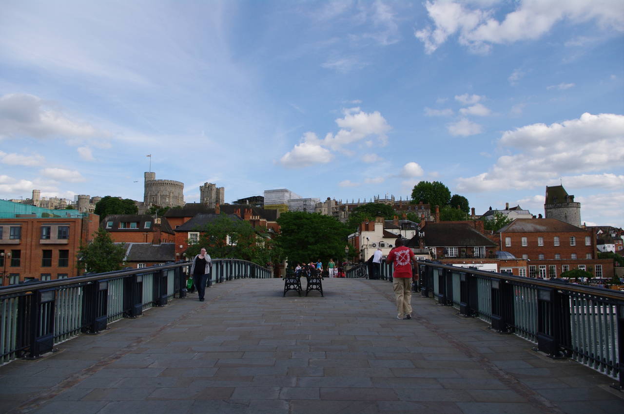
Reaching the other side of the Brocas Meadow, the path heads between buildings and along a lane to reach the foot of Eton's High Street (picture 26). Here the Thames Path turns right and soon crosses over Windsor Bridge (picture 27), which has carried only pedestrians since cracks were discovered in the iron structure in 1970.
At the Windsor end of the bridge, I left the Thames Path, having crossed off another 22.6km of the trail. From the bridge it was about ten minutes walk ahead and then to the right along Thames Street beneath the high walls of Windsor Castle (picture 28) to reach the shopping mall that contains the Windsor & Eton Central Station.