
Two Moors Way
The Two Moors Way, opened on 29 May 1976, links the town of Ivybridge on the southern edge of Dartmoor to the coastal village of Lynmouth on the northern edge of Exmoor. Between these settlements, the Way crosses the Dartmoor National Park, the fertile farmland of mid-Devon, and the Exmoor National Park. Combined with the shorter Erme-Plym Trail, the Two Moors Way provides the bulk of the Devon Coast to Coast Walk, though part of the route across Exmoor is actually in Somerset.
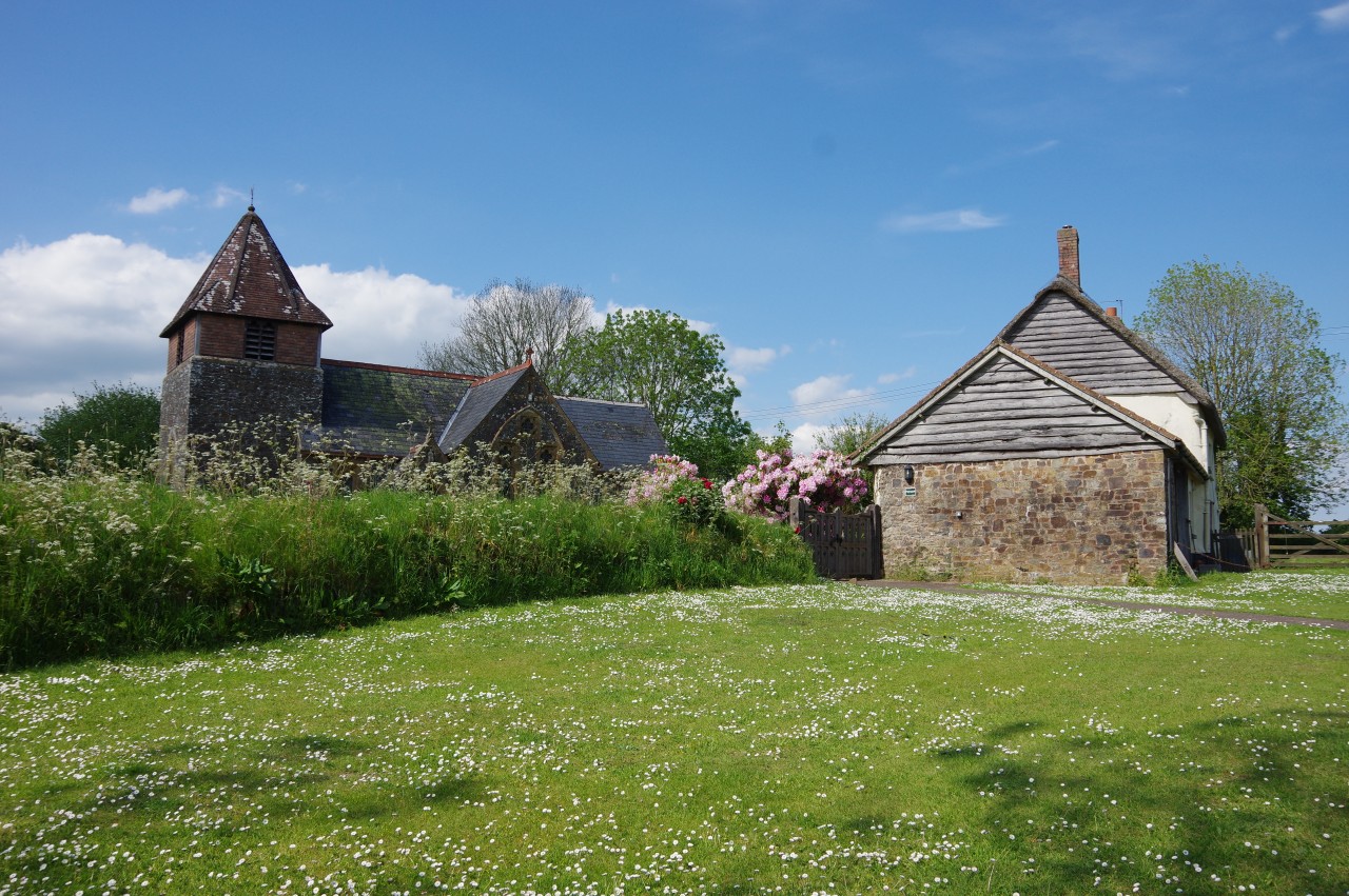
Ivybridge is the only town on the Two Moors Way, though there are villages along the rest of the path providing accommodation, pubs and a few village stores. There are also several campsites on or near the path and wild-camping is permitted on most of Dartmoor, so it is possible to camp out for the majority of the walk for those willing to carry the extra weight of a tent and sleeping bag.
One of the attractions of the Two Moors Way is that the three areas it visits offers three very different landscapes.
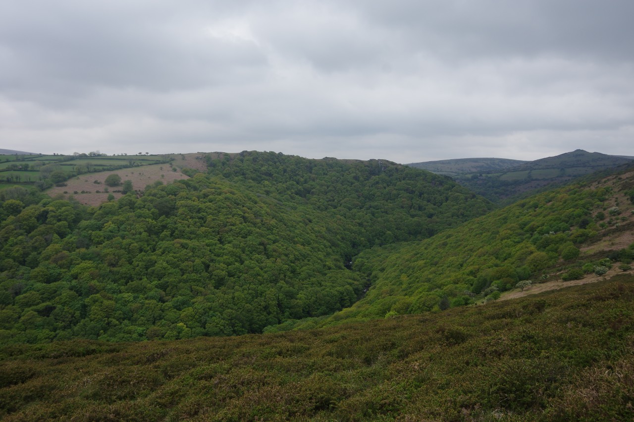
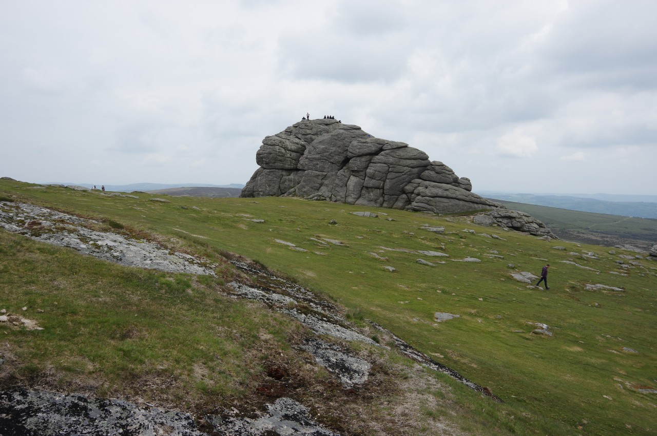
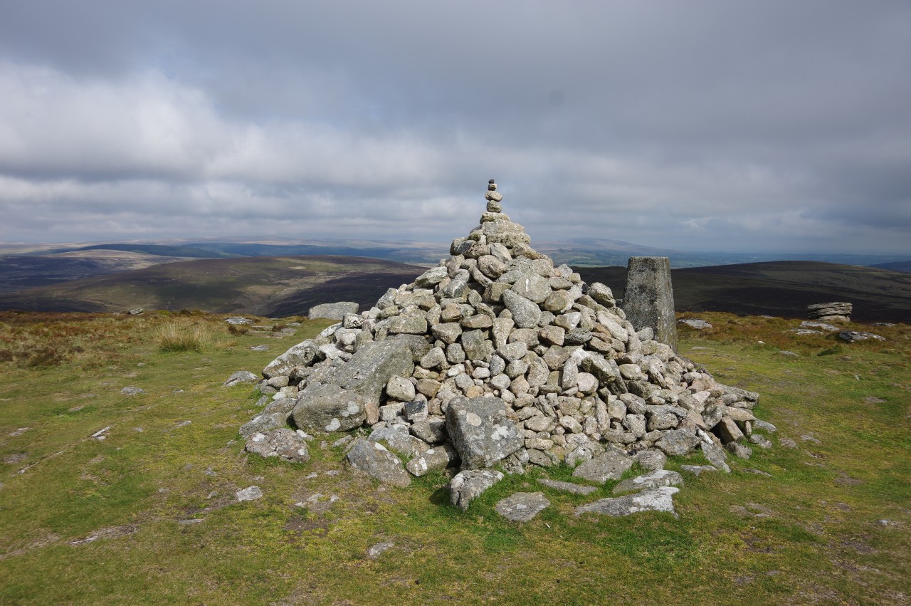
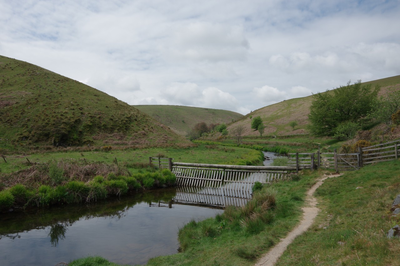
Dartmoor is an elevated granite plateau, part of the same mass of granite that stretches westward under Cornwall, surfacing on Bodmin Moor, the West Penwith Moors and the Isles of Scilly. The sparsely-settled central moor is mostly covered in fairly barren moorland and peat bogs, with dozens of minor peaks topped by spectacular rocky granite tors. Contrastingly, the fringe of the moor is ringed by attractive villages and lush river valleys fed by the moor's high annual rainfall, which typically doubles that of the surrounding territory.
I have seen Dartmoor described in several places as "England's last wilderness", but that is a long way from the truth. The barren landscape we see today is actually the product of ancient humans, who cleared the once-heavily-forested moor to make it suitable for grazing and early farming. Evidence of occupation by prehistoric humans is everywhere on Dartmoor, with the high moor possessing England's greatest concentration of stone circles, stone rows, standing stones, and hut circles, along with the impressive stone-walled enclosure of Grimspound. Relics of a tin-mining industry that operated from medieval times until the 20th century are also quite abundant on the moor.
For such a barren-looking landscape, Dartmoor has a surprising amount of wildlife in addition to the sheep and cattle that graze common land. On the high moor one will regularly encounter groups of roaming Dartmoor Ponies and see birds of prey patrolling the skies.
Dartmoor's highest tors are found in the north-west quarter, much of which is reserved as a military training ground. The highest peak is High Wilhays, near Okehampton, which at 621 metres above sea-level is the highest ground in Britain south of the Brecon Beacons.
The Two Moors Way crosses the eastern half of Dartmoor, taking in some moderately challenging terrain (both physically and navigationally), but missing the highest part of the moor in favour of passing close to some of Dartmoor's famous beauty spots. The most popular of these are the village of Widecombe-in-the-Moor, the peaks of Hound Tor and Haytor (off the Way a little east of Widecombe, but visible from the trail), and the heavily-wooded valley of the River Dart around New Bridge. During the day, these spots are often thronged with coachloads of tourists, but a walker visiting in the morning or late-afternoon can have these places almost to themselves. Away from the tourist honeypots, one might walk for hours and see nobody save for an occasional mountain-biker or a fellow long-distance walker.
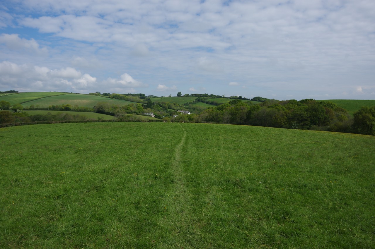
In contrast to Dartmoor, the almost fifty kilometres of rolling mid-Devon farmland that separates the two moors has few specific sights, aside from some wonderful views back to Dartmoor and forward to Exmoor, and is little-visited by tourists. The walking here is very pleasant and generally easy, with most of the path crossing a patchwork of green fields and small woods, with a few stretches on lightly-trafficked rural lanes.
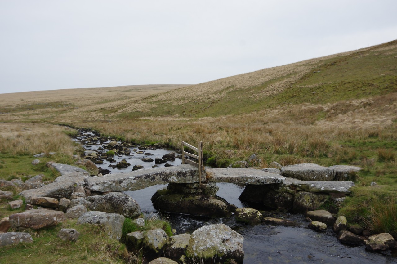
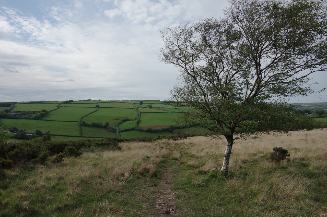
The Exmoor section of the Two Moors Way begins by crossing peaceful farmland and moorland before descending into the valley of the River Barle, which is followed upstream to the small village of Simonsbath. Climbing over a moorland ridge behind the village, the Way passes the source of the River Exe before following the valley of Hoar Oak Water down to the East Lyn River at Watersmeet. The final stretch of the path climbs one last time to run along the lip of the gorge high above the East Lyn River before descending into Lynmouth to reach the end of the Two Moors Way on the sea-wall in front of the Exmoor National Park Visitor Centre.
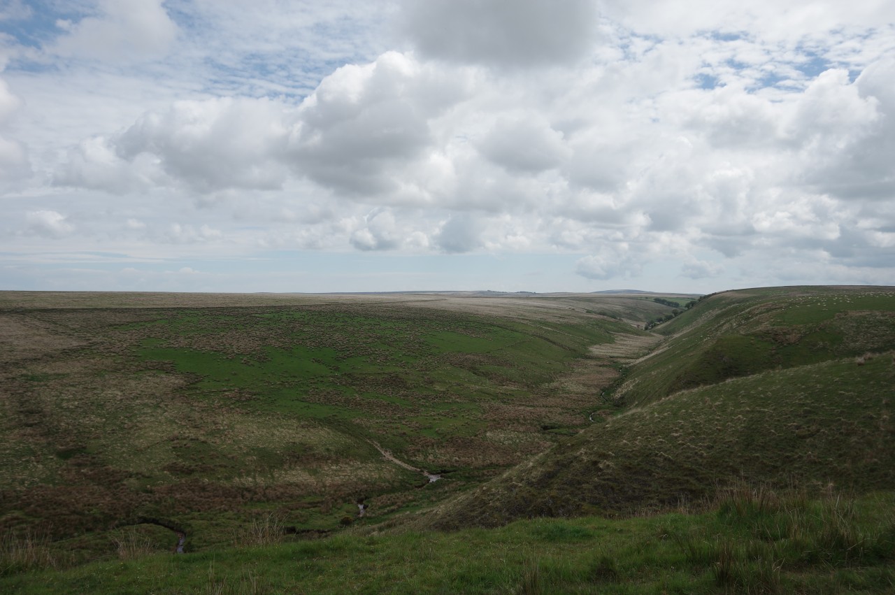
Exmoor feels much less like wilderness than Dartmoor, with small villages scattered throughout the moor, fewer areas of barren moorland and a larger percentage of the land devoted to productive farming. With the underlying geology being sandstone and shale, Exmoor has rounded hills and deep combes and gorges rather than the jagged granite tors of its southern neighbour. There are also fewer prehistoric remains on Exmoor. There is plenty of wildlife on Exmoor, however, with the most prominent being England's largest herd of red deer, which inhabit the valleys around Simonsbath. Exmoor also has its own distinct breed of pony, though these are rarer than their cousins on Dartmoor.
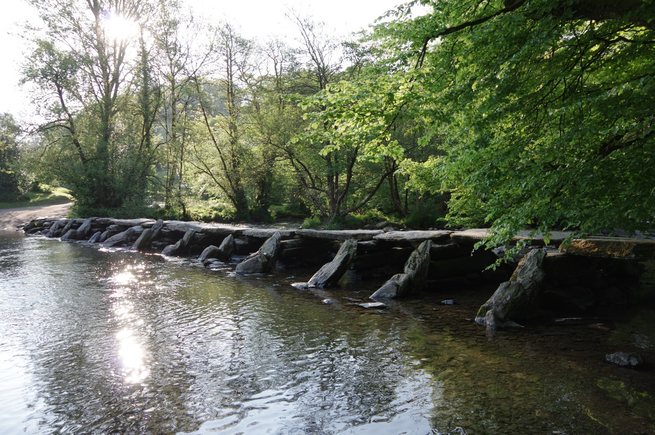
Like Dartmoor, Exmoor has it share of beauty spots on the itineraries of coach holidays, but once again peace returns after the last coach leaves. The most popular tourist spot on Exmoor is Tarr Steps, an ancient clapper bridge spanning the River Barle. I was lucky enough to have the whole place to myself when I camped on the riverbank next to the famous bridge.
Getting to and from the Two Moors Way is very easy. Ivybridge has regular trains from Plymouth, Exeter and points farther afield, while Lynmouth has buses that connect to the National Rail network at Barnstaple and to the West Somerset Railway's regular steam-hauled trains at Minehead. The village of Morchard Road, roughly at the halfway point of the Two Moors Way, is also on the branch line between Barnstaple and Exeter.
The route of the Two Moors Way is shown on Ordnance Survey maps, though there did appear to be a few minor errors on the maps, which I will mention at the relevant points in the descriptions of each day's walk. The path is well-signposted for most of the way, except on open moorland, where some map-reading and navigational skills are required.
Day 1
Ivybridge to Holne
16 May 2019
22.1km
Day 2
Holne to Hamel Down
17 May 2019
11.6km
Day 2A
Circular walk from Widecombe-in-the-Moor
18 May 2019
20km
Day 3
Hamel Down to Drewsteignton
19 May 2019
24.4km
Day 4
Drewsteignton to Morchard Road
20 May 2019
20km
Day 5
Morchard Road to Witheridge
22 May 2019
15.8km
Day 6
Witheridge to Tarr Steps
23 May 2019
26.2km
Day 7
Tarr Steps to Simonsbath
24 May 2019
16.6km
Day 8
Simonsbath to Lynmouth
25 May 2019
16.2km