TWO MOORS WAY
Stage 4: Drewsteignton to Morchard Road
Monday, May 20, 2019

(1) The Square, Drewsteignton

(2) Lane descending from Drewsteignton

(3) Path to Winscombe

(4) Winscombe
After a good night's sleep in the Barley Meadow campsite, I awoke to overcast skies. My attempt to select a camping pitch where I could catch the early morning sun would go unrewarded. Packing away my tent and the rest of my gear as quietly as I could, it wasn't long before I was tramping up the deserted lane towards Drewsteignton in the cool and eerily still morning air.
On returning to The Square (picture 1), the only sign of life was in the small village store, which was just opening for the day. This proved to be rather fortuitous, as I had failed to note the previous evening that the pub only serves breakfast from Wednesday to Saturday.
A few minutes later I was heading back down the narrow lane (picture 2), nibbling on a fresh salad roll; not quite as tasty as my customary Full English Breakfast, but no doubt a lot healthier. In the bottom of the valley, where the lane turns right towards the camping ground, the Two Moors Way goes straight ahead over a small footbridge and along the driveway of Veet Mill Farm.
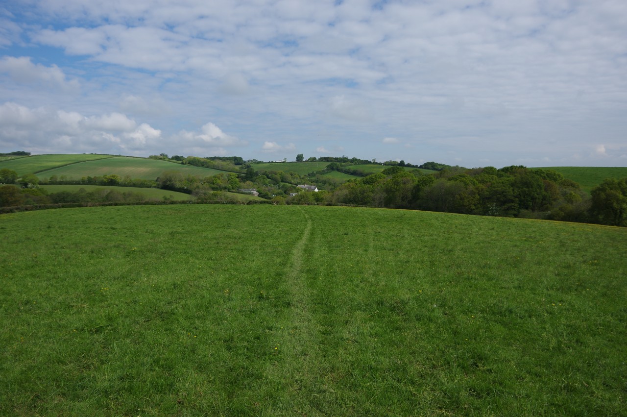
A signpost to the right of the first ivy-clad barn points the way across a small stream and then uphill beside it, climbing a flower-lined woodland path through a couple of gates before recrossing the stream to join a path that continues to ascend between hedges (picture 3).
Just before the top of the path, I found the way almost blocked by a large metal trailer, leaving barely enough room to squeeze past to reach the farm buildings of Winscombe (picture 4). As I followed the farm drive between the buildings, an unseen but fearsome-sounding dog seemed keen for me to be on my way without delay. Not the most walker-friendly spot on the Two Moors Way, it has to be said.

(5) View back to Drewsteignton

(6) View west along the A30

(7) Ramshackle barns
(8) Descending to West Ford Farm
The driveway climbs to meet Hask Lane, where the Way turns left toward a bridge over the A30. I paused for a few moments to admire the view back to Drewsteignton (picture 5) before crossing over the busy road (picture 6), which here forms the northern boundary of Dartmoor National Park. From this point, the Two Moors Way will traverse fifty kilometres of fertile mid-Devon farmland that separates Dartmoor from Exmoor.
Across the bridge, the Way turns right down a gravel track to reach a stile between two farm gates. Over the stile, a line of trampled grass heads left to climb along the edge of a large, grassy field and pass a couple of airy barns (picture 7) before the path falls away towards a stile in the corner of the field. After descending the short edge of the next field to cross a second stile, the path keeps on in the same direction across the next couple of fields, heading for West Ford Farm (picture 8).

(9) West Ford

(10) Hill Farm

(11) Boardwalk

(12) Whitethorn Farm
From the bottom of the last field, a short stretch of woodland path leads to a ford over the River Yeo (picture 9). Just along the lane from the ford, the Way turns right at a junction near the farmhouse of West Ford Farm and at the next junction, half a dozen steps lead up to a gate and a path that climbs steeply up a couple of grassy meadows in Hill Farm (picture 10).
At the top of the hill, the Way is signposted across a smaller meadow, through trees and across another meadow, skirting around the buildings of Hill Farm, which are screened from view just over to the left of the path. A fenced path then leads over a stile onto a shady stretch of boardwalk (picture 11) from which the Way continues along the edge of a field to turn right over one more stile to emerge in the middle of Whitethorn Farm (picture 12).

(13) Newhouse Lane

(14) Old School House, Hittisleigh

(15) Hittisleigh Barton

(16) View across Coltsfoot Farm toward Exmoor
The Two Moors Way turns left to follow Newhouse Lane away from Whitethorn, across a little valley (picture 13) and up to a junction at the edge of the hamlet of Hittisleigh. To the right, the Way passes the brick and granite 19th-century former primary school building (picture 14) and continues through a crossroads on a quiet lane passing several more farms, the first of which is Hittisleigh Barton.
Barton is an Old English term that literally means "barley settlement" and is still in use in mid-Devon to denote large, self-contained farming estates that have their own private church, as indeed this one does, with the castellated tower of the Church of St Andrew visible from the road (picture 15).
The Way sticks to the narrow, but thankfully lightly-trafficked, lane for another hour's walking. For the first couple of kilometres, the lane is lined with hedges and there are no views until the top of a small rise, where one can gaze northward across a green valley to Coltsfoot Farm and the more distant outline of Exmoor (picture 16).

(17) Great Heale Cross

(18) Crossing the River Troney

(19) Muddy track

(20) Westcombe Hill
There are several more spots with views to the north as the lane continues through Road Down Cross and Binneford Cross, eventually reaching Great Heale Cross (picture 17). Here the Two Moors Way finally leaves the lane after a little more than four kilometres, turning sharp left to follow another narrow lane steeply downhill.
At the foot of the slope, the Two Moors Way ignores a turning signposted for Great Heale, instead continuing to the next junction to turn right across a timber road bridge spanning the languid River Troney (picture 18). At a bend a few paces ahead, the Way leaves the lane through a wooden five-bar gate to join a sunken uphill track. After negotiating a rather muddy section (picture 19), the track emerges into a large meadow on Westcombe Hill, climbing a little more before the ground levels out (picture 20). This was a pleasant spot to sit down on the soft grass for twenty minutes to rest and eat my lunch.

(21) Horwell Wood

(22) Crossing the Okehampton branch line

(23) Whelmstone Cross

(24) Ford Hill
Ahead, I joined a farm track at the next gate, following it out to turn right along a quiet lane. I was a little confused about the route here, with the OS map and the TMW website showing two different earlier turnings off the track, but I failed to spot any signposts or well-worn paths for either of those. It didn't really matter as both end up on the same lane a little further on.
Almost a kilometre along the lane, a TMW signpost points left along a track leading to a gate on the edge of Horwell Wood (picture 21). The natural woodland soon transitions to tall plantation trees as the path descends gently to a stile beside the single track of the Okehampton branch line (picture 22).
The line was once busy with passengers travelling between Exeter and Okehampton on the north-western edge of Dartmoor and with stone being shipped out from the Meldon quarry to Okehampton's west, but over the last fifty years traffic on the line has dwindled to a handful of tourist trains on summer Sundays. At the time of writing there are plans to restore daily passenger services from Exeter to Okehampton and perhaps to eventually reinstate the track from Okehampton to Plymouth to provide a backup for the main coastal line, which was cut off for six weeks in 2014 after a storm undermined the sea-wall and tracks near the town of Dawlish.
Across the railway line, a sunken path climbs along the middle of a thin band of trees to reach a road junction at Whelmstone Cross. The Way continues ahead through the crossroads and down Ford Hill, but there were some worrying signs at the junction (picture 23). Closer inspection of the notice posted by the local council revealed that the road was closed to through traffic but still open to Two Moors Way walkers, so I continued on my way down the narrow sunken lane (picture 24). Descending into a small copse a short distance beyond the thatched farmhouse of Whelmstone Barton, the reason for the road closure became obvious, with one side of the lane having collapsed into a small stream. Nothing on four wheels was going to be driving through here anytime soon.

(25) Paschoe Dairy Farm

(26) Paschoe Dairy Farm

(27) Appledore Farm

(28) Approaching Sweetfield
After a brief climb up from the copse, the Way turns left off the lane to cross the middle of a large field toward a gate on the edge of Paschoe Dairy Farm, where the Two Moors Way joins the route of the Devonshire Heartland Way. The Way follows a wire fence along the left edge of a meadow to pass between a large pond and a stone cottage where a small team of workmen were constructing a new roof (picture 25). The cottage is an outbuilding of Paschoe House, which stands among tall trees further to the left of the path.
The Way continues alongside the fence to reach a gate as it draws level with dairy buildings (picture 26), turning through the gate and running beside the long building to some steps up into a pasture. The route follows the right edge of the pasture beside a hedge and through a gate to join a steep gravel farm track heading up the right edge of a second pasture. I had to wait at the gate for a few minutes for a large herd of dairy cows to pass by before I could proceed up the hill. (The OS map incorrectly shows a non-existent path on the other side of the hedge, but at least the signposting is clear here so it's easy to stay on the correct route.)
At the far end of the hedge, the Way turns right below a solitary wind turbine to head into a copse where the track zigzags downhill to head through Appledore Farm (picture 27). Meeting a lane at the front of the farm, the Way heads left for a hundred metres before bearing right through a gate and then immediately turning up steps into a pasture below a small cluster of thatched farm buildings at Sweetfield.
As I climbed up the edge of the field at a leisurely pace, I was passed by the first walkers I had seen for the day; a group of four who marched resolutely past me, evidently keen to get somewhere in a hurry and too breathless to return my cheerful greeting (picture 28). I have never really understood why some walkers need to eat up the kilometres as quickly as possible without taking the time to enjoy the countryside they pass through, but perhaps I would have been the same if I had taken up long-distance walking in my twenties rather than in my late thirties.

(29) Fields beyond Sweetfield

(30) Church of St Petrock, Clannaborough Barton

(31) View toward Down St Mary

(32) Approaching Barn Hill
From a gate at the top of the field, a path curves around behind the buildings of Sweetfield before turning right up the middle of a huge field, following a well-worn groove uphill past a telegraph pole and onward to join a flower-lined track (picture 29).
The Two Moors Way soon follows the track around a right-hand bend, parting company with the Devonshire Heartland Way, which continues up the hill towards Clannaborough Cross. The track heads across a hillside to Clannaborough Barton, where the Way turns left in front of the medieval Church of St Petrock (picture 30) to follow the farm drive out to the A3072. As I walked through the farm, the familiar aroma of sweet malt and earthy hops alerted me to the presence of the newly-opened Utopian Brewing Company in a large metal barn, though sadly the brewery didn't appear to be open to the public.
One hundred and fifty metres to the right along the vergeless A3072, the Way turns left up a flowery sunken lane, climbing up to a junction with Lammacott Lane and turning right past a large rounded barn. Beyond the barn there is a view across a shallow valley to the village of Down St Mary (picture 31) before a signpost points down a farm track that follows a tall hedgerow along the edge of a large field of barley. The Way ignores the first gate at the bottom of the field, following the track to a second gate, where a path heads through scrub, along the edge of a small meadow and through a small wood to cross a footbridge into a larger, triangular meadow (picture 32). A line of trampled grass aims for a gate in the far right corner, from which a short farm track leads out to a quiet lane named Barn Hill.

(33) Path between A377 and railway

(34) Shobrooke Bridge

(35) Morchard Road Station

(36) Exeter Cathedral
Following the lane to the right, the Two Moors Way soon passes the whitewashed Barn Shelley Lodge. When the lane bears right, a gate on the left opens into an irregularly-shaped field and the Way crosses it and continues along the middle of a long, narrow arm to reach the A377.
Here one must turn left along the skinny roadside verge until a waymarker post points across the busy road. After waiting several minutes for a break in the traffic, I crossed over and joined a grassy track running along a series of narrow fields (picture 33), sandwiched between the main road and the Tarka Line, which runs between Exeter and Barnstaple. The track climbs gently up to Shobrooke Bridge (picture 34), where the Way crosses over the railway line, but I left the trail here, with the 19.9km I had covered for the day bringing me roughly to the midpoint of the Two Moors Way.
Rejoining the A377, I walked for another five minutes to reach the village of Morchard Road, where the Devonshire Dumpling pub is the main facility of interest to walkers, though it isn't open on Mondays, so I missed out on a refreshing pint once again.
A few minutes walk further up the road, the little Morchard Road railway station is a request stop on the Tarka Line. I planned to celebrate reaching the halfway point of the trail by catching a train to Exeter for a day off before returning to walk the rest of the way to Lynmouth.
It turned out that my timing was poor and it was almost an hour until the next Exeter-bound train was due. The attractive stone station building (picture 35), dating from the station's opening in 1854, is now a private residence, so I waited on the platform. Now that I had stopped moving, I soon began to feel quite cold and had put on a couple of extra layers of clothing by the time the train approached the station and I signalled the driver to stop.
Arriving in Exeter, I still had about an hour of daylight left to wander around the city centre and the Cathedral Close, where I watched the setting sun light up the recently-restored west front of the cathedral (picture 36) as the bell-ringers began a long practice session. Accompanied by their melodious tune, I headed back into the city, finally finding that pint that I had been craving all afternoon.