OFFA'S DYKE PATH NATIONAL TRAIL
Stage 1: Sedbury Cliffs to Brockweir
Saturday, June 1, 2019
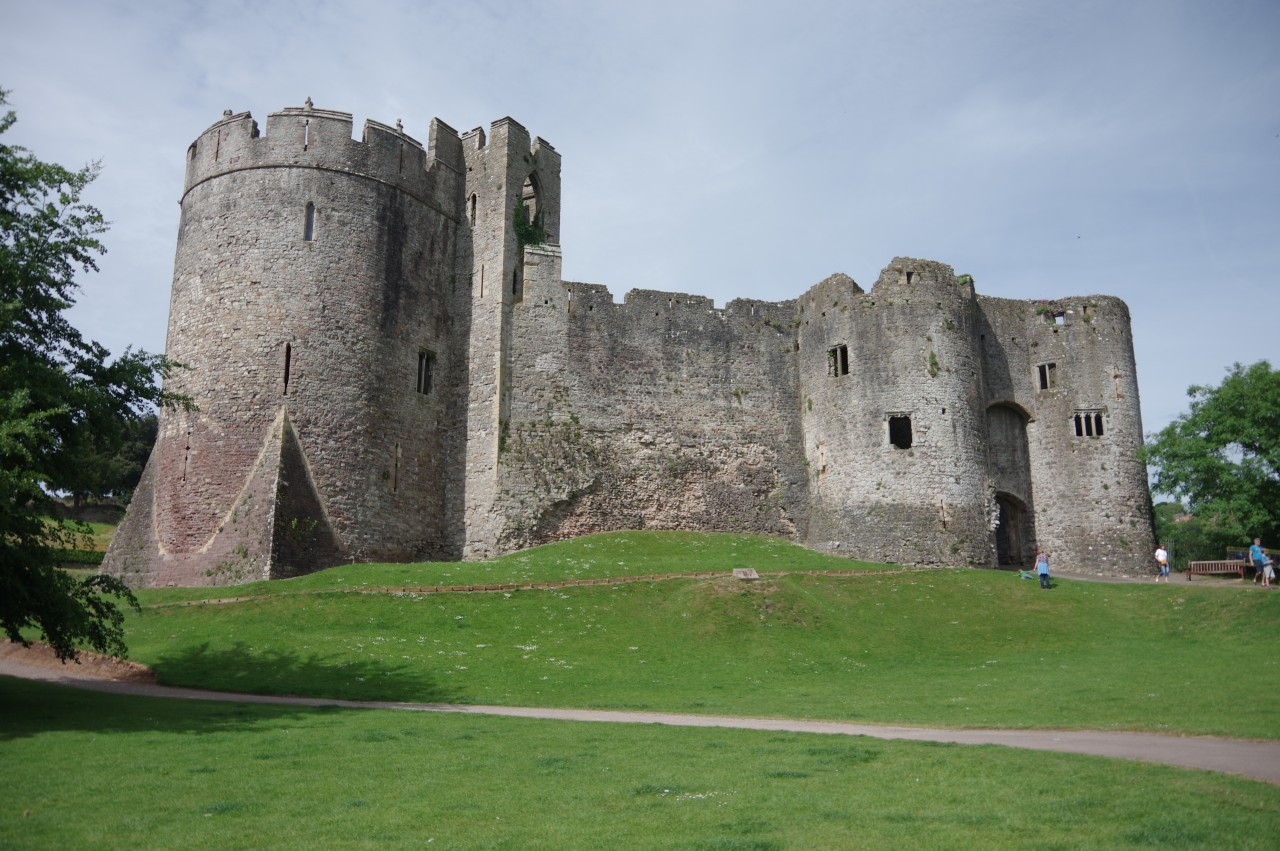
(1) Chepstow Castle
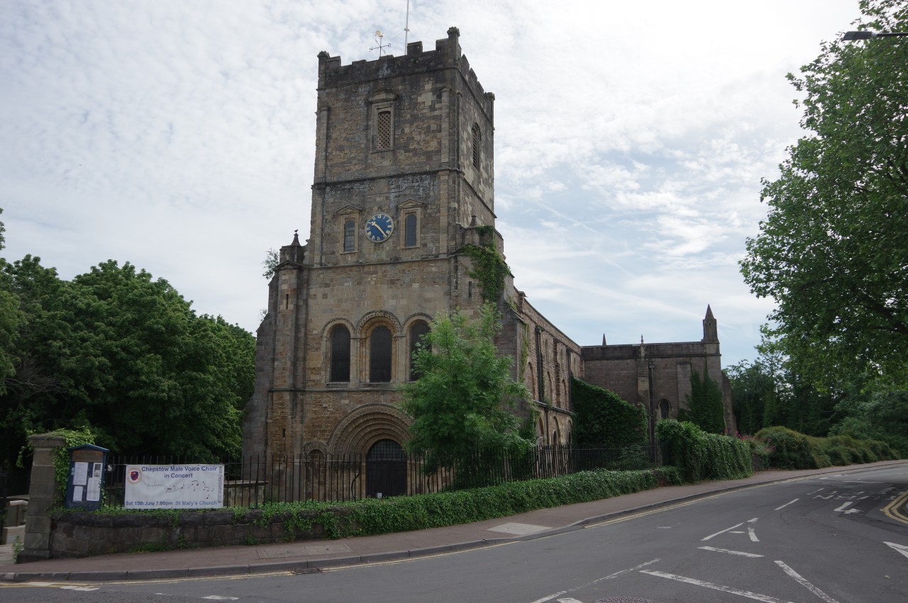
(2) Priory Church of St Mary, Chepstow
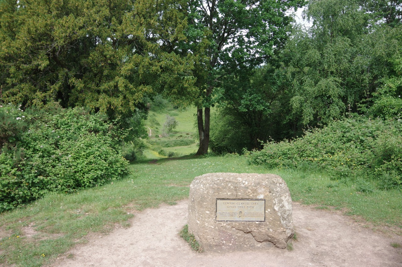
(3) The start of Offa's Dyke Path
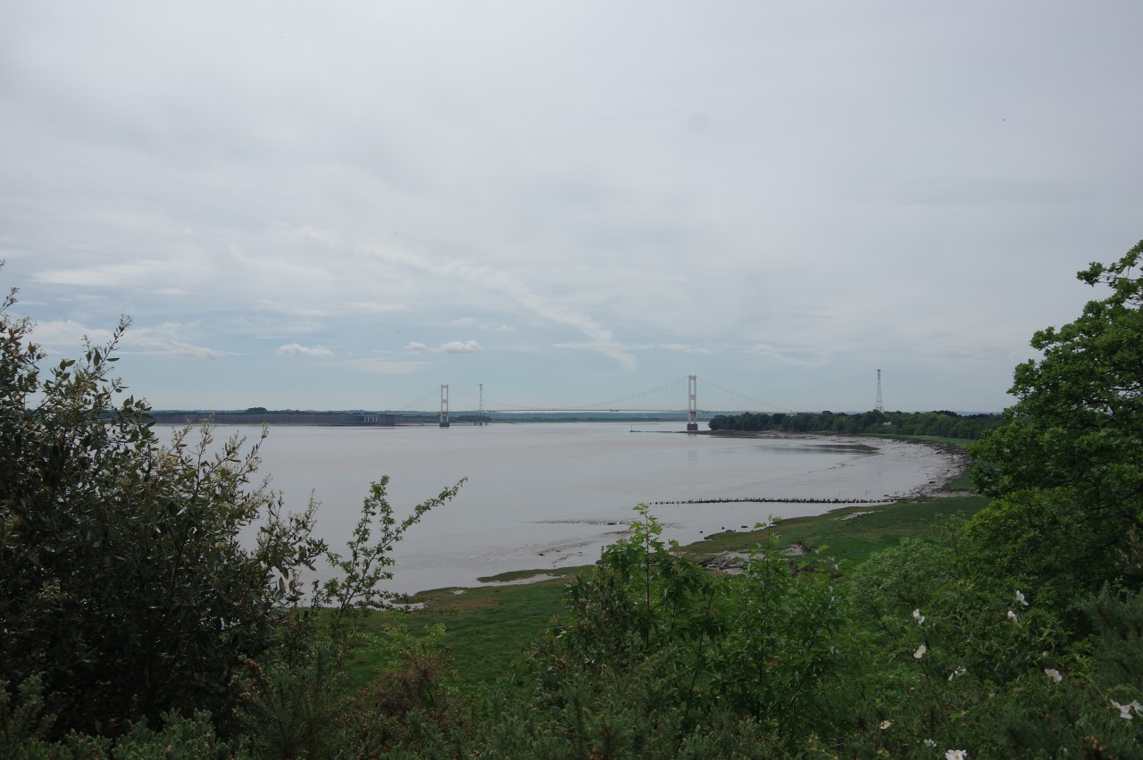
(4) River Severn
The first official day of summer was warm and sunny as I boarded the bus in Bristol's bus station and claimed the prime position at the front of the top deck for the hour-long ride through the urban sprawl of Bristol's northern suburbs and over the Severn Bridge to the bustling little Welsh town of Chepstow.
From the terminus just off the top of Chepstow's High Street, it's about three kilometres walk to the official starting point of Offa's Dyke Path. There is an occasional bus that passes five hundred metres from the start, but with more than two hours to wait for the next one, I opted to use Shanks' Pony. After making a brief diversion to walk past Chepstow Castle (picture 1), which I had last visited for a Proclaimers concert in 2016, I headed out of town past the imposing tower of the Priory Church of St Mary (picture 2). Construction of both the castle and church began in 1067, the year after the Norman conquest, putting them among the oldest Norman buildings in Britain, though both have been much modified in later centuries.
A little east of the church, the A48 crosses over the River Wye and leaves Wales. On the English side of the bridge, a pedestrian ramp climbs up to Beachley Road, which runs south-eastward through the mainly residential village of Sedbury. Sedbury was established in 1917 when the British government decided to build new wartime shipyards on both sides of the mouth of the Wye at Chepstow and Beachley (the next village south of Sedbury) to replace merchant ships that were being sunk in the Atlantic by German U-boats. Only one ship was launched before the war was over and little of the partially completed shipyards remains today, though there is still an army barracks in the shadow of the Severn Bridge in Beachley.
At the end of Beachley Road, I swung right along the pavement beside Buttington Hill, climbing to the crest of the hill, where the Offa's Dyke Path crosses the road near the bus stop mentioned previously. From there, it's five hundred metres along the top of the dyke to the edge of Sedbury Cliffs, where a plaque affixed to a boulder marks the official start of Offa's Dyke Path (picture 3) but underestimates the length of the trail by nine miles (fifteen kilometres).
From the edge of the cliff, one can gaze over the wide tidal estuary of the mighty River Severn (picture 4), where the view is dominated by the Severn Bridge. Opened in 1966, the four lane suspension bridge was the lowest crossing of the River Severn for thirty years until the Prince Of Wales Bridge was built six kilometres further downstream at the point where the estuary begins to widen to become the Bristol Channel.
For an engineer, the Severn Bridge is an interesting subject for study. From my vantage point on the bus ride over the bridge, I could see that the road surface had been patched up many many times. I am also aware that the bridge will eventually become unsafe, as the two suspension cables that hold the bridge up are each made of more than eight thousand individual strands of wire and periodically a corroded strand snaps and weakens the cable slightly. Several measures have been taken to slow the corrosion and prolong the life of the bridge, but its days are numbered as it is virtually impossible to replace the suspension cables without the bridge collapsing. The newer Prince of Wales Bridge does not have the same problem. Being a cable-stayed bridge rather than a suspension bridge, its support cables can be replaced without dangerously weakening the structure.
(5) Offa's Dyke
(6) Approaching Sedbury
(7) Rock Villa Lane, Tutshill
(8) Old Wye Bridge
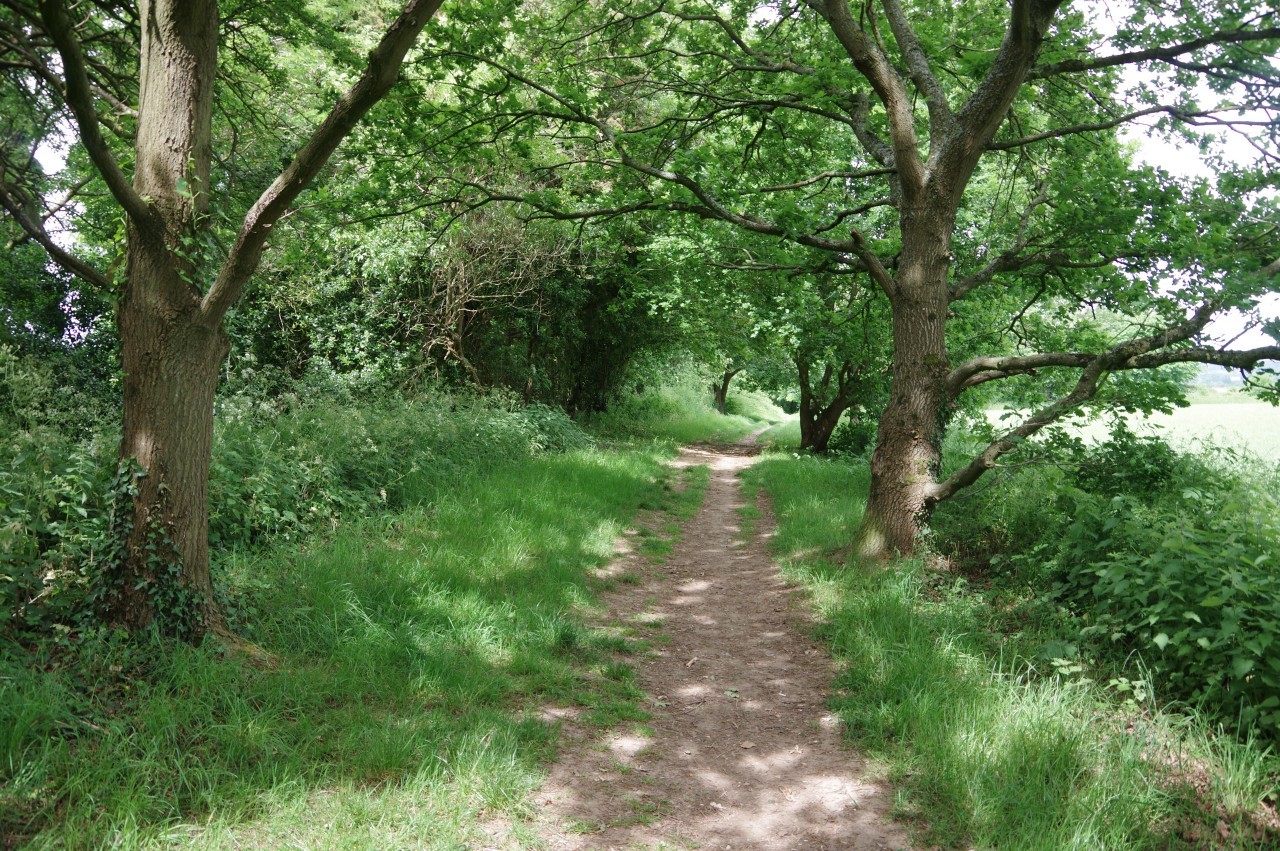
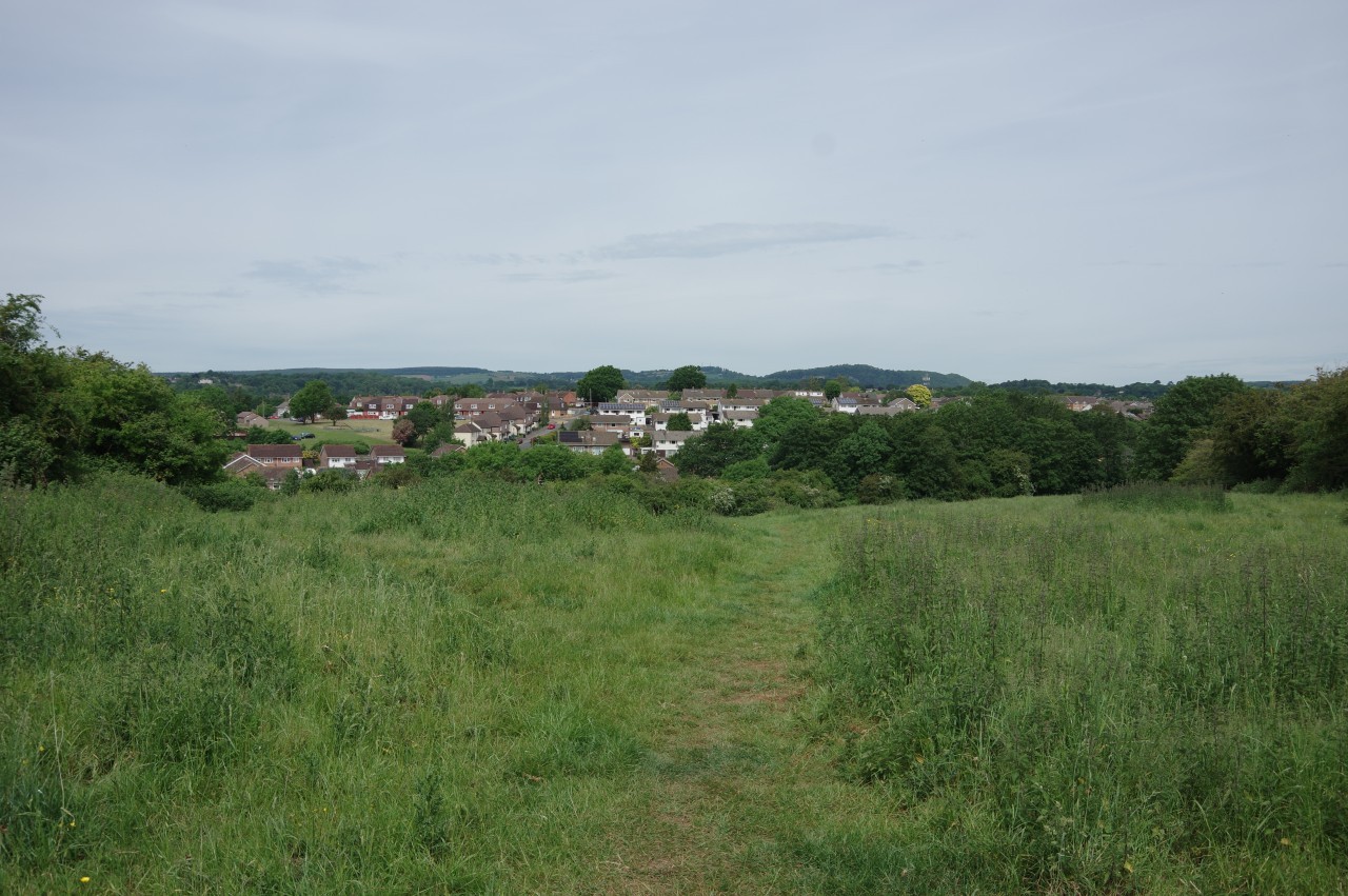
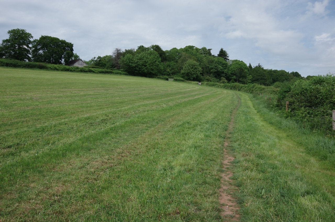
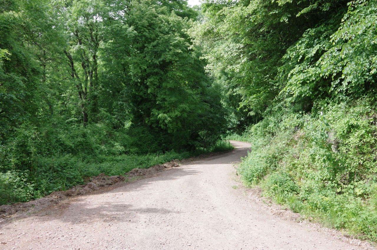
Having finished my contemplation of civil engineering matters, I finally set off on my walk along the Offa's Dyke Path, retracing my steps along the raised bank of Offa's Dyke (picture 5) to Buttington Hill. Across the road, the Path climbs a track to a kissing gate then descends a grassy meadow overlooking Sedbury village (picture 6), passing through a band of trees to emerge onto the end of Danes Hill, a quiet residential street.
Just beyond the third house on the left, a signposted path runs alongside a wooden fence to Mercian Way, which heads through the small housing estate of Pennsylvania Garden City, built hastily in 1917 to house shipbuilders brought in from Glasgow and Newcastle to work in the new shipyards. The houses to the right of the street were built on the line of Offa's Dyke. Beyond the last of the houses, Mercian Way becomes Offa's Close, a narrow lane that runs past allotments on the southern edge of Sedbury. At the end of the lane, the Offa's Dyke Path bears right to join an enclosed footpath sandwiched between the backyards of half a dozen houses and the tree-lined bank of the River Wye. The view across the river was a little less than inspiring — the large and untidy construction site of a new housing development on the site of the former Chepstow shipyard.
The path opens out onto a grassy strip beside Wyebank Road for a little while before another enclosed path skirts more backyards to arrive on Wyebank Avenue. The avenue is followed left then right to join Beachley Road and cross over the A48 on the same bridge I used earlier on my way to the start, passing from Sedbury into the adjoining village of Tutshill.
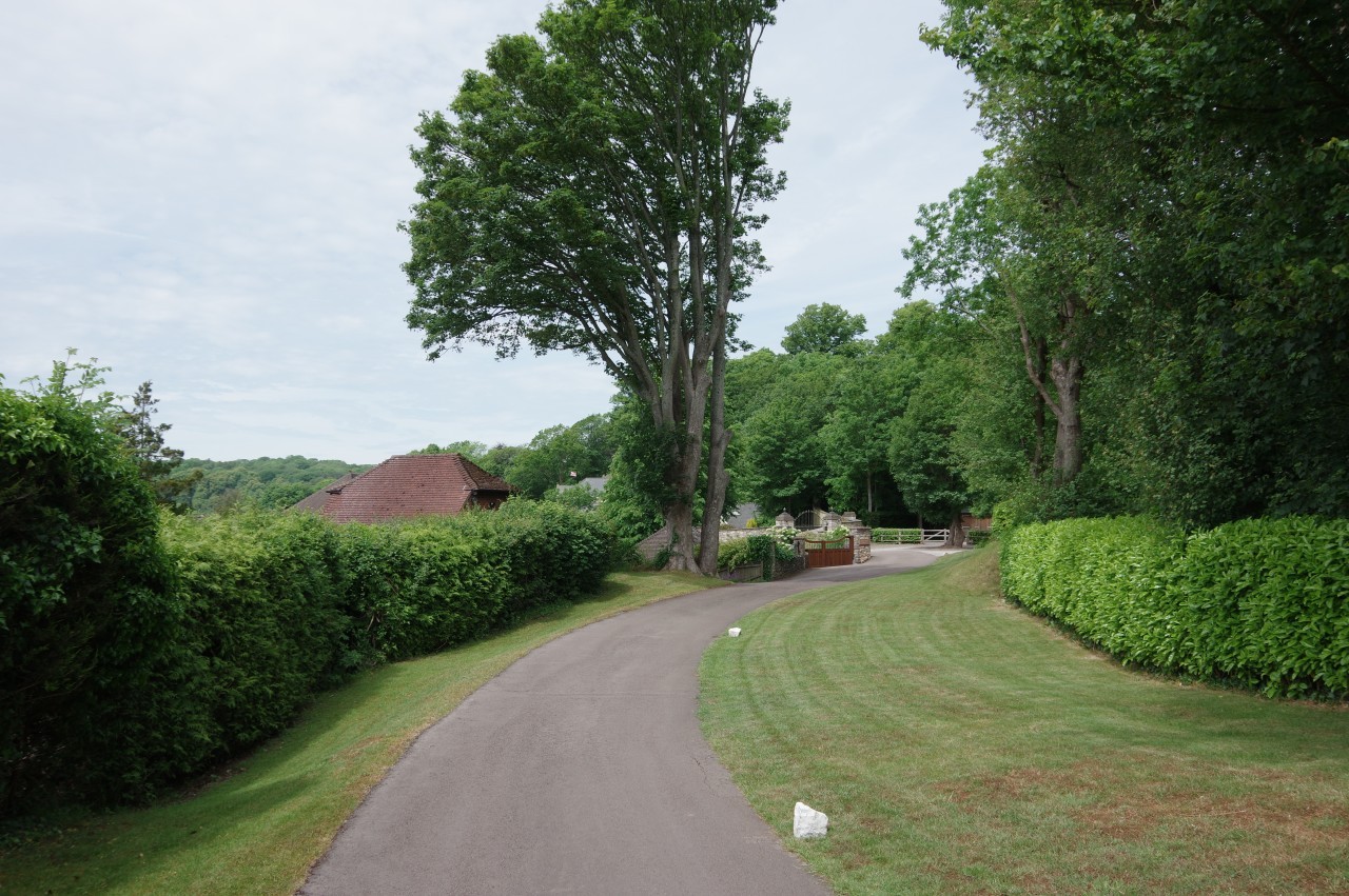
Two hundred metres further up Beachley Road, Offa's Dyke Path turns left between stone pillars onto the short, but neatly manicured, Rock Villa Lane (picture 7). Just beyond the gates of Highcliffe House, a waymarker disc on a fencepost points down a narrow footpath between fences. This path briefly encounters the bank of the River Wye once again and a gap in the foliage gives a view over the elegant cast-iron arches of the Old Wye Bridge of 1816 (picture 8), which connects Tutshill to Chepstow.
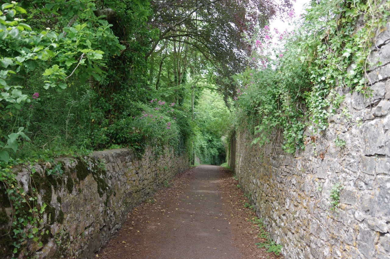
(9) Walled footpath, Tutshill

(10) View toward Chepstow

(11) Approaching Woodcroft
(12) Woodcroft
The fenced path immediately turns away from the river, climbing to join a slightly broader path enclosed by high stone walls (picture 9). The latter path ends at a junction, where one can turn left for a couple of minutes to make a much closer inspection of the Old Wye Bridge, or right to stick with the Offa's Dyke Path as is ascends another walled path to some stone steps beside a minor road called Castleford Hill.
Directly opposite, the Offa's Dyke Path crosses an overgrown little green and continues along Mopla Road. Around a bend, a signpost on the left points through a kissing gate and up a gentle grassy slope with views back to Chepstow (picture 10). At the top of the slope, the Path bears slightly right to find a kissing gate under trees, then runs along the left edge of a field to another kissing gate in the next corner. A short path between a wooden fence and a high stone wall soon emerges onto a driveway, which is only followed for about forty metres to yet another kissing gate (picture 11).
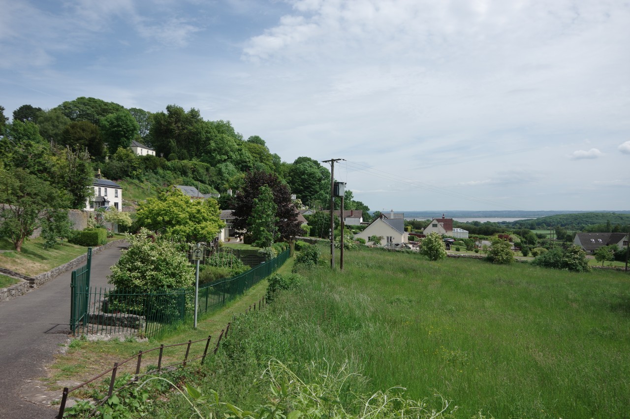
The ODP now crosses a large meadow, aiming just to the right of a lone tree and left of a large house on the edge of the village of Woodcroft. Under trees on the far side, the Path turns right through a gate, now discretely out of sight next to a stone wall as it runs past the house and out to the B4228, where the houses of Woodcroft line a hillside overlooking the Severn (picture 12).
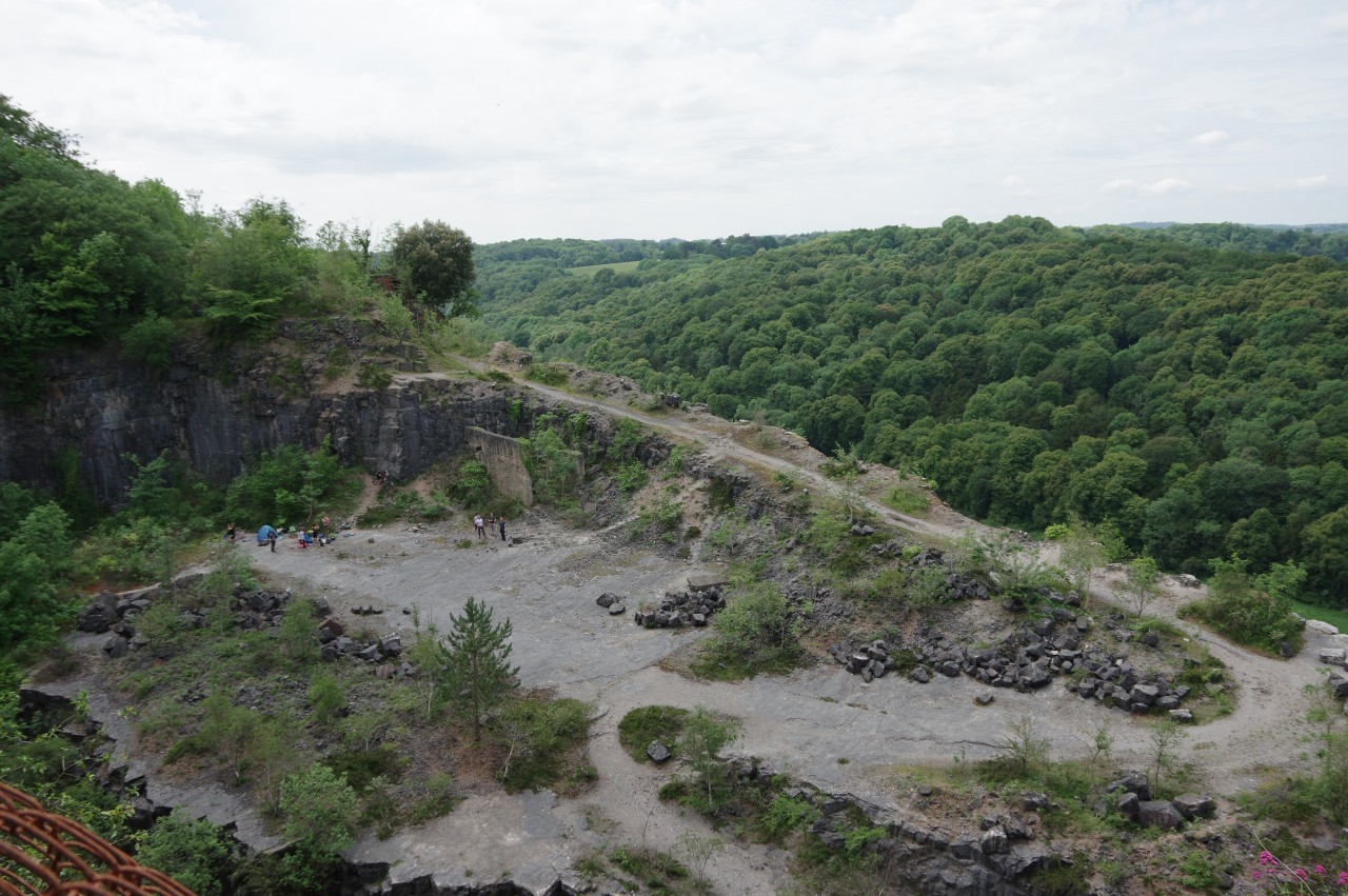
(13) Disused quarry near Woodcroft
(14) Wallhope Grove
(15) Wallhope Farm
(16) View over the River Severn
A stone-arched gateway soon appears on the left side of the road, with the capstone carved with the name Moyle Old School Lane. The Offa's Dyke Path goes through and climbs the lane, really just an enclosed footpath, soon swinging around to the right alongside the back fences of Woodcroft. At the top of the lane, an ODP signpost points ahead along the lip of a disused limestone quarry high above the wooded gorge of the River Wye (picture 13). As I passed, a group of rock climbers were chatting excitedly as they prepared to tackle one of the quarry's sheer walls.
Beyond the quarry, the path passes under a footbridge then skirts more backyards before curving down to rejoin the B4228. Fifty metres south, a narrow path leaves the road, heading between houses and out into grassy meadows. Across a small meadow and then a larger one, a waymark points left along the edge of a third and into a small wood. On the other side of the wood, a lane leads out to the B4228 once more. It was about here that I noticed that it was getting rather hot and the breeze had dwindled away to nothing. It was starting to feel more like an Australian summer than a British one, so I paused to rest for a few minutes in a bus shelter by the road.
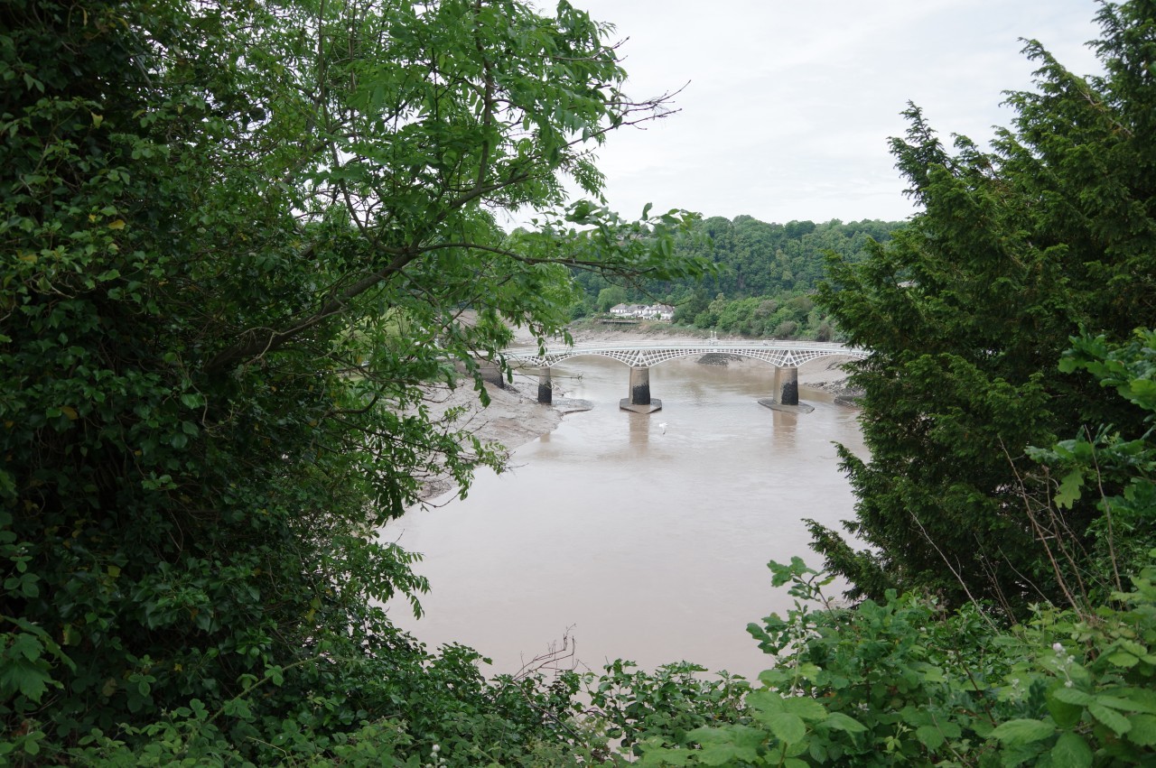
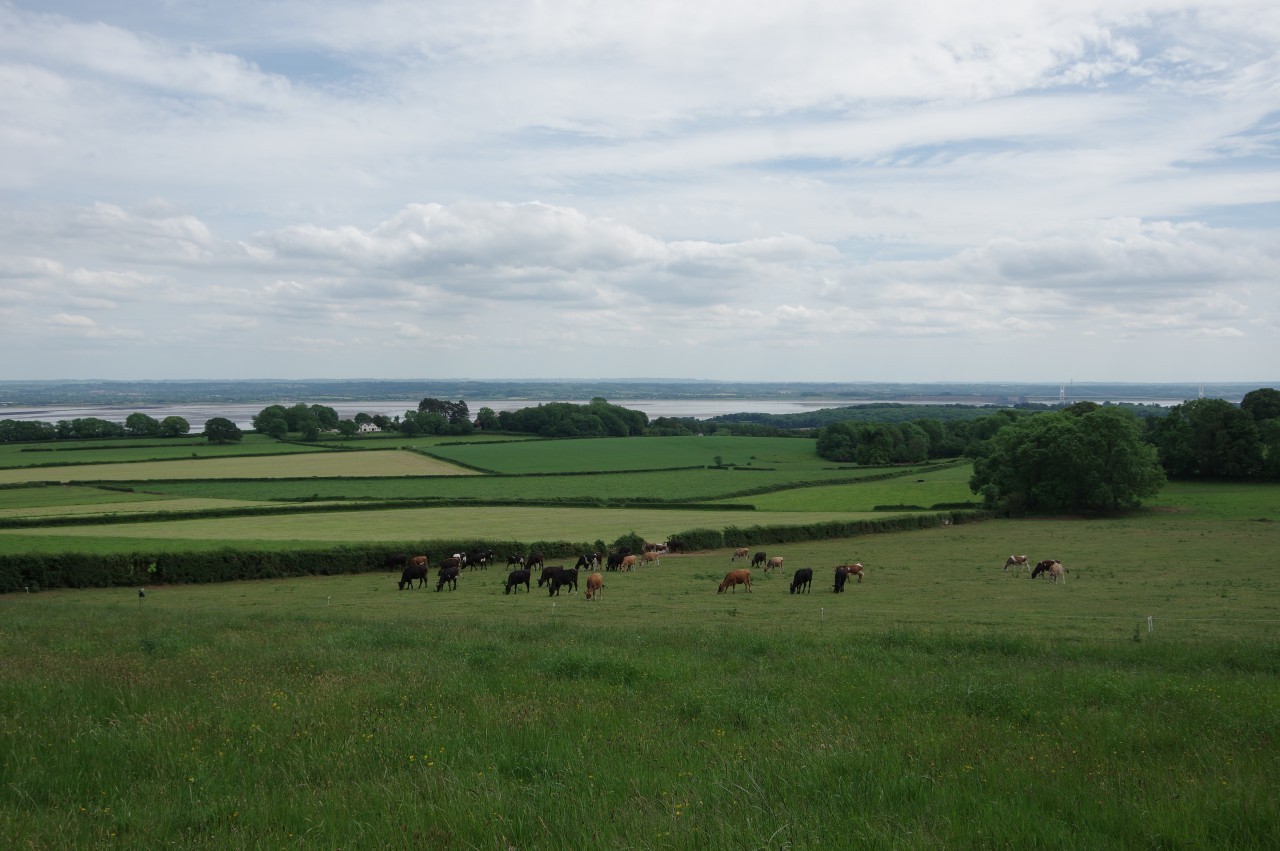
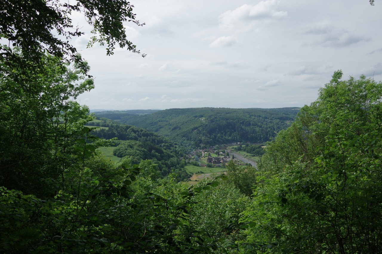
Just past the bus stop, the Path leaves the road to run through the southern and eastern edges of Wallhope Grove (picture 14) before following a hedge across Wallhope Farm (picture 15) and climbing a small meadow back up to the B4228. Just before the path reaches the road, there is another fine view over the River Severn (picture 16), the last view of the Severn from Offa's Dyke Path for the better part of a week's walking.
(17) Tidenham Chase
(18) Path on top of Offa's Dyke
(19) Boatwood Plantation
(20) Worgan's Wood
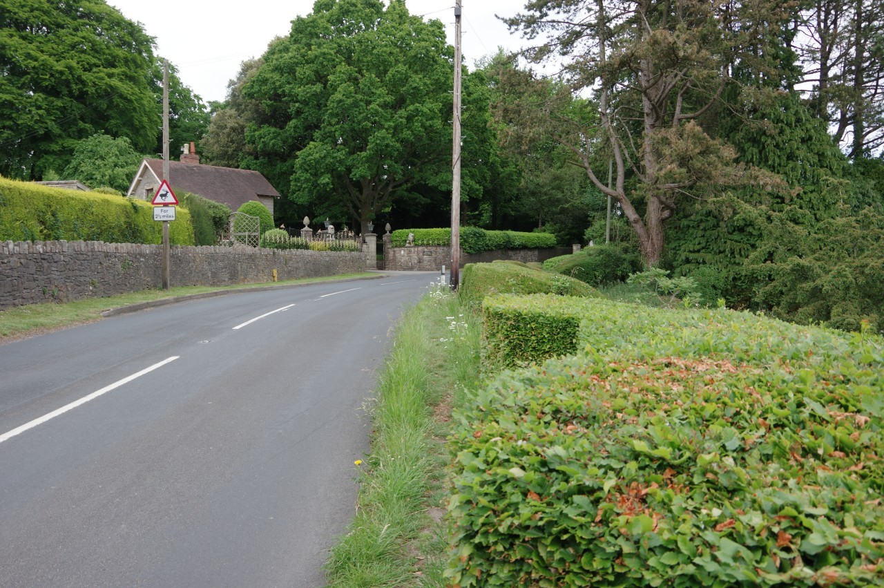
The Path now runs along the road for seven hundred metres, passing the gates of the large country house of Tidenham Chase (picture 17). For most of the way, there is no choice other than to walk on the tarmac, keeping a careful eye on the traffic.
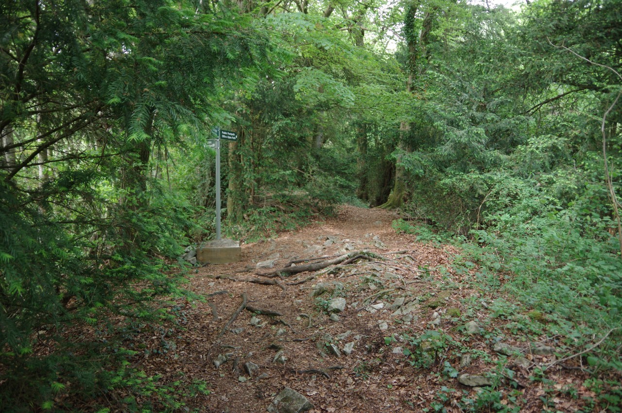
Mercifully, a signposted footpath eventually appears on the left, at the end of a long stone wall. The path heads away from the road for a few minutes to reach a kissing gate in the middle of a quiet wood. Here the Path meets a section of Offa's Dyke (picture 18) and is signposted along the top for almost a kilometre before descending to meet a forestry track in Boatwood Plantation (picture 19).
The next stretch of the path used to continue atop the Dyke, but just before my walk the Gloucestershire County Council decided to permanently divert the walk along the forestry track due to erosion of the Dyke. The Ordnance Survey map has since been updated to show the new route.
The forestry track was easy walking, though with less shade I was really feeling the heat, which must have been creeping up into the low thirties. Six hundred metres along the track, the ODP turns into Worgan's Wood and climbs to find some wooden steps back up onto the top of Offa's Dyke (picture 20).
(21) Shorn Cliff
(22) View over Tintern
(23) Devil's Pulpit
(24) Caswell Wood
Through Worgan's Wood, the Dyke reaches Shorn Cliff (picture 21), turning right to follow the contours of the hillside. A gap in the dense woods reveals the village of Tintern (picture 22), my destination for the day, strung out along an almost 180 degree bend of the River Wye, with the ruin of Tintern Abbey at the near end of the village.
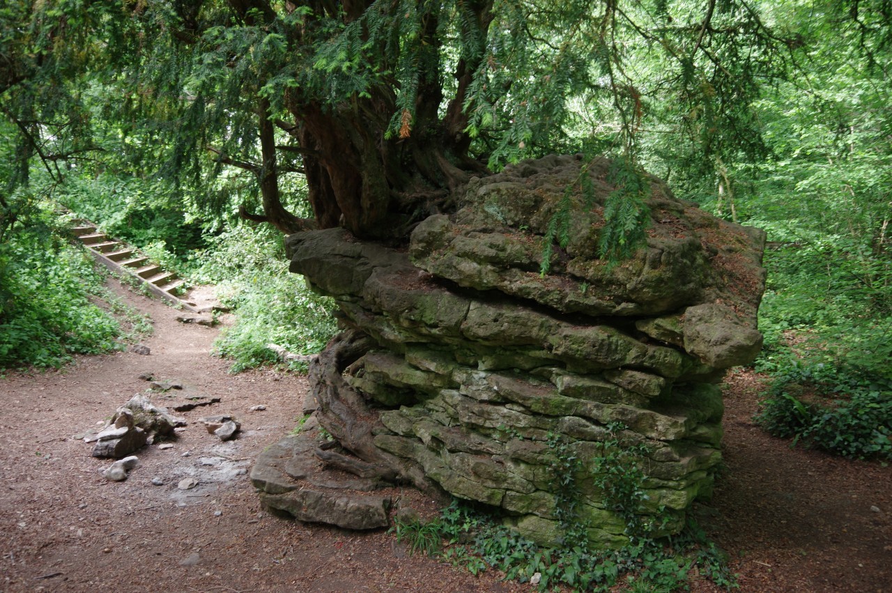
A little further along the path, some steps on the right lead down into a hollow containing the Devil's Pulpit (picture 23), a limestone stack where the devil reputedly perched himself and preached to the monks of Tintern Abbey in a futile attempt to entice them away from their life of piety.
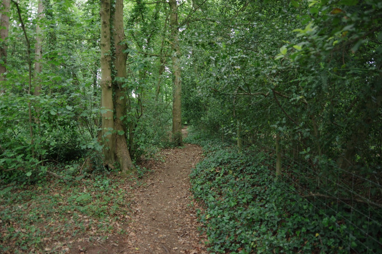
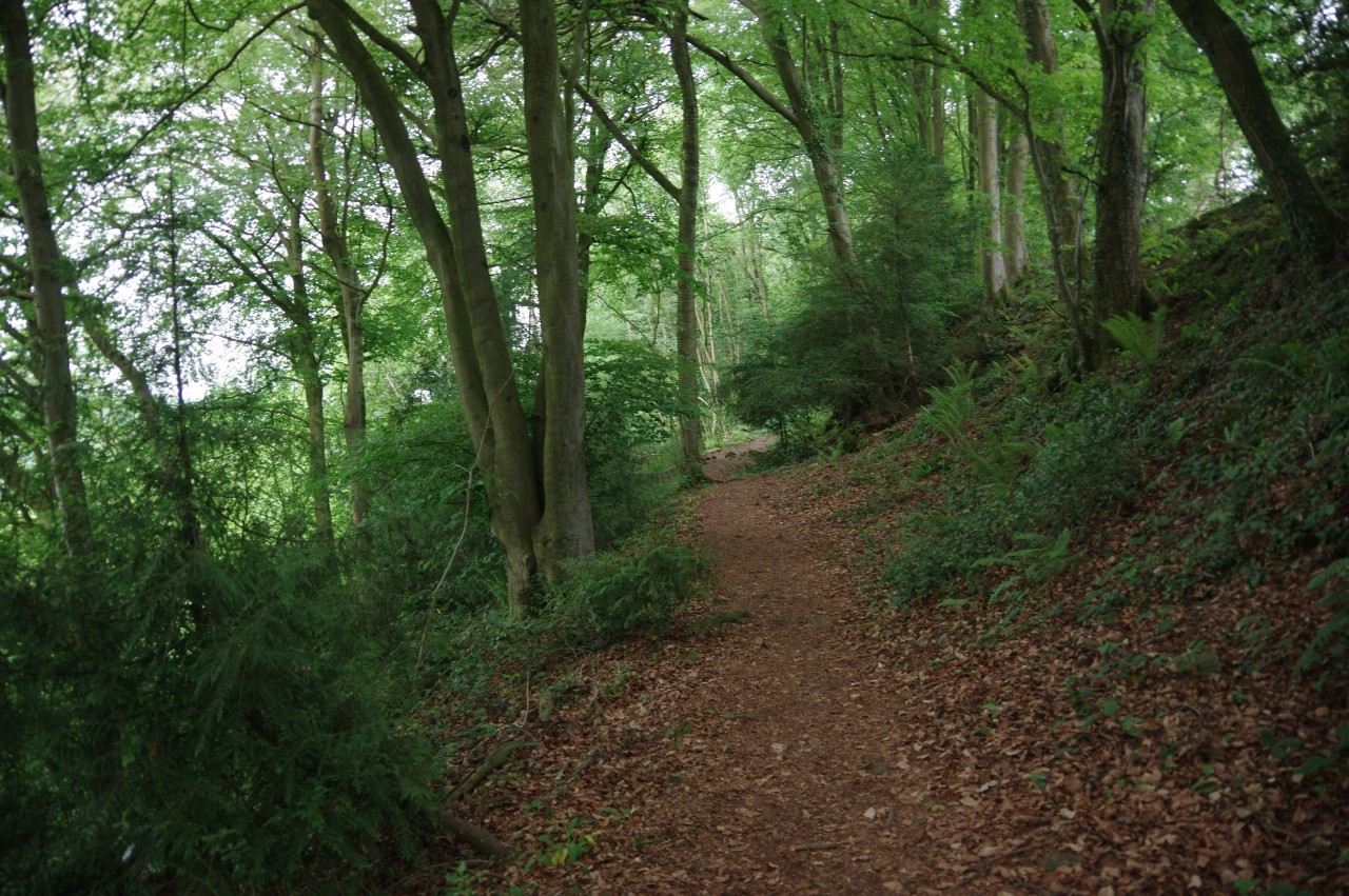
Leaving the Devil's Pulpit behind, the Offa's Dyke Path continues along the lip of the steep hillside, high above the Wye and mostly in the ditch to the left of the Dyke. This stretch of the path runs through Passage Grove, Luppets Grove and Caswell Wood (picture 24), where the path finally begins to descend from the ridge.
(25) St Briavels Common
(26) Brockweir Bridge

(27) River Wye from Brockweir Bridge

(28) The Old Station, Tintern
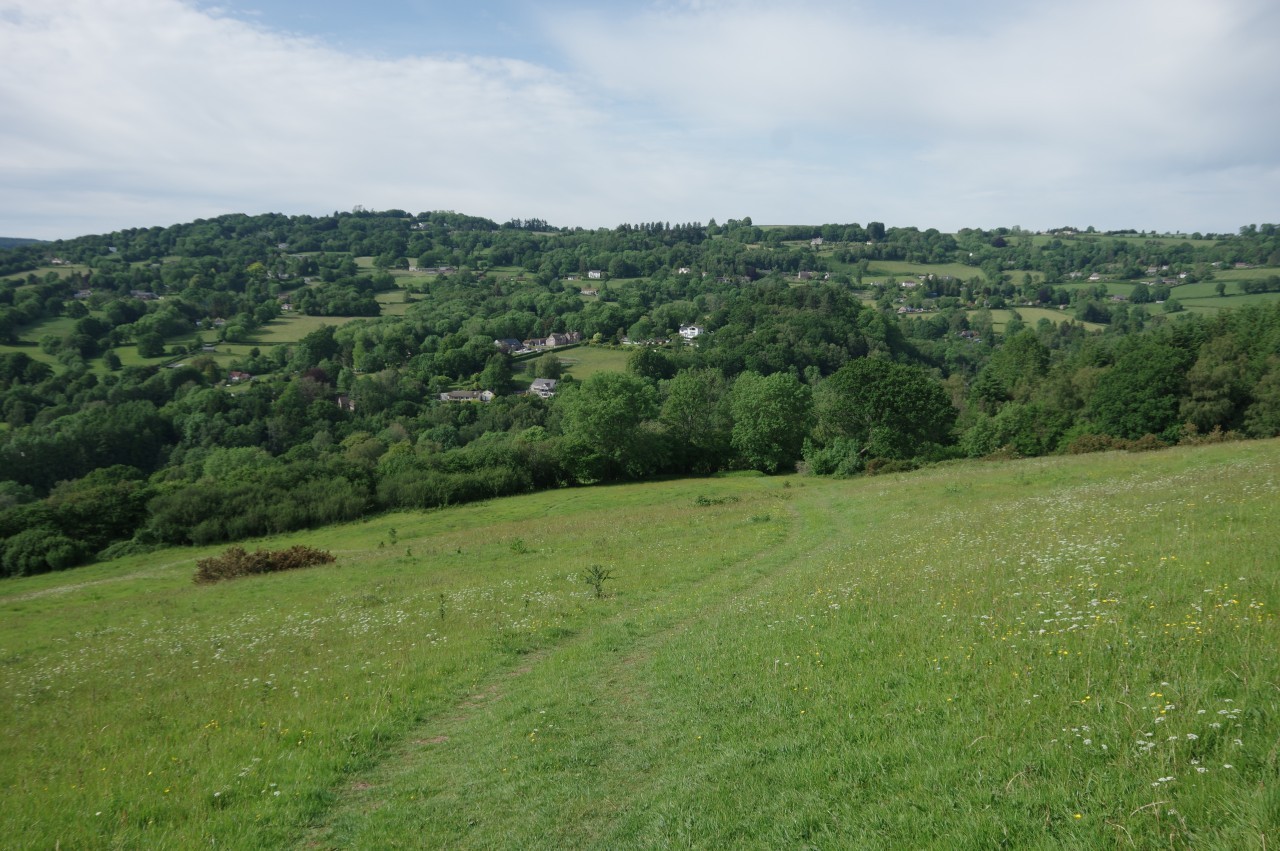
On the edge of Caswell Wood, the trail descends on a boardwalk and a flight of wooden steps to emerge on the grassy northern slope of Madgett Hill with the scattered hamlets and farms of St Briavels Common laid out ahead (picture 25).
Down the steep slope is a stile under trees, from which a track descends to a signpost where the Offa's Dyke Path splits into two alternative routes. One branch strikes out across St Briavel's Common on quiet tracks and lanes, while a slightly longer branch stays on the track and descends to the riverside village of Brockweir before following the east bank of the River Wye northward. The two routes converge further up the Wye at Bigsweir Bridge.
I chose the riverside route for this walk, though I did walk across the common when I walked the ODP southward a few months later. Both routes have their charms, though the riverside route was certainly easier to navigate as some of the waymarking on the common was in need of repair. Most of the stretch of Offa's Dyke on the common has been obliterated over the centuries and the path across the common rarely encounters the remaining fragments.
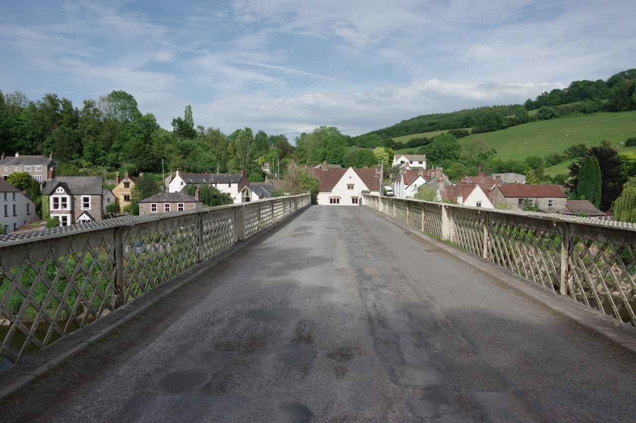
In any case, today I was leaving Offa's Dyke Path at Brockweir, where a sturdy old bridge crosses the Wye and gives a good view back over the village (picture 26) and down the river (picture 27). I was a little disappointed, particularly given the unusually hot weather, to find that Brockweir's village pub was closed for renovations, so I chose not to linger and crossed over to the Welsh side of the river to follow a stretch of the Wye Valley Walk back downstream to Tintern.
About 500 metres south of Brockweir Bridge is The Old Station, Tintern's stop on the former Wye Valley railway line, which carried passengers between Chepstow and Monmouth from 1876 until 1959. As well as the original station building (picture 28), a signal box and three carriages are preserved in the park.
(29) Wye Valley Hotel, Tintern
(30) River Wye, Tintern

(31) Tintern Abbey
(32) The Anchor Inn, Tintern
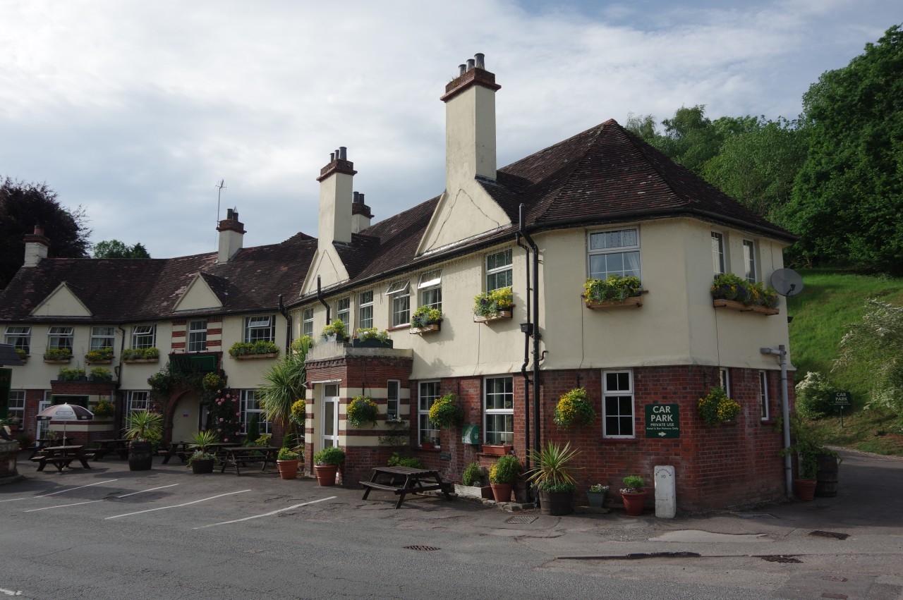
There is also a campsite next to the Old Station, but I had already arranged to stay at one of the village inns, so after pausing for a while on a shady bench to try to cool down, I continued for another kilometre along the riverbank beside large fields before coming up through the churchyard of St Michael's to meet the A466, where my room in the Wye Valley Hotel (picture 29) awaited me.
The lady at the check-in desk noted that I looked rather overheated. I had only covered thirteen kilometres of Offa's Dyke Path, but the extra walking to get to the start of the walk and to get to Tintern afterwards made it closer to eighteen kilometres and it the hot weather made it feel much longer.
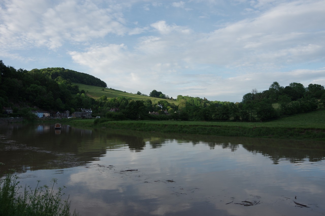
Fortunately it started to cool down in the late afternoon and after taking a couple of hours to rest, I felt refreshed enough to go for an evening wander and follow the road around the long curve of the River Wye (picture 30) to take a closer look at the outside of Tintern Abbey (picture 31). The abbey was founded in 1131 and although the devil himself could not tempt the monks away by preaching from across the river, King Henry VIII succeeded in dissolving the abbey in 1536 and what had been one of the wealthiest religious communities in Britain gradually fell into ruin.
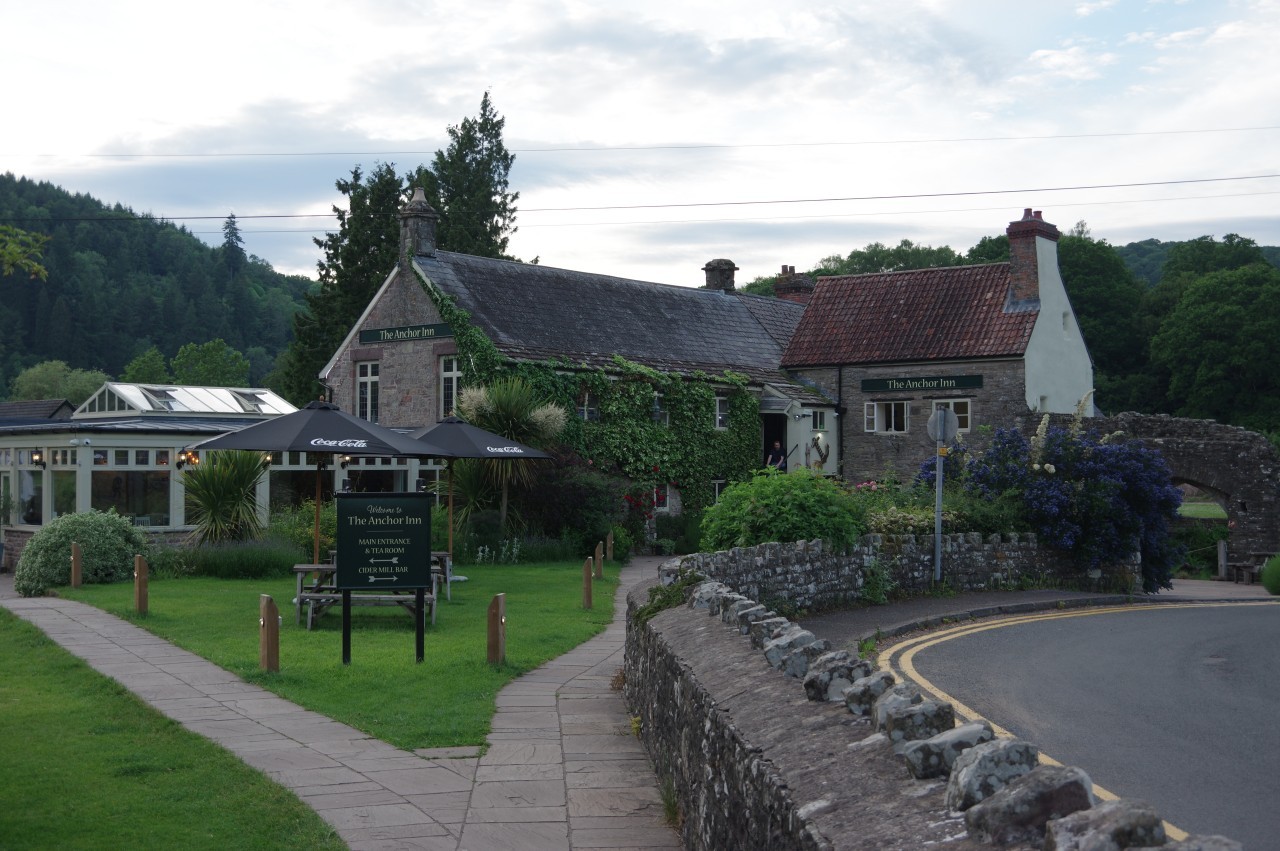
Having seen as much of the abbey as I could from outside, I stopped off for a pint in the adjacent Anchor Inn (picture 32) before heading back up the road to the hotel, where I had dinner and a couple more cleansing ales in the bar. After walking on such a hot day, hydration is very important.