1066 COUNTRY WALK
Stage 3: Bexhill Link - Bexhill-on-Sea to Battle
Saturday, July 2, 2011
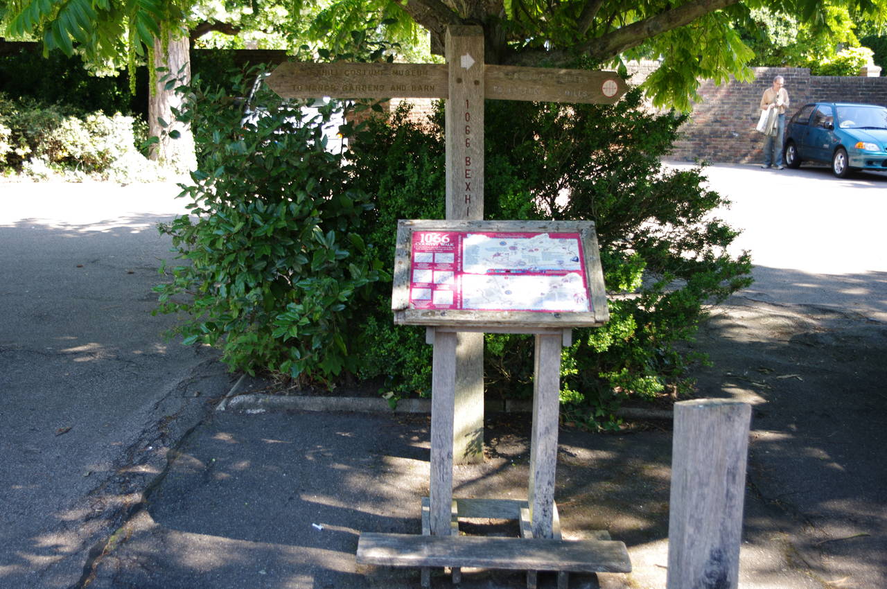
(1) Manor Gardens carpark, Bexhill

(2) Upper Worsham Farm

(3) Approaching Little Worsham Farm
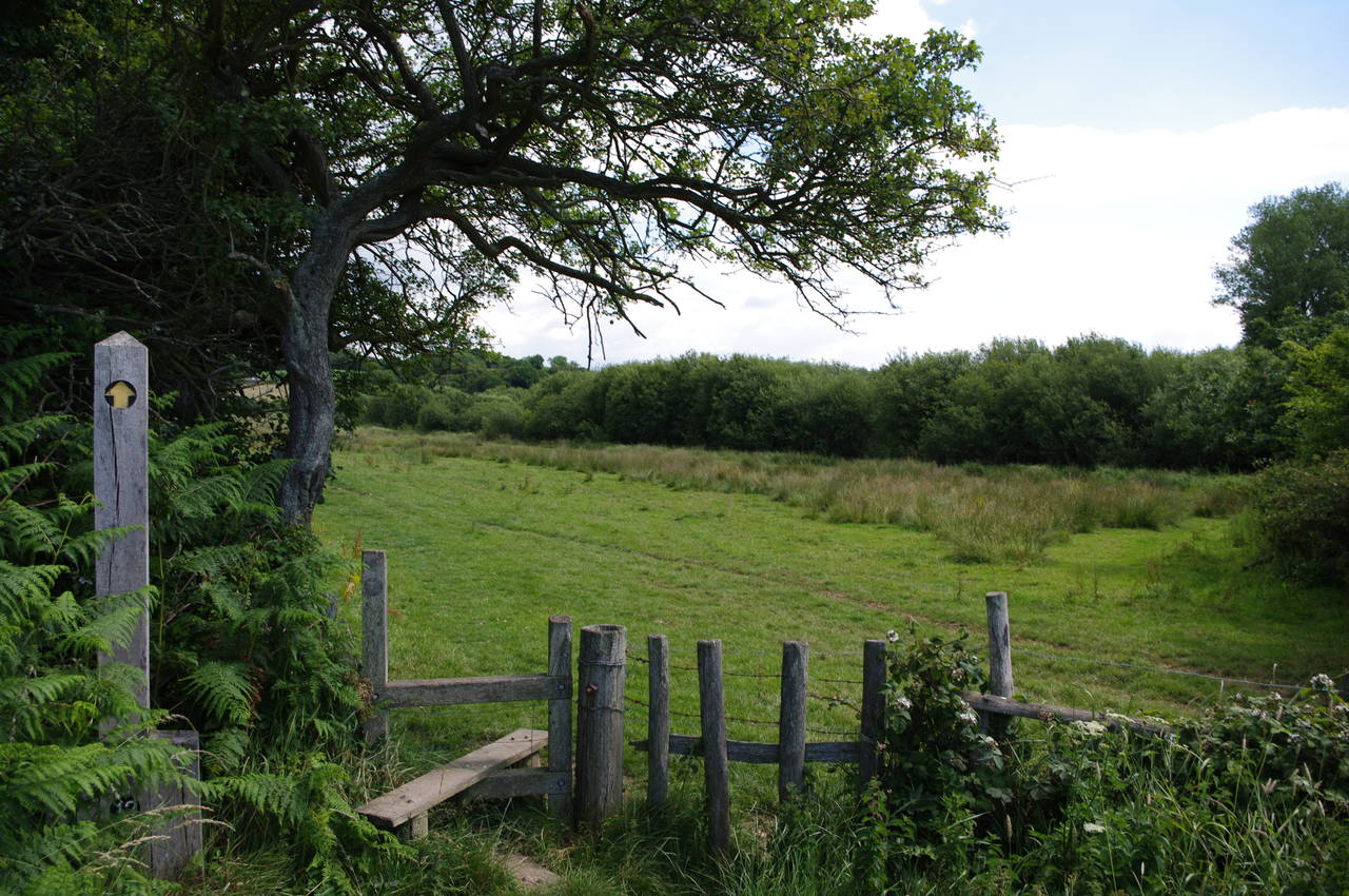
(4) Stile near Adam's Farm
The 1066 Country Walk Bexhill Link begins at the Manor Gardens Carpark in the seaside town of Bexhill-on-Sea. From Bexhill Railway Station, the start of the walk can be reached by turning left out of the station and following Upper Sea Road away from the seafront for about five hundred metres until it curves left into Church Street and then De La Warr Road, where the carpark is soon reached on the right-hand side. An information board under a tree in the middle of the carpark marks the official start of the walk (picture 1).
From the information board, the Bexhill Link heads to the right to leave via the entrance of the carpark and crosses De La Warr Road into Hastings Road, which runs up to a footbridge over the A259, which in these parts is known as King Offa Way. Once over the bridge the route continues to follow Hastings Road for another two hundred metres before a waymarker post on the left points along a gravel path between houses.
The path reaches Portfield Close and after about twenty metres another waymarker points to the right along a narrow path which winds its way between high fences. About 250 metres later, this path reaches a crossing over the busy A2036 Wrestwood Road, and continues straight ahead over a stile, at last out in open countryside.
The path heads down the right edge of the field, crossing another stile where a waymarker points diagonally across the next field, passing by the buildings of Upper Worsham Farm which stand uphill to the left (picture 2). On my way across the field I was passed by several other walkers out for an Saturday morning stroll.
Crossing a stile in the far corner of the field, the route heads down the unsealed Worsham Lane, which soon bends to the right and descends to pass by Little Worsham Farm (picture 3), where the lane bends back to the left. A few hundred metres later the lane forks and the Bexhill Link takes the left branch, descending through a line of trees standing on a disused railway embankment before continuing downhill over a large field that contained a mature crop of beans. At the bottom of this field the path levels out and crosses a stile under a shady tree (picture 4).

(5) Sandrock Road, Crowhurst

(6) Large field at Crowhurst

(7) Church of St George, Crowhurst

(8) Fore Wood Nature Reserve
The well-worn path continues ahead, soon crossing three consecutive wooden footbridges over irrigation channels before bearing a little to the right towards a signpost under the near end of a long row of trees lining the bank of an overgrown ditch. The path now follows the contorted course of the ditch for about 1200 metres in a generally northerly direction to reach Sandrock Road at Crowhurst, where a signpost points to the right along the road (picture 5).
The route soon turns left into Sampson's Lane and then after about eighty metres turns left again over a stile next to a gate bearing a Southern Water Services sign. The path continues down the left side of a long field then over a footbridge (picture 6) and along the right edge of another long field to reach another road, still part of Crowhurst.
Turning right, the route follows the road uphill around two sides of the parish church of St George (picture 7). A little further along, the road bends to the right but the Bexhill Link continues ahead through a wooden kissing gate and across a field to enter a small patch of woodland. Emerging from the woods the path bears right, crossing another field towards a stile on the edge of the Fore Wood Nature Reserve. The path winds its way through the woods for around a kilometre, passing through both dark enclosed areas and open clearings (picture 8).

(9) Approaching Stumblet's Wood
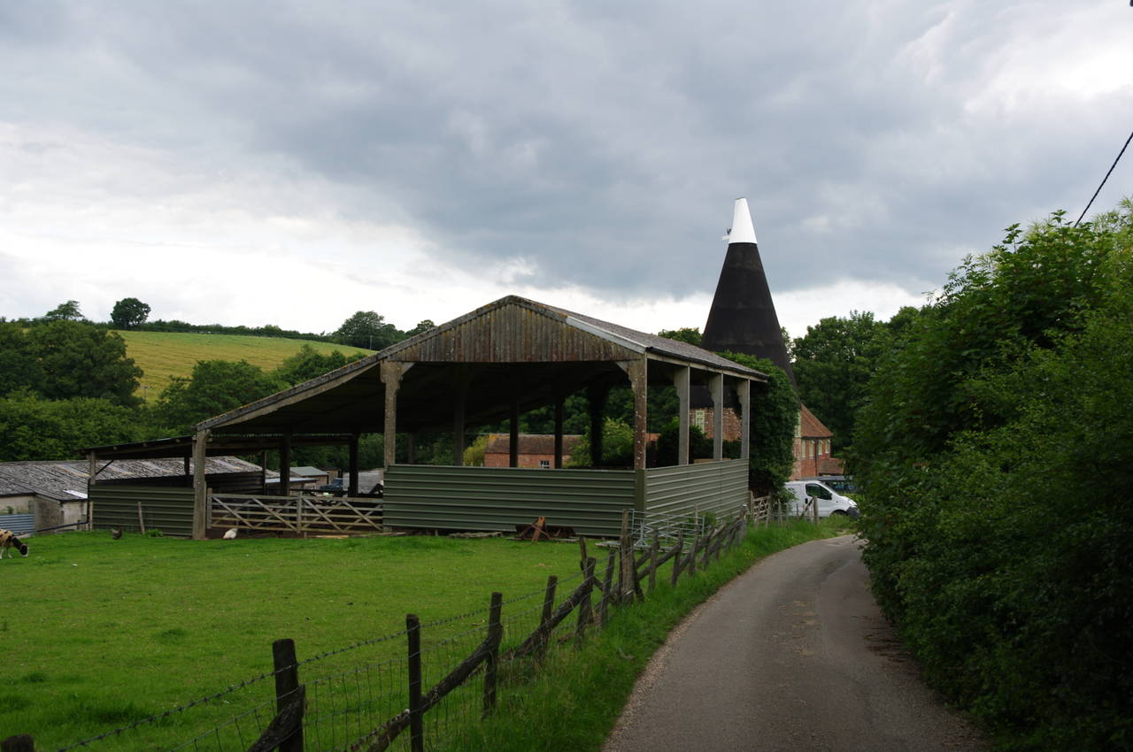
(10) Peppering Eye Farm
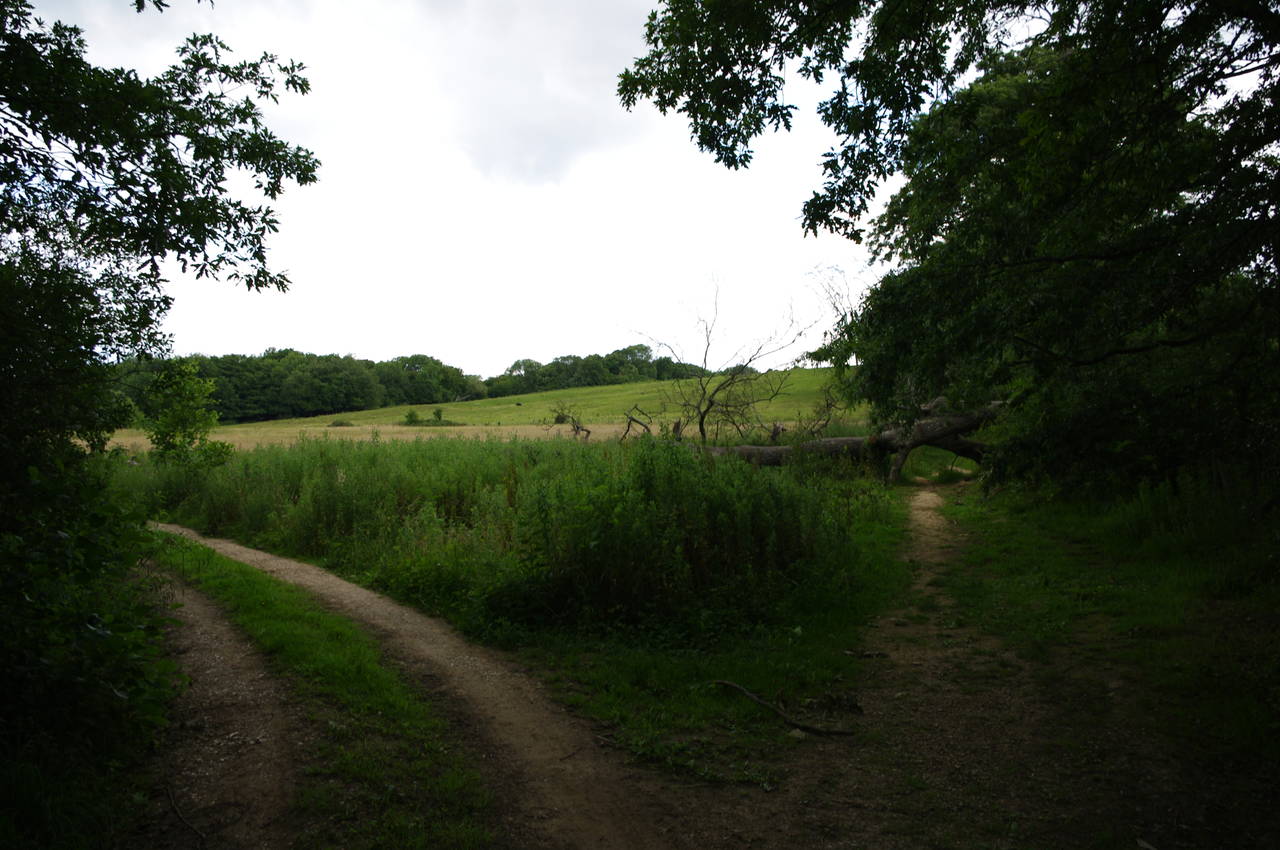
(11) Fallen tree blocks the path

(12) Meeting the main 1066 Country Walk near Battle
Eventually the path reaches a concrete footbridge and leaves Fore Wood, crossing a grassy field towards the much smaller Stumblet's Wood (picture 9), where the route turns right and follows a vehicle track through the trees. The track soon becomes a sealed lane which heads north for about a kilometre, passing through the oddly named Peppering Eye Farm (picture 10) to reach a junction with Telham Lane, where a couple who were following the Bexhill Link in the opposite direction stopped to ask if I could confirm that they were heading the right way.
The Bexhill Link turns left along Telham Lane, soon reaching the busier Powdermill Lane at a sharp bend where it was difficult to safely cross the road to the signpost on the inside of the bend. Here the path climbs up to a field and follows the shady right edge above Powermill Lane.
After about two hundred metres the path crosses two stiles and then follows a track downhill. When the track eventually turns left, the Bexhill Link continues ahead along the right edge of a field, though this route wasn't entirely obvious as a tree had fallen across the path (picture 11).
After negotiating this obstacle, I followed the field boundary over a ridge and then down to a signpost that marks the point where the Bexhill Link joins the main route of the 1066 Country Walk a short distance west of the town of Battle (picture 12). From this junction I followed the broad path eastwards through woods for about ten minutes to arrive in the middle of Battle, just after midday.

(13) Gatehouse of Battle Abbey

(14) Battle Abbey School
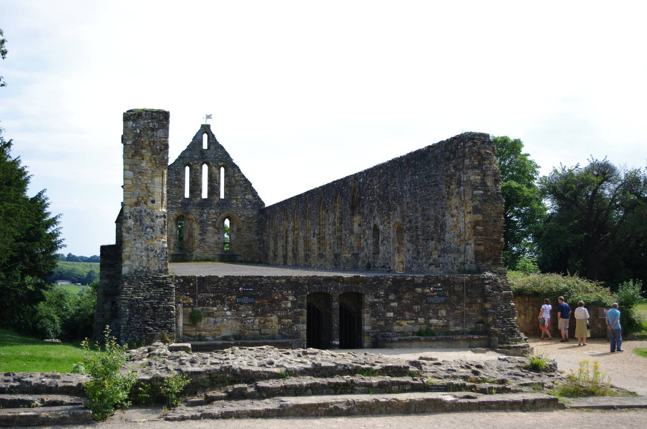
(15) Former monks dormitory, Battle Abbey

(16) 1066 Battlefield
My GPS showed that I had walked around twelve kilometres, ten of that being on the Bexhill Link. After retiring to one of the local pubs for lunch, I spent the afternoon wandering around the buildings and grounds of Battle Abbey.
The abbey was founded by William the Conqueror around the year 1070, on the site of the Battle of Hastings, which was so named because Hastings was the nearest settlement of any significant size at that time. As every English school student knows, the battle took place here on October 14, 1066, when William's army defeated the army of the English King Harold, who had held the English throne for just nine months.
A few weeks earlier, Harold's army had defeated an army of invading Norwegians at Stamford Bridge near York in England's north, and must have been exhausted after marching all the way down to Battle to face William's forces who had landed at Pevensey Bay at the end of September. During the battle, King Harold was reputedly killed on the top of the hill where the former abbey church was built, though little of that building remains today.
During the centuries after the battle, the abbey complex grew, and most of what is visible today is from the 13th century or later. The magnificent gatehouse (picture 13) was built in 1338 to help protect the abbey from french raiders shortly after the beginning of the Hundred Years War, and houses an exhibition on monastic life throughout the abbey's history.
In 1539, the abbey was dissolved by King Henry VIII and many of the original buildings were demolished. What was left became a private estate, though the buildings were not always well-maintained. The roof of the large monks dormitory (picture 14) survived for centuries until collapsing late in the 19th century. Since the 1930's, some of the abbey buildings have been used as a school (picture 15). In the present day, the abbey site is owned by the UK government and is managed by English Heritage.
The grounds of the abbey used to be about four times larger than they are today, but still cover much of the hillside where the battle took place, known at the time of the battle as Senlac Hill. There are several walking paths around and across the battlefield below the abbey buildings (picture 16) and there are information boards placed around the battlefield describing the events in detail.
Here endeth the history lesson.
There is plenty to see at Battle Abbey, including an interesting falconry demonstration with a variety of birds of prey, and I hadn't managed to explore everything before closing time came around.