1066 COUNTRY WALK
Stage 5: South Downs Link - Pevensey to Jevington
Monday, July 4, 2011

(1) Pevensey Castle
(2) Castle Farm

(3) Peelings Lane, Westham

(4) Parish church of St Luke, Stone Cross
The short final stage of my walk in 1066 Country links the end of the main 1066 Country Walk at Pevensey with the route of the South Downs Way at Jevington. After spending most of the day wandering around Eastbourne, I started the walk at the east gate of Pevensey Castle just after 4pm.
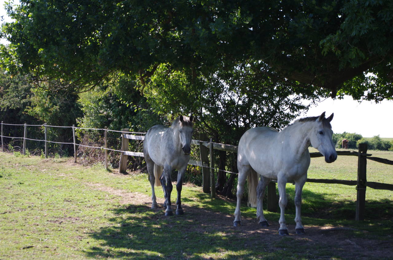
From the castle gate, the walk follows the B2191 road around the castle's outer wall (picture 1) until it begins to curve away from the road. Here the route of the walk leaves the road through the wooden gate of Princes Farm and follows the left edge of a field to a wooden footbridge over a tree-lined ditch. The route crosses the next two fields diagonally, with two more footbridges on the field boundaries, and then follows a wooden fence along the right edge of a large horse paddock at Castle Farm (picture 2).
The route heads straight between the farm buildings then along the left edge of the next field until a stile takes the path out onto the quiet Peelings Lane (picture 3). The route follows Peelings Lane for almost two and a half kilometres, first along the fringe of Westham, across open farmland near the main A27 road, and then bearing left as the lane becomes a pedestrian-only footpath to head into the centre of Stone Cross, an outlying part of the town of Eastbourne.
Reaching the B2247 Dittons Road at Stone Cross, the route follows the road ahead to cross an intersection where the parish church of St Luke (picture 4) stands on the right and the Red Lion pub stands on the left.
(5) View towards the South Downs

(6) Crossing the A22

(7) Railway crossing

(8) Mornings Mill Farm
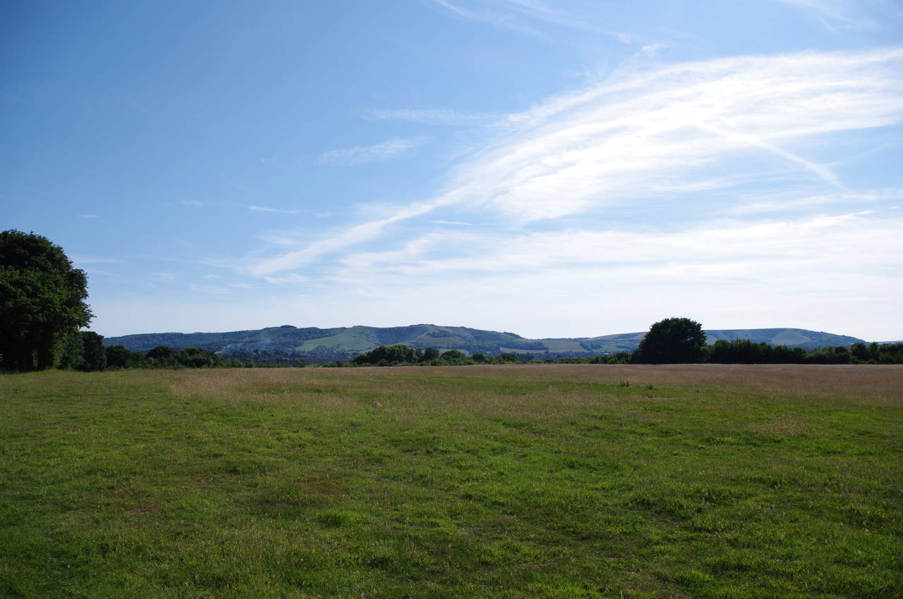
The path follows Dittons Road west for about a kilometre before a waymarker on a stile just up from the road on the left points along the left edge of a field, where there were good views west to the hills of the South Downs (picture 5). On the other side of the field, concrete steps lead down to a crossing of the dual carriageway of the A22 Golden Jubilee Way (picture 6). With the traffic hurtling along here at around 100km per hour, it took me some time to get across the busy highway safely. There really should be a footbridge or tunnel here to keep the pedestrians separated from the fast-moving traffic.
Once I had finally managed to cross safely, I continued to follow the path west across a series of fields for almost a kilometre to reach a crossing of the main rail line between Eastbourne and Lewes. After waiting for one of the short trains to pass (picture 7), I crossed the tracks and followed a hedge along the right edge of the next large field towards Mornings Mill Farm, the slopes of the South Downs growing larger all the time (picture 8).

(9) Approaching Lower Willingdon

(10) Climbing Combe Hill

(11) View over Eastbourne from Combe Hill

(12) View towards the top of Combe Hill
In the corner of the field, the path kinks right over a stile in the hedge and continues along the left edge of the next couple of fields until a roughly surfaced farm road merges in from the right (picture 9) and takes the path the last few hundred metres to the A2270 Eastbourne Road at Lower Willingdon.
The route crosses the road and follows it south through the built-up area for about five hundred metres to the corner of Gorringe Valley Road, where the route turns right by a Veterinary Surgery. This turn would have been very easy to miss, as I failed to find any waymarkers near this corner and I had to examine my Ordnance Survey map very closely to reassure myself that this was the correct place to turn.
Three hundred metres along Gorringe Valley Road, a large 1066 Country Walk sign on the right footpath points left along the driveway of the Willingdon Cemetery. Just to the left of the cemetery gates, an enclosed footpath runs beside a wire fence, gradually beginning to climb. Once past the cemetery, the path heads through a gate on the left and climbs more steeply up to another gate in the trees at the top of a field where a group of walkers were resting in the shade.
Continuing to climb Combe Hill above the band of trees, there are magnificent views over the surrounding towns, but at the same time it becomes obvious that there's plenty more climbing ahead (picture 10). Following the well-worn path as it curves around a patch of trees to the right, there are more extensive views over Willingdon to the east and Eastbourne and Pevensey Bay to the south (picture 11).
Once around the clump of trees, one can finally see the extent of the long climb to the summit of Combe Hill ahead (picture 12). Soon the worn path forks to either side of a waymarker post, the 1066 South Downs Link bearing right and continuing to climb. After a few hundred metres more steady climbing, the path passes by a tumulus (ancient burial mound) on the top of Combe Hill, 193 metres above sea level.

(13) View back from Combe Hill
(14) View west from Combe Hill

(15) Sheep grazing on the South Downs

(16) Descending from Combe Hill
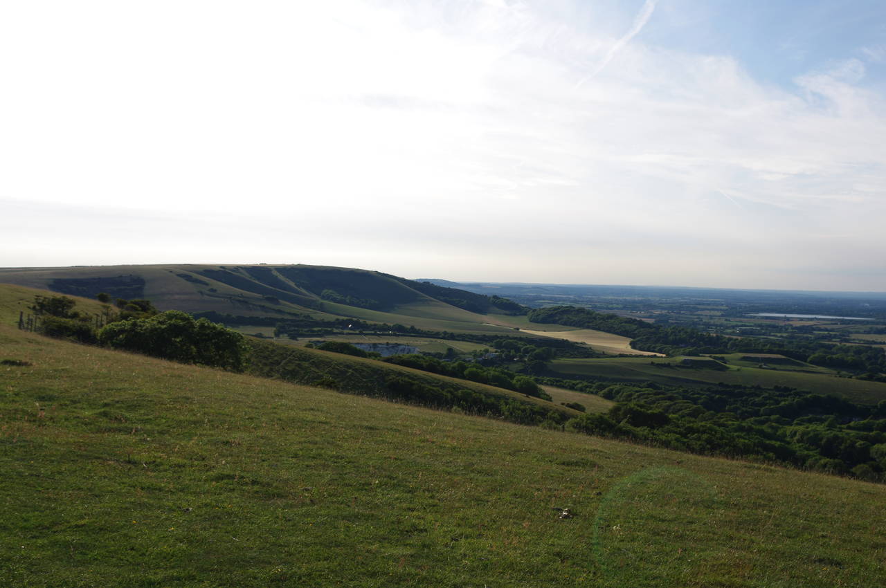
From the crest of the hill there were views to the east over just about the entire area covered by the 1066 Country Walk (picture 13) and also west along the escarpment of the South Downs (picture 14). All over the high ground here were groups of sheep grazing happily in the late afternoon sun (picture 15).
The South Downs Link now gradually descends from the top of Combe Hill across a series of grazing pastures (picture 16), sharing this part of the route with another long-distance path called the Wealdway, which runs north over the Kent Weald from Eastbourne Pier to Gravesend Pier on the River Thames, a good five-day walk which I hope to do sometime in the future.

(17) Descending towards Jevington

(18) Field above Jevington

(19) Arriving at Jevington

(20) Stone house, Jevington
After about a kilometre, the South Downs Link parts company with the Wealdway, the former bearing left into trees while the latter continues ahead. Emerging from the trees surrounded by colourful flowers (picture 17), the path descends across a wheat field (picture 18).
Through one more band of trees, the houses of Jevington come into view (picture 19) and the path descends across one more field to a gate at the end of Willingdon Lane. A short walk along the lane leads to the main road through the village, where the 1066 South Downs Link meets the route of the South Downs Way National Trail, with an attractive stone house opposite (picture 20).
According to my GPS, the walk from Pevensey Castle had been 11.7km, which I had covered in about three and a quarter hours. This was by no means the end of my day's walking however, as I now had another 6.5km to walk along the South Downs Way to the edge of Eastbourne and about 3km further to reach my accommodation which lay about ten minutes walk beyond Eastbourne Pier. I won't cover that walk here however, as I covered this ground again two days later on the first stage of the South Downs Way.