ISLE OF WIGHT COAST PATH
Stage 4: Yarmouth to East Cowes
Thursday, May 24, 2012

(1) View towards Yarmouth Pier

(2) Victoria Road, Bouldnor
(3) Path beside Bouldnor Copse

(4) Old and new paths on Bouldnor Cliff
From Yarmouth Quay, the Coast Path heads east along Bridge Road, passing the Wheatsheaf pub before the road swings left, then turning right into High Street just before the Bugle Coaching Inn. The narrow High Street leads through a mainly residential part of Yarmouth to join the shore at a grassy park where there were misty views back the other way to Yarmouth Pier (picture 1).
The park narrows as the A3054 Tennyson Road comes in from the left and the Coast Path follows the road for about a kilometre, passing through the quiet village of Bouldnor, where the path swaps sides of the road a couple of times. Shortly after passing Bouldnor Lodge, the Coast Path turns left on an unsurfaced lane, Public Footpath S43, marked on the map as Victoria Road (picture 2). At the end of the lane, the route turns left for a short distance to reach the shoreline.
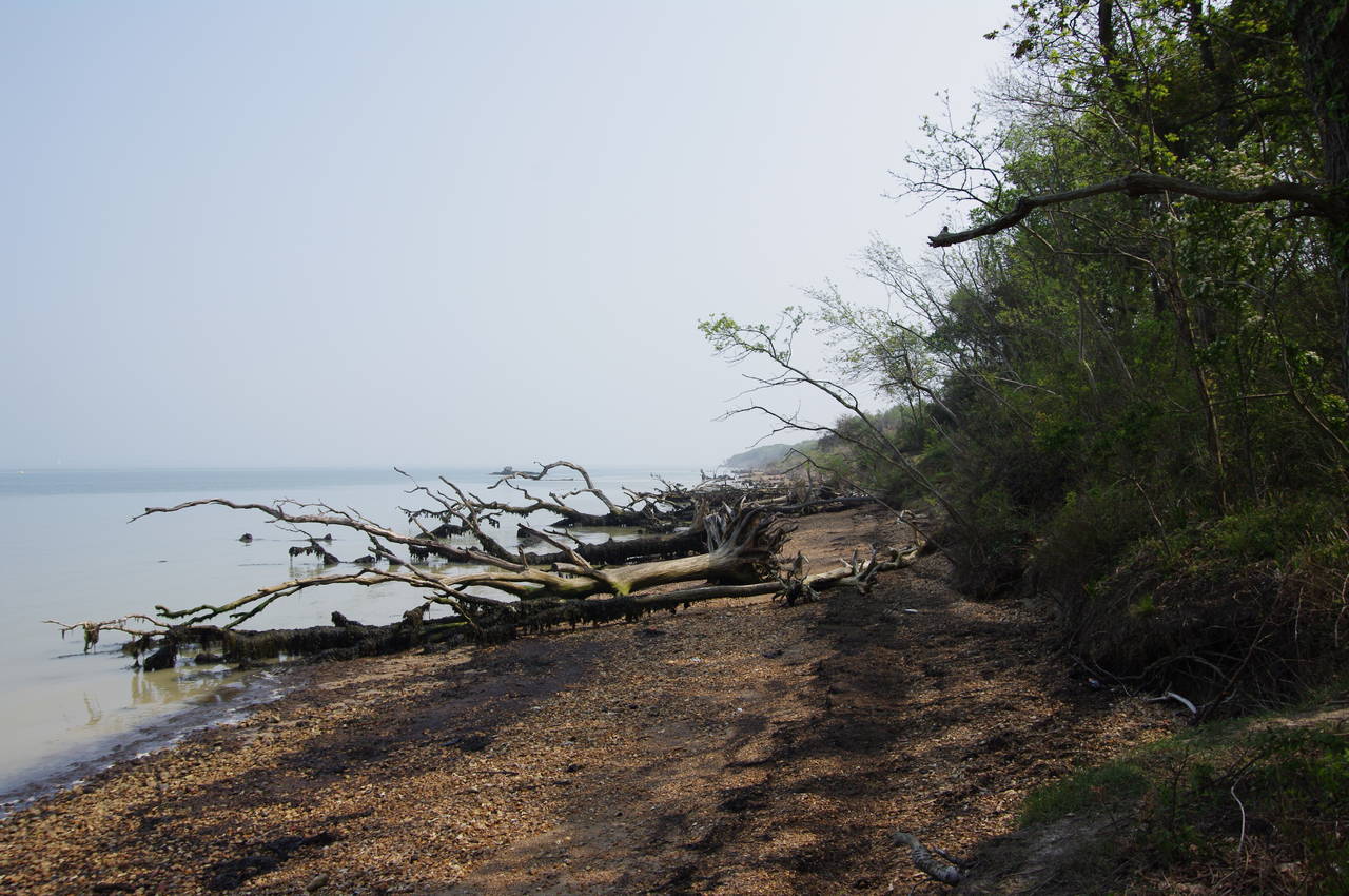
At first the Coast Path follows the shoreline eastwards along the edge of Bouldnor Copse, where a number of uprooted trees lay on the beach (picture 3). After about 500 metres the path leaves the shore and climbs gently uphill above Bouldnor Cliff. Where the path levelled off, there was a long crack running along the ground parallel to the path on the right for a few hundred metres, where a recent landslip had moved the land on the left side of the crack a foot or so lower. A little further on I came across a man driving a small digger. He explained that the landslip had only happened a few days earlier and he was making a new course for the Coast Path a few metres to the right of the crack (picture 4, with the old path on the left and the freshly cut path on the right).

(5) West Hamstead Farm
(6) Newtown Bay
(7) Boardwalk near Newtown River

(8) Newtown River
Beyond the landslip area, the path continues through Bouldnor Forest, eventually joining West Close and then turning left along Sea View Road. Reaching gates, the route joins a fenced path beside the road for a short distance before crossing a stile and following a grassy path across West Hamstead Farm (picture 5) to Hamstead Drive. Turning left along the lane, the path soon reaches another stile next to a gate, crossing it to join a path that gradually descends for almost a kilometre to return to the shore near Hamstead Point.
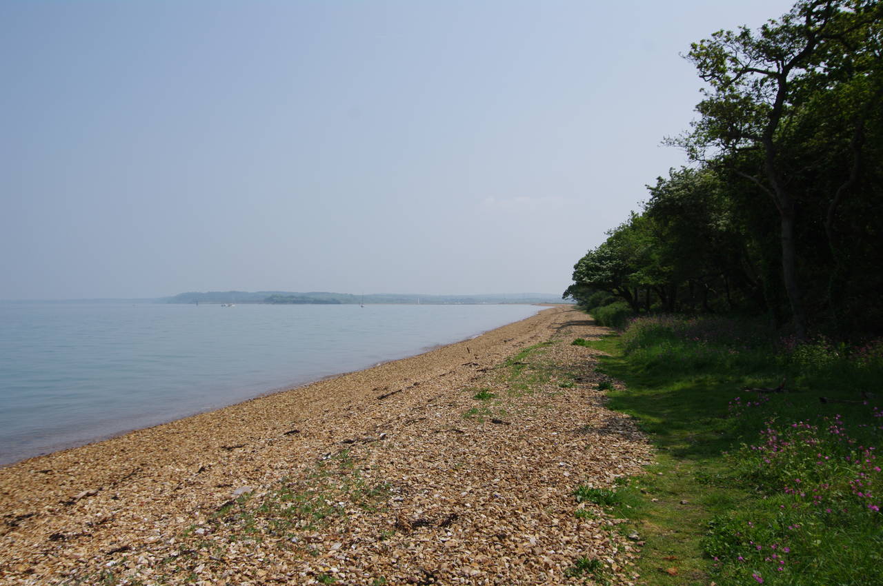
The Coast Path follows the shingle beach around Hamstead Point into Newtown Bay (picture 6), but just after rounding the point the path turns right at a Coastal Path sign and climbs some steps away from the shore. This is the beginning of a long, 14 kilometre, detour away from the coast as the path makes its way around the estuary of the Newtown River, with its many branches and backwaters.
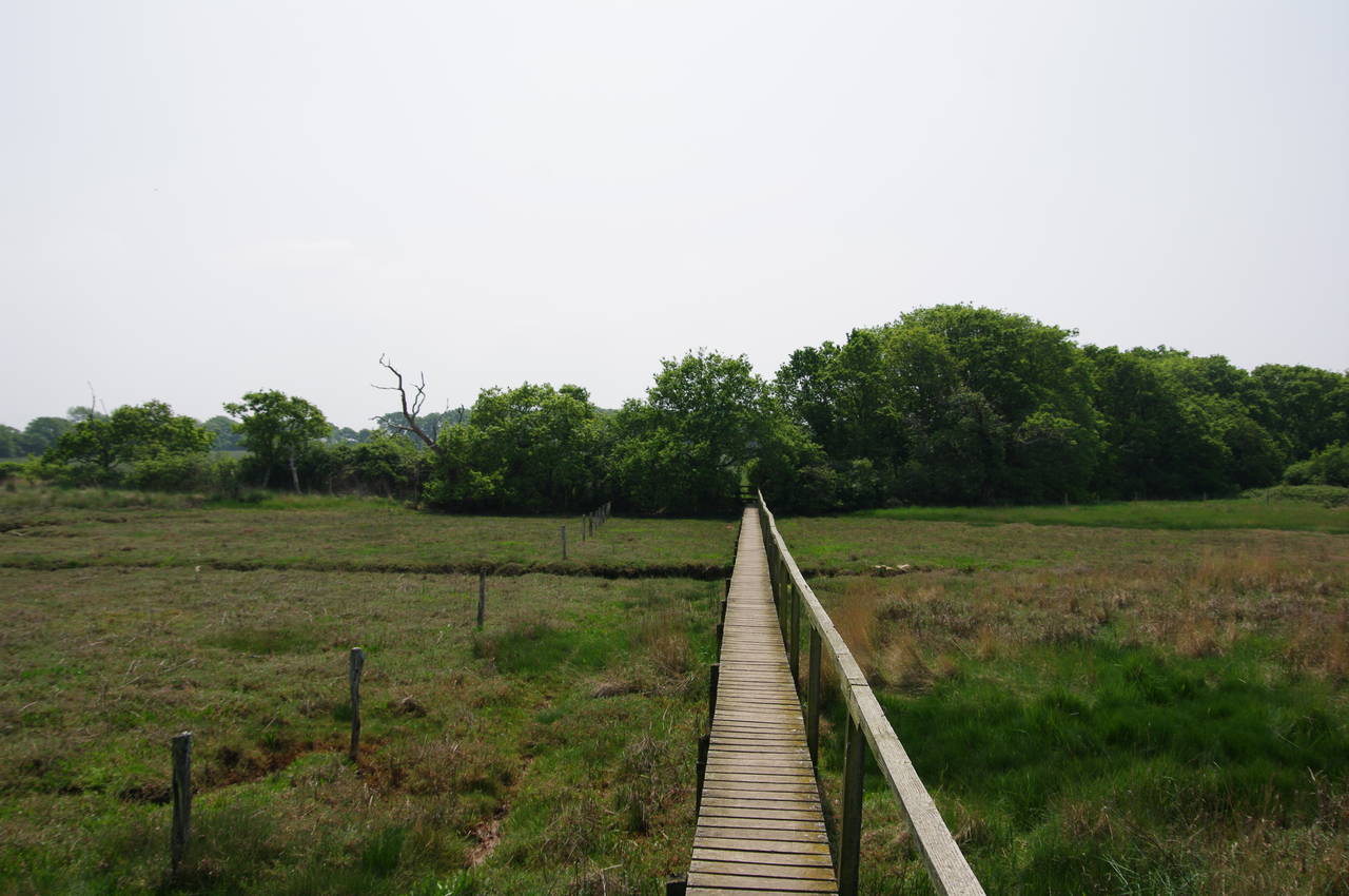
The path skirts around the tip of the first branch, making use of a boardwalk across the marshy ground (picture 7), then cuts across fields to the tip of the second branch. Turning left along the edge of this branch, using more footbridges and boardwalks, the path reaches the main channel of the river near a jetty, where there are views towards the river mouth (picture 8).

(9) Public Footpath S28

(10) Ningwood Lake

(11) The New Inn, Shalfleet

(12) Footbridge over Shalfleet Mill Stream
From the jetty, the path follows a shady vehicle track, marked as Public Footpath S28 (picture 9), which gradually bears away from the river, soon passing Lower Hamstead Farm before heading through woods for another kilometre to reach Hamstead Drive for a second time. The route turns left, following the unsealed road for about 800 metres to cross a bridge over Ningwood Lake (picture 10), another branch of the Newtown River, where a couple of kayakers were paddling across the water.
After crossing the bridge the path turns left off the road, following the water's edge for a short distance to a footbridge, then heading across a field to reach a stile in a tall hedge by the side of the busy A3054 road, which is the main road link between Yarmouth and Newport, the island's capital. The Coast Path turns left along the grassy verge of the road towards the village of Shalfleet, reaching the New Inn (picture 11), opposite the 12th-century parish church, in about 800 metres.
After calling in at the pub's award-winning restaurant for lunch, I rejoined the Coast Path, which heads away from the main road beside the pub on Mill Lane. When the lane forks, the Coast Path takes the right branch, heading past the mill and crossing a footbridge over the mill stream (picture 12) to join a track that leads to a minor lane, at the end of which the Coast Path bears left to join Corfe Road.

(13) Old Town Hall, Newtown

(14) Stone cottage, Newtown

(15) Newtown Meadows

(16) Lodge near Newtown Meadows
After just under a kilometre, Corfe Road reaches a junction with Town Lane, which the Coast Path follows left towards Newtown. Now a small, sleepy village, Newtown is the oldest settlement on the Isle of Wight, established before the Norman invasion, and was a thriving port in medieval times until the silting up of the river made it inaccessible to large boats. The first building the path passes, on the right after about 600 metres, is the Old Town Hall, built in 1699 (picture 13). Like much of the village, the hall is owned by the National Trust.
A little further up on the right is a stone cottage (picture 14), beside which the Coast Path turns right through a wooden gate and into Newtown Meadows (picture 15) an area of medieval farmland divided up into many small fields by hedges and now part of a nature reserve. The path goes more or less straight ahead for the next 800 metres, initially between hedges and then across fields to reach a road by a lodge (picture 16).

(17) Porchfield
(18) The Sportsman's Rest, Porchfield

(19) Thorness Bay

(20) Path climbs above Thorness Bay
From the lodge, the Coast Path follows the quiet, shady road right, turning left after another 800 metres at a junction at the corner of Windgate Copse. This next road is followed for nearly two kilometres as it winds its way through woods to the village of Porchfield, passing the Porchfield Business Park, the National Trust's Clamerkiln Farm, the tiny hamlet of Locksgreen and a Ministry of Defence property along the way. There are no verges for most of the way, so one has to walk on the road and keep an eye out for cars, which came along quite often.
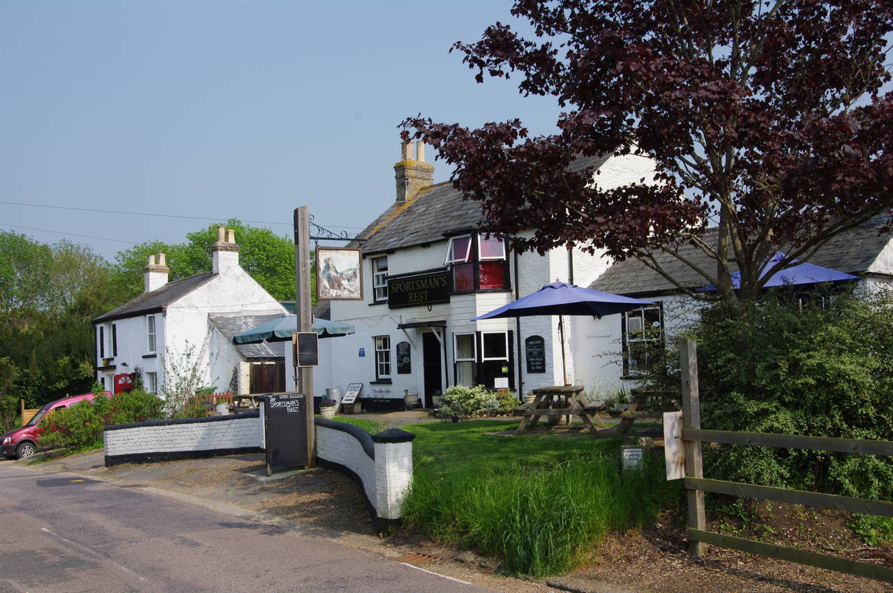
When the road does eventually reach Porchfield, it swings to the right around a small triangular green where the village war memorial stands (picture 17), becoming Main Road. Just up to the right is the Sportsman's Rest pub (picture 18).
The Coast Path follows the road through the village and then uphill with fields on either side. Opposite the woods of Bunts Hill Copse, a sign on the left points the path off the road and along Public Footpath CB12a, which runs along the edges of a couple of grassy fields before reaching a third where the going was much harder. The wide path, fenced off from the rest of the field appeared to have been trampled by many cattle while muddy, leaving the surface very uneven and difficult to walk on, even in dry weather.
Mercifully, the path along the next field edge is back to firm. easy walking. The Coast Path climbs about three quarters of the way up the edge of the field before a sign points through a gap in the hedge on the right and about 60 metres later the path crosses a stile and turns left onto Thorness Lane at the edge of the large Thorness Bay Holiday Park.
Just around the first bend in the road, the Coast Path heads off to the right, taking a narrow trail through scrub just outside the perimeter of a camping ground before bearing right between chalets to join one of the roads through the park. The path continues pretty much directly ahead from here, passing by the park's reception office and a handy shop, where I stopped to buy an icecream, before heading downhill on a gravel track that leads out of the holiday park and eventually down to the shore at Thorness Bay (picture 19).
The Coast Path turns right along the beach, soon crossing a small stream via a footbridge that had nearly half of its planks missing. After about 500 metres, the path bears right to a stile in the corner of a fenced field, gradually ascending the crumbling low cliffs above the beach (picture 20).
(21) Gurnard Bay

(22) The Luck, Gurnard

(23) Gurnard Beach

(24) Princes Esplanade, Gurnard
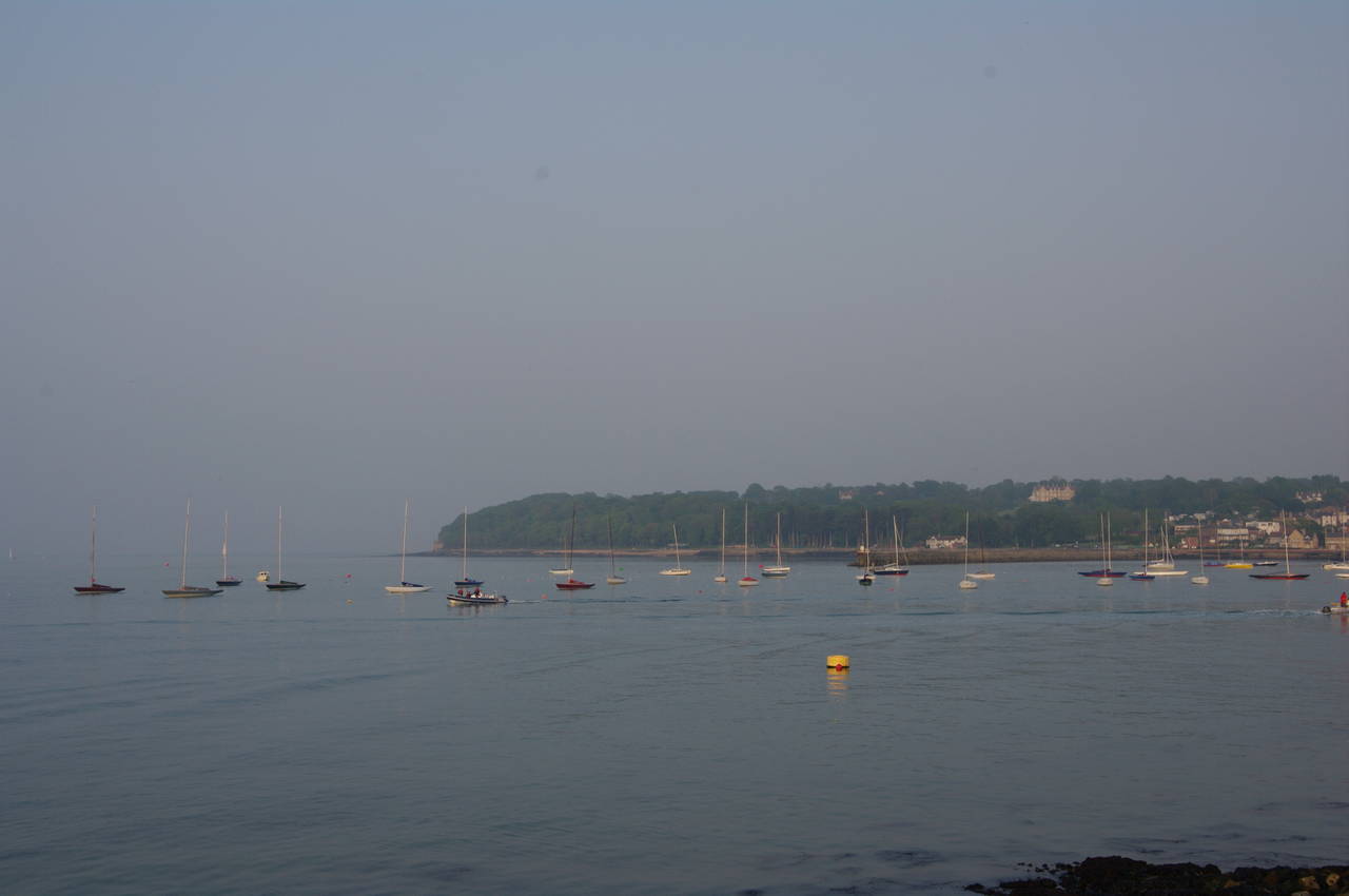
The path follows the crumbly cliff edge for the next one and a half kilometres, sometimes on field edges and sometimes through scrub, rounding the next point that separates Thorness Bay from Gurnard Bay (picture 21). The path then gradually descends towards the town of Gurnard, meeting Marsh Road at the end of a small inlet known as The Luck, where about thirty boats were beached on the mud with the tide having receded (picture 22).
The Coast Path follows Marsh Road through the town, continuing ahead when Marsh Road becomes Solent View Road and starts to climb. At the top of Solent View Road, the route turns left, following Worsley Road, then just after the road bends right, a Coastal Path signpost points left on an alleyway signed as Winding Way. The alley emerges onto Shore Road, which continues to descend to the beach next to the Gurnard Sailing Club, where four small craft were being dragged up onto the shingle (picture 23).
From here the Coast Path heads along the sea wall past a row of beach huts to join Princes Esplanade (picture 24), where a plaque commemorates its opening by the then Prince of Wales on 22nd July 1926.

(25) Egypt Point
(26) River Medina
(27) The Duke of York, Cowes

(28) Cowes Floating Bridge
After about a kilometre, the Princes Esplanade rounds Egypt Point, where a beacon stands on the sea wall and a rather expensive looking yacht was moored beyond the point in a stretch of water known as Cowes Roads (picture 25). Beyond Egypt Point, the esplanade changes name to Egypt Esplanade and soon passes the first houses of West Cowes, before changing its name again to Queens Road about 500 metres later.
Cowes is a town that is famous for its sailing associations, particularly yacht racing, and is the home of the Royal Yacht Squadron which was formed in 1815.
When Queens Road bears away from the beach, the Coast Path leaves it, instead continuing along the beachside promenade, around the clubhouse of the Royal Yacht Squadron and into the mouth of the River Medina, which flows down from the town of Newport in the centre of the island.
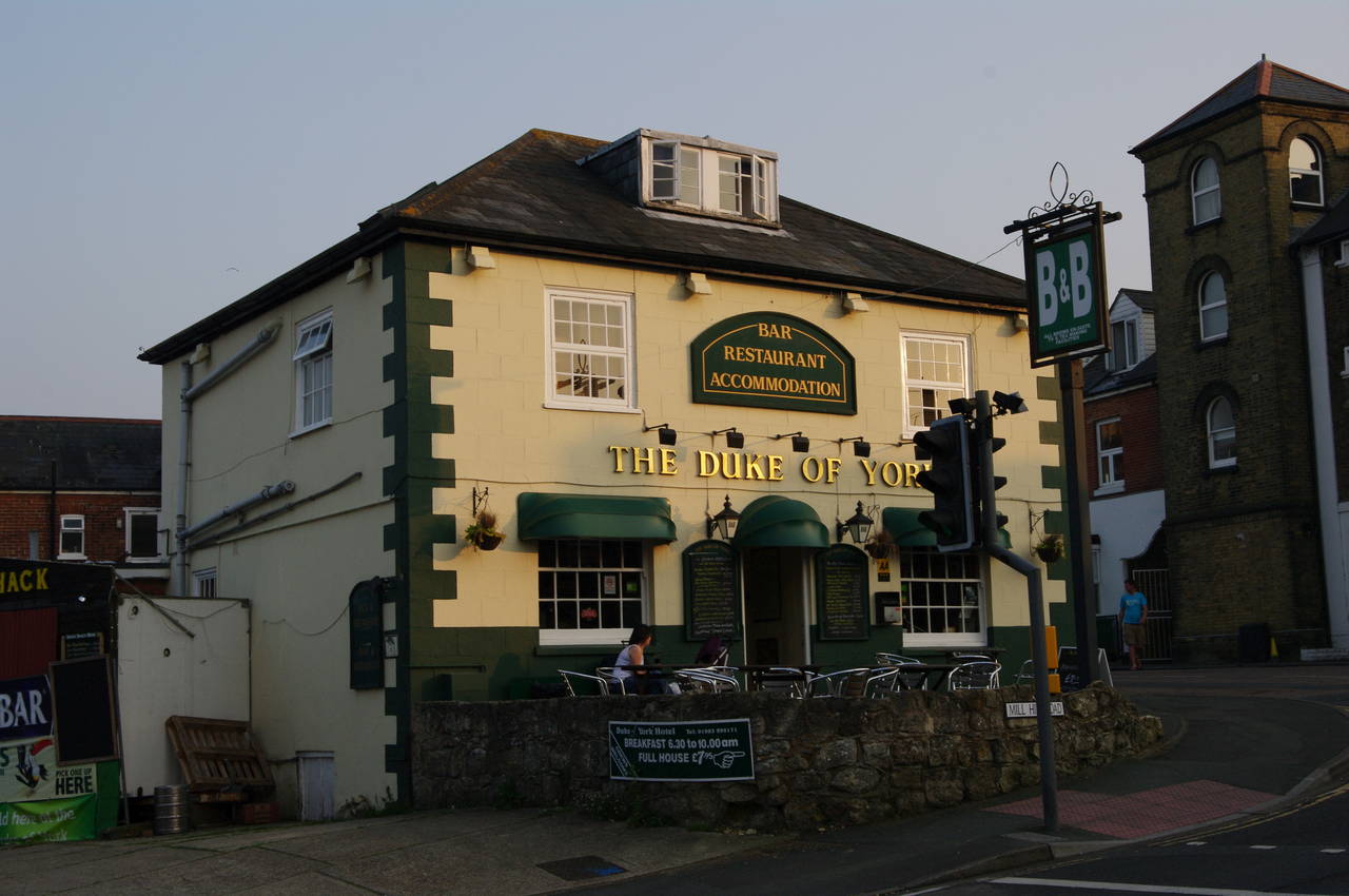
The path then follows The Parade along the edge of the river, passing The Globe before turning right along Watchhouse Lane and then left on the High Street. The High Street is then followed through the town's main shopping district, passing several pubs along the way, including the Union Inn, the Pier View and The Anchor Inn, before the High Street briefly becomes Birmingham Road, ending in front of the Duke of York pub (picture 27).
From there, the Coast Path follows Medina Road to the left and down to the Cowes Floating Bridge (picture 28), a chain ferry that provides a road link across the River Medina to the town of East Cowes.

(29) Town Hall, East Cowes
(30) Monument by York Avenue, East Cowes

(31) Gates of Osborne House

(32) Prince of Wales pub, East Cowes
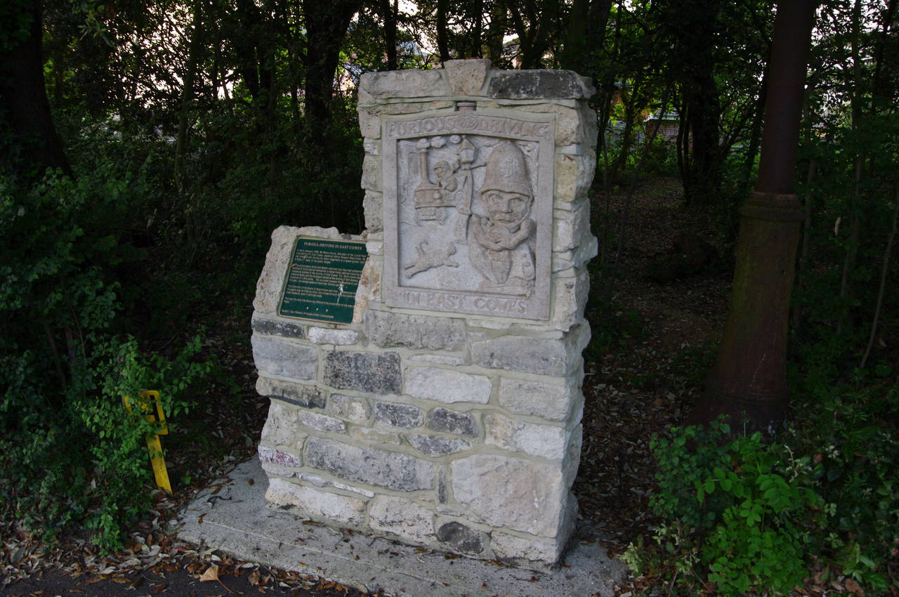
Alighting from the ferry after a very short journey, I continued ahead on Ferry Road for about 100 metres before bearing right onto York Avenue, which soon passes the Town Hall of East Cowes (picture 29). Further on, as the road climbs away from the river, it passes by the large Jubilee Recreation Ground and a little later, at the junction with New Barn Road, I passed by a rather unusual monument to the Isle of Wight's first recorded traffic offence (picture 30).
The plaque tells the story of a Mr Henry House, who was fined three pounds and eleven shillings in January 1899 for driving his motor vehicle along York Avenue at the terrifying speed of 18 miles per hour.
Visible to the left, a short way along New Barn Road, are the grand gates of Osborne House (picture 31), a favourite retreat of Queen Victoria in the latter half of the 19th century. The house itself is set in a large estate and is not visible from the road. It is now owned by English Heritage and is open to the public for those so inclined.
The Coast Path continues along York Avenue and after about 500 metres the road kinks left then right before passing the Prince of Wales pub (picture 32), where I had planned to finish the day's walk. To my dismay, I found the pub closed with "To Let" signs up in the windows, so I would have to wait a bit longer for dinner.
As it was getting close to sunset, I decided to finish the walk here anyway, with my GPS showing 29.6 kilometres of the path completed since Yarmouth. From the bus stop right across the road from the pub it was a fairly quick journey back to my B&B in Ryde.