THE SAXON SHORE WAY
Stage 1: Gravesend to High Halstow
Wednesday, December 29th 2010

(1) Gravesend Town Pier

(2) Cargo ship on the Thames

(3) NCN signpost

(4) Lock gates
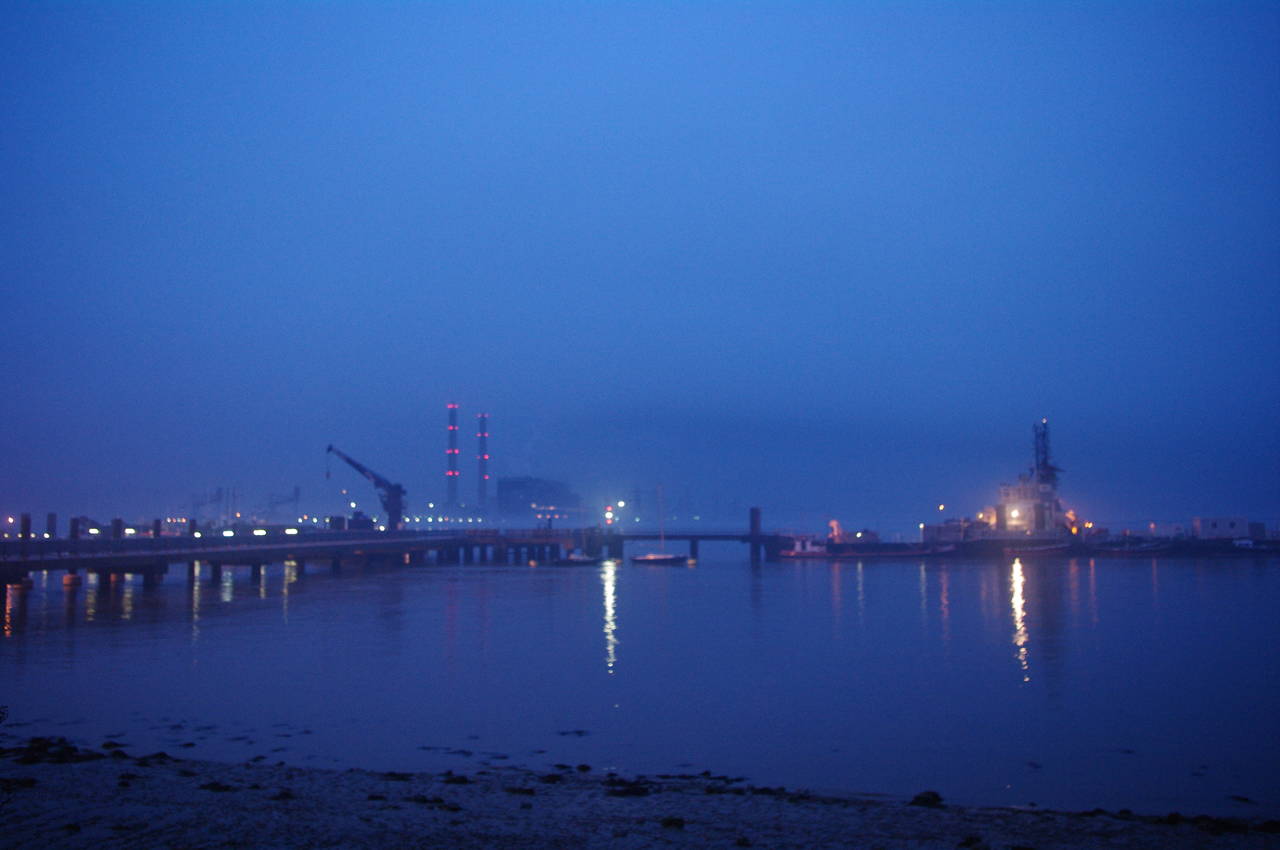
I walked the first section of the Saxon Shore Way on Wednesday, December 29th 2010. Due to the short daylight hours at this time of year, I wanted to make an early start in case it would be possible to push on to Hoo St Werburgh or even all the way to Strood on this stage. I arrived at the Gravesend Town Pier, where the Saxon Shore Way officially starts, at around 7.15am. The pier is the world's oldest remaining cast iron pier, constructed in 1834 and restored in 2000.
Given the early hour, the pier wasn't open, so I stood on the sea wall next to it and looked out at the pier and the Thames (picture 1). There was quite a lot of noise from the Tilbury Power Station on the other side of the river and from shipping on the river. As I watched, a large cargo ship made its way slowly up river (picture 2).
At 7.45, I set off along the river, just as the first hint of dawn appeared in the sky to the east. The path crosses the gardens of the Three Daws pub (the oldest pub in Gravesend) to the first Saxon Shore Way marker, on a lamppost on West Street. The trail then follows Royal Pier Road away from the river until joining Gordon Promenade and heading back down to the Thames, passing the Royal Terrace Pier and a signpost for the National Cycle Network (picture 3). At the end of the promenade, the path crosses a bridge over a canal with lock gates that lead into a marina (picture 4).

(5) Thameside Industrial Estate

(6) Ship & Lobster, Gravesend
(7) Misty view across the Thames

(8) Path along the floodbank
The path leads past the marina and along an alleyway through the Thameside Industrial Estate, looking quite run down and uninviting in the twilight (picture 5). The route soon joins a road and continues through the industrial area, eventually rejoining the paved path along the riverfront behind a concrete sea wall and passing the Ship & Lobster pub (picture 6).
In the improving light, it soon became apparent that there was a lot of fog on and around the river as I looked across the jetties to the Tilbury Power Station on the other side of the river (picture 7).
The path soon reaches a set of concrete steps that lead up on to the top of the floodbank. There is no waymarker here, but continuing along the concrete path quickly leads around a corner to a dead end. A few minutes walk along the floodbank, the path passes under a large conveyor (picture 8), which was eerily silent.

(9) Shornmead Fort
(10) Horses on the floodbank

(11) Approaching the Cliffe Pools

(12) The Black Bull, Cliffe
There were no more points of interest for another couple of kilometres as the path continued along the floodbank in the thick fog, with the industrial noises gradually dying away behind me. The path was quite muddy due to the recent poor weather and my progress was soon slowed dramatically as my boots became weighed down with several kilos of mud clinging to them in great lumps.
Eventually I reached the remains of Shornmead Fort (picture 9). The present fort was built in the 1860's but much of it was demolished in the 1960's, leaving little aside from the long curved facade.
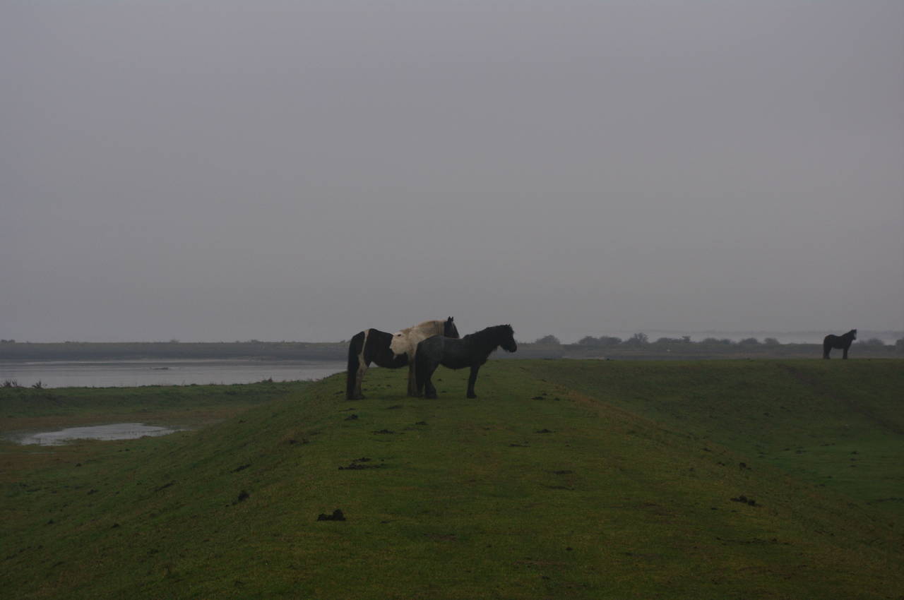
Beyond the fort, a number of horses were standing atop the floodbank (picture 10), and a little further on the first of the Cliffe Pools came into view, with the buildings and conveyor of a gravel works visible in the distance (picture 11). The Cliffe Pools are a series of abandoned gravel pits, now flooded, forming man-made lakes that cover an area of around three square kilometres.
At the first pool, the path turns to the left to run along the floodbank with the river Thames on the left and the pool on the right. Unfortunately, there was no waymarker to mark the turn and I continued straight ahead towards the gravel works for some distance before realizing my mistake.
Back on the correct route, the path passes between Cliffe Fort, another 1860's defensive installation, and the river before passing under the gravel conveyor. A short distance later, the path turns away from the river, heading along Cliffe Creek before crossing the creek and heading along a path between two of the pools. At the end of this path the route turns left along a wide track keeping the pool on the left then continues ahead across fields and into the small town of Cliffe, where it passes the Black Bull pub (picture 12) before turning left into Swingate Avenue.

(13) Approaching Common Lane

(14) Cooling Castle

(15) St James's Church, Cooling
(16) Bromhey Farm
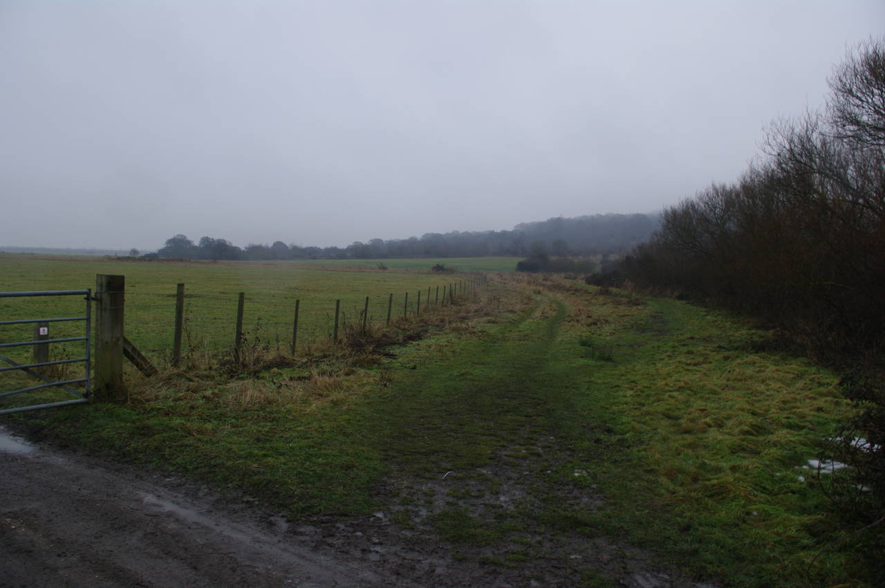
When Swingate Avenue ends, the Saxon Shore Way crosses a road and continues straight ahead between a couple of houses and out into an extremely muddy field, which it crosses towards some more houses (picture 13) where the route turns right along Common Lane. When the road bends to the right after a little more than a hundred metres, the Saxon Shore Way heads to the left through a metal gate and takes another muddy footpath across several small fields before reaching Cooling Road.
A short distance to the left along Cooling Road, the path passes the gatehouse of Cooling Castle (picture 14). A little further along the road you can also see the remains of a tower and part of the moat.
Continuing along the road, the path reaches St James's Church in Cooling (picture 15), where a group of children's graves in the churchyard gave Dickens the inspiration for the opening of Great Expectations.
Although Cooling Road turns to head around the left side of the church, the Saxon Shore Way continues ahead along the right side of the church and behind some houses before eventually turning left and rejoining the road through the village.
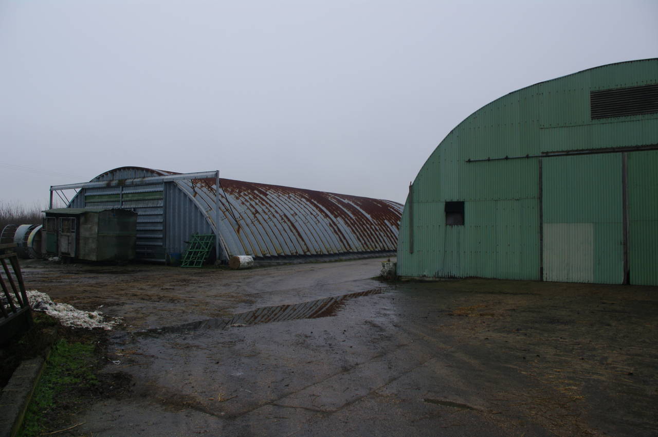
Following the road as it twists and turns beyond the village, the route passes Child's Farm before leaving the road along a farm track to the left through a pear orchard (although the trees were devoid of both leaves and fruit at this time of year) and between the two domed buildings of Bromhey Farm (picture 16).

(17) Eastborough Farm
(18) Northward Hill
(19) Bridge on Northward Hill

(20) View north from Northward Hill
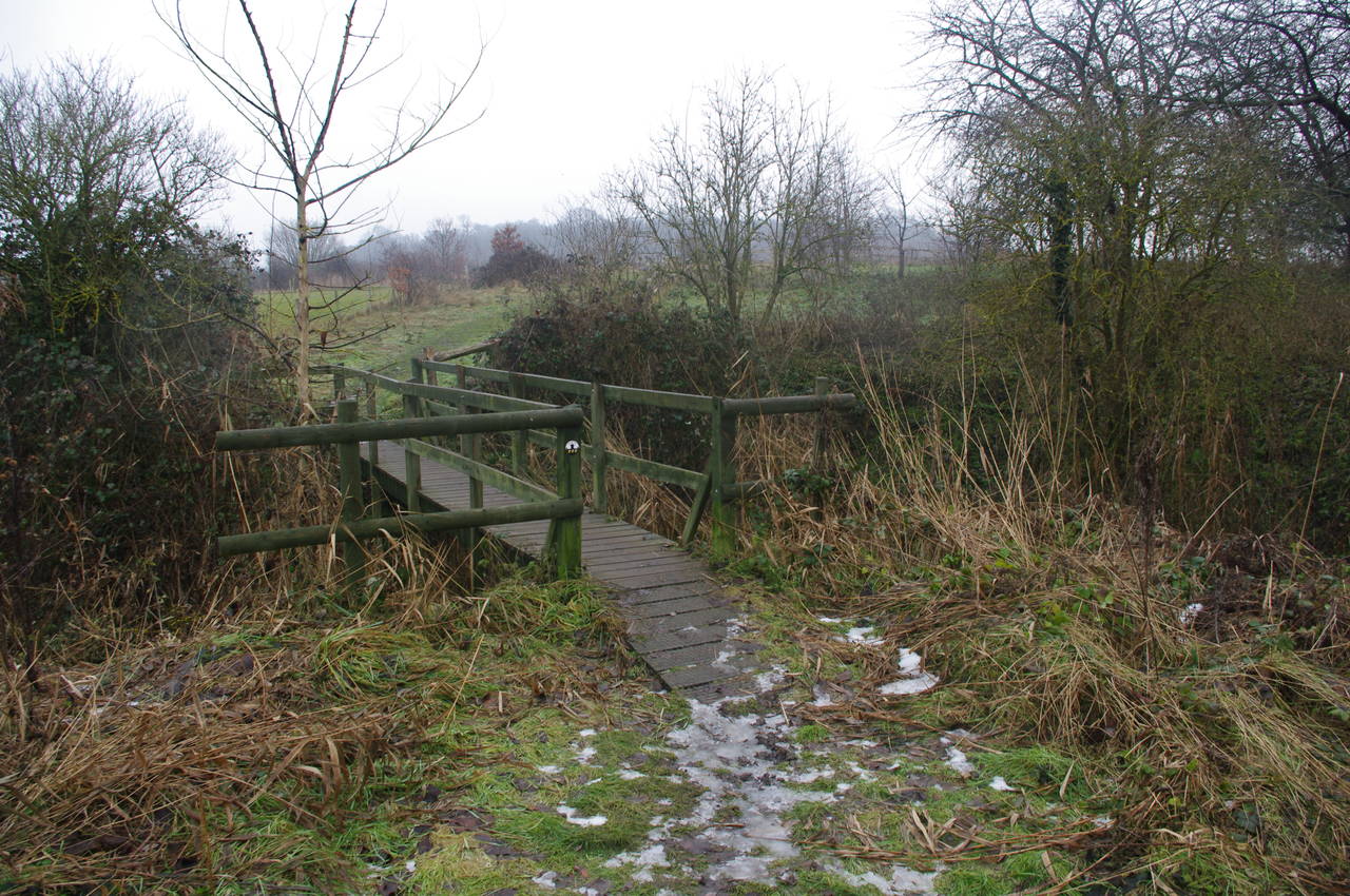
Just beyond Bromhey Farm, the path goes by a huge stack of hay bales at Eastborough Farm (picture 17). The route follows the farm track a little further, eventually reaching a metal gate across the track, where the Saxon Shore Way turns to the right and begins to climb Northward Hill, which was shrouded in mist (picture 18).
Before very long the path crosses a small wooden bridge (picture 19) and continues uphill with the vegetation closing in more and more as the path rises. Part of the way up the hill, the path passes a viewpoint with a large sign describing what could be seen to the north on a clear day, however today the view was anything but clear (picture 20).

(21) High Halstow

(22) Clinchstreet Farm

(23) Bessie's Lane
(24) Britannia Road, High Halstow
From the viewpoint, the path continues over the top of Northward Hill, eventually emerging from the scrub into an open field less than a hundred metres from the edge of the village of High Halstow. Here the fog was particularly thick and it was difficult to make out the houses (picture 21).
Where the path emerges into the field, it turns left and heads east along the field edge rather than continuing straight ahead towards the village, though again there was no waymarking to indicate this. Passing through a narrow gap in the hedge at the end of the field, the route continues ahead across the very foggy and muddy fields of Clinchstreet Farm (picture 22).
The route crosses Decoy Hill Road and another field, before reaching a marker post where the Way turns right into Bessie's Lane -- not really a lane at all, just a depression between two rough hedges that was filled with the remains of the previous week's snowfall (picture 23).
Sadly, someone had tampered with the marker post (quite recently judging from the fresh earth around the foot of the post), having rotated it ninety degrees to send unsuspecting walkers on a fruitless two kilometre walk towards the hamlet of St Mary Hoo. For the life of me, I can't understand why some people want to cause others trouble by messing with the waymarkers, but it seems to be an all-too-common thing. This emphasized the point, yet again, that while the authorities do their best to maintain the waymarking of the long-distance trails, the walker can't rely on the waymarking alone, and must carry Ordnance Survey maps or a GPS receiver (I carry both).
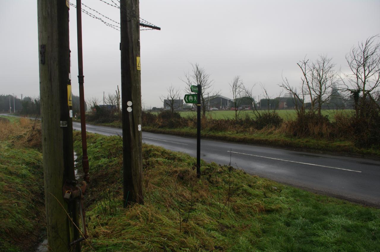
Having set the marker post back to the correct orientation (though heaven only knows how long it will stay that way), I headed off down Bessie's Lane until it joins Britannia Road next to a couple of telegraph poles (picture 24). Here I left the Saxon Shore Way for the day and headed down the road to the right into the village of High Halstow, where I caught a bus to Rochester Station.
My GPS estimated the distance I had covered on the trail at 17 kilometres. My legs were unusually tired for this distance due to the amount of walking on very muddy surfaces and even though there were still about two and a half hours of daylight left, I decided not to try to push on further today, but rather to seek out a nice warm pub where I could enjoy a local ale or two.