THE THAMES PATH
Stage 12: Tower Bridge to Thames Barrier
Monday, June 20, 2011

(1) View downstream from Tower Bridge

(2) Shad Thames

(3) Butler's Wharf

(4) Tower Bridge
On a busy Monday morning, I got the tube to Tower Hill station and walked downhill past the Tower of London and across Tower Bridge to rejoin the Thames Path. From the bridge there were good views down the river (picture 1).
Beneath the southern end of Tower Bridge, the Thames Path heads along a narrow street called Shad Thames which runs between the buildings of Butlers Wharf, once the largest wharf complex on the river. Ahead, a number of iron footbridges cross above the street.
Beneath the first bridge, the Thames Path follows a passage to the left, through the building and back to the waterfront (picture 3). From here, there are good views back to Tower Bridge and the skyline of the City of London (picture 4).

(5) Sculpture in front of Butlers Wharf

(6) New Concordia Wharf

(7) Fountain Green Square, Bermondsey

(8) Fishy paving
The promenade in front of Butlers Wharf is littered with a number of anchors and a curious sculpture of a disembodied head (picture 5). At the end of the promenade, the path crosses a footbridge over St. Saviours Dock to reach the New Concordia Wharf (picture 6), another old dock converted to housing, where several old shipping cranes are still fixed to the side of the building.
The route leaves the river via a narrow passage through the wharf building, before following a succession of narrow streets between a mixture of Victorian and modern offices and warehouses in the district of Bermondsey. Bermondsey Wall West leads to a right turn into Flockton Street, then a left turn into Chambers Street, and soon to turn left again into Loftie Street and then right into Bermondsey Wall East.
A short distance along Bermondsey Wall East, the path turns left across the peaceful Fountain Green Square (picture 7) to regain the riverside path, part of which is cobbled with a pattern depicting fish (picture 8).

(9) Doctor Salter

(10) Ruins of Edward III's mansion, Rotherhithe

(11) The Angel, Rotherhithe

(12) Rotherhithe Street
A short distance later the path briefly detours around the buildings of Angel Wharf before returning to the river by a group of sculptures depicting Doctor Salter, a local politician of the 1920's, waving to his daughter and cat (picture 9). On a grassy square across the road are some low ruins that are all that remains of a 14th-century moated house that belonged to King Edward III (picture 10), and just ahead on the riverside is The Angel pub (picture 11).
The route goes around the pub and along a brief section of riverside path before following King Stairs Close to reach the narrow canyon of Rotherhithe Street (picture 12).
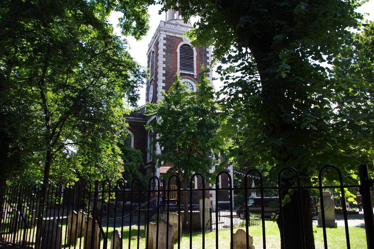
(13) St Mary's Church, Rotherhithe

(14) The Mayflower, Rotherhithe

(15) Rotherhithe Street lift-bridge

(16) Footbridge across inlet, Rotherhith
The street soon passes picturesque St Mary's church on the right (picture 13), and then the Mayflower pub on the left. Both of these are closely associated with the ship of the same name -- the captain and some of the owners are buried in the churchyard and the pub claims to stand on the point from which the ship departed on its journey to America in 1620.
A little further along the street, the Thames Path joins a riverside walkway past apartments before crossing the entrance channel of Surrey Water via a strange-looking "lift-bridge" that used to be able to roll on its curved end to lift the deck and allow boats through into the docks (picture 15).
The route then joins a riverside promenade which passes the large Old Salt Quay pub (not as old as the name suggests, having been built in 1995) and a series of riverside apartment buildings, skirting around one inlet before crossing a footbridge over another (picture 16).

(17) View to Canary Wharf from Sovereign Crescent

(18) Canada Wharf

(19) View to Canary Wharf from Lawrence Wharf

(20) Durand's Wharf
After passing a couple more apartment buildings, the path has to detour around the bulky Globe Wharf building before rejoining the riverside on a section of footpath called Sovereign Crescent. The river slowly curves to the right along this stretch, bringing the tower blocks of Canary Wharf into view across the river (picture 17). The building with the pointed top is One Canada Square, the tallest building in Britain from its opening in 1991 until being surpassed by the Shard in November 2010.
The path crosses a footbridge over a small inlet and then follows another riverside walkway until the large brick Canada Wharf warehouse blocks the way (picture 18). The path returns to the road to pass the building and then climbs a driveway to turn right and skirt around a large man-made pond to return to the riverside walkway in front of the Lawrence Wharf apartment development.
A large section of the riverbed was exposed here on the low tide and a number of people appeared to be searching through the mud as I looked across towards Canary Wharf (picture 19). Apparently a great many historical relics have been found this way over the years, some of which were on display at the Museum of London in the City's Barbican complex, which I visited the following weekend.
The riverside path leads past a grassy park on the site of the former Durand's Wharf (picture 20) and then past two modern apartment buildings and into the gardens of Surrey Docks Farm.

(21) Crane on Commercial Wharf

(22) South Dock Lock

(23) View to Millwall

(24) Pepys Park, Deptford
Leaving the little farm the path soon reaches a concrete square with a big red crane (picture 21). The path heads down some steps next to the crane and then follows Odessa Street past a couple of buildings on New Caledonian Wharf. When the road turns right the route keeps on ahead a little further before turning left on a narrow alley called Randall Rents, which leads back to the riverside. Beyond the building of Helsinki Square, the path reaches the inlet of Greenland Dock and follows it to the right to cross a footbridge to the other side before following the riverside path a short way to the inlet of South Dock, where the path passes over the lower lock gates (picture 22).
After another 400 metres of riverside walking, the path reaches the small river frontage of Pepys Park at Deptford, where a couple of old cannons point across the river towards the area of Millwall on the southern end of the Isle of Dogs (picture 23).
Here the Thames Path has to leave the river and take a long detour through Deptford. The path turns away from the river and crosses the park, heading between a couple of apartment blocks and along a footpath through another section of the park to emerge on Grove Street near some much larger apartment blocks (picture 24).

(25) Deptford Creek

(26) The Greenwich Union and the Richard I

(27) The Old Royal Naval College, Greenwich

(28) View from the Trafalgar Tavern, Greenwich
Just beyond a right-hand bend in Grove Street, the path turns left through the gates of Sayes Court Park and crosses towards the far right corner of the park, where Sayes Court Road soon leads to a left turn into Prince Street. Near the far end of Prince Street, the route turns left into Watergate Street and at the end of this, the path turns right into Borthwick Street. At the far end of Borthwick Street, the route leaves the road along a bicycle path which quickly returns the Thames Path to the riverside.
The riverside path runs beside Gaisher Street, soon reaching the mouth of Deptford Creek (picture 25). The route follows the road beside the creek to reach the busy Creek Road, which carries the path over the creek and into Greenwich. Once across the creek, the path turns left into Norway Street, right into Thames Street, then left again into Horseferry Place, which leads back to the riverside once again.
The riverside path soon leads up to an open area known as Cutty Sark Gardens, which on previous visits I have found to be quite a pleasant place. Unfortunately on this occasion the area was mostly barricaded by construction hoardings and the domed entry of the Greenwich Foot Tunnel was surrounded by scaffolding while being spruced up a little in preparation for the London Olympics.
The other main sight here is the Cutty Sark, once the world's fastest sailing ship, but what remains of the ship after a serious fire was also hidden behind hoardings while being repaired.
At this point I left the trail and headed up through the bustling shopping precinct of Greenwich and on a bit further into a mainly residential area to visit a pub called The Greenwich Union (picture 26), one of my favourite London pubs. I always visit the Union at least once each time I come to London. The pub serves the full range of beers from the award-winning Meantime brewery, and the food menu is also rather good. Being a little outside the touristy area of Greenwich, the pub tends to have a mixture of local residents and only a few tourists who are in-the-know. I've always meant to check out the next-door Richard I pub, but haven't quite gotten around to it yet.
After a pleasant hour relaxing in the pub, I headed back to rejoin the Thames Path which leaves Cutty Sark Gardens on a riverside footpath that soon passes by the twin buildings of the Old Royal Naval College (picture 27). This famous view includes the white Queen's House visible beyond the gap between the college buildings and the Greenwich Royal Observatory high on the hill of Greenwich Park in the distance.
Beyond the college buildings, the path reaches the Trafalgar Tavern, where a statue of Lord Nelson watches over the river (picture 27). From here, there are good views across to Island Gardens on the southern tip of the Isle of Dogs and downstream to the Millennium Dome (picture 28).

(29) Trinity Hospital, Greenwich
(30) Cast and crew of Spooks

(31) The Cutty Sark pub, Greenwich

(32) Gas holder, North Greenwich
The path heads around behind the pub and along the narrow Crane Street, passing by another pub called The Yacht. At the far end of Crane Street, the route rejoins the riverside in front of the Trinity Hospital (picture 29), which is dwarfed by the next-door London Transport Power Station.
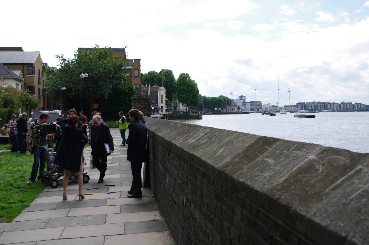
In front of the hospital, I had to wait for a few minutes, as the path was temporarily blocked by a large film crew working on the BBC series Spooks (picture 30).
Beyond the power station, the path crosses Ballast Quay to reach the Cutty Sark pub (picture 31), which dates from 1795. The inside of the pub is decked out to look like the inside of an 18th century ship, and is quite well done.
A short distance beyond the pub, the riverside path passed a new apartment complex and then ended abruptly at a construction hoarding which encircles the former Lovell's Wharf. A signed diversion heads away from the river beside the apartments and into an industrial area, turning left into Christchurch Way, right into Mauritus Road then left into Blackwall Lane, which leads up to the busy Blackwall Tunnel Approach Road. This road is followed for some distance, passing a large gas-holder (picture 32), before eventually turning off to follow a narrow fenced path across an industrial site to eventually return to the riverbank.

(33) Excavator on the Thames Path, North Greenwich

(34) View from North Greenwich to the Isle of Dogs

(35) The Millennium Dome

(36) QEII Pier, North Greenwich
The next stretch of the path runs along disused wharves, where many large piles of soil and sand were stacked up next to the path. A large excavator was transferring some of this onto a barge and I had to wait a couple of minutes before the driver noticed me and stopped work so that I could pass safely (picture 33). Along this stretch of the path there were good views across the river to the opposite side of the Isle of Dogs from that which I had passed earlier in the day (picture 34), the Thames Path having followed a curve around three sides of the man-made island.
The route briefly heads through a greener area and joins a broad cycle path as the river begins to curve back the other way to pass around three sides of the Millenium Dome. Although the path passes quite close to the building, which is the world's largest dome, the views were rather disappointing as various kinds of fences surround most of the site -- picture 35, taken from the western side, was the best I could get.
Having rounded the Greenwich Peninsula, the path passes by the QEII Pier, where a rather strange artwork sits, looking like a large metal tree (picture 36).

(37) View downstream towards the Thames Barrier

(38) Sundial, North Greenwich

(39) The Thames Flood Barrier
(40) The Thames Flood Barrier
Downstream from the pier, there were quite a number of boats on the river (picture 37) and beyond them was my first sight of the Thames Barrier, still a few kilometres away. The Thames Path continues to follow the cycle path, soon passing apartment buildings and an unusual sundial (picture 38), before heading around behind the riverside Greenwich Yacht Club.
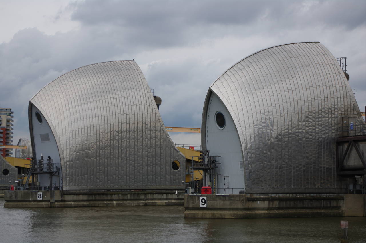
The path returns to the river to pass under a couple of large gravel conveyors, before following a road through an industrial area, passing by the riverside Anchor & Hope pub. From here, the route follows one last stretch of riverside footpath towards the shiny stainless steel shells of the Thames Flood Barrier (pictures 39 and 40).
Reaching the Thames Barrier, the path follows a tunnel under the edge of the control centre, emerging at the official end of the Thames Path National Trail in a small grassy park beside the river. On this stage of the walk I had covered only 16.1km, but there had been a lot to see.
The Thames Barrier was built to protect London from flooding due to extreme tides bringing massive quantities of water up the river. The structure was opened in 1982 and is the second largest movable flood barrier in the world. The barrier consists of ten massive curved gates which lay on the riverbed to stay out of the way of shipping and can be raised by the machinery to a vertical position to block the flow of tidal waters.
The little park was a very different scene to the rural setting where I had started my walk at the dry source of the Thames sixteen days earlier. From a few puddles near the village of Ewen, the river had grown to a width of 520 metres at the Thames Barrier.
Although I had completed the official route of the National Trail, this was not quite the end of my journey along the Thames, as I planned to return the following day to walk along the Thames Path Southeast Extension, which heads downstream along the southern bank of the Thames Estuary.